Rosedale is a town in Florida Township, Parke County, in the U.S. state of Indiana. The population was 725 at the 2010 census.
| Name: | Rosedale town |
|---|---|
| LSAD Code: | 43 |
| LSAD Description: | town (suffix) |
| State: | Indiana |
| County: | Parke County |
| Elevation: | 535 ft (163 m) |
| Total Area: | 0.40 sq mi (1.02 km²) |
| Land Area: | 0.40 sq mi (1.02 km²) |
| Water Area: | 0.00 sq mi (0.00 km²) |
| Total Population: | 636 |
| Population Density: | 1,610.13/sq mi (622.01/km²) |
| ZIP code: | 47874 |
| Area code: | 765 |
| FIPS code: | 1865934 |
| GNISfeature ID: | 442304 |
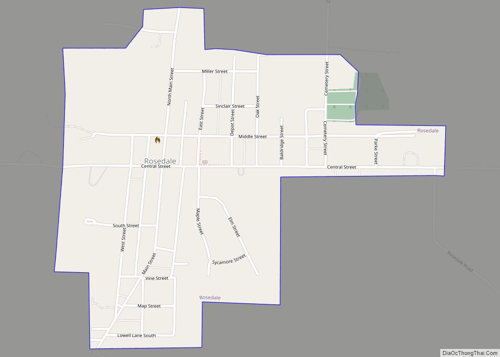
Online Interactive Map
Click on ![]() to view map in "full screen" mode.
to view map in "full screen" mode.
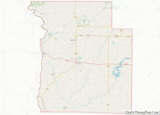
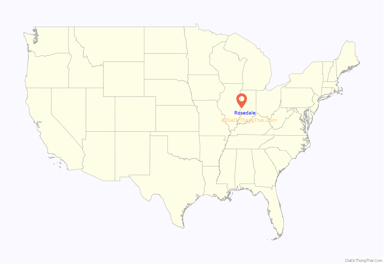
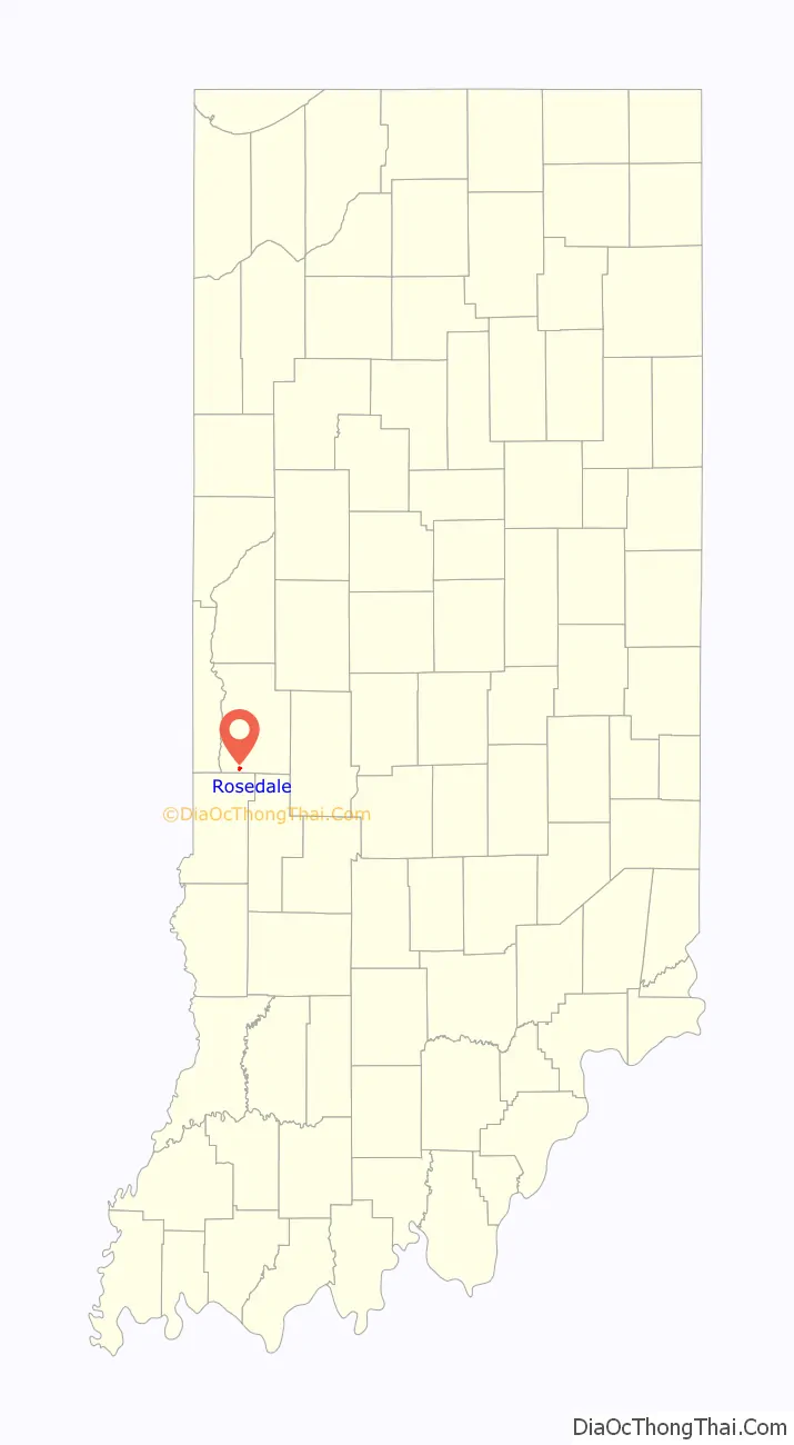
Rosedale location map. Where is Rosedale town?
History
When Parke County was established in 1821, Rosedale was the first village in the county, and served as the first county seat. The town was named for Chauncey Rose, a pioneer who settled in this township in 1819. Later the county seat was moved to Armiesburg, and then in 1822 to Rockville (where it remained). The first court session in the county was held in Roseville. The town flourished until 1835 when more business began to be drawn to Rockville. In 1861, the post office was established in Rosedale, where it is still currently operating.
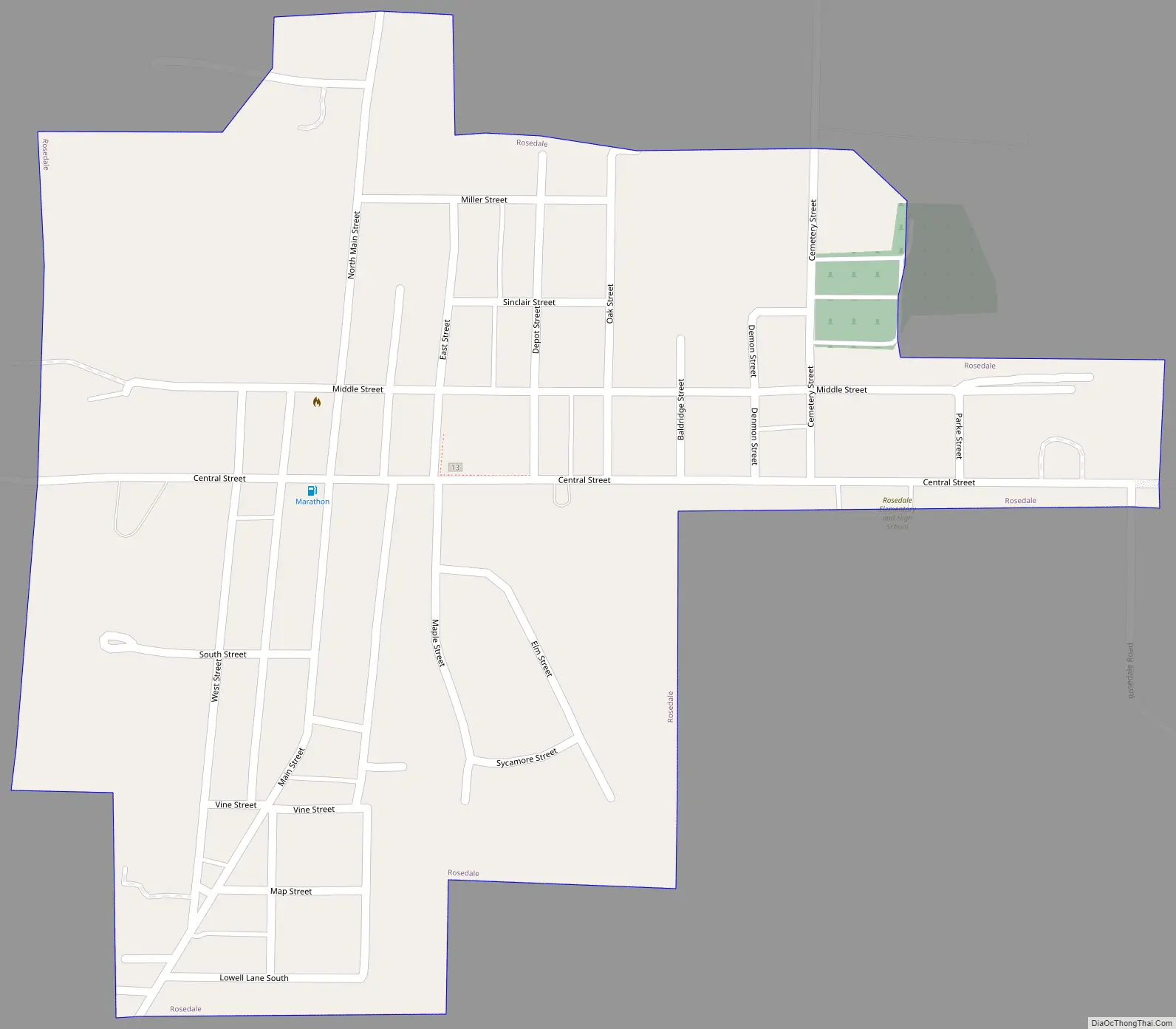
Rosedale Road Map
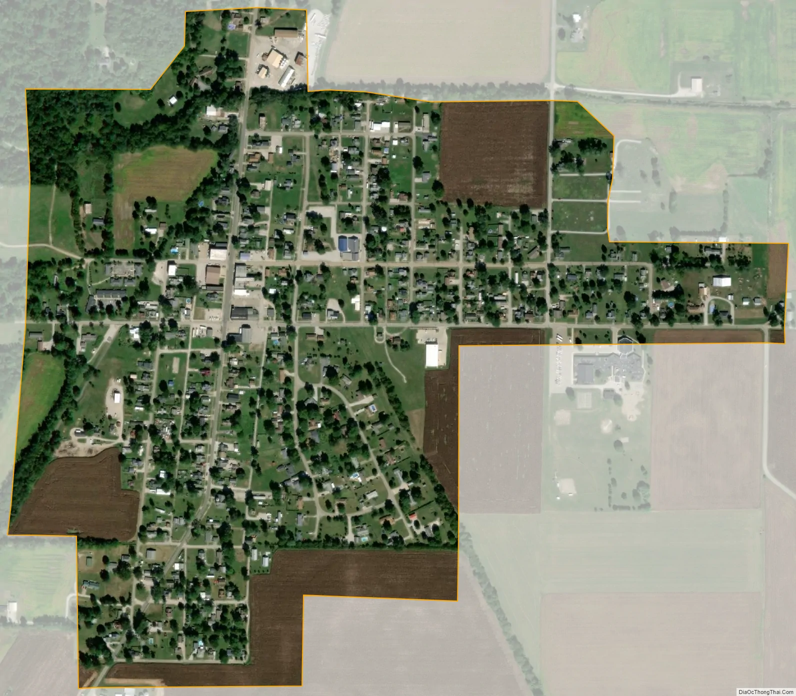
Rosedale city Satellite Map
Geography
Rosedale is located near the southern border of the county, about 10 miles (16 km) from the county seat of Rockville, and less than 1 mile (1.6 km) south of Big Raccoon Creek.
According to the 2010 census, Rosedale has a total area of 0.39 square miles (1.01 km), all land.
See also
Map of Indiana State and its subdivision:- Adams
- Allen
- Bartholomew
- Benton
- Blackford
- Boone
- Brown
- Carroll
- Cass
- Clark
- Clay
- Clinton
- Crawford
- Daviess
- De Kalb
- Dearborn
- Decatur
- Delaware
- Dubois
- Elkhart
- Fayette
- Floyd
- Fountain
- Franklin
- Fulton
- Gibson
- Grant
- Greene
- Hamilton
- Hancock
- Harrison
- Hendricks
- Henry
- Howard
- Huntington
- Jackson
- Jasper
- Jay
- Jefferson
- Jennings
- Johnson
- Knox
- Kosciusko
- LaGrange
- Lake
- Lake Michigan
- LaPorte
- Lawrence
- Madison
- Marion
- Marshall
- Martin
- Miami
- Monroe
- Montgomery
- Morgan
- Newton
- Noble
- Ohio
- Orange
- Owen
- Parke
- Perry
- Pike
- Porter
- Posey
- Pulaski
- Putnam
- Randolph
- Ripley
- Rush
- Saint Joseph
- Scott
- Shelby
- Spencer
- Starke
- Steuben
- Sullivan
- Switzerland
- Tippecanoe
- Tipton
- Union
- Vanderburgh
- Vermillion
- Vigo
- Wabash
- Warren
- Warrick
- Washington
- Wayne
- Wells
- White
- Whitley
- Alabama
- Alaska
- Arizona
- Arkansas
- California
- Colorado
- Connecticut
- Delaware
- District of Columbia
- Florida
- Georgia
- Hawaii
- Idaho
- Illinois
- Indiana
- Iowa
- Kansas
- Kentucky
- Louisiana
- Maine
- Maryland
- Massachusetts
- Michigan
- Minnesota
- Mississippi
- Missouri
- Montana
- Nebraska
- Nevada
- New Hampshire
- New Jersey
- New Mexico
- New York
- North Carolina
- North Dakota
- Ohio
- Oklahoma
- Oregon
- Pennsylvania
- Rhode Island
- South Carolina
- South Dakota
- Tennessee
- Texas
- Utah
- Vermont
- Virginia
- Washington
- West Virginia
- Wisconsin
- Wyoming