Cumberland is a town in Hancock and Marion counties, Indiana, United States. The population was 5,954 at the 2020 census, up from 5,169 in 2010.
| Name: | Cumberland town |
|---|---|
| LSAD Code: | 43 |
| LSAD Description: | town (suffix) |
| State: | Indiana |
| County: | Hancock County, Marion County |
| Elevation: | 853 ft (260 m) |
| Total Area: | 2.82 sq mi (7.30 km²) |
| Land Area: | 2.81 sq mi (7.28 km²) |
| Water Area: | 0.01 sq mi (0.02 km²) |
| Total Population: | 5,954 |
| Population Density: | 2,118.11/sq mi (817.93/km²) |
| ZIP code: | 46229 |
| Area code: | 317 |
| FIPS code: | 1816336 |
| GNISfeature ID: | 0433243 |
| Website: | www.town.cumberland.in.us |
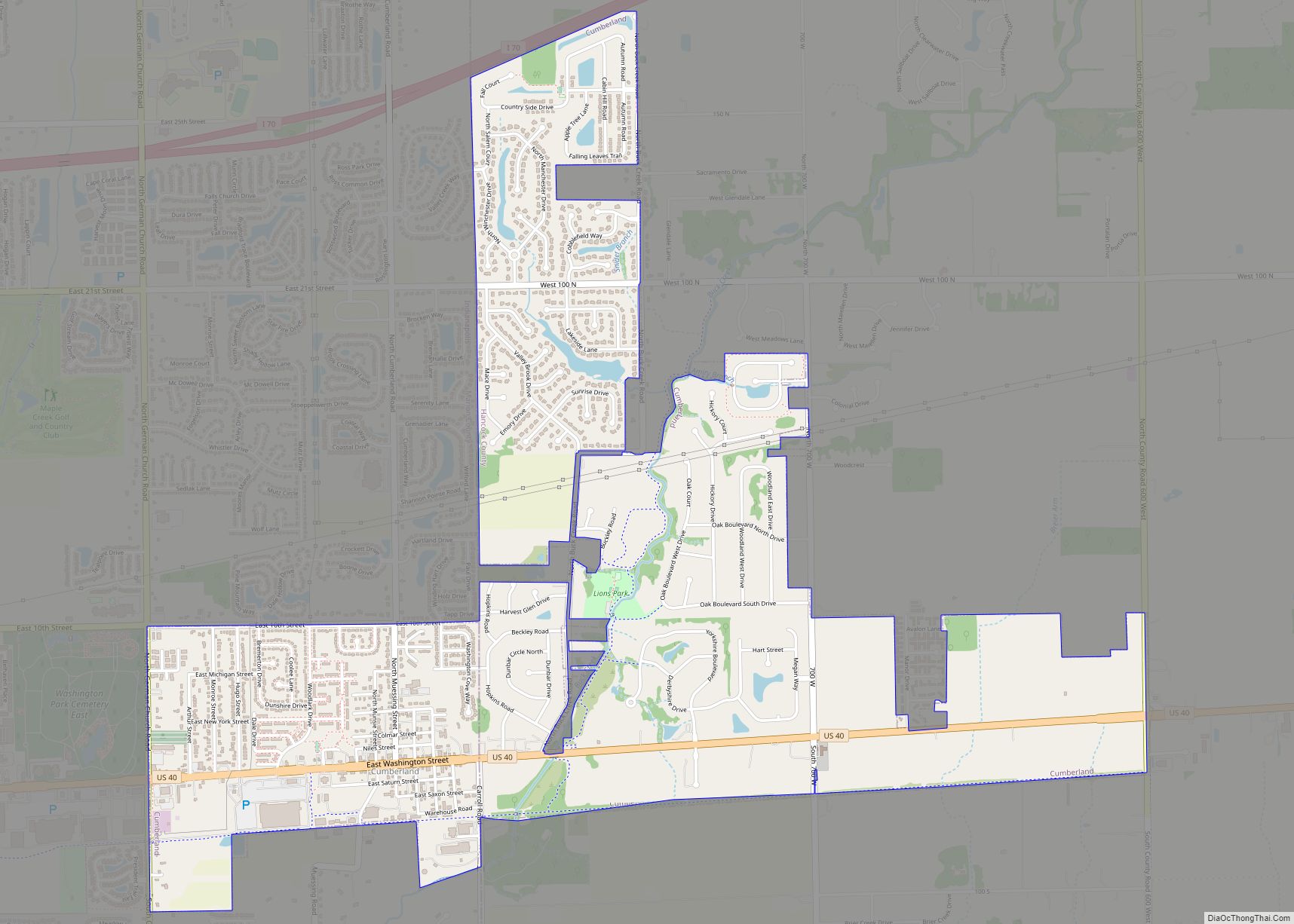
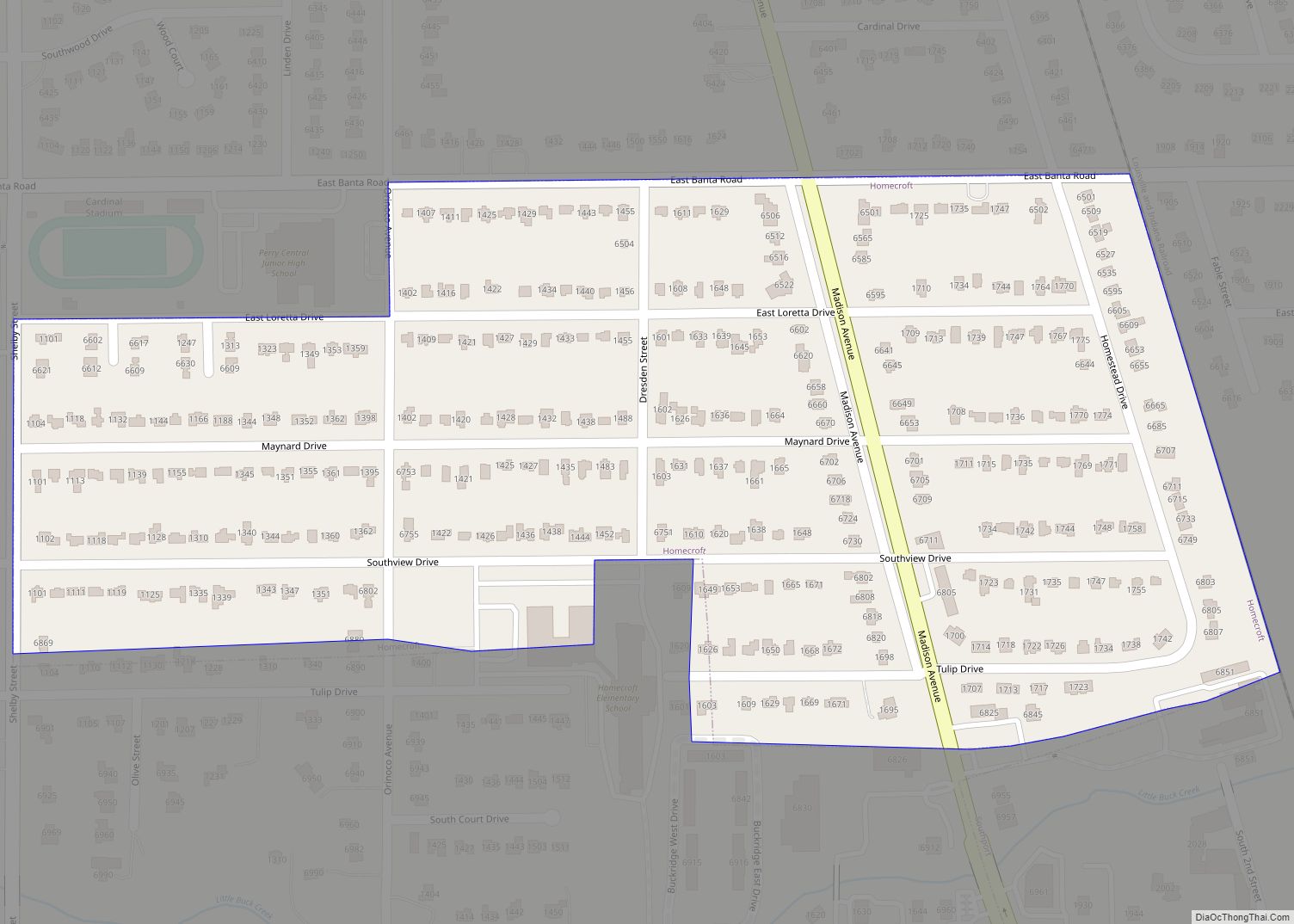
Online Interactive Map
Click on ![]() to view map in "full screen" mode.
to view map in "full screen" mode.
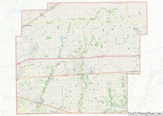
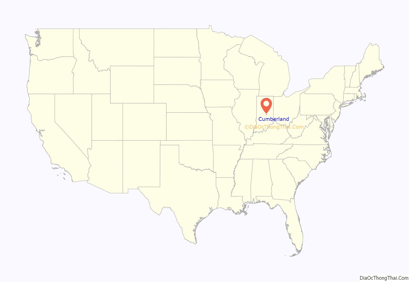
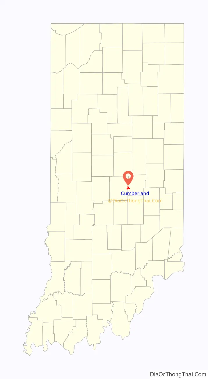
Cumberland location map. Where is Cumberland town?
History
Cumberland was founded in the 1830s when the Cumberland Road (also known as the National Road) was extended to that point. Cumberland contained a post office from 1834 until it was discontinued in 1958. Since 1970, the Marion County portion of Cumberland has been subject to Unigov as an included town.
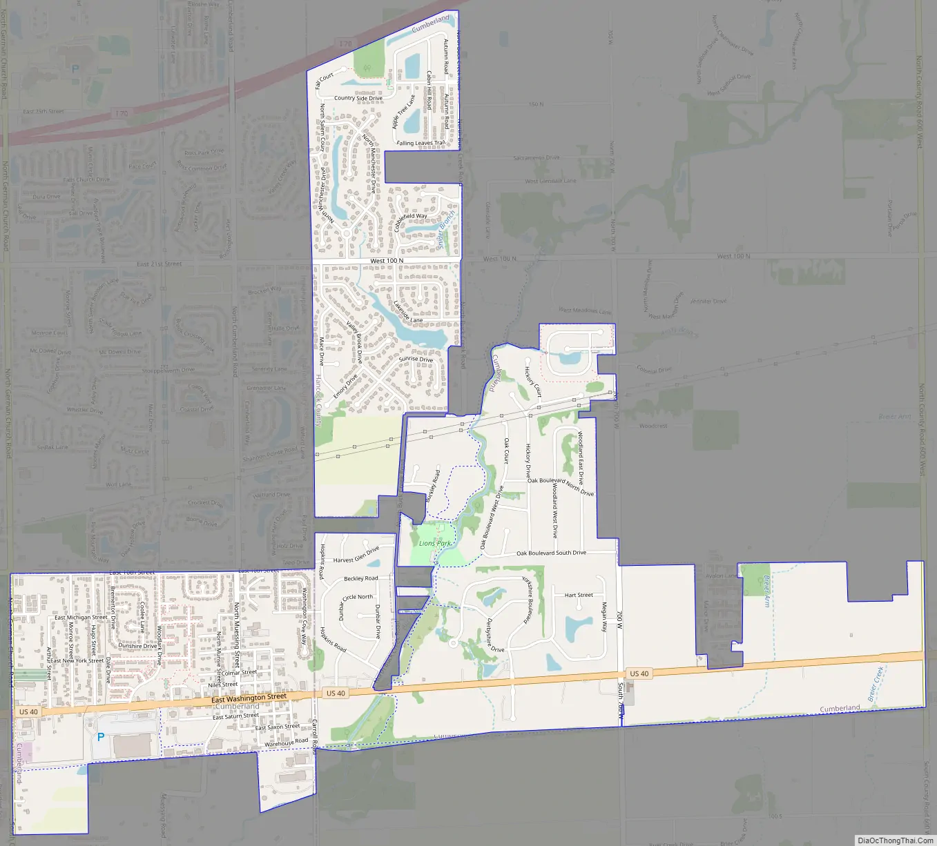
Cumberland Road Map
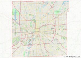
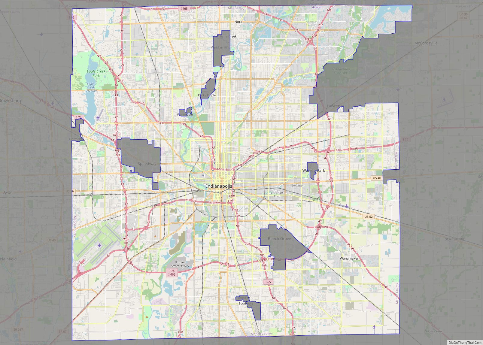
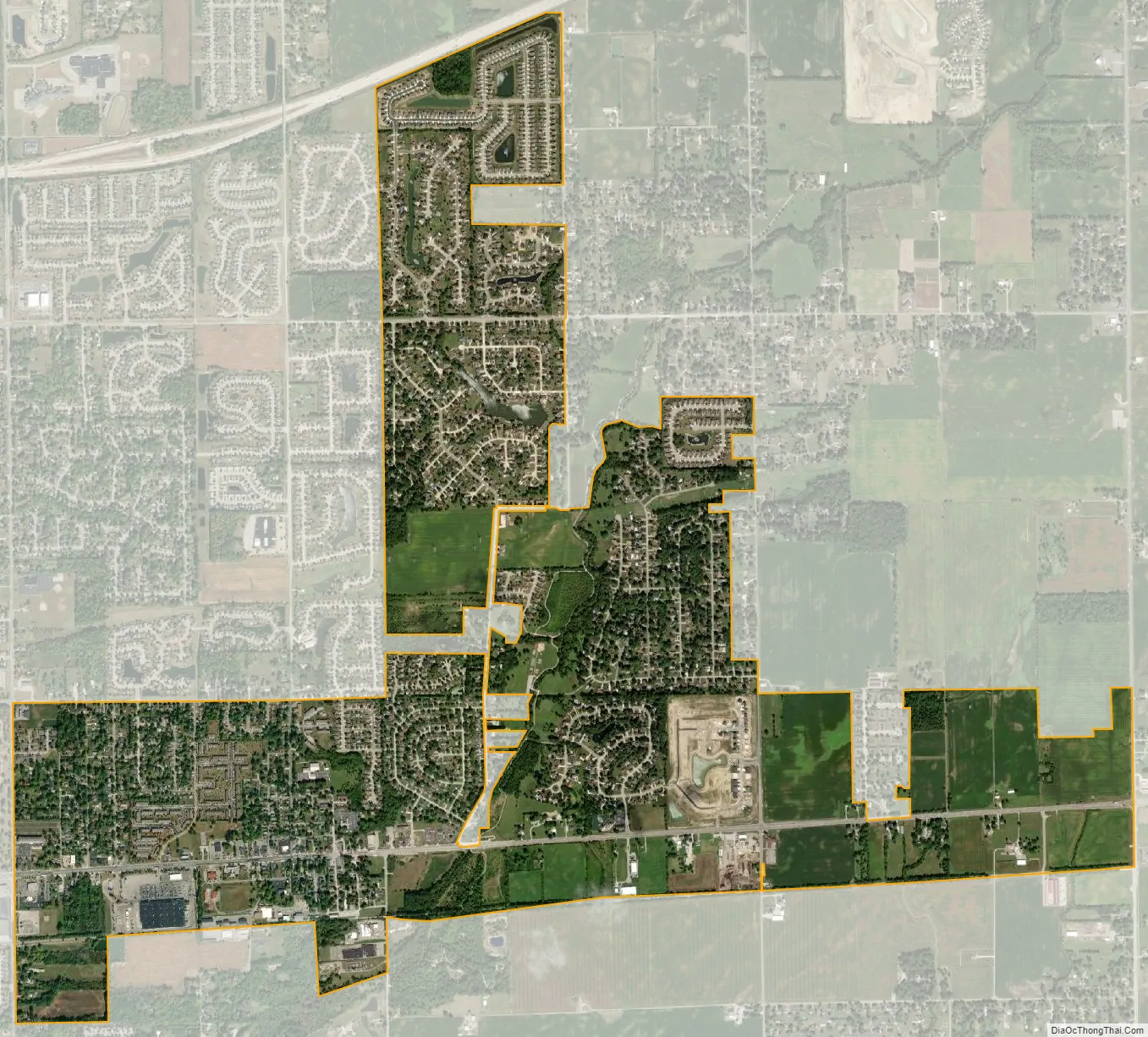
Cumberland city Satellite Map
Geography
The center of Cumberland is in eastern Marion County, but the town limits extend east and north into western Hancock County, so that the majority of the town’s area is now in Hancock County. U.S. Route 40, following the route of the National Road, is the main road through the community, leading west 10 miles (16 km) to downtown Indianapolis and east the same distance to Greenfield, the Hancock county seat.
According to the U.S. Census Bureau, the town has a total area of 2.82 square miles (7.3 km), of which 0.01 square miles (0.026 km), or 0.35%, are water. Buck Creek crosses the town, flowing south to join Sugar Creek near London. The town is part of the watershed of the East Branch of the White River.
See also
Map of Indiana State and its subdivision:- Adams
- Allen
- Bartholomew
- Benton
- Blackford
- Boone
- Brown
- Carroll
- Cass
- Clark
- Clay
- Clinton
- Crawford
- Daviess
- De Kalb
- Dearborn
- Decatur
- Delaware
- Dubois
- Elkhart
- Fayette
- Floyd
- Fountain
- Franklin
- Fulton
- Gibson
- Grant
- Greene
- Hamilton
- Hancock
- Harrison
- Hendricks
- Henry
- Howard
- Huntington
- Jackson
- Jasper
- Jay
- Jefferson
- Jennings
- Johnson
- Knox
- Kosciusko
- LaGrange
- Lake
- Lake Michigan
- LaPorte
- Lawrence
- Madison
- Marion
- Marshall
- Martin
- Miami
- Monroe
- Montgomery
- Morgan
- Newton
- Noble
- Ohio
- Orange
- Owen
- Parke
- Perry
- Pike
- Porter
- Posey
- Pulaski
- Putnam
- Randolph
- Ripley
- Rush
- Saint Joseph
- Scott
- Shelby
- Spencer
- Starke
- Steuben
- Sullivan
- Switzerland
- Tippecanoe
- Tipton
- Union
- Vanderburgh
- Vermillion
- Vigo
- Wabash
- Warren
- Warrick
- Washington
- Wayne
- Wells
- White
- Whitley
- Alabama
- Alaska
- Arizona
- Arkansas
- California
- Colorado
- Connecticut
- Delaware
- District of Columbia
- Florida
- Georgia
- Hawaii
- Idaho
- Illinois
- Indiana
- Iowa
- Kansas
- Kentucky
- Louisiana
- Maine
- Maryland
- Massachusetts
- Michigan
- Minnesota
- Mississippi
- Missouri
- Montana
- Nebraska
- Nevada
- New Hampshire
- New Jersey
- New Mexico
- New York
- North Carolina
- North Dakota
- Ohio
- Oklahoma
- Oregon
- Pennsylvania
- Rhode Island
- South Carolina
- South Dakota
- Tennessee
- Texas
- Utah
- Vermont
- Virginia
- Washington
- West Virginia
- Wisconsin
- Wyoming