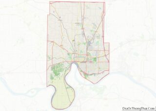
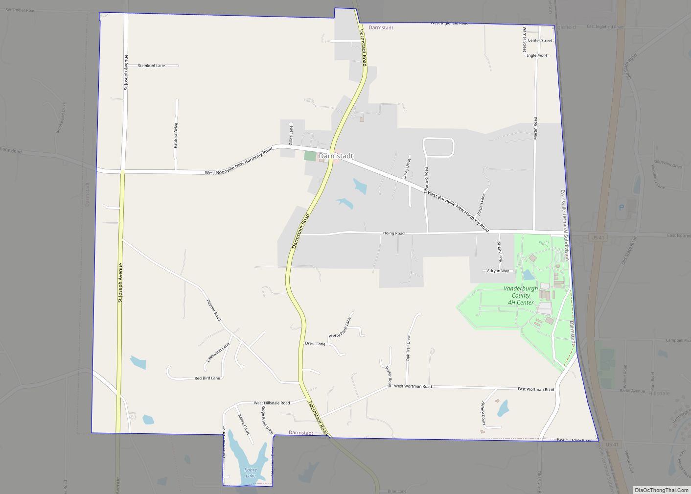
Darmstadt is a small, German-heritage town primarily located in Scott Township, Vanderburgh County, Indiana, United States. It also extends slightly into Armstrong, Center and German townships. The population was 1,407 at the 2010 census. Darmstadt, located just north of Evansville, is the only other incorporated municipality in Vanderburgh County besides Evansville.
| Name: | Darmstadt town |
|---|---|
| LSAD Code: | 43 |
| LSAD Description: | town (suffix) |
| State: | Indiana |
| County: | Vanderburgh County |
| Elevation: | 479 ft (146 m) |
| Total Area: | 4.58 sq mi (11.85 km²) |
| Land Area: | 4.52 sq mi (11.70 km²) |
| Water Area: | 0.06 sq mi (0.15 km²) |
| Total Population: | 1,373 |
| Population Density: | 304.03/sq mi (117.38/km²) |
| ZIP code: | 47720, 47725, 47710, 47618 |
| Area code: | 812 |
| FIPS code: | 1816858 |
| GNISfeature ID: | 2396680 |
| Website: | http://www.darmstadt-indiana.org |
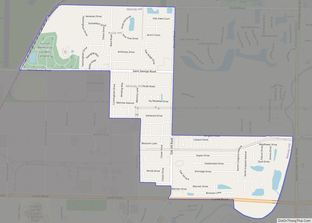
Online Interactive Map
Click on ![]() to view map in "full screen" mode.
to view map in "full screen" mode.
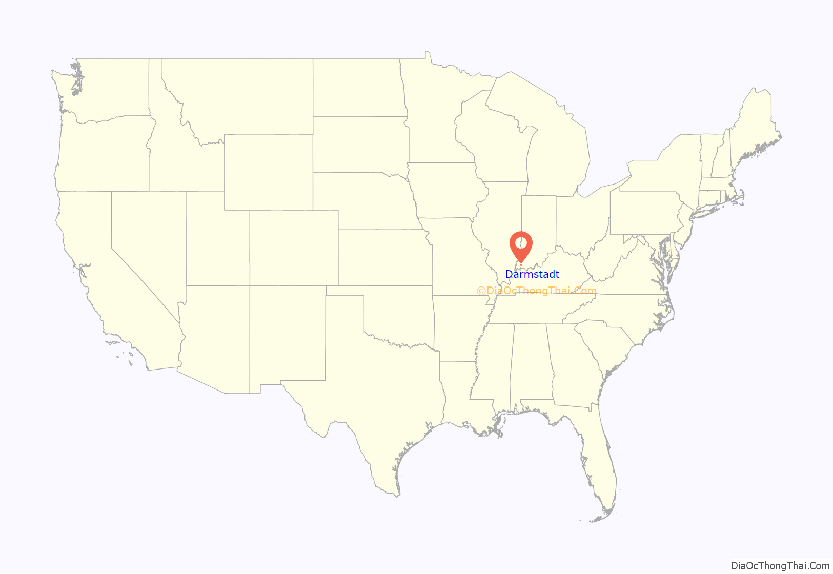
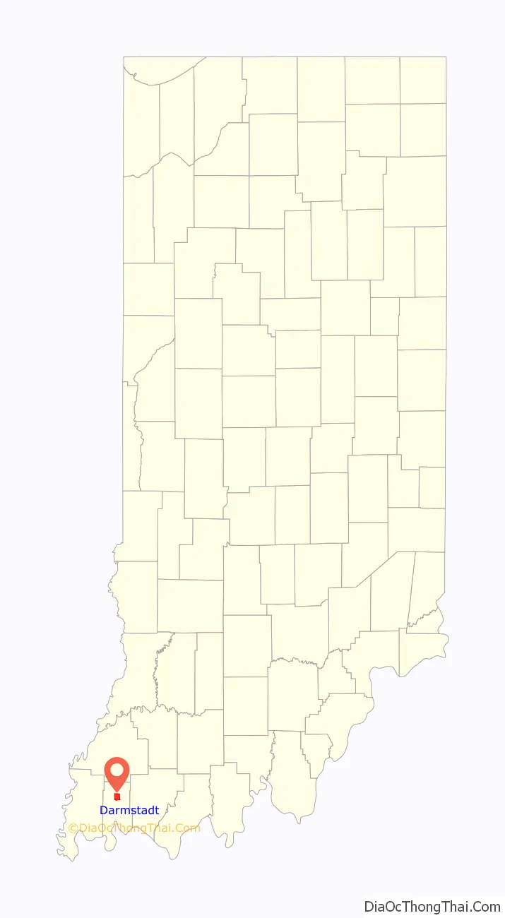
Darmstadt location map. Where is Darmstadt town?
Darmstadt Road Map
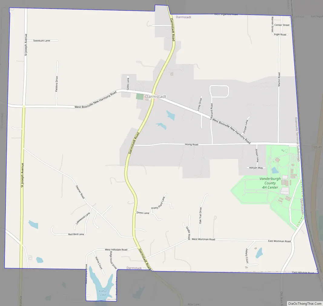
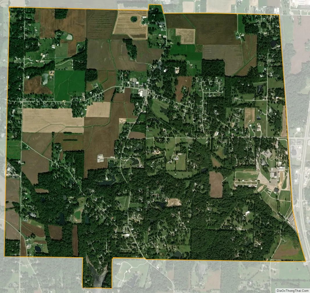
Darmstadt city Satellite Map
Geography
Darmstadt is located at 38°5′28″N 87°34′34″W / 38.09111°N 87.57611°W / 38.09111; -87.57611 (38.091041, -87.576207).
According to the 2010 census, Darmstadt has a total area of 4.58 square miles (11.86 km), of which 4.52 square miles (11.71 km) (or 98.69%) is land and 0.06 square miles (0.16 km) (or 1.31%) is water.
See also
Map of Indiana State and its subdivision:- Adams
- Allen
- Bartholomew
- Benton
- Blackford
- Boone
- Brown
- Carroll
- Cass
- Clark
- Clay
- Clinton
- Crawford
- Daviess
- De Kalb
- Dearborn
- Decatur
- Delaware
- Dubois
- Elkhart
- Fayette
- Floyd
- Fountain
- Franklin
- Fulton
- Gibson
- Grant
- Greene
- Hamilton
- Hancock
- Harrison
- Hendricks
- Henry
- Howard
- Huntington
- Jackson
- Jasper
- Jay
- Jefferson
- Jennings
- Johnson
- Knox
- Kosciusko
- LaGrange
- Lake
- Lake Michigan
- LaPorte
- Lawrence
- Madison
- Marion
- Marshall
- Martin
- Miami
- Monroe
- Montgomery
- Morgan
- Newton
- Noble
- Ohio
- Orange
- Owen
- Parke
- Perry
- Pike
- Porter
- Posey
- Pulaski
- Putnam
- Randolph
- Ripley
- Rush
- Saint Joseph
- Scott
- Shelby
- Spencer
- Starke
- Steuben
- Sullivan
- Switzerland
- Tippecanoe
- Tipton
- Union
- Vanderburgh
- Vermillion
- Vigo
- Wabash
- Warren
- Warrick
- Washington
- Wayne
- Wells
- White
- Whitley
- Alabama
- Alaska
- Arizona
- Arkansas
- California
- Colorado
- Connecticut
- Delaware
- District of Columbia
- Florida
- Georgia
- Hawaii
- Idaho
- Illinois
- Indiana
- Iowa
- Kansas
- Kentucky
- Louisiana
- Maine
- Maryland
- Massachusetts
- Michigan
- Minnesota
- Mississippi
- Missouri
- Montana
- Nebraska
- Nevada
- New Hampshire
- New Jersey
- New Mexico
- New York
- North Carolina
- North Dakota
- Ohio
- Oklahoma
- Oregon
- Pennsylvania
- Rhode Island
- South Carolina
- South Dakota
- Tennessee
- Texas
- Utah
- Vermont
- Virginia
- Washington
- West Virginia
- Wisconsin
- Wyoming