Dayton is a town in Sheffield Township, Tippecanoe County, in the U.S. state of Indiana. The population was 1,420 at the 2010 census.
It is part of the Lafayette, Indiana Metropolitan Statistical Area.
| Name: | Dayton town |
|---|---|
| LSAD Code: | 43 |
| LSAD Description: | town (suffix) |
| State: | Indiana |
| County: | Tippecanoe County |
| Founded: | 1827 |
| Elevation: | 676 ft (206 m) |
| Total Area: | 1.14 sq mi (2.96 km²) |
| Land Area: | 1.14 sq mi (2.96 km²) |
| Water Area: | 0.00 sq mi (0.00 km²) |
| Total Population: | 1,330 |
| Population Density: | 1,163.60/sq mi (449.26/km²) |
| ZIP code: | 47941 |
| Area code: | 765 |
| FIPS code: | 1817002 |
| GNISfeature ID: | 433370 |
| Website: | dayton.in.gov |
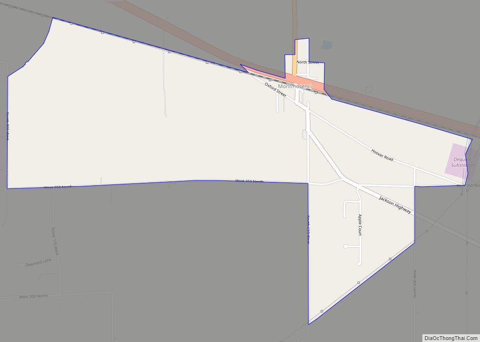
Online Interactive Map
Click on ![]() to view map in "full screen" mode.
to view map in "full screen" mode.
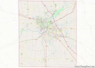
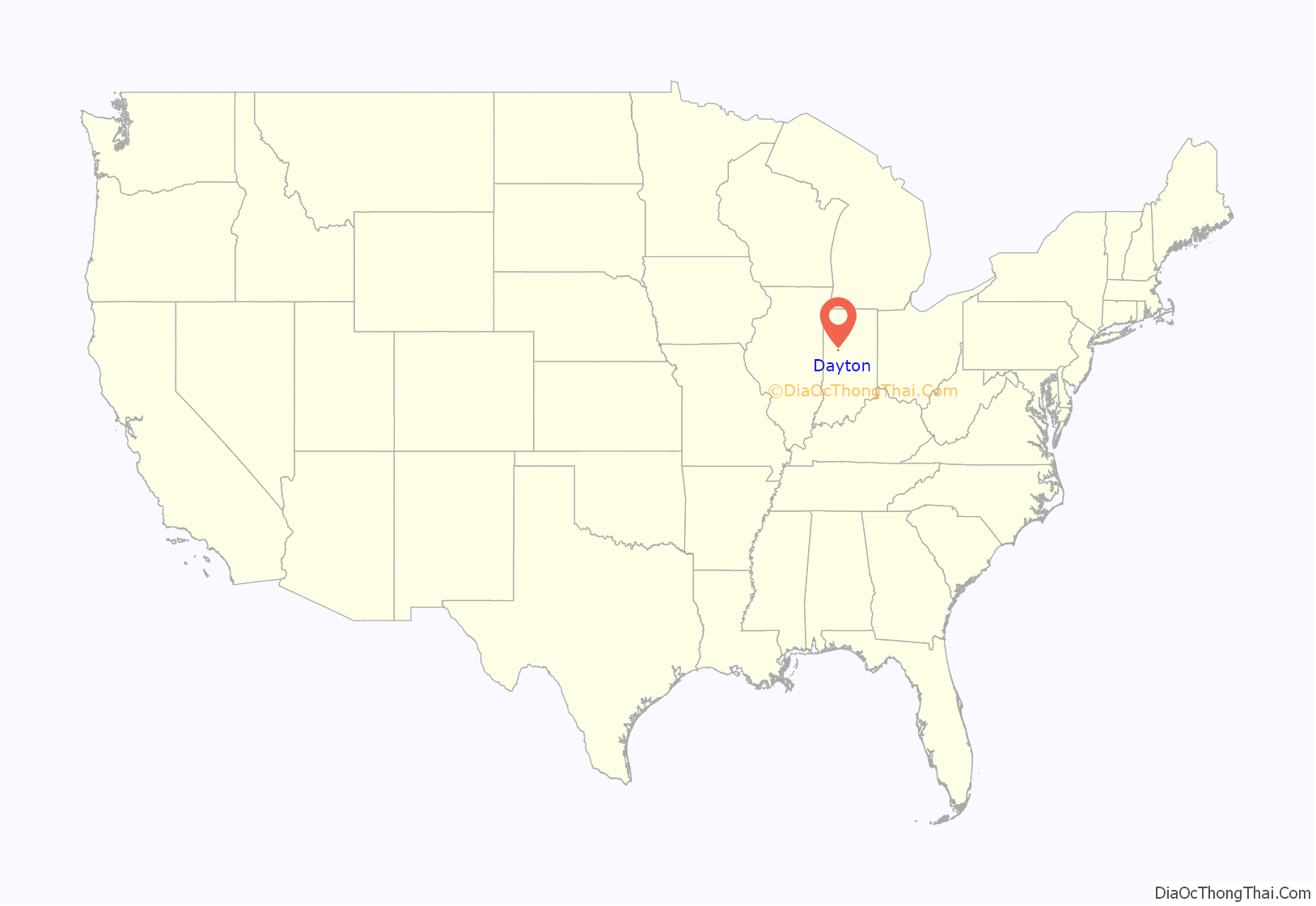
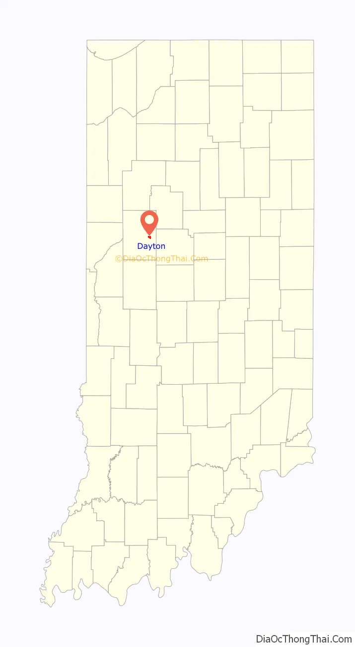
Dayton location map. Where is Dayton town?
History
Dayton was known as Fairfield until 1830. The post office at Dayton has been in operation since 1831.
Dayton Historic District was listed on the National Register of Historic Places in 2003.
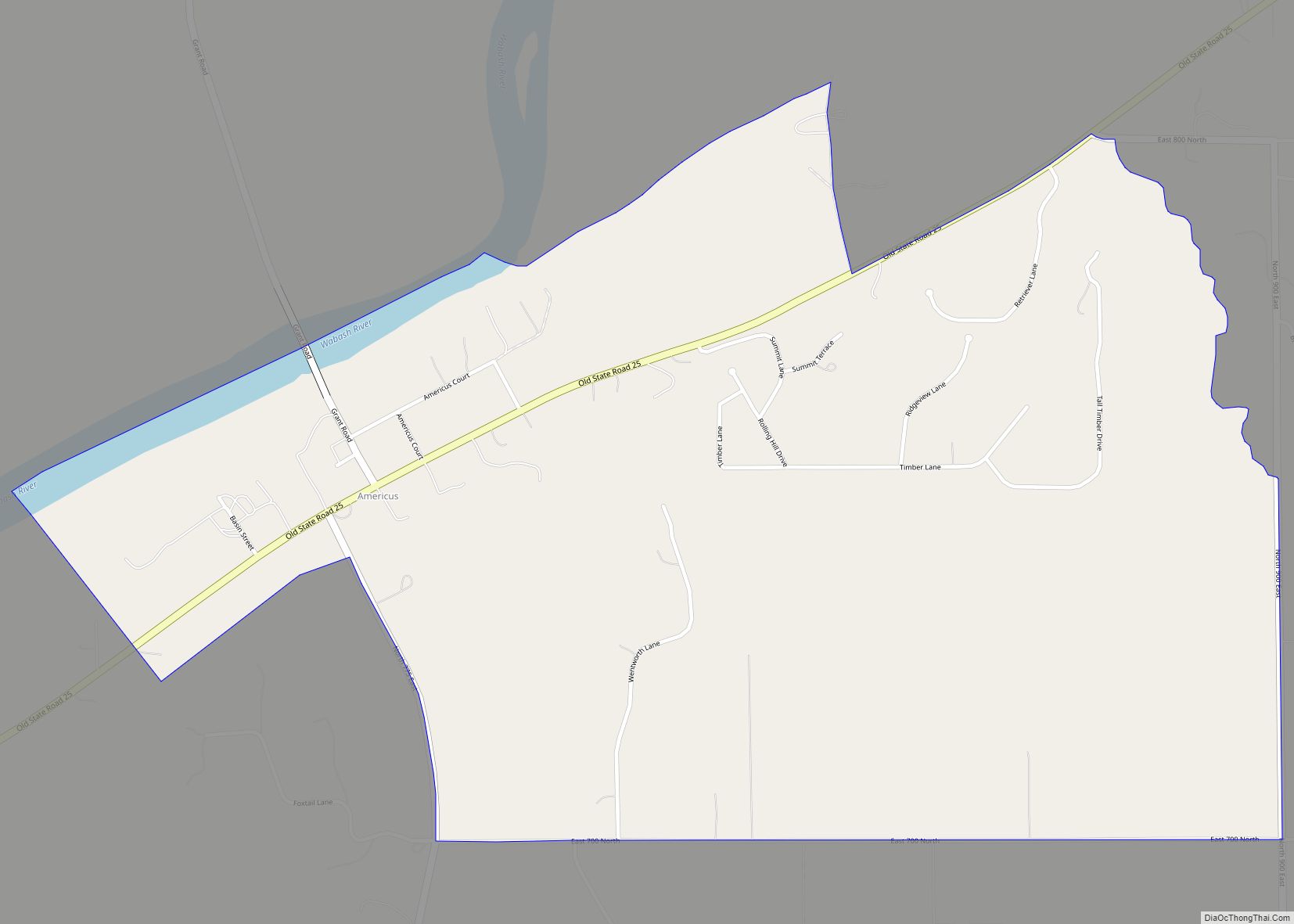
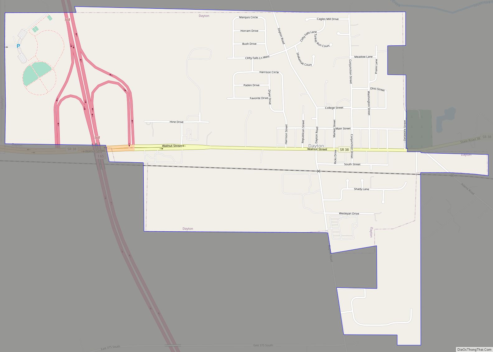
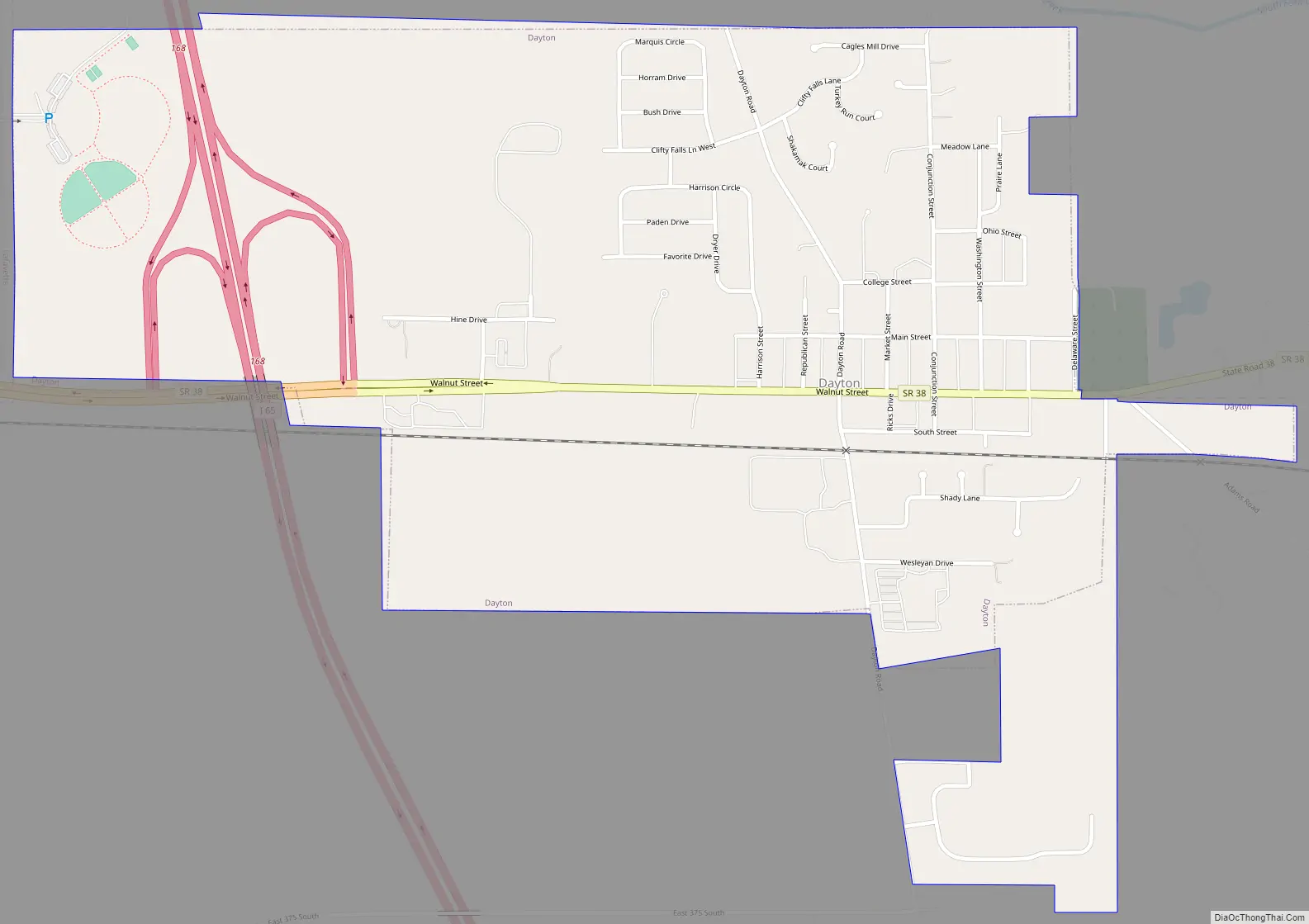
Dayton Road Map
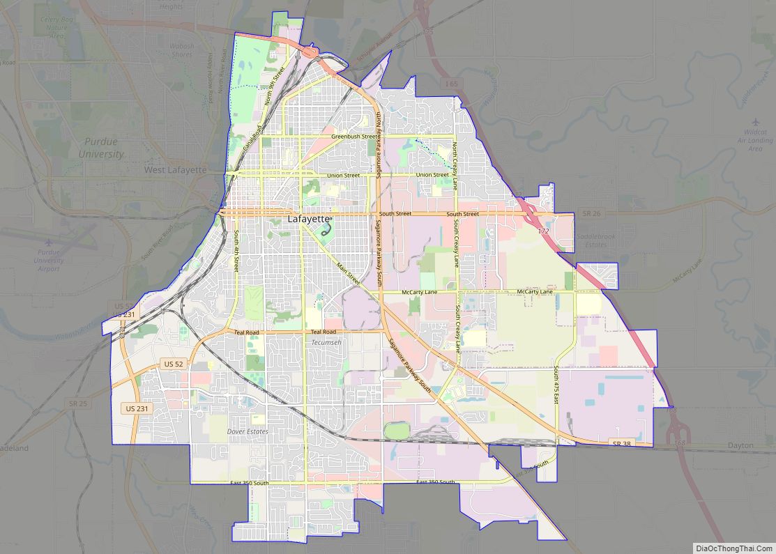
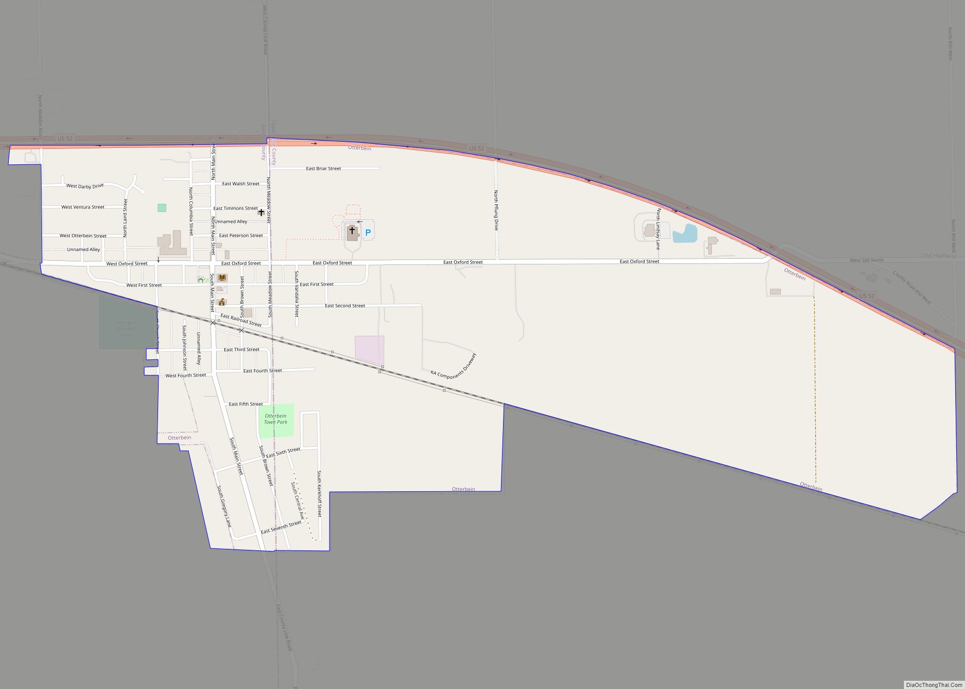
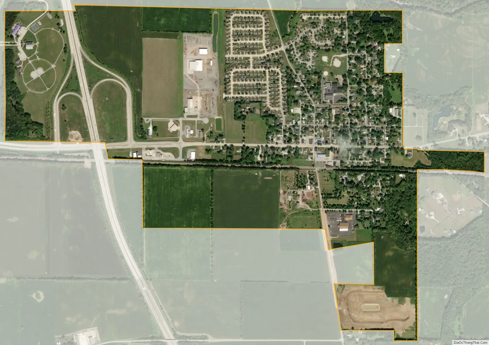
Dayton city Satellite Map
Geography
Dayton is located at 40°22′28″N 86°46′10″W / 40.37444°N 86.76944°W / 40.37444; -86.76944 (40.374579, -86.769379) in Sheffield Township, at an elevation of 676 feet (206 m).
According to the 2010 census, Dayton has a total area of 1.06 square miles (2.75 km), all land.
See also
Map of Indiana State and its subdivision:- Adams
- Allen
- Bartholomew
- Benton
- Blackford
- Boone
- Brown
- Carroll
- Cass
- Clark
- Clay
- Clinton
- Crawford
- Daviess
- De Kalb
- Dearborn
- Decatur
- Delaware
- Dubois
- Elkhart
- Fayette
- Floyd
- Fountain
- Franklin
- Fulton
- Gibson
- Grant
- Greene
- Hamilton
- Hancock
- Harrison
- Hendricks
- Henry
- Howard
- Huntington
- Jackson
- Jasper
- Jay
- Jefferson
- Jennings
- Johnson
- Knox
- Kosciusko
- LaGrange
- Lake
- Lake Michigan
- LaPorte
- Lawrence
- Madison
- Marion
- Marshall
- Martin
- Miami
- Monroe
- Montgomery
- Morgan
- Newton
- Noble
- Ohio
- Orange
- Owen
- Parke
- Perry
- Pike
- Porter
- Posey
- Pulaski
- Putnam
- Randolph
- Ripley
- Rush
- Saint Joseph
- Scott
- Shelby
- Spencer
- Starke
- Steuben
- Sullivan
- Switzerland
- Tippecanoe
- Tipton
- Union
- Vanderburgh
- Vermillion
- Vigo
- Wabash
- Warren
- Warrick
- Washington
- Wayne
- Wells
- White
- Whitley
- Alabama
- Alaska
- Arizona
- Arkansas
- California
- Colorado
- Connecticut
- Delaware
- District of Columbia
- Florida
- Georgia
- Hawaii
- Idaho
- Illinois
- Indiana
- Iowa
- Kansas
- Kentucky
- Louisiana
- Maine
- Maryland
- Massachusetts
- Michigan
- Minnesota
- Mississippi
- Missouri
- Montana
- Nebraska
- Nevada
- New Hampshire
- New Jersey
- New Mexico
- New York
- North Carolina
- North Dakota
- Ohio
- Oklahoma
- Oregon
- Pennsylvania
- Rhode Island
- South Carolina
- South Dakota
- Tennessee
- Texas
- Utah
- Vermont
- Virginia
- Washington
- West Virginia
- Wisconsin
- Wyoming