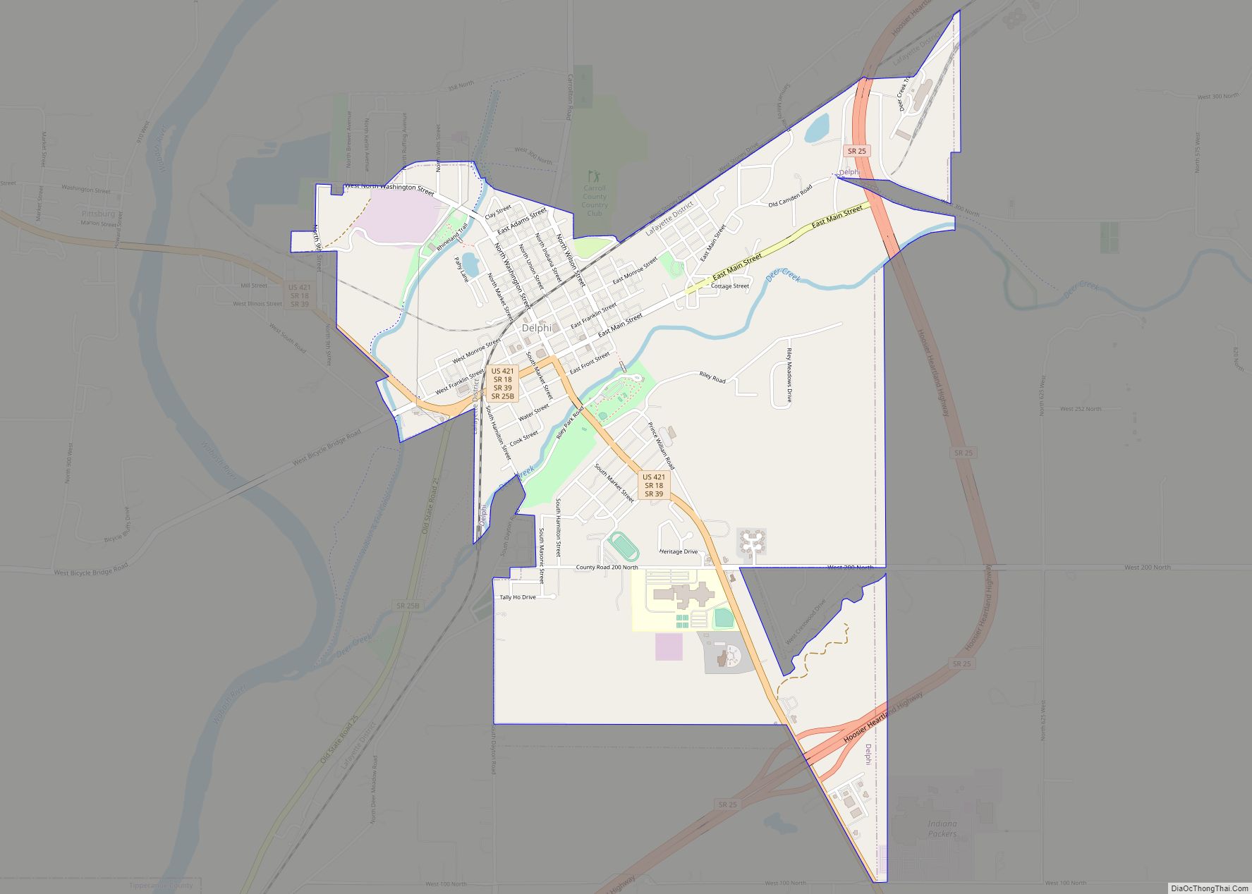
Delphi (/ˈdɛlfaɪ/) is a city in and the county seat of Carroll County, in the U.S. state of Indiana. Located twenty minutes northeast of Lafayette, it is part of the Lafayette, Indiana Metropolitan Statistical Area. The population was 2,893 at the 2010 census.
| Name: | Delphi city |
|---|---|
| LSAD Code: | 25 |
| LSAD Description: | city (suffix) |
| State: | Indiana |
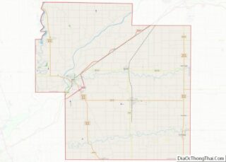
| County: | Carroll County |
| Elevation: | 568 ft (173 m) |
| Total Area: | 2.71 sq mi (7.03 km²) |
| Land Area: | 2.71 sq mi (7.03 km²) |
| Water Area: | 0.00 sq mi (0.00 km²) |
| Total Population: | 2,961 |
| Population Density: | 1,090.61/sq mi (421.10/km²) |
| ZIP code: | 46923 |
| Area code: | 765 |
| FIPS code: | 1817614 |
| GNISfeature ID: | 0433461 |
| Website: | www.cityofdelphi.org |
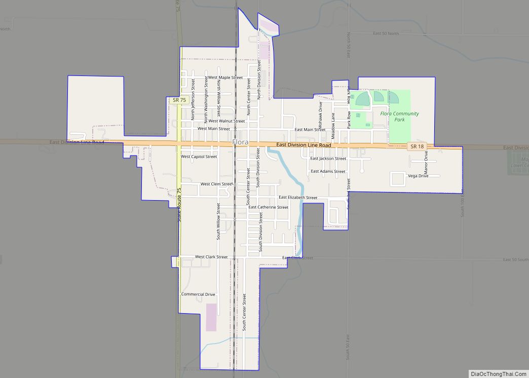
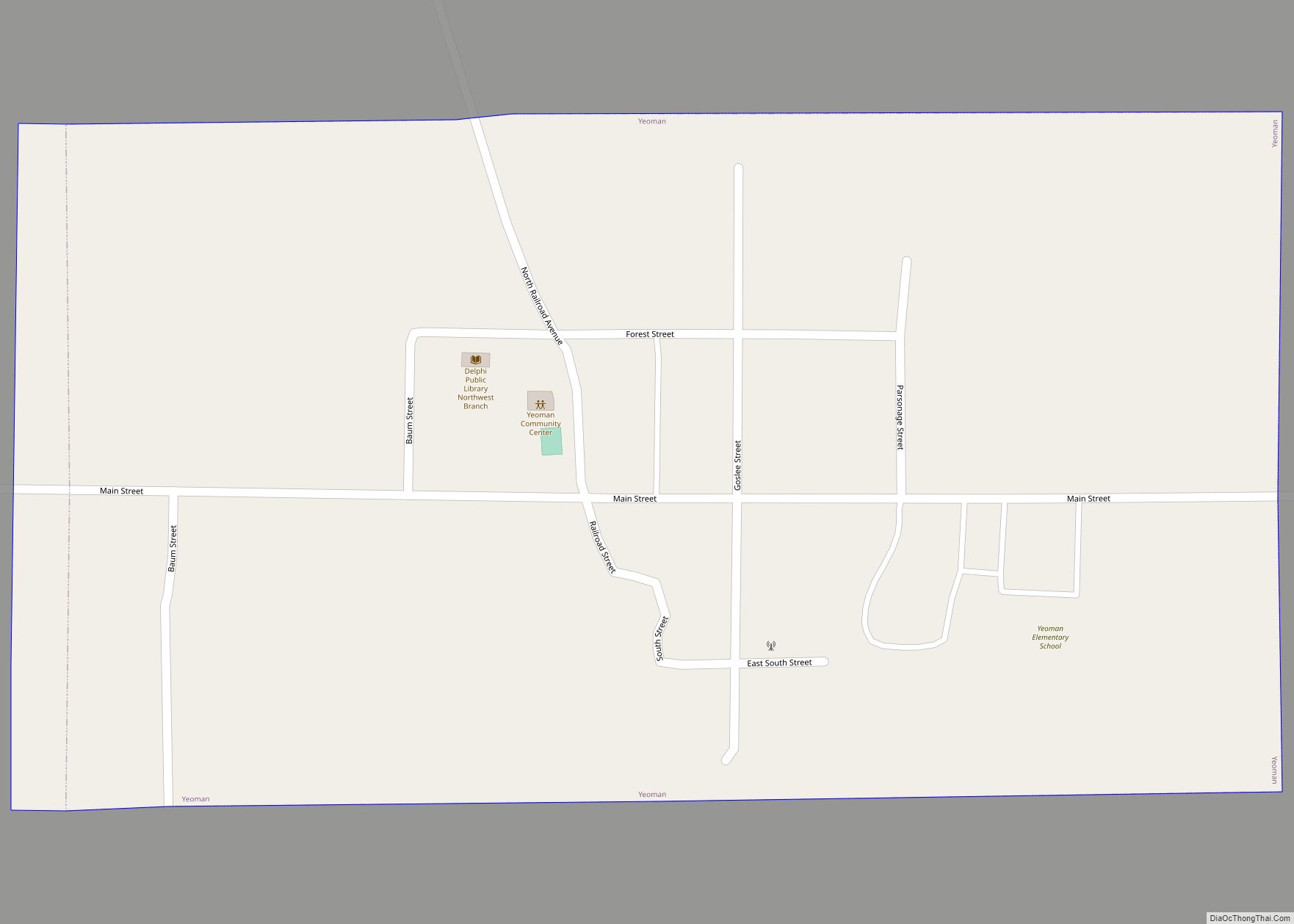
Online Interactive Map
Click on ![]() to view map in "full screen" mode.
to view map in "full screen" mode.
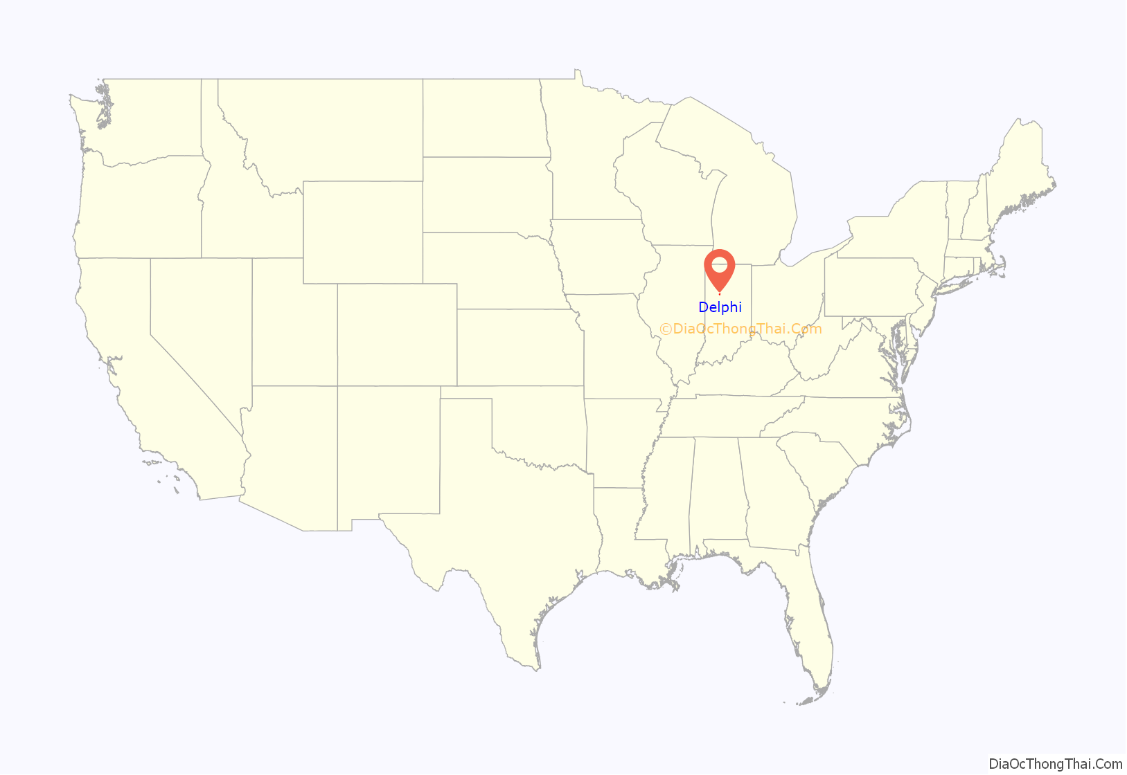
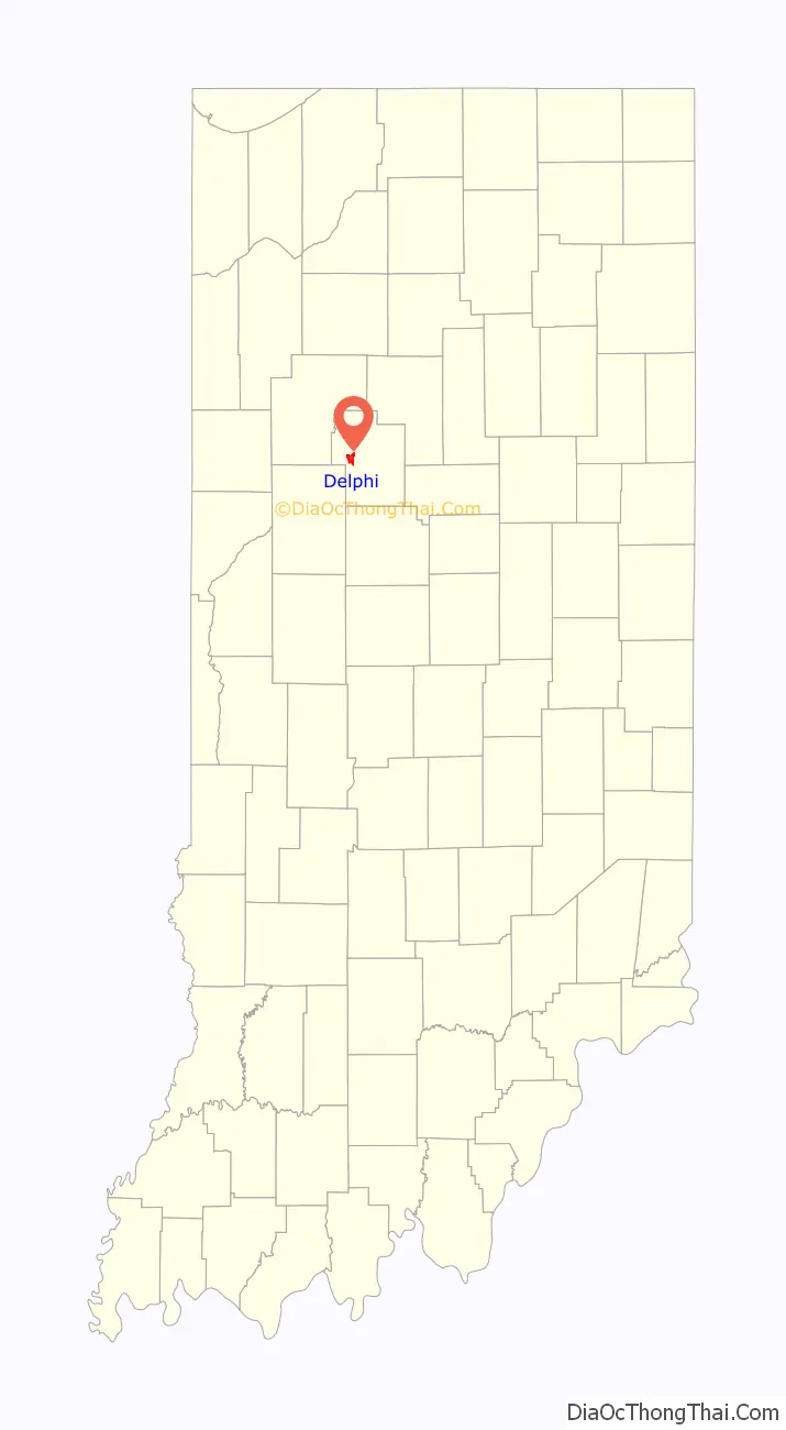
Delphi location map. Where is Delphi city?
History
Delphi was platted in 1828. It took its name from the ancient city of Delphi, in Greece. Several months after Delphi was founded, it was designated as the county seat.
The Barnett-Seawright-Wilson House, Carroll County Courthouse, Delphi City Hall, Delphi Courthouse Square Historic District, Delphi Methodist Episcopal Church, Foreman-Case House, and Niewerth Building are listed on the National Register of Historic Places.
Local heritage centers on the Wabash and Erie Canal, a canal and towpath that once bound together northern, central, and southern Indiana. The segment of the canal that passes through Delphi has been rewatered and serves as the focus of canal activities. A visitor center and museum, the Wabash & Erie Canal Interpretive Center, welcomes guests.
Delphi gained significant attention after becoming the site of the murders of Abigail Williams and Liberty German in February 2017, for which no arrest was made until October 2022.
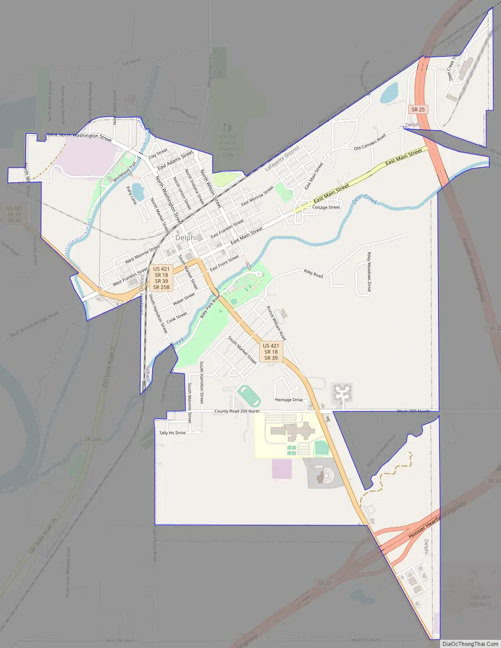
Delphi Road Map
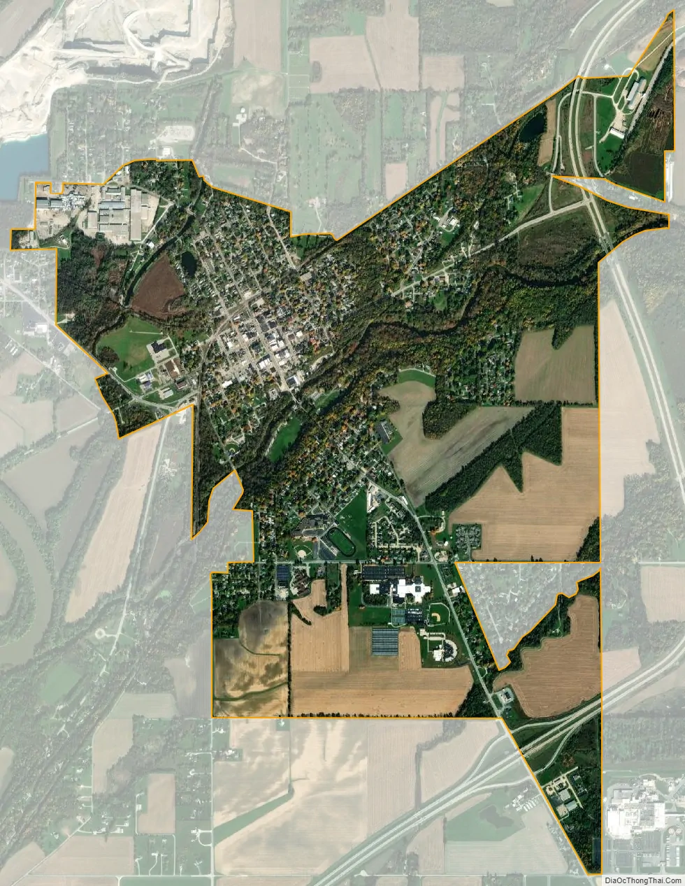
Delphi city Satellite Map
Geography
Delphi is located at 40°35′15″N 86°40′18″W / 40.587461°N 86.671638°W / 40.587461; -86.671638.
According to the 2010 census, Delphi has a total area of 2.73 square miles (7.07 km), all land.
See also
Map of Indiana State and its subdivision:- Adams
- Allen
- Bartholomew
- Benton
- Blackford
- Boone
- Brown
- Carroll
- Cass
- Clark
- Clay
- Clinton
- Crawford
- Daviess
- De Kalb
- Dearborn
- Decatur
- Delaware
- Dubois
- Elkhart
- Fayette
- Floyd
- Fountain
- Franklin
- Fulton
- Gibson
- Grant
- Greene
- Hamilton
- Hancock
- Harrison
- Hendricks
- Henry
- Howard
- Huntington
- Jackson
- Jasper
- Jay
- Jefferson
- Jennings
- Johnson
- Knox
- Kosciusko
- LaGrange
- Lake
- Lake Michigan
- LaPorte
- Lawrence
- Madison
- Marion
- Marshall
- Martin
- Miami
- Monroe
- Montgomery
- Morgan
- Newton
- Noble
- Ohio
- Orange
- Owen
- Parke
- Perry
- Pike
- Porter
- Posey
- Pulaski
- Putnam
- Randolph
- Ripley
- Rush
- Saint Joseph
- Scott
- Shelby
- Spencer
- Starke
- Steuben
- Sullivan
- Switzerland
- Tippecanoe
- Tipton
- Union
- Vanderburgh
- Vermillion
- Vigo
- Wabash
- Warren
- Warrick
- Washington
- Wayne
- Wells
- White
- Whitley
- Alabama
- Alaska
- Arizona
- Arkansas
- California
- Colorado
- Connecticut
- Delaware
- District of Columbia
- Florida
- Georgia
- Hawaii
- Idaho
- Illinois
- Indiana
- Iowa
- Kansas
- Kentucky
- Louisiana
- Maine
- Maryland
- Massachusetts
- Michigan
- Minnesota
- Mississippi
- Missouri
- Montana
- Nebraska
- Nevada
- New Hampshire
- New Jersey
- New Mexico
- New York
- North Carolina
- North Dakota
- Ohio
- Oklahoma
- Oregon
- Pennsylvania
- Rhode Island
- South Carolina
- South Dakota
- Tennessee
- Texas
- Utah
- Vermont
- Virginia
- Washington
- West Virginia
- Wisconsin
- Wyoming