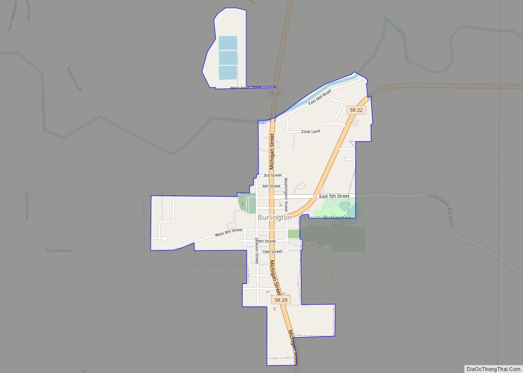
Burlington is a town in Burlington Township, Carroll County, Indiana, United States. The population was 603 at the 2010 census. It is part of the Lafayette, Indiana Metropolitan Statistical Area. State Road 22 connects it to Kokomo.
| Name: | Burlington town |
|---|---|
| LSAD Code: | 43 |
| LSAD Description: | town (suffix) |
| State: | Indiana |
| County: | Carroll County |
| Founded: | 1828 |
| Incorporated: | 1967 |
| Elevation: | 784 ft (239 m) |
| Total Area: | 0.61 sq mi (1.58 km²) |
| Land Area: | 0.61 sq mi (1.58 km²) |
| Water Area: | 0.00 sq mi (0.00 km²) |
| Total Population: | 517 |
| Population Density: | 844.77/sq mi (326.26/km²) |
| ZIP code: | 46915 |
| Area code: | 765 |
| FIPS code: | 1809244 |
| GNISfeature ID: | 0431841 |
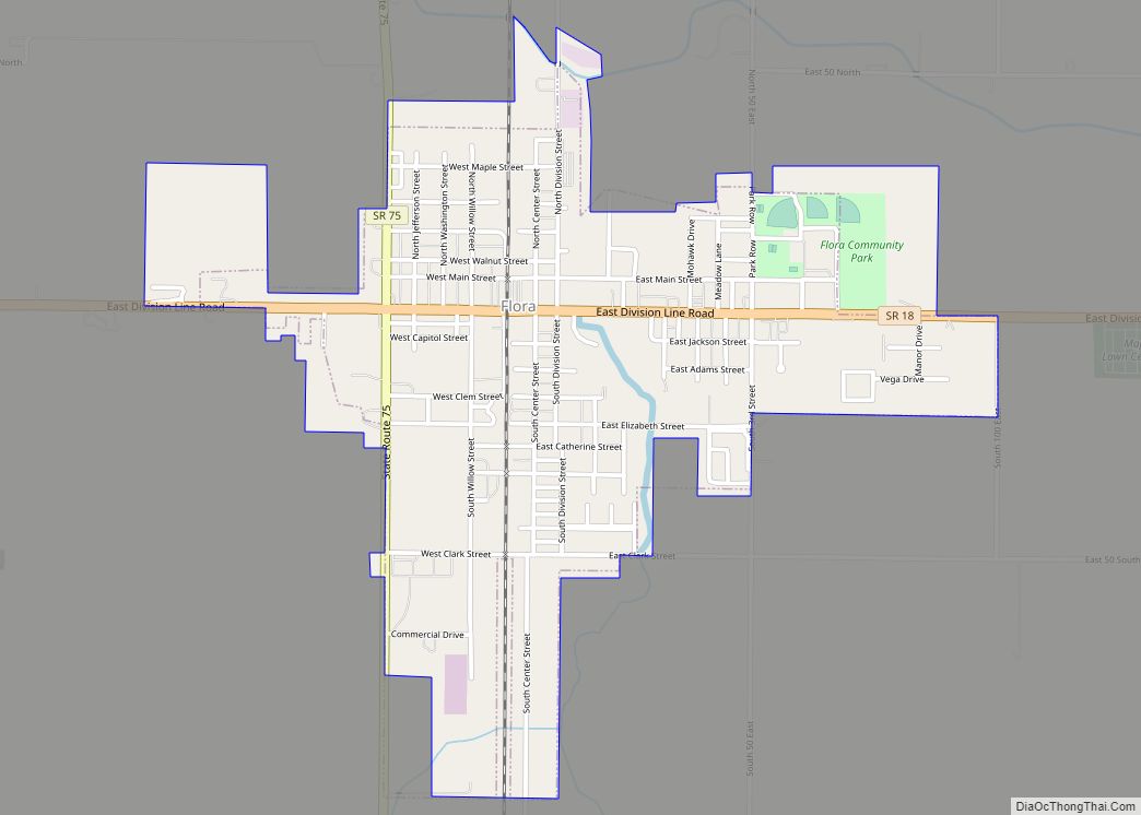
Online Interactive Map
Click on ![]() to view map in "full screen" mode.
to view map in "full screen" mode.
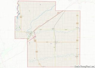
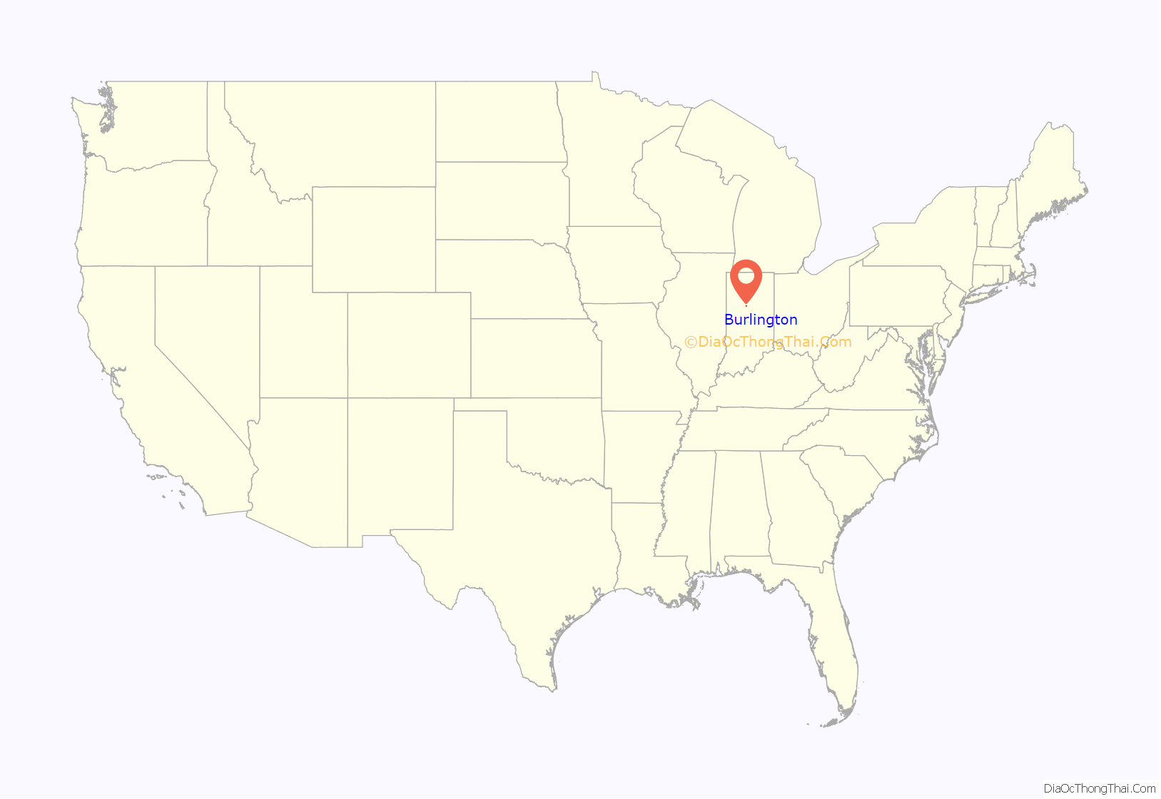
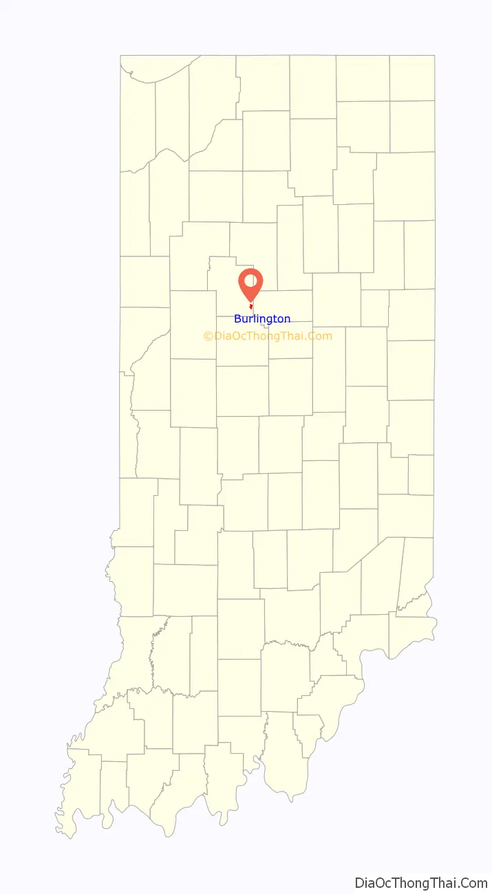
Burlington location map. Where is Burlington town?
History
Burlington was laid out in 1832 by David Stipp – an employee of the General Land Office in Crawfordsville, Indiana – about a year after settlers first appeared in the area. Stipp donated land for the town’s first school house. The town was incorporated in 1967. It is named for Wyandot Chief Burlington. In 1830, work began on the Michigan Road which passed directly through the center of town. The road, which became Indiana’s first superhighway, connected Madison, Indiana and Michigan City, Indiana turning the town into a major thoroughfare.
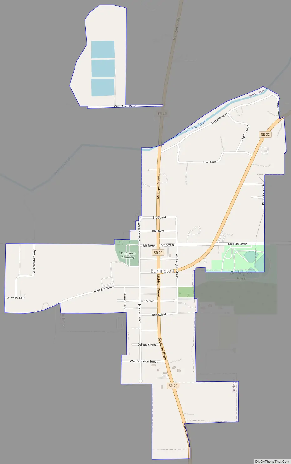
Burlington Road Map
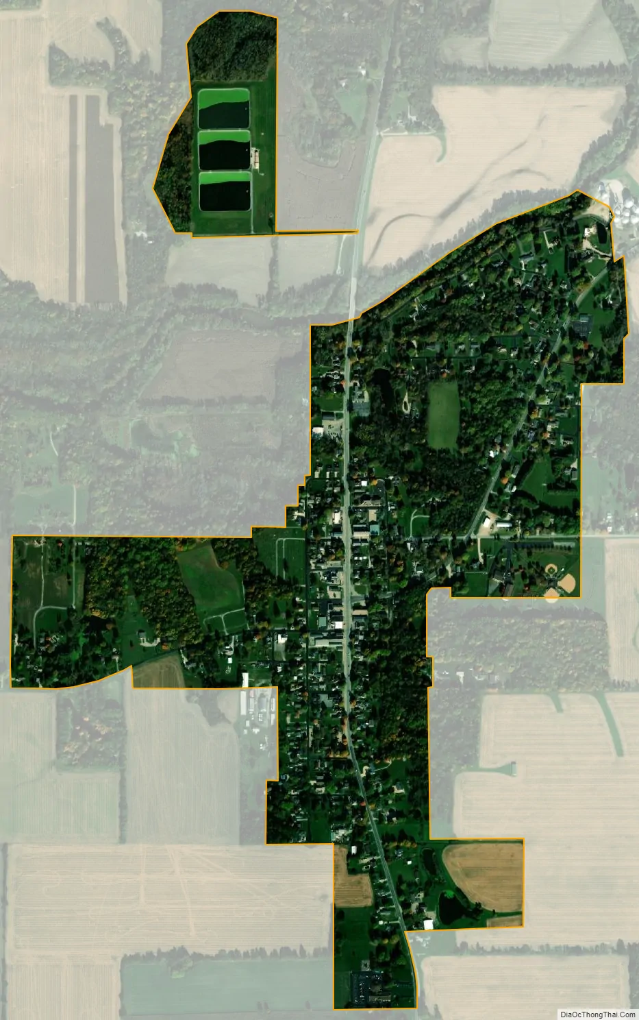
Burlington city Satellite Map
Geography
Burlington is located at 40°28′50″N 86°23′40″W / 40.48056°N 86.39444°W / 40.48056; -86.39444 (40.480564, -86.394470).
According to the 2010 census, Burlington has a total area of 0.6 square miles (1.55 km), all land.
Climate
July is typically the warmest month in Burlington, when highs average 84 °F (29 °C) and lows average 63 °F (17 °C). January is coldest, when the high temperatures average 33 °F (-1 °C) and the lows average 18 °F (-8 °C). The highest recorded temperature was 105 °F (41 °C) in 1980, and the lowest was -26 °F (−32 °C) in 1983.
See also
Map of Indiana State and its subdivision:- Adams
- Allen
- Bartholomew
- Benton
- Blackford
- Boone
- Brown
- Carroll
- Cass
- Clark
- Clay
- Clinton
- Crawford
- Daviess
- De Kalb
- Dearborn
- Decatur
- Delaware
- Dubois
- Elkhart
- Fayette
- Floyd
- Fountain
- Franklin
- Fulton
- Gibson
- Grant
- Greene
- Hamilton
- Hancock
- Harrison
- Hendricks
- Henry
- Howard
- Huntington
- Jackson
- Jasper
- Jay
- Jefferson
- Jennings
- Johnson
- Knox
- Kosciusko
- LaGrange
- Lake
- Lake Michigan
- LaPorte
- Lawrence
- Madison
- Marion
- Marshall
- Martin
- Miami
- Monroe
- Montgomery
- Morgan
- Newton
- Noble
- Ohio
- Orange
- Owen
- Parke
- Perry
- Pike
- Porter
- Posey
- Pulaski
- Putnam
- Randolph
- Ripley
- Rush
- Saint Joseph
- Scott
- Shelby
- Spencer
- Starke
- Steuben
- Sullivan
- Switzerland
- Tippecanoe
- Tipton
- Union
- Vanderburgh
- Vermillion
- Vigo
- Wabash
- Warren
- Warrick
- Washington
- Wayne
- Wells
- White
- Whitley
- Alabama
- Alaska
- Arizona
- Arkansas
- California
- Colorado
- Connecticut
- Delaware
- District of Columbia
- Florida
- Georgia
- Hawaii
- Idaho
- Illinois
- Indiana
- Iowa
- Kansas
- Kentucky
- Louisiana
- Maine
- Maryland
- Massachusetts
- Michigan
- Minnesota
- Mississippi
- Missouri
- Montana
- Nebraska
- Nevada
- New Hampshire
- New Jersey
- New Mexico
- New York
- North Carolina
- North Dakota
- Ohio
- Oklahoma
- Oregon
- Pennsylvania
- Rhode Island
- South Carolina
- South Dakota
- Tennessee
- Texas
- Utah
- Vermont
- Virginia
- Washington
- West Virginia
- Wisconsin
- Wyoming