Fairland is a town in Brandywine Township, Shelby County, Indiana. The population was 315 at the 2010 census.
| Name: | Fairland town |
|---|---|
| LSAD Code: | 43 |
| LSAD Description: | town (suffix) |
| State: | Indiana |
| County: | Shelby County |
| Elevation: | 774 ft (236 m) |
| Total Area: | 1.16 sq mi (3.00 km²) |
| Land Area: | 1.14 sq mi (2.96 km²) |
| Water Area: | 0.02 sq mi (0.04 km²) |
| Total Population: | 542 |
| Population Density: | 474.61/sq mi (183.24/km²) |
| ZIP code: | 46126 |
| Area code: | 317 |
| FIPS code: | 1822396 |
| GNISfeature ID: | 434301 |
| Website: | fairlandin.org |
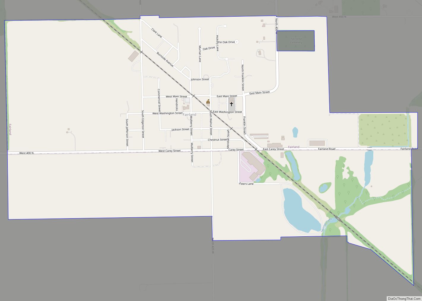
Online Interactive Map
Click on ![]() to view map in "full screen" mode.
to view map in "full screen" mode.
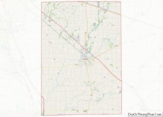
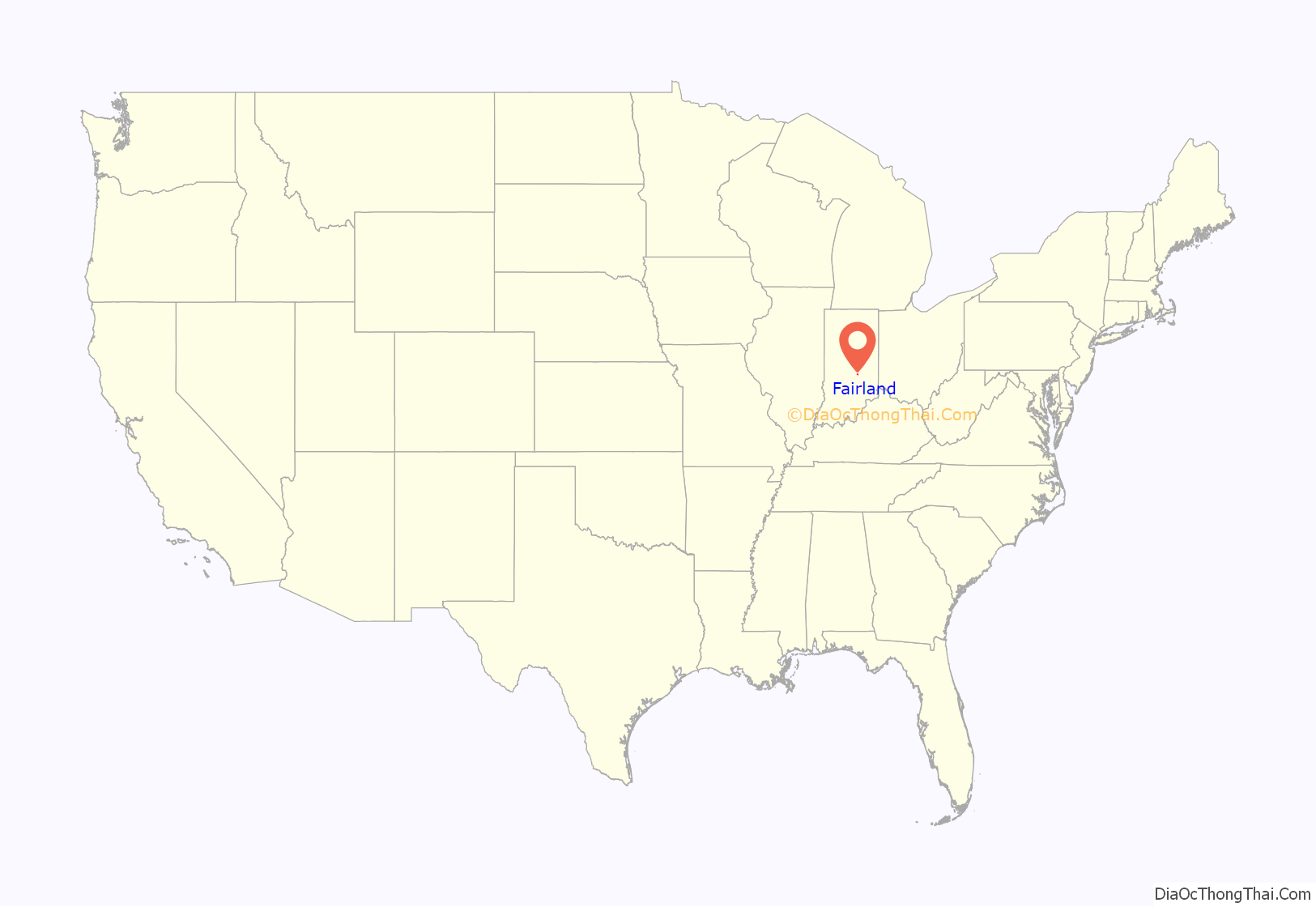
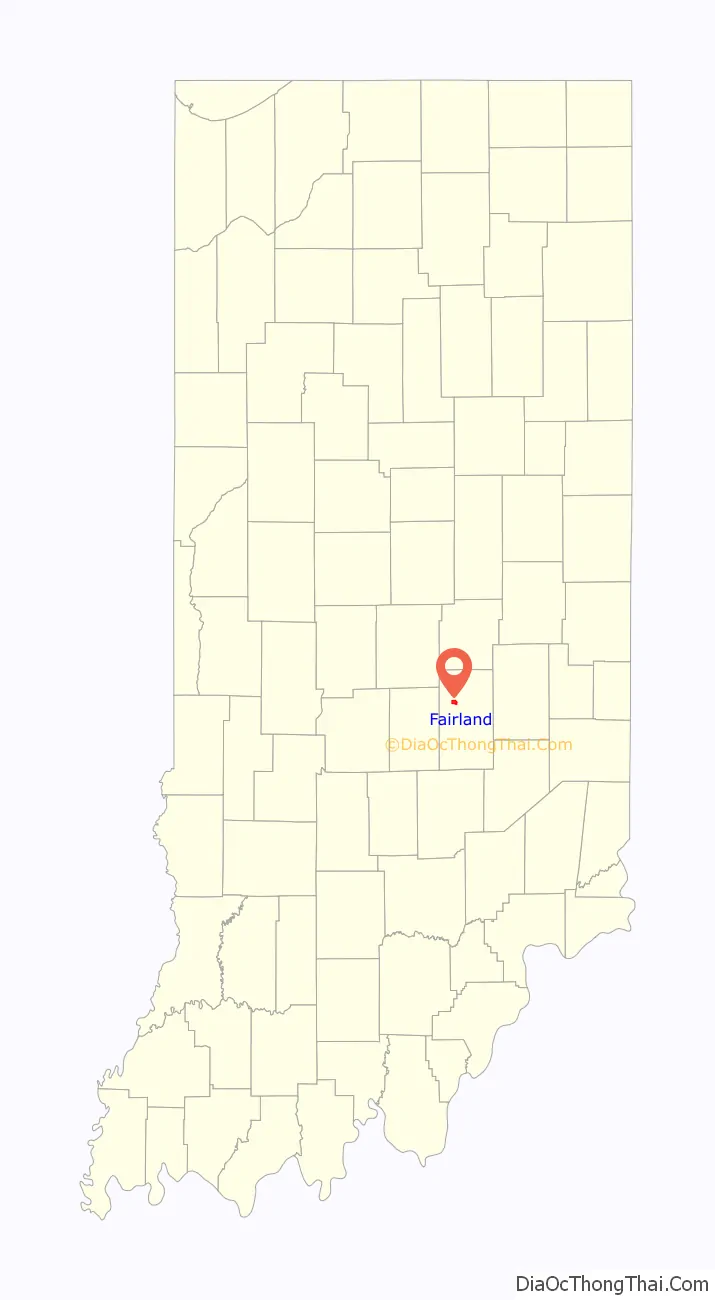
Fairland location map. Where is Fairland town?
History
Construction of the Indianapolis, Cincinnati, and Lafayette Railroad began in 1849, and Fairland was platted in 1852. Isaac Odell and Henry Jenkins hired the J. M. Elliott Company of Shelby County to draw the plans, and this was recorded on Oct. 21, 1852. The town was named for the “beautiful land” near the original town site. A post office has been in operation at Fairland since 1854 with Isaac Odell as the first postmaster. Several additions were made to the town: Daniel Bradley Addition (1857), Odell’s First Addition (1865), Granville S. Harrel Addition (1866), Odell’s Second Addition (1868), Richardson & McQuiston Addition (1872), J. B. Plymate First Addition (1891), Joseph & Luvina Plymate Addition (1902), Walker’s Addition (1903), Drake’s Addition (1907), and Henderson’s Addition (1914). In 1866, the railroad between Martinsville and Franklin was extended from Franklin to Fairland with General Ambrose E. Burnside leading the project. The Fairland Cemetery Association was formed in 1887.
The town boasted the 22-room Park Hotel, bank, blacksmith, physicians, restaurants, general store, hardware store, butcher, Masonic hall, lumber company, sawmill, and livery stable. And, the “Fairland Bulletin” newspaper was published until it was moved to Shelbyville and became the “Volunteer”.
On September 9, 1969, Allegheny Airlines Flight 853 collided in mid-air with a smaller private aircraft northwest of Fairland, killing all 83 passengers and crew of both aircraft.
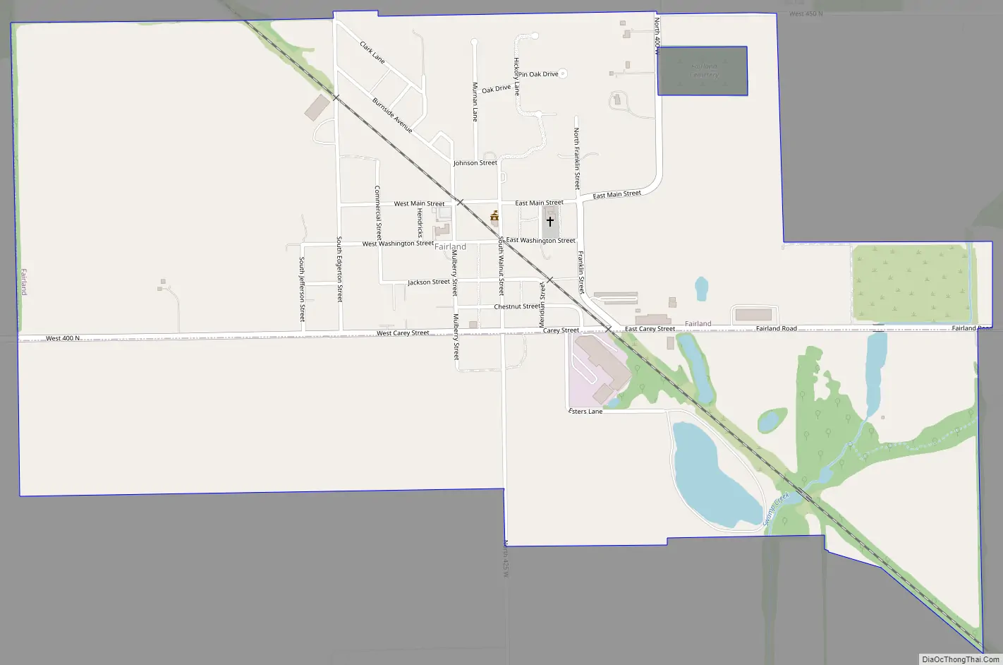
Fairland Road Map
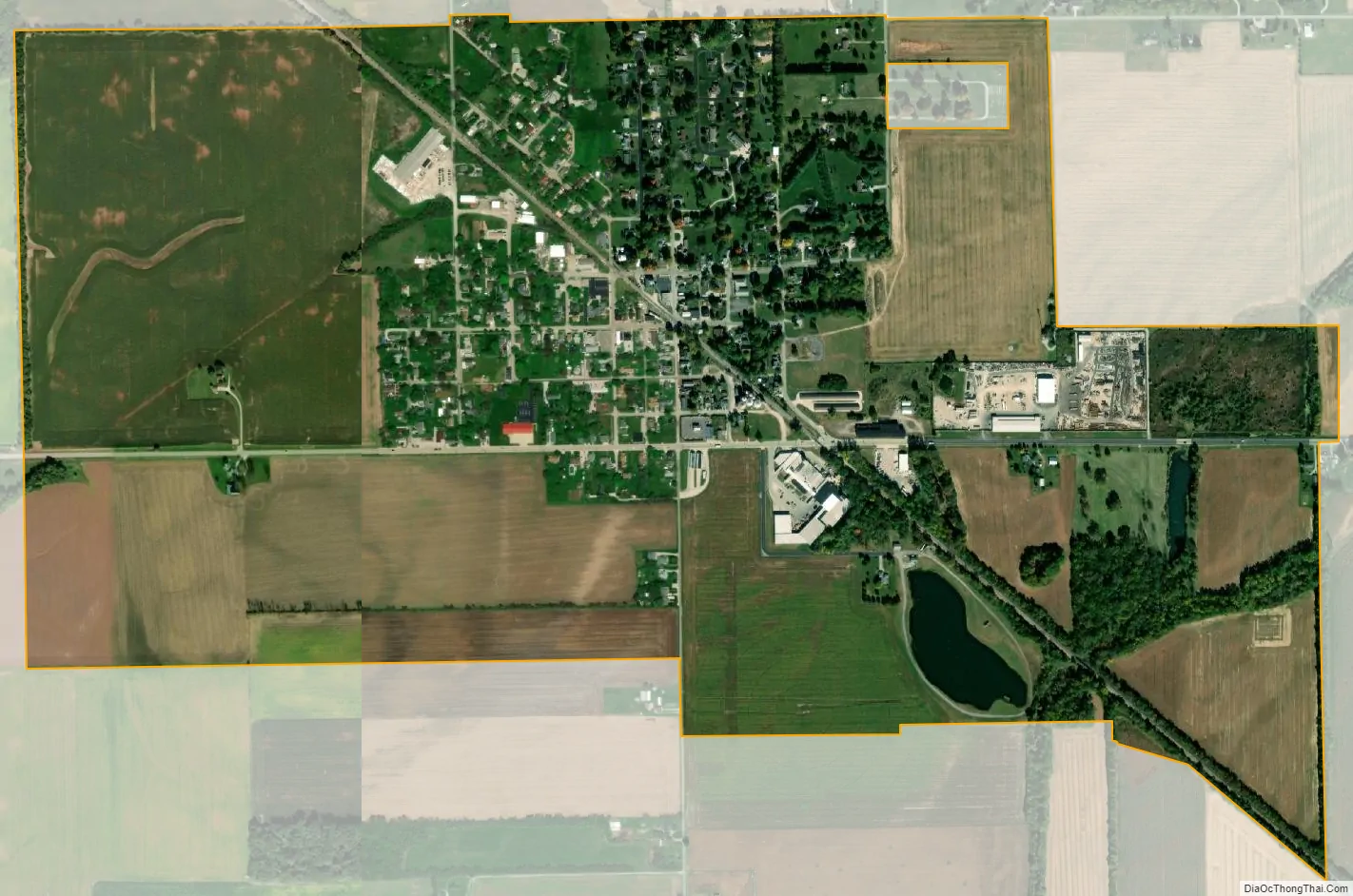
Fairland city Satellite Map
Geography
Fairland is located at 39°35′20″N 85°51′43″W / 39.58889°N 85.86194°W / 39.58889; -85.86194 (39.588962, -85.861885).
According to the 2010 census, Fairland has a total area of 0.16 square miles (0.41 km), all land.
See also
Map of Indiana State and its subdivision:- Adams
- Allen
- Bartholomew
- Benton
- Blackford
- Boone
- Brown
- Carroll
- Cass
- Clark
- Clay
- Clinton
- Crawford
- Daviess
- De Kalb
- Dearborn
- Decatur
- Delaware
- Dubois
- Elkhart
- Fayette
- Floyd
- Fountain
- Franklin
- Fulton
- Gibson
- Grant
- Greene
- Hamilton
- Hancock
- Harrison
- Hendricks
- Henry
- Howard
- Huntington
- Jackson
- Jasper
- Jay
- Jefferson
- Jennings
- Johnson
- Knox
- Kosciusko
- LaGrange
- Lake
- Lake Michigan
- LaPorte
- Lawrence
- Madison
- Marion
- Marshall
- Martin
- Miami
- Monroe
- Montgomery
- Morgan
- Newton
- Noble
- Ohio
- Orange
- Owen
- Parke
- Perry
- Pike
- Porter
- Posey
- Pulaski
- Putnam
- Randolph
- Ripley
- Rush
- Saint Joseph
- Scott
- Shelby
- Spencer
- Starke
- Steuben
- Sullivan
- Switzerland
- Tippecanoe
- Tipton
- Union
- Vanderburgh
- Vermillion
- Vigo
- Wabash
- Warren
- Warrick
- Washington
- Wayne
- Wells
- White
- Whitley
- Alabama
- Alaska
- Arizona
- Arkansas
- California
- Colorado
- Connecticut
- Delaware
- District of Columbia
- Florida
- Georgia
- Hawaii
- Idaho
- Illinois
- Indiana
- Iowa
- Kansas
- Kentucky
- Louisiana
- Maine
- Maryland
- Massachusetts
- Michigan
- Minnesota
- Mississippi
- Missouri
- Montana
- Nebraska
- Nevada
- New Hampshire
- New Jersey
- New Mexico
- New York
- North Carolina
- North Dakota
- Ohio
- Oklahoma
- Oregon
- Pennsylvania
- Rhode Island
- South Carolina
- South Dakota
- Tennessee
- Texas
- Utah
- Vermont
- Virginia
- Washington
- West Virginia
- Wisconsin
- Wyoming