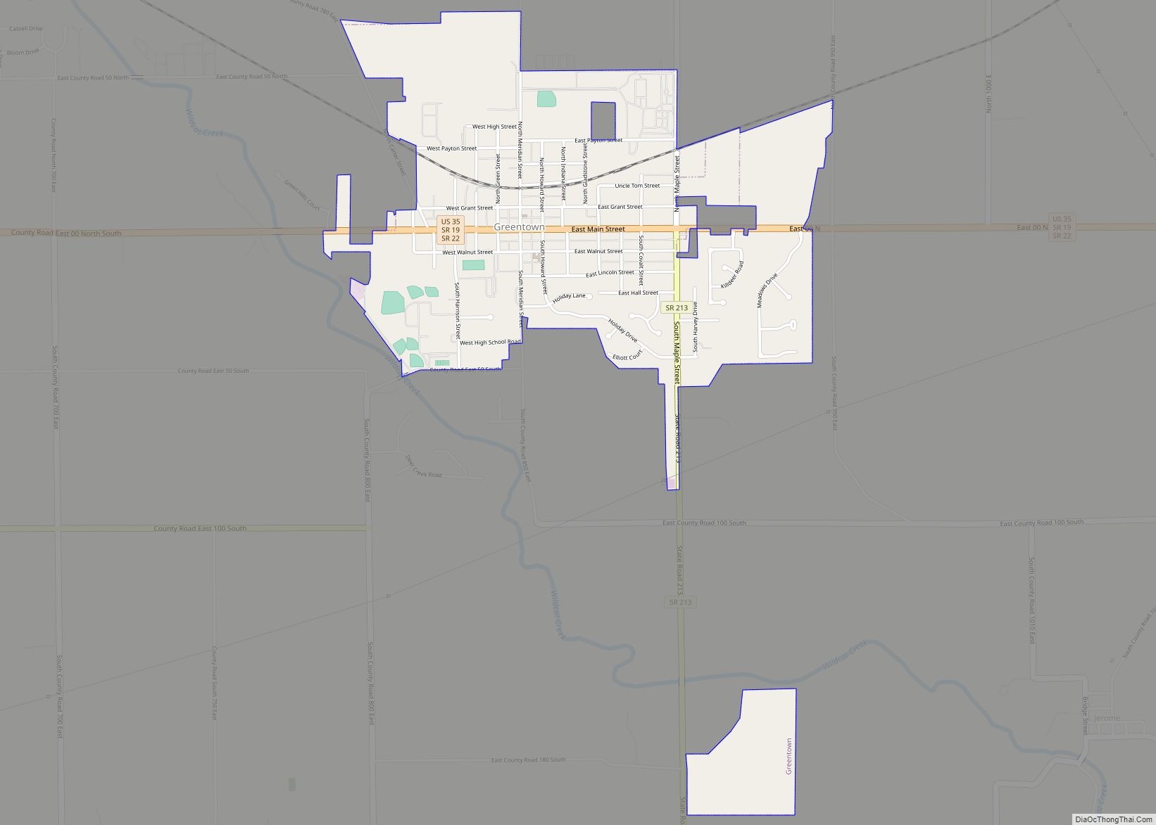
Greentown is a town in Liberty Township, Howard County, Indiana, United States. Located approximately 9 miles east of Kokomo on State Road 22 / US 35; it is home to the Howard County Fair Grounds. The town was platted in 1848, and incorporated as a town in 1873. Known for its collectible glassware made for only a few years by a local factory destroyed in 1903, it is home to the Greentown Glass Museum. As of the 2010 census, the town’s population was 2,415.
| Name: | Greentown town |
|---|---|
| LSAD Code: | 43 |
| LSAD Description: | town (suffix) |
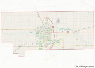
| State: | Indiana |
| County: | Howard County |
| Elevation: | 840 ft (256 m) |
| Total Area: | 1.29 sq mi (3.35 km²) |
| Land Area: | 1.29 sq mi (3.35 km²) |
| Water Area: | 0.00 sq mi (0.00 km²) |
| Total Population: | 2,370 |
| Population Density: | 1,831.53/sq mi (706.90/km²) |
| Area code: | 765 |
| FIPS code: | 1829772 |
| GNISfeature ID: | 0435455 |
Online Interactive Map
Click on ![]() to view map in "full screen" mode.
to view map in "full screen" mode.
Greentown location map. Where is Greentown town?


History
Greentown was laid out in 1848 on the site of a former Native American village. Its inception was largely due to the need for a nearby trading post by people living in the area. First was a merchant, L. W. Bacon who built a log house on the northeast corner of Main and Merdian. Next was C. O. Fry who built on the southwest corner of the intersection. Just prior to the establishment of these local stores, around 1840 the Miami tribe of the Algonquin native peoples had a population in Howard county of about two hundred. There was an established village where South Kokomo is located, as well as villages south of present-day Cassville and Greentown. The frequently traveled paths were from Kokomo to Peru by way of the village of Cassville, and from Kokomo to Meshingomesia by way of a village south of Greentown.
There are a few different versions of how Greentown received its name. One of the more obvious versions would be that Greentown was an area of luscious green grass. Another version deals with the fact that before the town was incorporated that land was a part of a former township named Green Township. Green Township formed into both Liberty and Union Townships in 1860, and so even though Greentown wasn’t incorporated until the 1870s people were still living there when it was Green Township, and may have possibly all opted to preserve Green Township in some way by naming their town after it. One other version is based on the idea of Greentown being an Indian settlement named after a Native American chief called Green.
Greentown was incorporated some time between 1870 and 1880 as it first appeared on the US census in 1880. The population started out at just over 200, and quickly reached a thousand. Over the years since, Greentown’s population numbers have seen notable gains every couple censuses followed by smaller drops between, which has enabled the town to slowly grow over time. The population has remained at nearly 2,500 since the 1990s. Greentown is expected to annex more area when the sewage treatment plant is updated, which is expected to bring another gain soon.
The Hy-Red Gasoline Station was listed on the National Register of Historic Places in 1983.
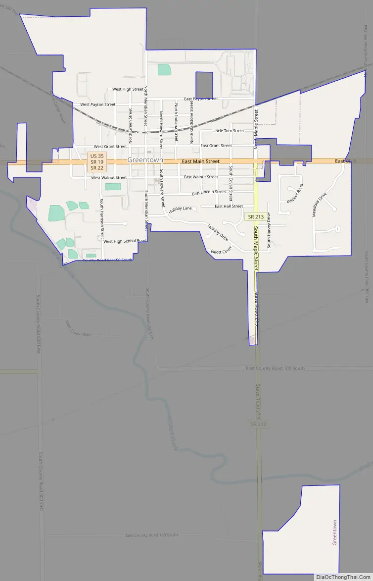
Greentown Road Map
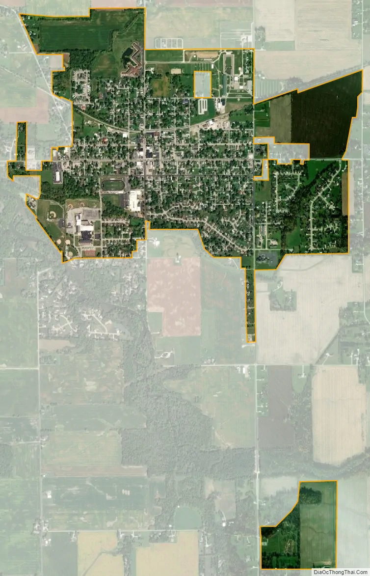
Greentown city Satellite Map
Geography
Greentown is located at 40°28′43″N 85°57′53″W / 40.47861°N 85.96472°W / 40.47861; -85.96472 (40.478556, −85.964683).
According to the 2010 census, Greentown has a total area of 1.37 square miles (3.55 km), all land. It was the nearest town to the epicenter of the magnitude 3.8 Indiana earthquake of December 30, 2010.
See also
Map of Indiana State and its subdivision:- Adams
- Allen
- Bartholomew
- Benton
- Blackford
- Boone
- Brown
- Carroll
- Cass
- Clark
- Clay
- Clinton
- Crawford
- Daviess
- De Kalb
- Dearborn
- Decatur
- Delaware
- Dubois
- Elkhart
- Fayette
- Floyd
- Fountain
- Franklin
- Fulton
- Gibson
- Grant
- Greene
- Hamilton
- Hancock
- Harrison
- Hendricks
- Henry
- Howard
- Huntington
- Jackson
- Jasper
- Jay
- Jefferson
- Jennings
- Johnson
- Knox
- Kosciusko
- LaGrange
- Lake
- Lake Michigan
- LaPorte
- Lawrence
- Madison
- Marion
- Marshall
- Martin
- Miami
- Monroe
- Montgomery
- Morgan
- Newton
- Noble
- Ohio
- Orange
- Owen
- Parke
- Perry
- Pike
- Porter
- Posey
- Pulaski
- Putnam
- Randolph
- Ripley
- Rush
- Saint Joseph
- Scott
- Shelby
- Spencer
- Starke
- Steuben
- Sullivan
- Switzerland
- Tippecanoe
- Tipton
- Union
- Vanderburgh
- Vermillion
- Vigo
- Wabash
- Warren
- Warrick
- Washington
- Wayne
- Wells
- White
- Whitley
- Alabama
- Alaska
- Arizona
- Arkansas
- California
- Colorado
- Connecticut
- Delaware
- District of Columbia
- Florida
- Georgia
- Hawaii
- Idaho
- Illinois
- Indiana
- Iowa
- Kansas
- Kentucky
- Louisiana
- Maine
- Maryland
- Massachusetts
- Michigan
- Minnesota
- Mississippi
- Missouri
- Montana
- Nebraska
- Nevada
- New Hampshire
- New Jersey
- New Mexico
- New York
- North Carolina
- North Dakota
- Ohio
- Oklahoma
- Oregon
- Pennsylvania
- Rhode Island
- South Carolina
- South Dakota
- Tennessee
- Texas
- Utah
- Vermont
- Virginia
- Washington
- West Virginia
- Wisconsin
- Wyoming