Greenwood is a city in Johnson County, Indiana, United States. The population was 63,830 at the 2020 Census. Greenwood is located southeast of central Indianapolis between Indiana State Road 37 and Interstate 65. The city shares a border with Indianapolis and is the most populous suburban municipality in the southern portion of the Indianapolis Metropolitan Area.
| Name: | Greenwood city |
|---|---|
| LSAD Code: | 25 |
| LSAD Description: | city (suffix) |
| State: | Indiana |
| County: | Johnson County |
| Elevation: | 813 ft (248 m) |
| Total Area: | 27.91 sq mi (72.28 km²) |
| Land Area: | 27.91 sq mi (72.28 km²) |
| Water Area: | 0.00 sq mi (0.00 km²) |
| Total Population: | 63,830 |
| Population Density: | 2,287.24/sq mi (883.12/km²) |
| ZIP code: | 46142-46143 |
| Area code: | 317 |
| FIPS code: | 1829898 |
| GNISfeature ID: | 0435464 |
| Website: | www.greenwood.in.gov |
Online Interactive Map
Click on ![]() to view map in "full screen" mode.
to view map in "full screen" mode.
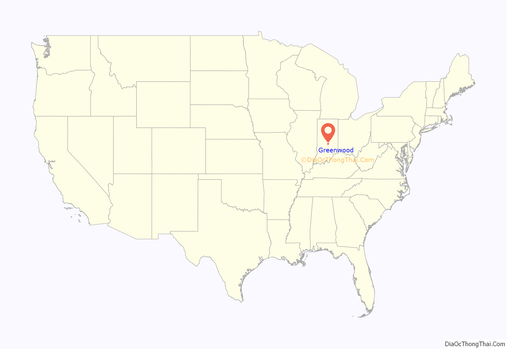
Greenwood location map. Where is Greenwood city?
History
The first inhabitants of the area currently known as Greenwood were the Delaware Indians (Lenape). In 1818, the Treaty of St. Mary’s opened central Indiana to European American settlement, and by 1823 the first cabin in northern Johnson County was erected by settlers John B. and Isaac Smock on land now occupied by Greenwood Park Mall. Greenwood was first known as “Smocktown” or “Smock’s Settlement” in honor of the Smock brothers, and became “Greenfield” in 1825. Since this clashed with another Greenfield located in Hancock County, the name of the settlement was changed to “Greenwood” in 1833.
Greenwood was incorporated as a town under Indiana law in 1864.
Greenwood was an early and key cog in the Electric Indianapolis Interurban Railway System. In 1895, Henry L. Smith proposed and organized the Indianapolis, Greenwood & Franklin Company and graded the line to Greenwood. The Indianapolis, Greenwood & Franklin Railway was opened between Indianapolis and Greenwood on January 1, 1900, and, according to Indianapolis historian Jacob Piatt Dunn, was the Hoosier capital’s first real interurban electric railway. The railway followed what is now Madison Avenue.
The J.T. Polk Canning Company was essential to Greenwood’s early growth. The cannery was a major employer and canned a variety of vegetables grown in Indiana. Later, the company expanded into the dairy market and provided milk delivery to customers. At one point the cannery was the largest canning operation west of Baltimore. The cannery was eventually purchased by the Stokely-Van Camp company and retained operations in Greenwood until the 1950s. Portions of the cannery are still standing on Main Street and have been repurposed for professional office space.
Greenwood became a fifth-class city in 1960.
In February 1965, an Indiana Civil Rights Commission report found that Greenwood had recently been one of 19 sundown towns in Indiana, where African Americans were not allowed to live or stay after dark. The city had been exclusively white since the 1920s. The report analyzes Greenwood’s housing problem within African American families in the few years leading up to 1965. The analysis confirms a study regarding poorly constructed homes on the outskirts of Greenwood and a purchased house bought by an African American family that sold below $15,000. Racial tensions rose when the family introduced themselves to their new neighbors. In response, the neighbors presented the African American family with hostile threats. In the aftermath, the owners revoked their sale from the housing market.
Greenwood has long been a rightward-leaning community politically. After the founding of the John Birch Society in Indianapolis in 1958, a landmark for many years on the south side, adjacent to U.S. Route 31, was a Society billboard demanding “Get US out! of the United Nations”. Circa 1967 Greenwood became home to one of the major “realms” of the Ku Klux Klan. Kentucky native William M. Chaney ran the Confederation of Independent Orders of the Invisible Empire, Knights of the KKK (apparently affiliated with the United Klans of America Inc.), from his home there until at least the early 1980’s (he died in 2002).
Greenwood Commercial Historic District was listed on the National Register of Historic Places in 1991. This district encompasses 25 buildings and 3.2 acres (1.3 hectares).
In 2010, the Greenwood City Council approved a measure to change the official status of Greenwood to second-class city in accordance with Indiana Code Title 36, Article 4, Chapter 1.
On July 17, 2022, three people were killed and two others wounded after a mass shooting occurred at the food court of Greenwood Park Mall. The gunman was subsequently shot and killed by an armed civilian who witnessed the shooting.
Greenwood Road Map
Greenwood city Satellite Map
Geography
Location and area
Greenwood is in northern Johnson County and occupies the northern half of Pleasant Township and the northeast portion of White River Township. The easternmost edge of Greenwood extends into Clark Township. It is bordered to the southwest by Bargersville, to the south by Whiteland and New Whiteland, and to the north, in Marion County, by the city of Indianapolis. Greenwood is 11 miles (18 km) south of Downtown Indianapolis and 12 miles (19 km) north of Franklin, the Johnson county seat.
According to the 2020 census, Greenwood has a total area of 27.91 square miles (72.29 km), of which 27.91 square miles (72.29 km) (or 100%) is land and 0.00 square miles (0.00 km) (or 0%) is water.
Greenwood’s mean elevation is 813 feet (248 m) above sea level. The city’s topography is flat to gently rolling.
Bodies of water
There are no navigable bodies of water within city limits. Several creeks run through the area and influence local drainage patterns, topography, and storm water management systems. Pleasant Run Creek flows from east to west across the northern half of the city, leading 5 miles (8 km) to the White River. Several municipal parks occupy the lowlands next to the creek. Grassy Creek and Tracy Ditch flow south from the city, connecting Greenwood to the towns of New Whiteland, Whiteland, and Franklin. Honey Creek originates in the southwest section of the city and after flowing through White River Township eventually joins the White River near the intersection of Smith Valley Road and Highway 37.
Climate
Greenwood’s climate is classified as warm temperate (Cfa) by the Köppen-Geiger system, with an average annual temperature of 54.3 °F (12.4 °C). About 45 inches (1,100 mm) of precipitation falls annually, distributed fairly evenly throughout the year.
Parks
Main Article: Parks
Over the years, Greenwood has constructed 17 parks that span upwards of 400 acres of land; furthermore, amongst these parks, there are more than 20 lineal miles of trailways for walking and biking, and many of them run through green spaces and wooded areas. Some of the parks, such as City Center Park or Freedom Park, provide children with the opportunity to have outdoor activity through amenities spanning anywhere from slides to splash pads.
- Children’s Garden Park: Located at 201 E Main St, this park offers a calm, natural environment for people located in the Old Town area. Fountains and other ornamental additions can be found throughout this park, and the gazebo can be rented for private events and gatherings.
- City Center Park: Located on Lincoln St, City Center Park is found right along the outskirts of Downtown, Greenwood. This park offers a multitude of resources for children to play outside, and it is one of the parks that feature a splash pad. Additionally, this park is close to Madison Ave and Market Plaza which have places to eat, drink, and take a break from outside.
- Craig Park: Located at 10 E Smith Valley Rd, this park is one of the city’s most known, including amenities such as playgrounds, tennis courts, walkways, and more. Adults and children alike can utilize this space for outdoor activity, and it has rental options for the gazebo and shelters are available.
- Freedom Park: Located at 850 W Stop 18 Rd, and Freedom Park’s amenities are extensive, arguably making it one of the city’s most popular outdoor attractions. Walking trails spanning 1.5 mi, a large playground, and various sporting courts and fields are available, this park surrounds Freedom Springs Aquatic Center – one of Greenwood’s busiest summer attractions.
- Grassy Creek Park: Located at 602 E Worthsville Rd, this park offers an outdoor area for residents closer to the Whiteland area. Sitting near Central Nine Education Center, Grassy Creek Park’s 5 mi of trails give students and residents opportunities for outside exercise.
- Northeast Park: Located at 100 Crestview Dr, this park is directly adjacent to Northeast Elementary School, and it spans 19 acres of land. Amenities include attractions such as a skate park, playground equipment, various sporting courts/fields, and two picnic shelters.
- Northwest Park: Located at 1300 W Fry Rd, Northwest Park is one of the largest parks in greenwood, covering over 12 acres of land. This park can be described as having a much more open space for people to walk, featuring much more landscape than construction, but there is still a playground near the entrance off of Fry.
- Northwest Park Annex: Located at 1576 W Fry Rd, this park is exclusively designed to attract those who want to walk in nature filled landscape. 20 acres of walking trails take park-goers into the forest, and much of the area is rather untouched by construction.
- Old City Park: Located at 304 S Meridian St, Old City Park is a newly renovated attraction for residents of the Greenwood area. With extensive work done on landscaping, sidewalks, and playground equipment, this park showcases the amenities of a modern park. Another perk of this location is that it is directly across the street from Mrs. Curls – a local greenwood ice cream shop.
- Summerfield Park: Located at 275 W Worthsville Rd, Summerfield Park spans 16 acres of open land right outside of growing residential areas in Greenwood. This park showcases wide area for walking or other outside activity, and a large shelter house is available for rent.
- Surina Square Park: Located at 100 Surina Way, this park is near many of Greenwood’s local city resources, which include the following: Greenwood Community Center, Greenwood Amphitheater, Greenwood Police Department, Greenwood City Court, and Greenwood Fire Station 91. This park does not have many amenities, but its location is optimal during event season in the city.
- Trails Park: Located at 1600 W Fry Road, Trails park is a small area designed for flood prevention. As a result, this park’s two acres are only accessible by foot.
- University Park: Located on 200 Legacy Blvd, this park covers 40 acres of land directly in between developed residential areas. Amenities include walking trails, a large playground, a dog park, and a basketball court. Additionally, a pavilion and shelter are both available for rent.
- Westside Park: Located at 820 W Main St, this park is known for its walking paths along Pleasant Creek. In addition to its paths, varying sporting areas, picnicking options, playground equipment, and other amenities take up the 27 acres of park. Much like the other parks, Westside has a shelter available for rent.
- Woodmen Park: Located at 720 Ashmore Dr, Woodmen park border the land directly next to Greenwood High School. This park offers multiple courts and fields for sporting activity, and it also holds a few playgrounds. Its shelter is available for rental.
- Community Garden: Located at 1190 W Fry Rd, this garden is open to all members of the Greenwood community. Many organizations use this land to grow food for unprivileged populations, and it is also available for private use through rental.
- Northeast Skatepark: Located at 100 Crestview Dr, this skatepark is a part of Northeast park, and it offers people the opportunity to skateboard on a concrete area. It has been recently renovated in 2021.
See also
Map of Indiana State and its subdivision:- Adams
- Allen
- Bartholomew
- Benton
- Blackford
- Boone
- Brown
- Carroll
- Cass
- Clark
- Clay
- Clinton
- Crawford
- Daviess
- De Kalb
- Dearborn
- Decatur
- Delaware
- Dubois
- Elkhart
- Fayette
- Floyd
- Fountain
- Franklin
- Fulton
- Gibson
- Grant
- Greene
- Hamilton
- Hancock
- Harrison
- Hendricks
- Henry
- Howard
- Huntington
- Jackson
- Jasper
- Jay
- Jefferson
- Jennings
- Johnson
- Knox
- Kosciusko
- LaGrange
- Lake
- Lake Michigan
- LaPorte
- Lawrence
- Madison
- Marion
- Marshall
- Martin
- Miami
- Monroe
- Montgomery
- Morgan
- Newton
- Noble
- Ohio
- Orange
- Owen
- Parke
- Perry
- Pike
- Porter
- Posey
- Pulaski
- Putnam
- Randolph
- Ripley
- Rush
- Saint Joseph
- Scott
- Shelby
- Spencer
- Starke
- Steuben
- Sullivan
- Switzerland
- Tippecanoe
- Tipton
- Union
- Vanderburgh
- Vermillion
- Vigo
- Wabash
- Warren
- Warrick
- Washington
- Wayne
- Wells
- White
- Whitley
- Alabama
- Alaska
- Arizona
- Arkansas
- California
- Colorado
- Connecticut
- Delaware
- District of Columbia
- Florida
- Georgia
- Hawaii
- Idaho
- Illinois
- Indiana
- Iowa
- Kansas
- Kentucky
- Louisiana
- Maine
- Maryland
- Massachusetts
- Michigan
- Minnesota
- Mississippi
- Missouri
- Montana
- Nebraska
- Nevada
- New Hampshire
- New Jersey
- New Mexico
- New York
- North Carolina
- North Dakota
- Ohio
- Oklahoma
- Oregon
- Pennsylvania
- Rhode Island
- South Carolina
- South Dakota
- Tennessee
- Texas
- Utah
- Vermont
- Virginia
- Washington
- West Virginia
- Wisconsin
- Wyoming
