Huntertown is a town in Allen County, Indiana. The population was 9,141 at the time of the 2020 census, making it one of the fastest-growing areas in northeastern Indiana, with a population increase of 90 percent since 2010.
| Name: | Huntertown town |
|---|---|
| LSAD Code: | 43 |
| LSAD Description: | town (suffix) |
| State: | Indiana |
| County: | Allen County |
| Elevation: | 837 ft (255 m) |
| Total Area: | 5.34 sq mi (13.83 km²) |
| Land Area: | 5.30 sq mi (13.74 km²) |
| Water Area: | 0.03 sq mi (0.09 km²) |
| Total Population: | 9,141 |
| Population Density: | 1,723.09/sq mi (665.34/km²) |
| ZIP code: | 46748 |
| Area code: | 260 |
| FIPS code: | 1835266 |
| GNISfeature ID: | 0436630 |
| Website: | www.huntertown.org |
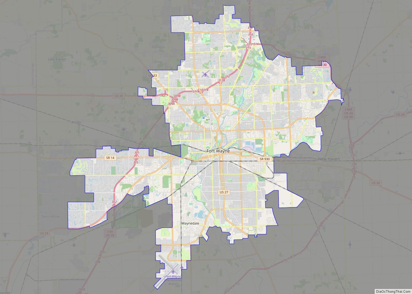
Online Interactive Map
Click on ![]() to view map in "full screen" mode.
to view map in "full screen" mode.
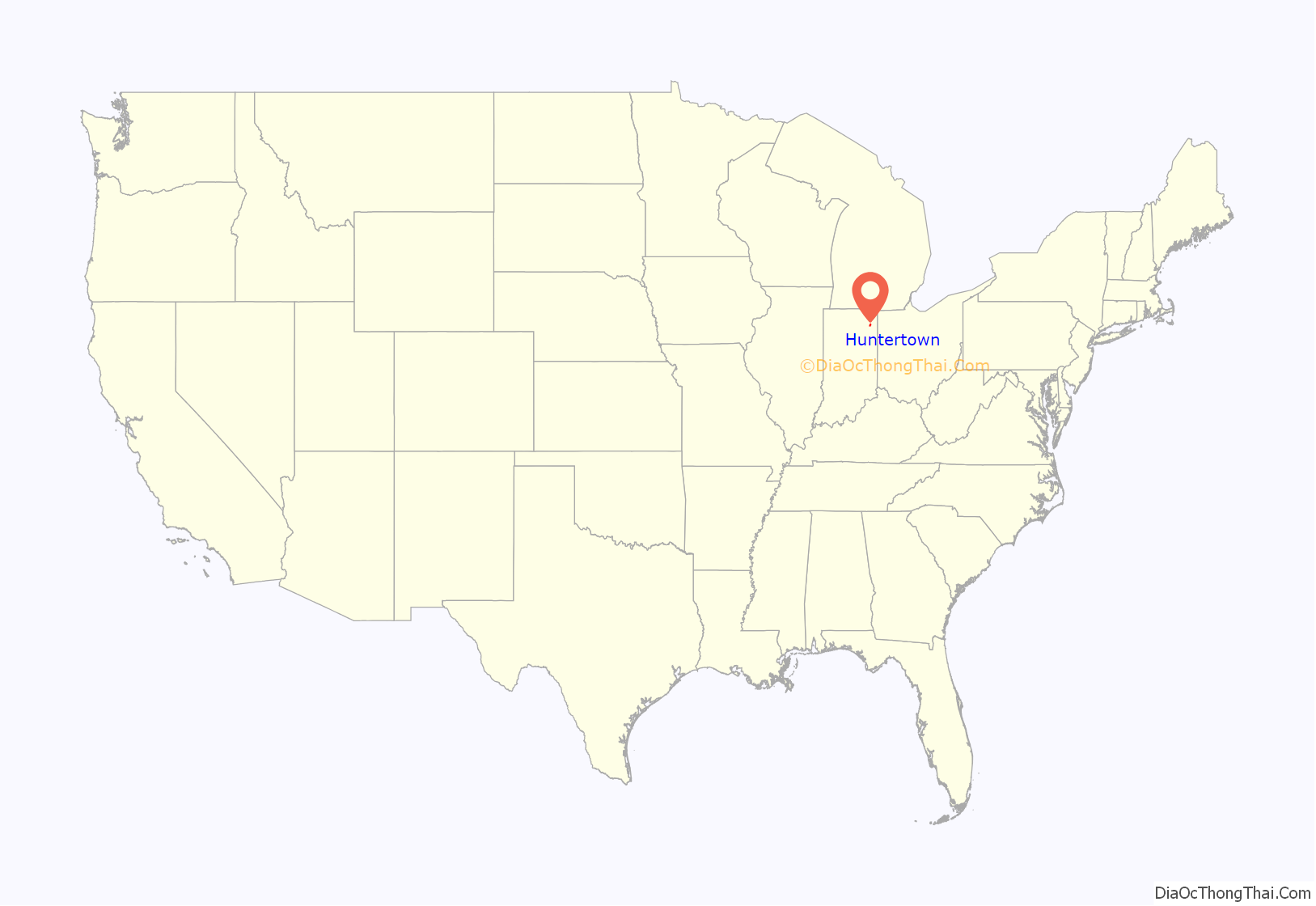
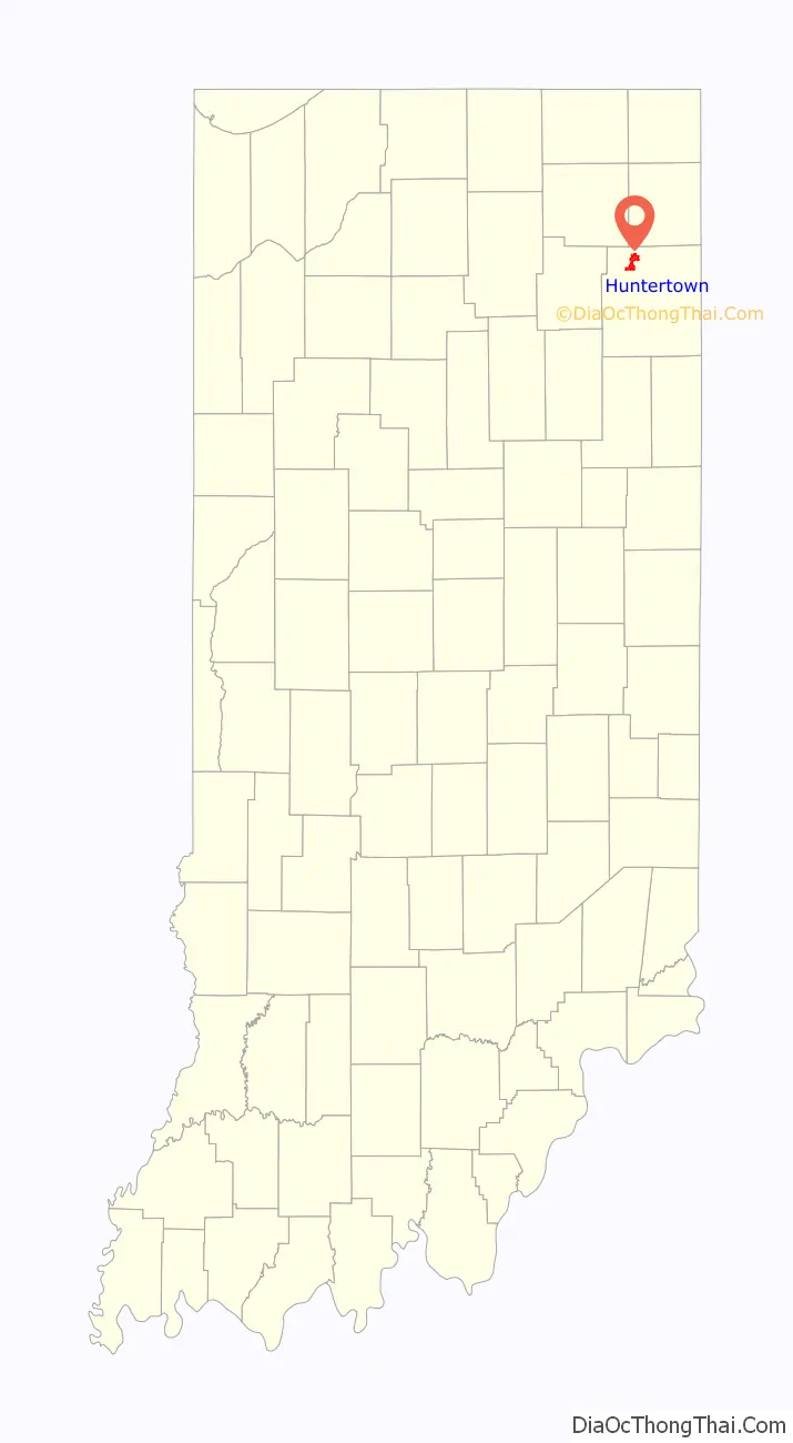
Huntertown location map. Where is Huntertown town?
History
Huntertown was originally called “The Opening” because it was a natural forest clearing. Huntertown was first settled circa 1837, founded by William T. Hunter. The village was located along the Lima Plank Road connecting Lima (now Howe) and Fort Wayne. The Perry Centre Seminary was founded in Huntertown in 1856, only to close five years later when the entire faculty and adult students enlisted in the Union Army. The town was platted in 1869, but not incorporated until 1966.
Some of the nation’s oldest reliable weather observations are from a nineteenth-century Huntertown farm. Rapin Andrews began keeping meteorological records on July 17, 1839, and continued until his death ten years later. His family continued the observations until April 30, 1874. The diary of weather records was presented to the U.S. Weather Bureau (now the National Weather Service) in 1934. The record highest temperature was 102 °F (39 °C) in July 1846 and the record lowest temperature was −34 °F (−37 °C) on January 29, 1873.
Huntertown today
Since much of Huntertown’s growth has come from people moving from urbanized areas like Fort Wayne to new suburban subdivisions, the expectations for services have increased. For example, the town council expanded from three to five members to lessen the workload. The council now is working on creating a new water plant, a parks board, and a new 27-acre (110,000 m) park.
The town’s weekly newspaper, Northwest News, began operations in the summer of 1997 in the former Huntertown State Bank, site of a 1930s robbery by the John Dillinger gang. Proof of the robbery is still visible today, as there is a bullet hole in the right window of the shop.
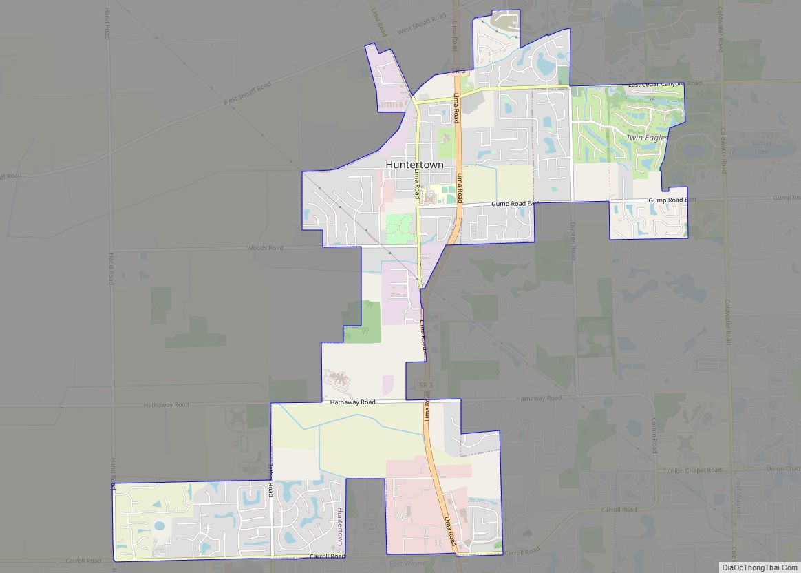
Huntertown Road Map
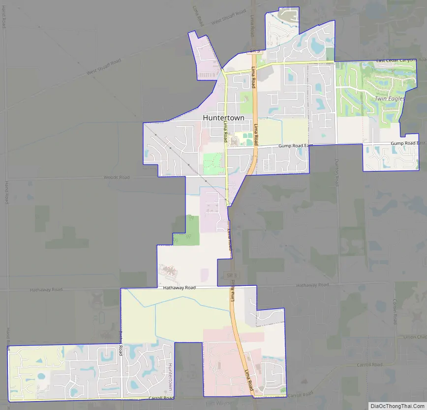
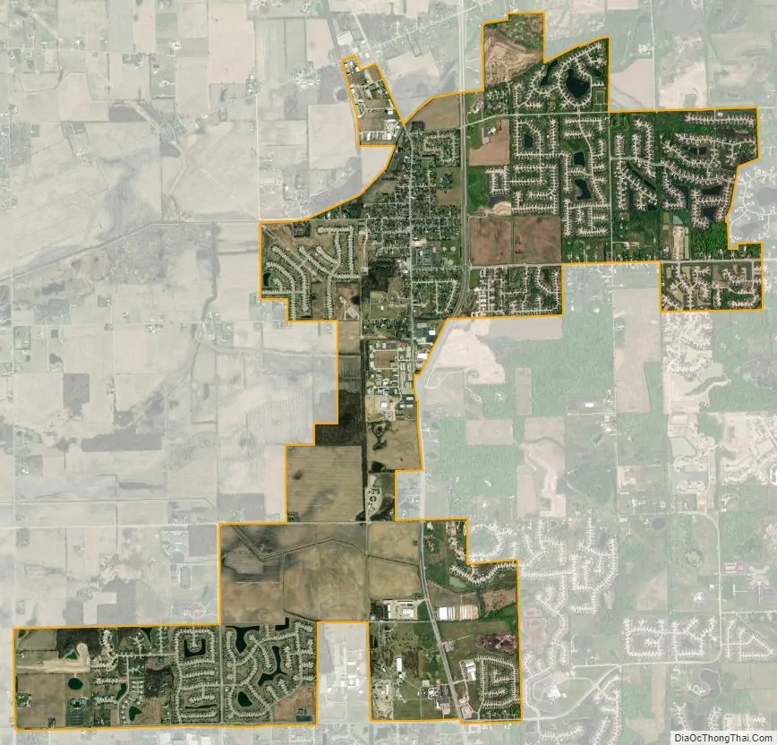
Huntertown city Satellite Map
Geography
Huntertown is located at 41°13′40″N 85°10′10″W / 41.22778°N 85.16944°W / 41.22778; -85.16944 (41.227798, -85.169371) at an elevation of 837 feet (255 m) and sits along State Road 3/Lima Road just north of Fort Wayne. Carroll Road is the southern boundary line between Huntertown and Fort Wayne.
According to the 2010 census, Huntertown has a total area of 3.81 square miles (9.87 km), of which 3.8 square miles (9.84 km) (or 99.74%) is land and 0.01 square miles (0.03 km) (or 0.26%) is water.
See also
Map of Indiana State and its subdivision:- Adams
- Allen
- Bartholomew
- Benton
- Blackford
- Boone
- Brown
- Carroll
- Cass
- Clark
- Clay
- Clinton
- Crawford
- Daviess
- De Kalb
- Dearborn
- Decatur
- Delaware
- Dubois
- Elkhart
- Fayette
- Floyd
- Fountain
- Franklin
- Fulton
- Gibson
- Grant
- Greene
- Hamilton
- Hancock
- Harrison
- Hendricks
- Henry
- Howard
- Huntington
- Jackson
- Jasper
- Jay
- Jefferson
- Jennings
- Johnson
- Knox
- Kosciusko
- LaGrange
- Lake
- Lake Michigan
- LaPorte
- Lawrence
- Madison
- Marion
- Marshall
- Martin
- Miami
- Monroe
- Montgomery
- Morgan
- Newton
- Noble
- Ohio
- Orange
- Owen
- Parke
- Perry
- Pike
- Porter
- Posey
- Pulaski
- Putnam
- Randolph
- Ripley
- Rush
- Saint Joseph
- Scott
- Shelby
- Spencer
- Starke
- Steuben
- Sullivan
- Switzerland
- Tippecanoe
- Tipton
- Union
- Vanderburgh
- Vermillion
- Vigo
- Wabash
- Warren
- Warrick
- Washington
- Wayne
- Wells
- White
- Whitley
- Alabama
- Alaska
- Arizona
- Arkansas
- California
- Colorado
- Connecticut
- Delaware
- District of Columbia
- Florida
- Georgia
- Hawaii
- Idaho
- Illinois
- Indiana
- Iowa
- Kansas
- Kentucky
- Louisiana
- Maine
- Maryland
- Massachusetts
- Michigan
- Minnesota
- Mississippi
- Missouri
- Montana
- Nebraska
- Nevada
- New Hampshire
- New Jersey
- New Mexico
- New York
- North Carolina
- North Dakota
- Ohio
- Oklahoma
- Oregon
- Pennsylvania
- Rhode Island
- South Carolina
- South Dakota
- Tennessee
- Texas
- Utah
- Vermont
- Virginia
- Washington
- West Virginia
- Wisconsin
- Wyoming