Knightsville is a town in Van Buren Township, Clay County, Indiana, United States. The population was 872 at the 2010 census. It is part of the Terre Haute Metropolitan Statistical Area.
| Name: | Knightsville town |
|---|---|
| LSAD Code: | 43 |
| LSAD Description: | town (suffix) |
| State: | Indiana |
| County: | Clay County |
| Elevation: | 653 ft (199 m) |
| Total Area: | 1.04 sq mi (2.69 km²) |
| Land Area: | 1.04 sq mi (2.69 km²) |
| Water Area: | 0.00 sq mi (0.00 km²) |
| Total Population: | 702 |
| Population Density: | 676.30/sq mi (261.06/km²) |
| ZIP code: | 47857 |
| Area code: | 812 |
| FIPS code: | 1840302 |
| GNISfeature ID: | 0437396 |
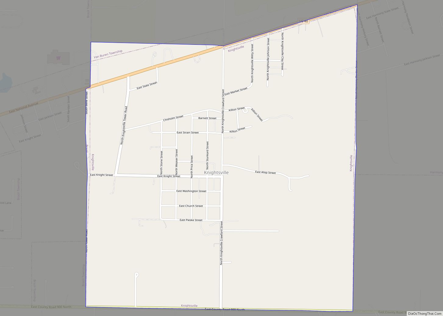
Online Interactive Map
Click on ![]() to view map in "full screen" mode.
to view map in "full screen" mode.
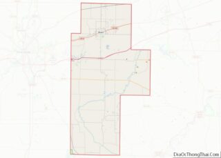
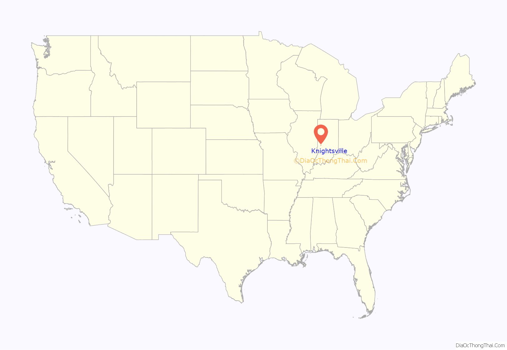
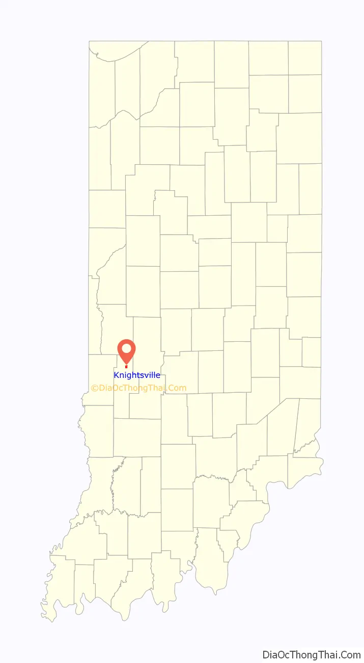
Knightsville location map. Where is Knightsville town?
History
Knightsville sprang up in 1867 around an iron furnace which had been built the year before. It was named for Dr. A. W. Knight, the original owner of the town site. The Knightsville post office was established in 1870.
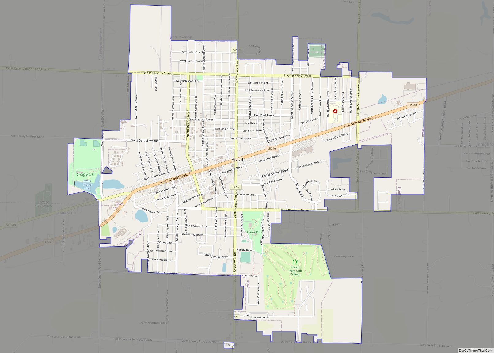
Knightsville Road Map
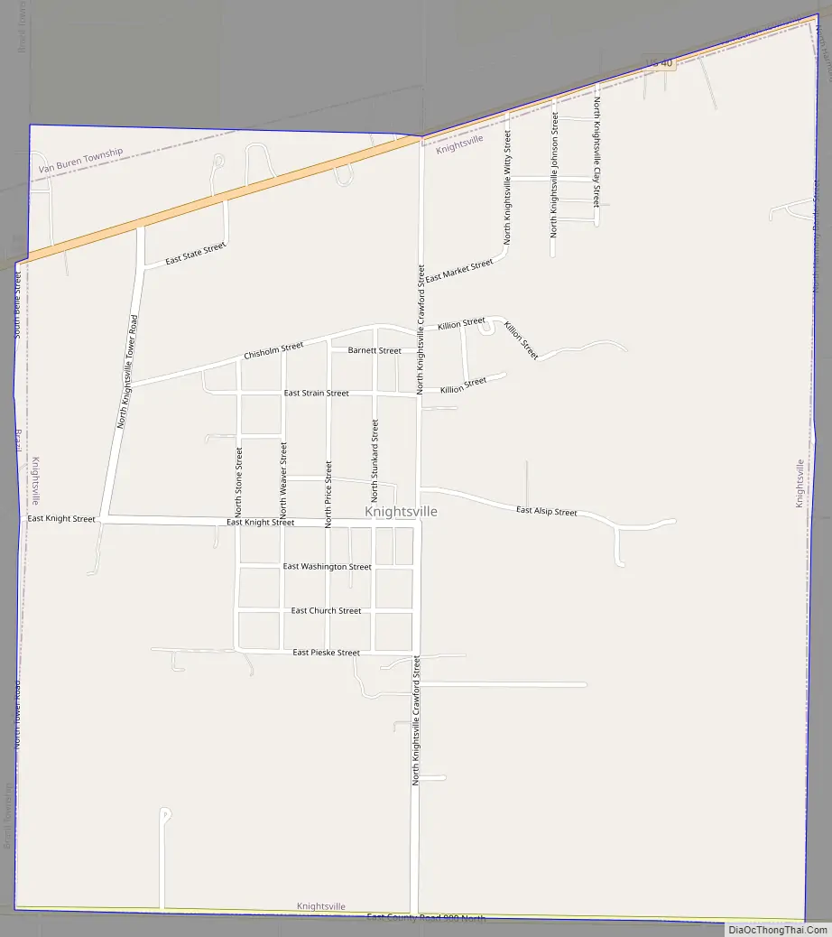
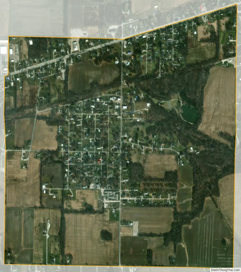
Knightsville city Satellite Map
Geography
Knightsville is located at 39°31′34″N 87°5′27″W / 39.52611°N 87.09083°W / 39.52611; -87.09083 (39.526209, -87.090828).
According to the 2010 census, Knightsville has a total area of 1.04 square miles (2.69 km), all land.
See also
Map of Indiana State and its subdivision:- Adams
- Allen
- Bartholomew
- Benton
- Blackford
- Boone
- Brown
- Carroll
- Cass
- Clark
- Clay
- Clinton
- Crawford
- Daviess
- De Kalb
- Dearborn
- Decatur
- Delaware
- Dubois
- Elkhart
- Fayette
- Floyd
- Fountain
- Franklin
- Fulton
- Gibson
- Grant
- Greene
- Hamilton
- Hancock
- Harrison
- Hendricks
- Henry
- Howard
- Huntington
- Jackson
- Jasper
- Jay
- Jefferson
- Jennings
- Johnson
- Knox
- Kosciusko
- LaGrange
- Lake
- Lake Michigan
- LaPorte
- Lawrence
- Madison
- Marion
- Marshall
- Martin
- Miami
- Monroe
- Montgomery
- Morgan
- Newton
- Noble
- Ohio
- Orange
- Owen
- Parke
- Perry
- Pike
- Porter
- Posey
- Pulaski
- Putnam
- Randolph
- Ripley
- Rush
- Saint Joseph
- Scott
- Shelby
- Spencer
- Starke
- Steuben
- Sullivan
- Switzerland
- Tippecanoe
- Tipton
- Union
- Vanderburgh
- Vermillion
- Vigo
- Wabash
- Warren
- Warrick
- Washington
- Wayne
- Wells
- White
- Whitley
- Alabama
- Alaska
- Arizona
- Arkansas
- California
- Colorado
- Connecticut
- Delaware
- District of Columbia
- Florida
- Georgia
- Hawaii
- Idaho
- Illinois
- Indiana
- Iowa
- Kansas
- Kentucky
- Louisiana
- Maine
- Maryland
- Massachusetts
- Michigan
- Minnesota
- Mississippi
- Missouri
- Montana
- Nebraska
- Nevada
- New Hampshire
- New Jersey
- New Mexico
- New York
- North Carolina
- North Dakota
- Ohio
- Oklahoma
- Oregon
- Pennsylvania
- Rhode Island
- South Carolina
- South Dakota
- Tennessee
- Texas
- Utah
- Vermont
- Virginia
- Washington
- West Virginia
- Wisconsin
- Wyoming