Koontz Lake is an unincorporated community and census-designated place (CDP) in Starke and Marshall counties, in the U.S. state of Indiana. The population was 1,667 at the 2020 census.
| Name: | Koontz Lake CDP |
|---|---|
| LSAD Code: | 57 |
| LSAD Description: | CDP (suffix) |
| State: | Indiana |
| County: | Marshall County, Starke County |
| Elevation: | 735 ft (224 m) |
| Total Area: | 4.05 sq mi (10.5 km²) |
| Land Area: | 3.52 sq mi (9.1 km²) |
| Water Area: | 0.52 sq mi (1.3 km²) |
| Total Population: | 1,667 |
| Population Density: | 473.0/sq mi (182.6/km²) |
| ZIP code: | 46574 (Walkerton) |
| FIPS code: | 1840464 |
| GNISfeature ID: | 437438 |
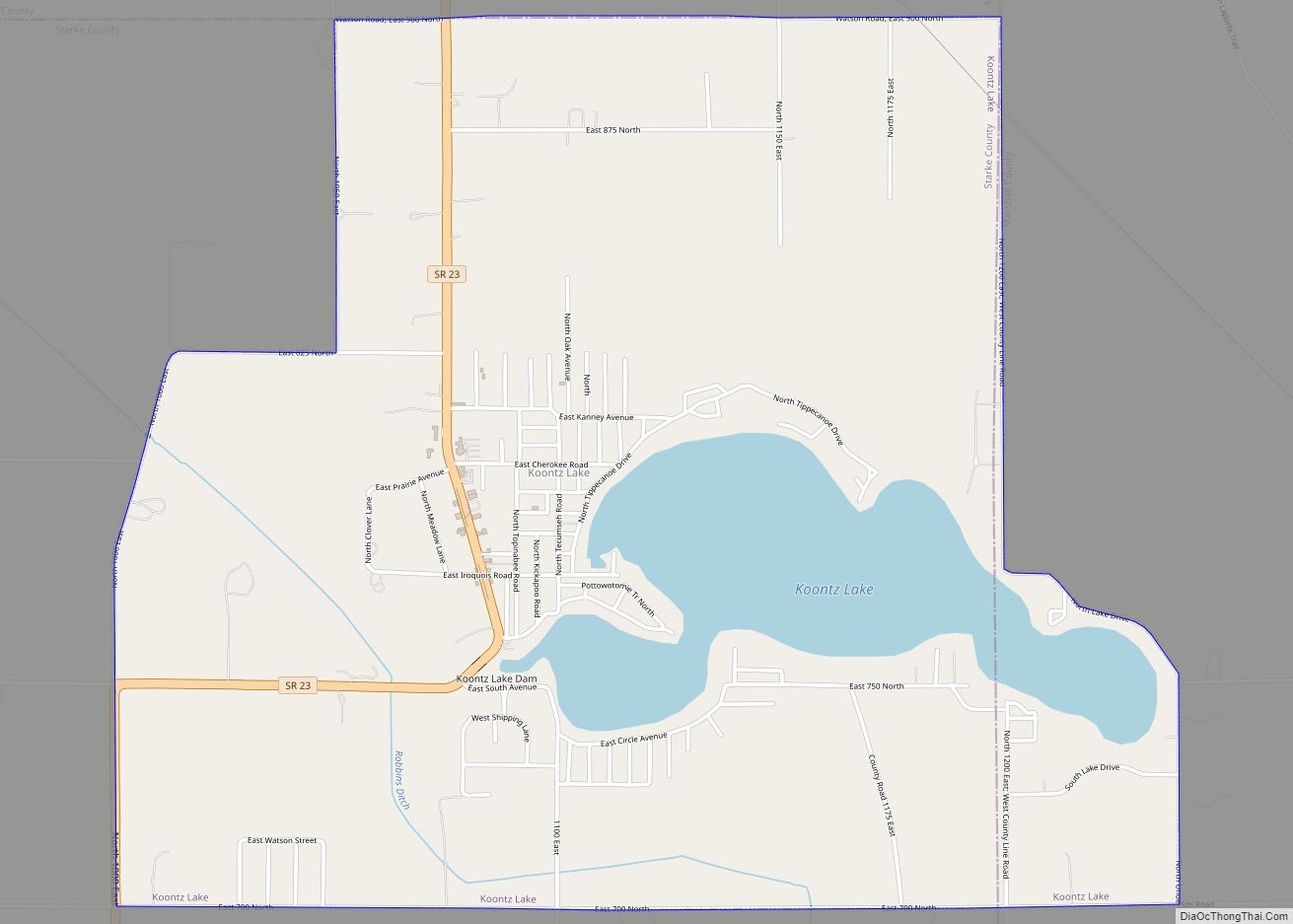
Online Interactive Map
Click on ![]() to view map in "full screen" mode.
to view map in "full screen" mode.
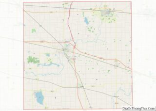
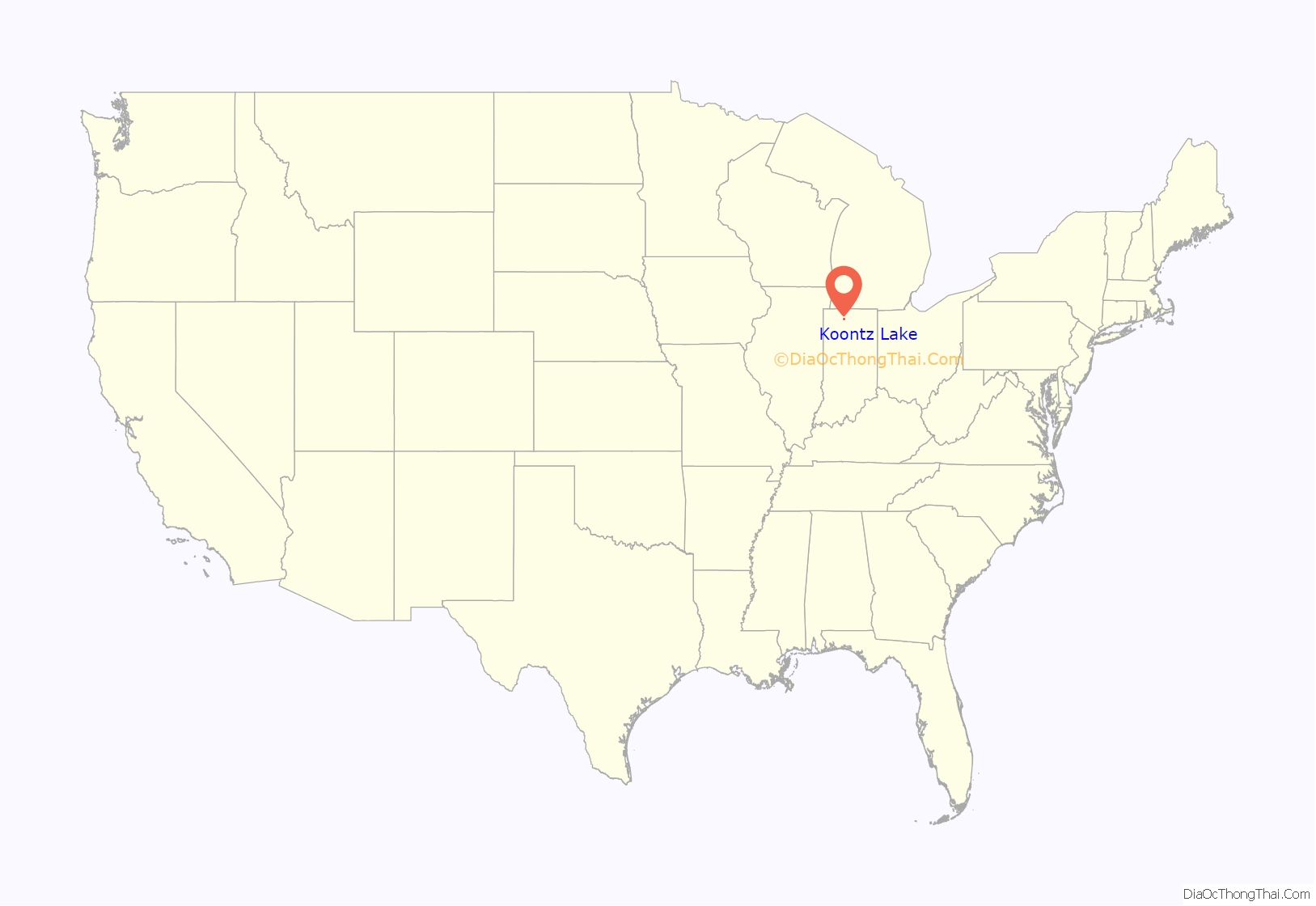
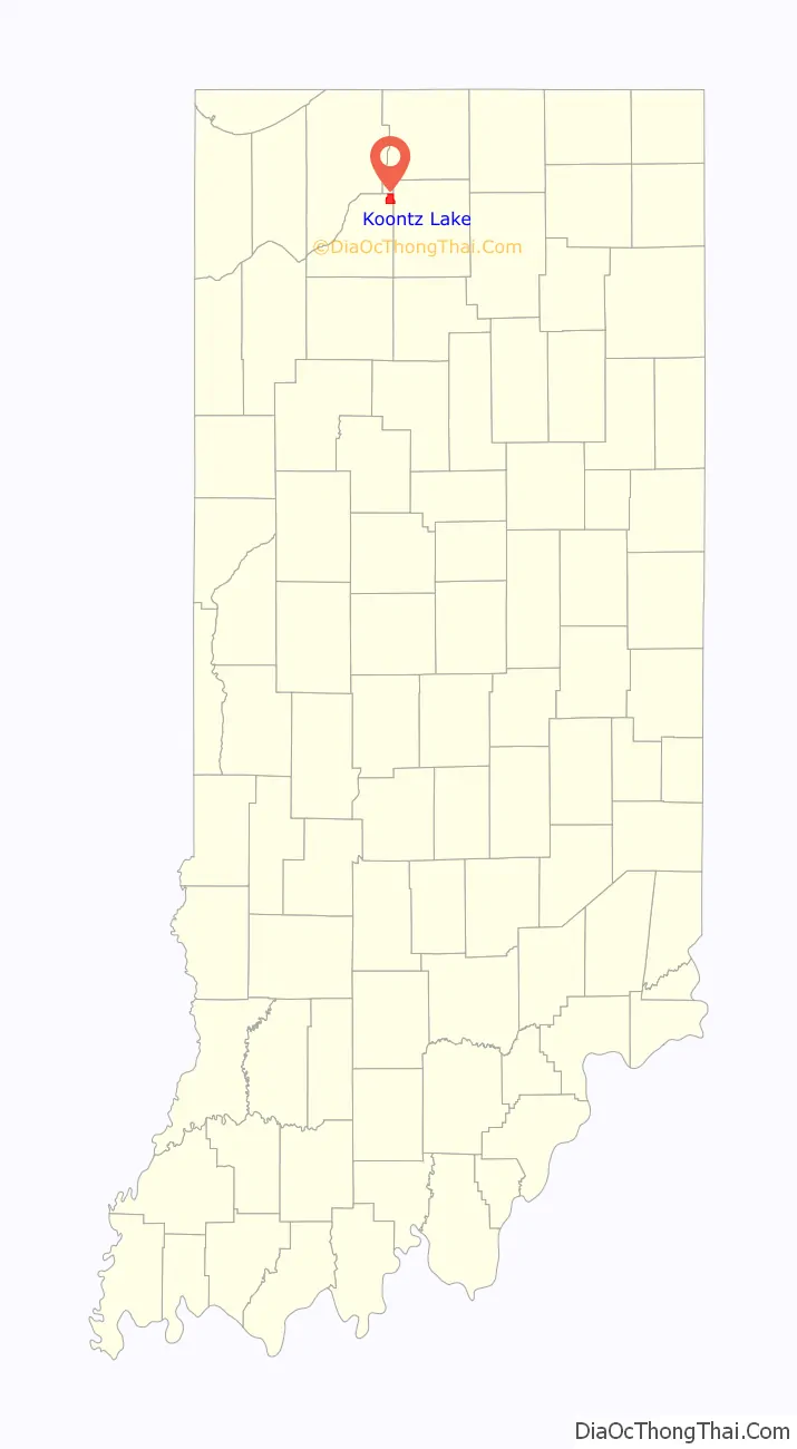
Koontz Lake location map. Where is Koontz Lake CDP?
History
Koontz Lake was named for the lake which the community surrounds, which in turn was named after local mill owner Samuel Koontz. The community was devastated by tornadoes as part of the Palm Sunday Tornado Outbreak of 1965.
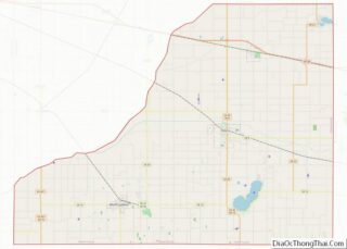
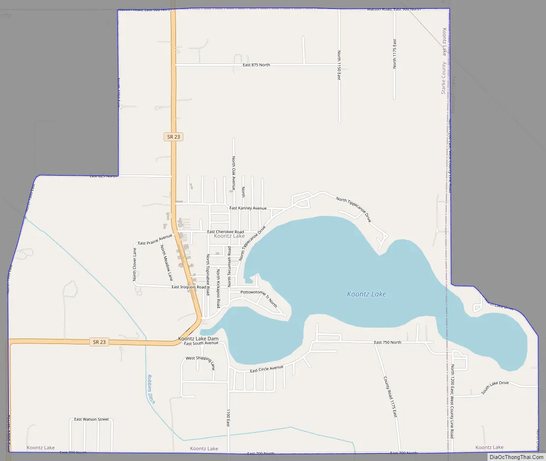
Koontz Lake Road Map
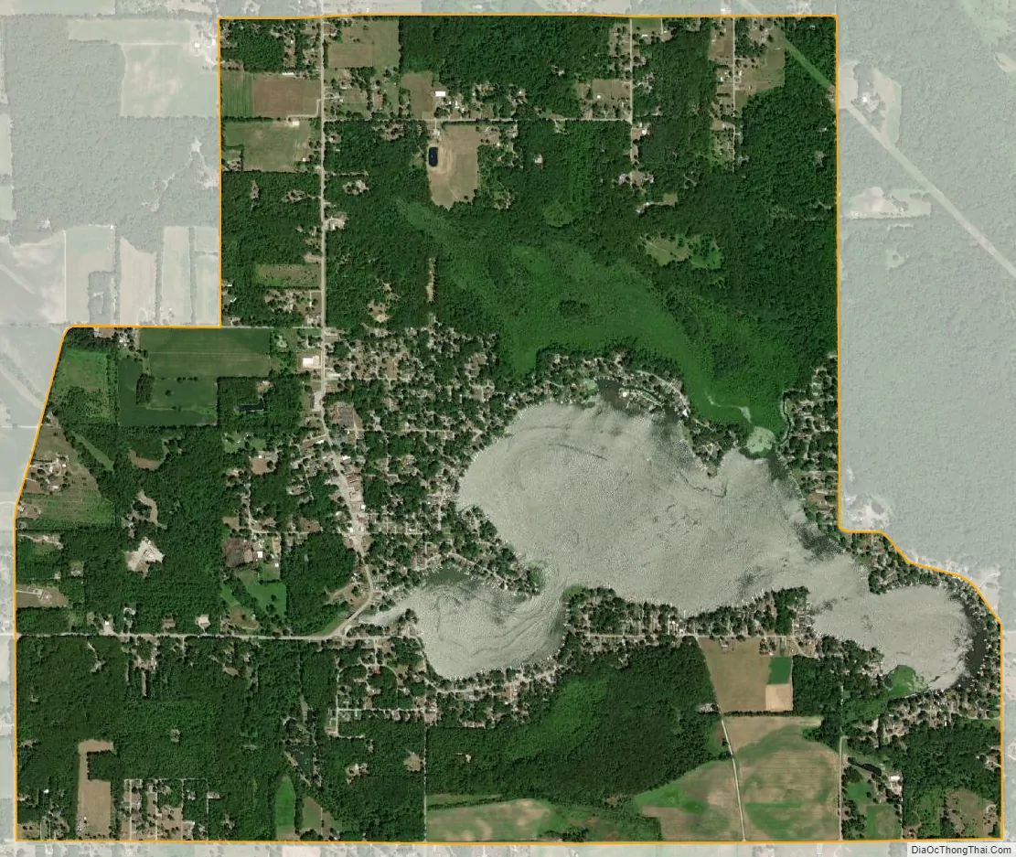
Koontz Lake city Satellite Map
Geography
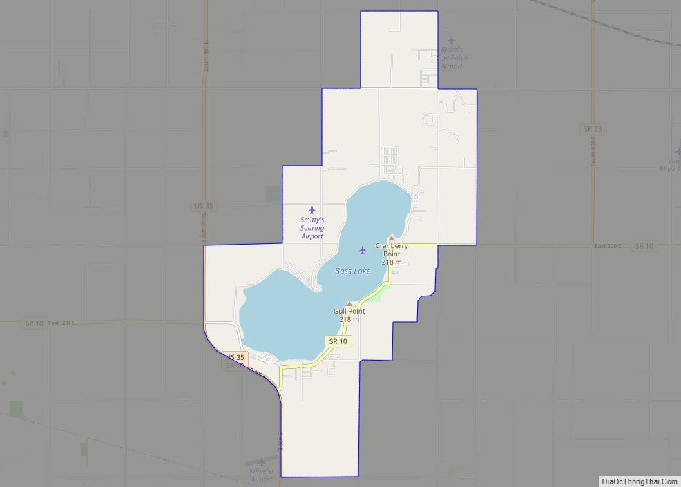
Koontz Lake is located in the northeast corner of Starke County at 41°24′50″N 86°28′57″W / 41.41389°N 86.48250°W / 41.41389; -86.48250 (41.413804, -86.482628). The east end of the lake and of the CDP are in western Marshall County. St. Joseph County borders the CDP to the north. Indiana State Road 23 passes through the community on the west side of the lake, leading north 4 miles (6 km) to Walkerton, the post office for Koontz Lake addresses, and south the same distance to U.S. Route 30 in Grovertown.
According to the United States Census Bureau, the CDP has a total area of 4.0 square miles (10 km), of which 3.5 square miles (9.1 km) are land and 0.5 square miles (1.3 km), or 12.90%, are water. The outlet of the lake is at its west end, into Robbins Ditch, which flows west to the Kankakee River, a tributary of the Illinois River.
See also
Map of Indiana State and its subdivision:- Adams
- Allen
- Bartholomew
- Benton
- Blackford
- Boone
- Brown
- Carroll
- Cass
- Clark
- Clay
- Clinton
- Crawford
- Daviess
- De Kalb
- Dearborn
- Decatur
- Delaware
- Dubois
- Elkhart
- Fayette
- Floyd
- Fountain
- Franklin
- Fulton
- Gibson
- Grant
- Greene
- Hamilton
- Hancock
- Harrison
- Hendricks
- Henry
- Howard
- Huntington
- Jackson
- Jasper
- Jay
- Jefferson
- Jennings
- Johnson
- Knox
- Kosciusko
- LaGrange
- Lake
- Lake Michigan
- LaPorte
- Lawrence
- Madison
- Marion
- Marshall
- Martin
- Miami
- Monroe
- Montgomery
- Morgan
- Newton
- Noble
- Ohio
- Orange
- Owen
- Parke
- Perry
- Pike
- Porter
- Posey
- Pulaski
- Putnam
- Randolph
- Ripley
- Rush
- Saint Joseph
- Scott
- Shelby
- Spencer
- Starke
- Steuben
- Sullivan
- Switzerland
- Tippecanoe
- Tipton
- Union
- Vanderburgh
- Vermillion
- Vigo
- Wabash
- Warren
- Warrick
- Washington
- Wayne
- Wells
- White
- Whitley
- Alabama
- Alaska
- Arizona
- Arkansas
- California
- Colorado
- Connecticut
- Delaware
- District of Columbia
- Florida
- Georgia
- Hawaii
- Idaho
- Illinois
- Indiana
- Iowa
- Kansas
- Kentucky
- Louisiana
- Maine
- Maryland
- Massachusetts
- Michigan
- Minnesota
- Mississippi
- Missouri
- Montana
- Nebraska
- Nevada
- New Hampshire
- New Jersey
- New Mexico
- New York
- North Carolina
- North Dakota
- Ohio
- Oklahoma
- Oregon
- Pennsylvania
- Rhode Island
- South Carolina
- South Dakota
- Tennessee
- Texas
- Utah
- Vermont
- Virginia
- Washington
- West Virginia
- Wisconsin
- Wyoming