Michiana Shores is a town in Springfield and Michigan townships, LaPorte County, Indiana, United States. The population was 313 at the 2010 census. It is included in the Michigan City, Indiana–La Porte, Indiana Metropolitan Statistical Area. Michiana Shores is located in northwesternmost Springfield Township, and is the township’s sole incorporated community.
Michiana Shores takes its name from the Michiana region along the Michigan-Indiana border.
| Name: | Michiana Shores town |
|---|---|
| LSAD Code: | 43 |
| LSAD Description: | town (suffix) |
| State: | Indiana |
| County: | LaPorte County |
| Elevation: | 610 ft (186 m) |
| Total Area: | 0.35 sq mi (0.90 km²) |
| Land Area: | 0.35 sq mi (0.90 km²) |
| Water Area: | 0.00 sq mi (0.00 km²) |
| Total Population: | 306 |
| Population Density: | 879.31/sq mi (339.26/km²) |
| ZIP code: | 46360 |
| Area code: | 219 |
| FIPS code: | 1848744 |
| GNISfeature ID: | 0446768 |
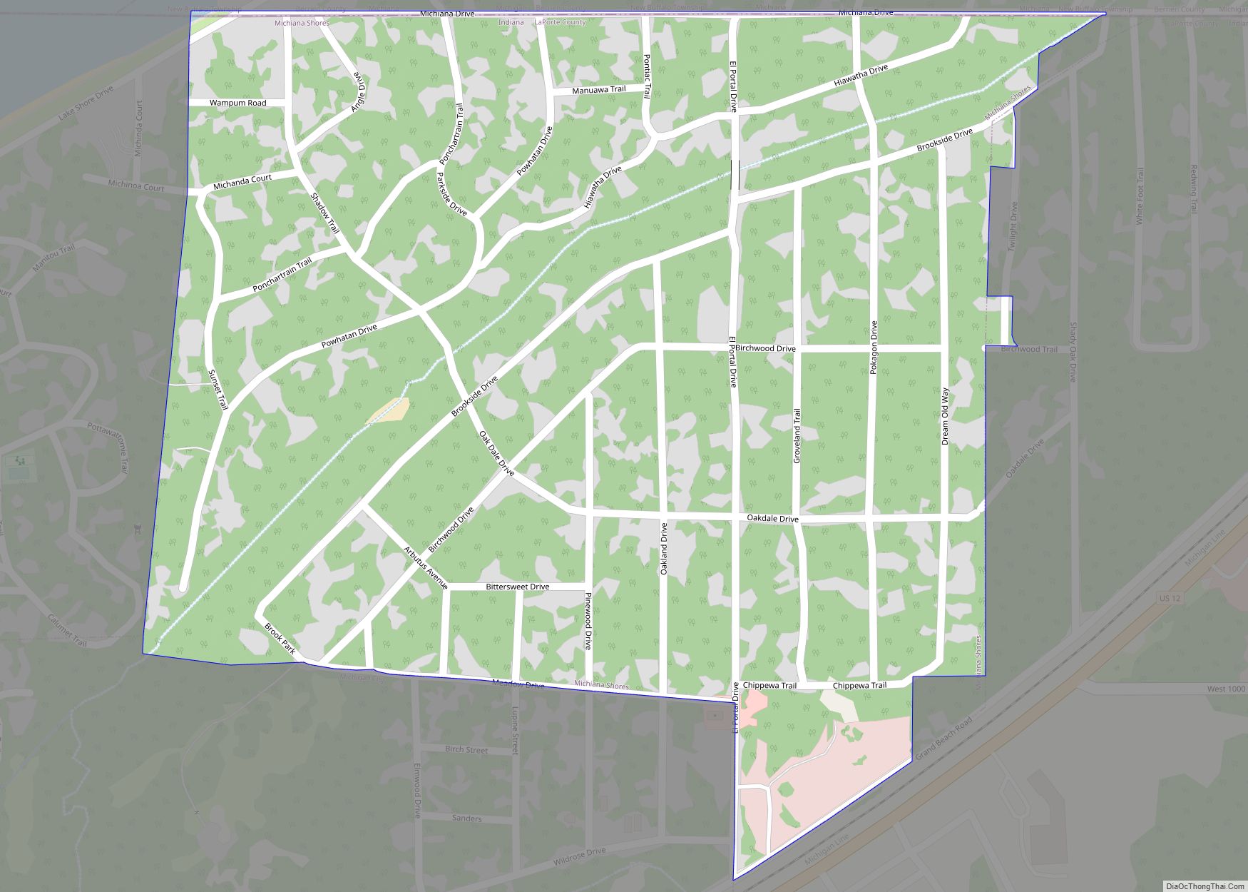
Online Interactive Map
Click on ![]() to view map in "full screen" mode.
to view map in "full screen" mode.
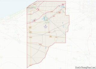
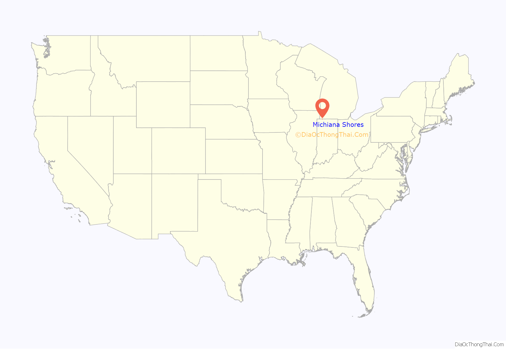
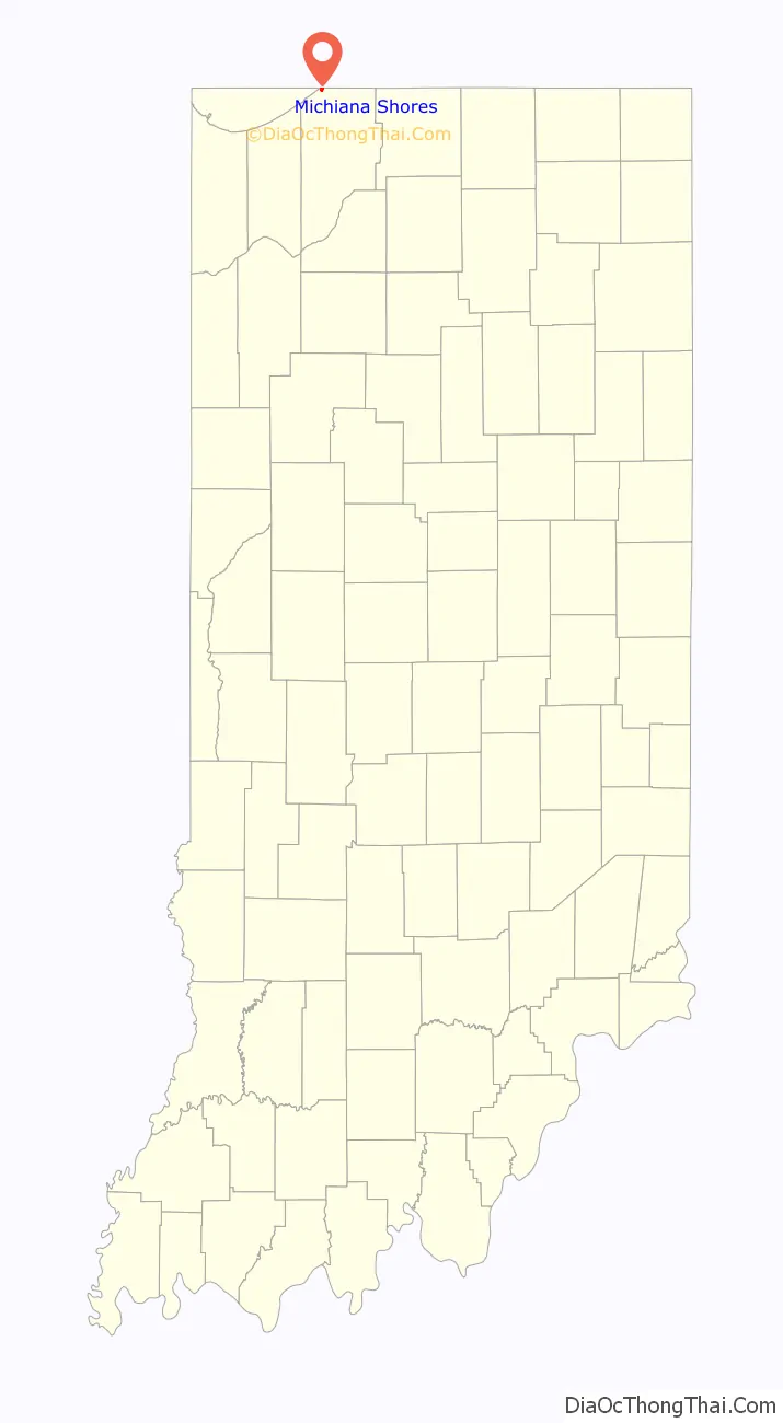
Michiana Shores location map. Where is Michiana Shores town?
History
The inland part of Michiana Shores was the site of the logging town of Corymbo in the 1860s and 1870s. Corymbo, located on the Michigan Central railroad, was home to a mixture of lumbermen and railroad employees. A post office was established there in 1861, but had been discontinued by 1880. The land was owned by the local Burgwald family, which sold it in the 1920s to the Long Beach Land Company.
The modern-day beach community began to be developed in the 1930s, when developers Orphie Gotto and Clarence Mathias began to build it as a log cabin town for vacationers. Many of the early residents were schoolteachers from Chicago. The town was incorporated in 1947.
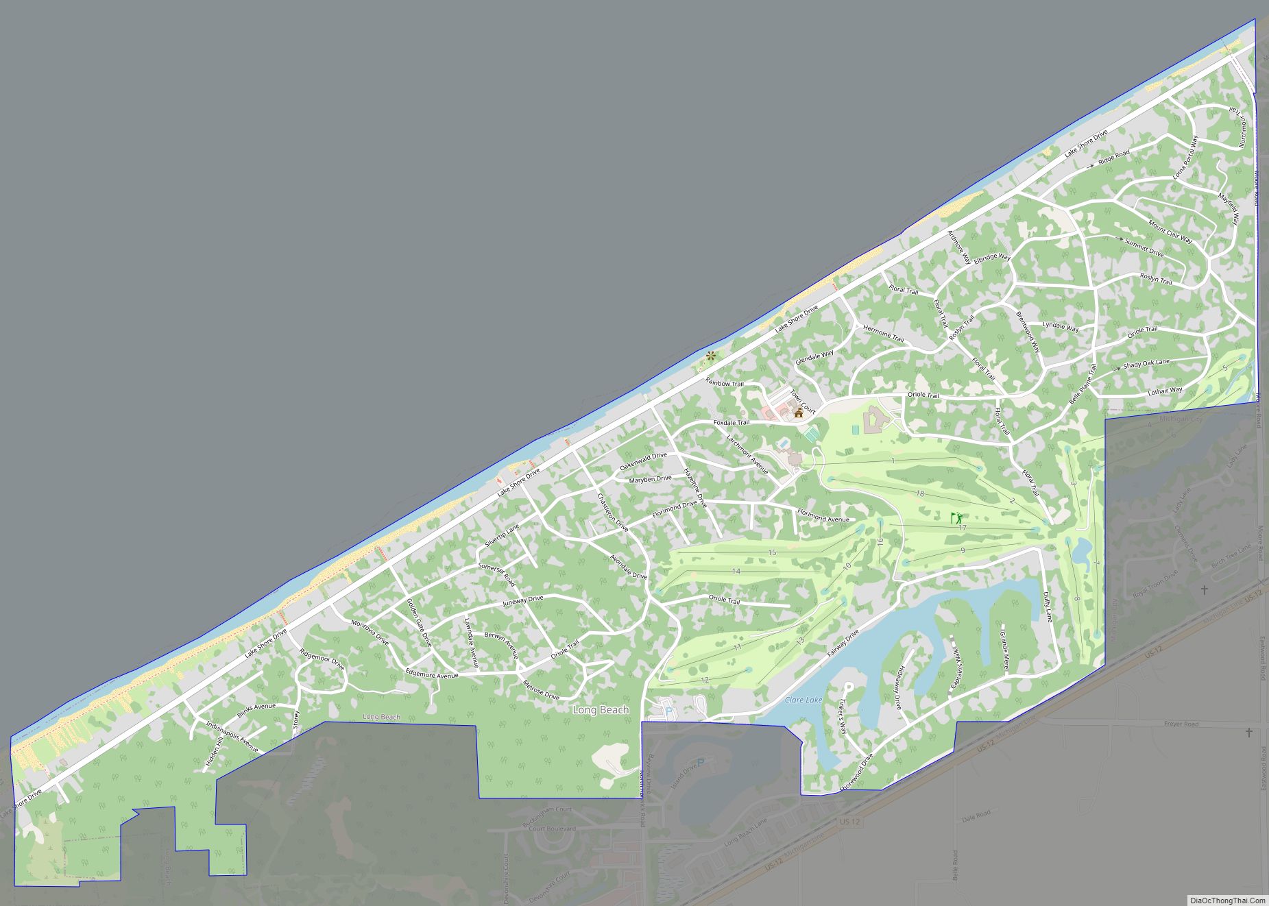
Michiana Shores Road Map
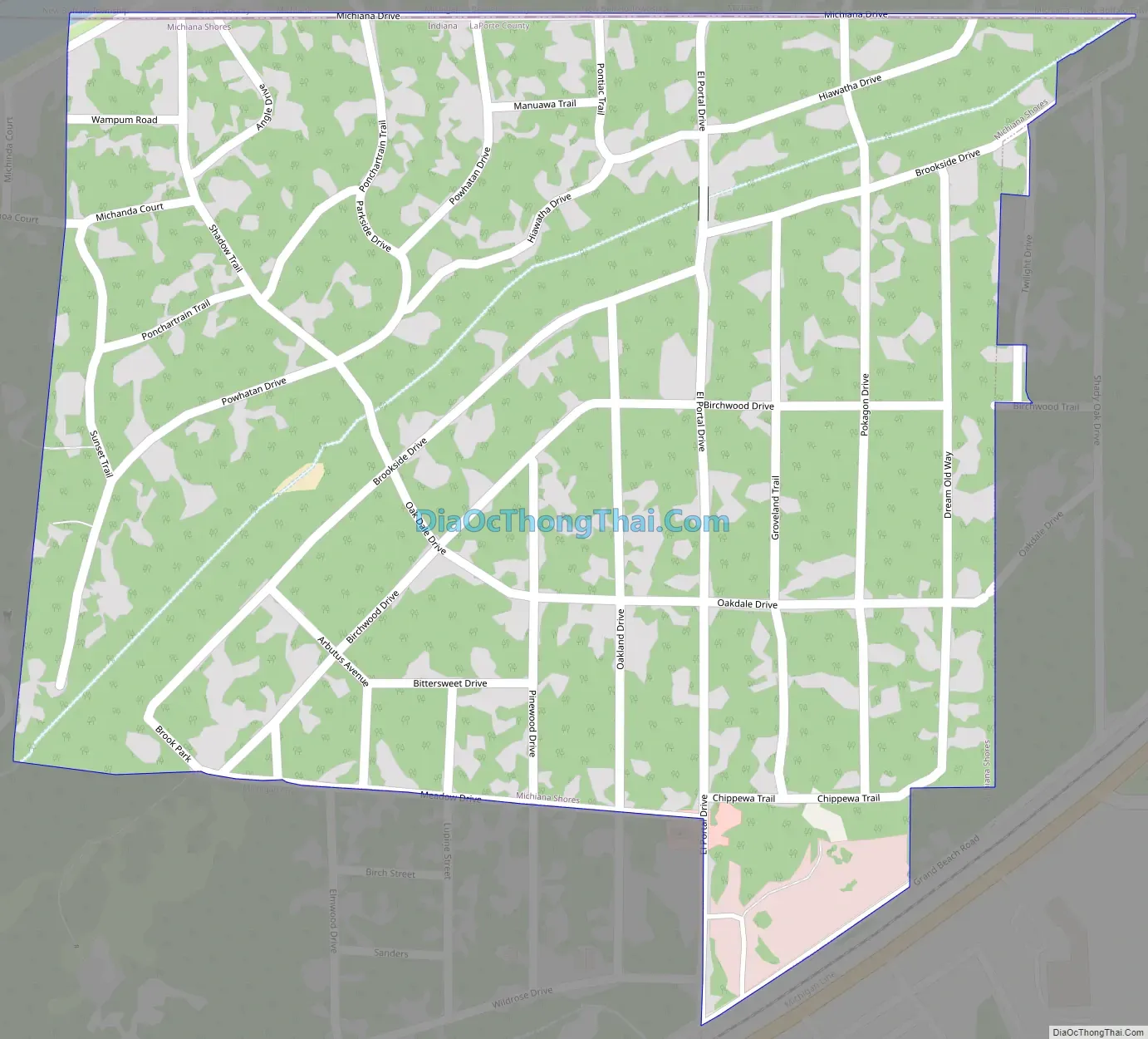
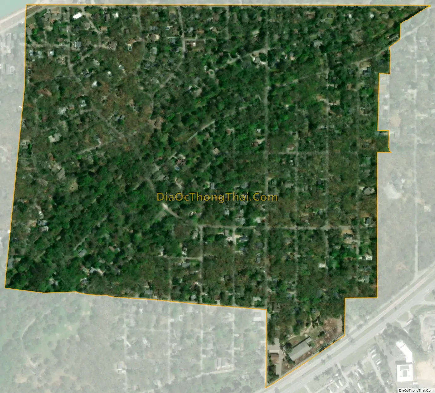
Michiana Shores city Satellite Map
Geography
Michiana Shores is located at 41°45′23″N 86°49′6″W / 41.75639°N 86.81833°W / 41.75639; -86.81833 (41.756290, -86.818447).
According to the 2010 census, Michiana Shores has a total area of 0.35 square miles (0.91 km), all land.
The town lies on the shore of Lake Michigan, just south of the Michigan state line. The town is adjacent to Michiana, Michigan, and also neighbors Long Beach, Indiana along the coast to the west.
See also
Map of Indiana State and its subdivision:- Adams
- Allen
- Bartholomew
- Benton
- Blackford
- Boone
- Brown
- Carroll
- Cass
- Clark
- Clay
- Clinton
- Crawford
- Daviess
- De Kalb
- Dearborn
- Decatur
- Delaware
- Dubois
- Elkhart
- Fayette
- Floyd
- Fountain
- Franklin
- Fulton
- Gibson
- Grant
- Greene
- Hamilton
- Hancock
- Harrison
- Hendricks
- Henry
- Howard
- Huntington
- Jackson
- Jasper
- Jay
- Jefferson
- Jennings
- Johnson
- Knox
- Kosciusko
- LaGrange
- Lake
- Lake Michigan
- LaPorte
- Lawrence
- Madison
- Marion
- Marshall
- Martin
- Miami
- Monroe
- Montgomery
- Morgan
- Newton
- Noble
- Ohio
- Orange
- Owen
- Parke
- Perry
- Pike
- Porter
- Posey
- Pulaski
- Putnam
- Randolph
- Ripley
- Rush
- Saint Joseph
- Scott
- Shelby
- Spencer
- Starke
- Steuben
- Sullivan
- Switzerland
- Tippecanoe
- Tipton
- Union
- Vanderburgh
- Vermillion
- Vigo
- Wabash
- Warren
- Warrick
- Washington
- Wayne
- Wells
- White
- Whitley
- Alabama
- Alaska
- Arizona
- Arkansas
- California
- Colorado
- Connecticut
- Delaware
- District of Columbia
- Florida
- Georgia
- Hawaii
- Idaho
- Illinois
- Indiana
- Iowa
- Kansas
- Kentucky
- Louisiana
- Maine
- Maryland
- Massachusetts
- Michigan
- Minnesota
- Mississippi
- Missouri
- Montana
- Nebraska
- Nevada
- New Hampshire
- New Jersey
- New Mexico
- New York
- North Carolina
- North Dakota
- Ohio
- Oklahoma
- Oregon
- Pennsylvania
- Rhode Island
- South Carolina
- South Dakota
- Tennessee
- Texas
- Utah
- Vermont
- Virginia
- Washington
- West Virginia
- Wisconsin
- Wyoming