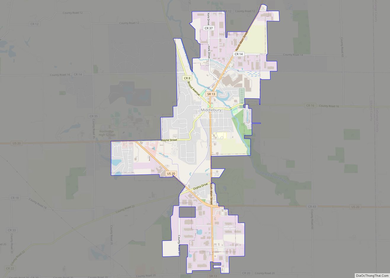
Middlebury is a town in Middlebury Township, Elkhart County, Indiana, United States. It is located approximately 35 miles east of South Bend, 130 miles east of Chicago, Illinois and 165 miles north of Indianapolis. Middlebury is nestled in Northern Indiana’s Amish country. As of the 2010 census, the town population was 3,420.
| Name: | Middlebury town |
|---|---|
| LSAD Code: | 43 |
| LSAD Description: | town (suffix) |
| State: | Indiana |
| County: | Elkhart County |
| Elevation: | 833 ft (254 m) |
| Total Area: | 4.35 sq mi (11.27 km²) |
| Land Area: | 4.33 sq mi (11.22 km²) |
| Water Area: | 0.02 sq mi (0.04 km²) |
| Total Population: | 3,466 |
| Population Density: | 799.91/sq mi (308.87/km²) |
| ZIP code: | 46540 |
| Area code: | 574 |
| FIPS code: | 1848924 |
| GNISfeature ID: | 0439113 |
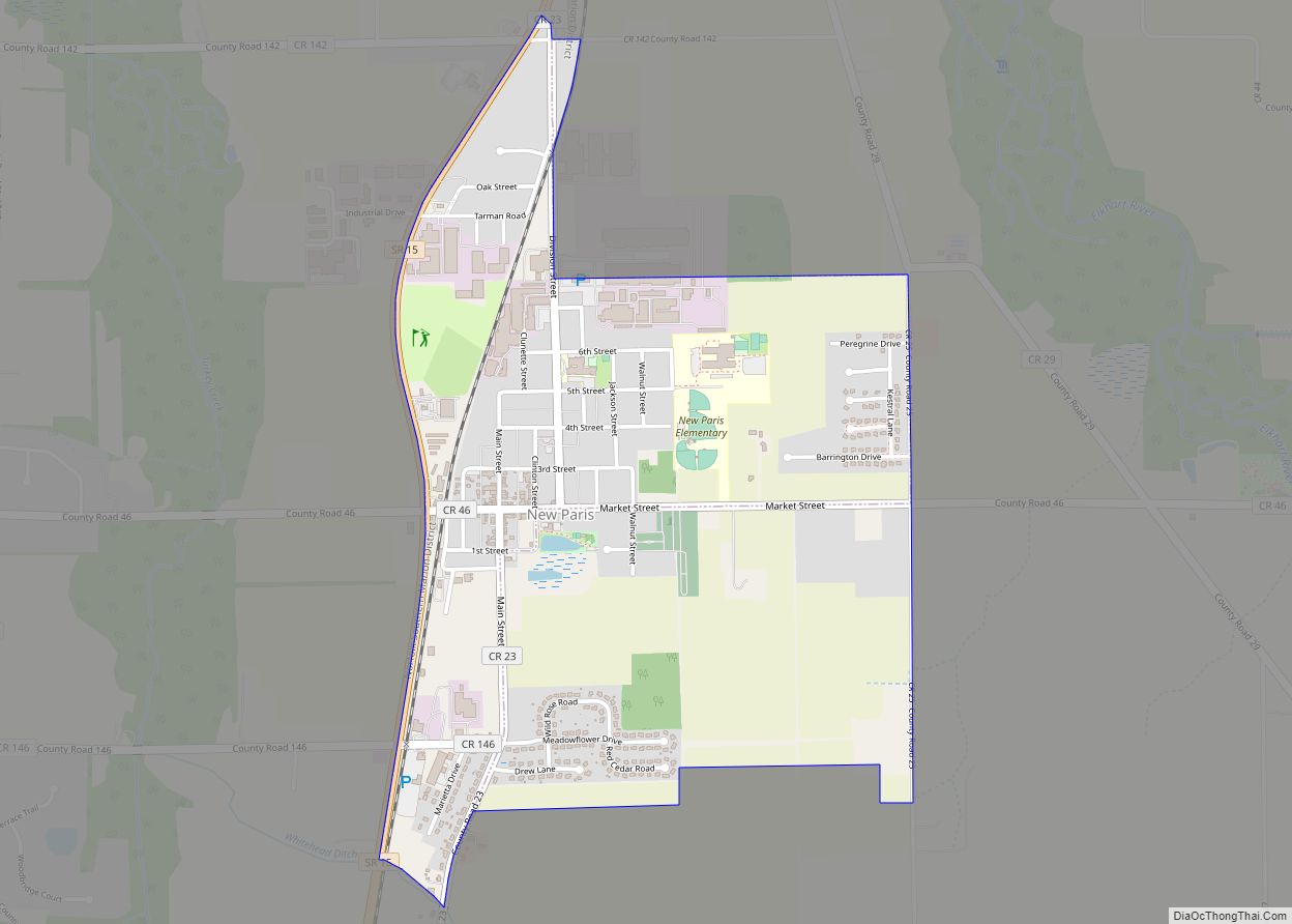
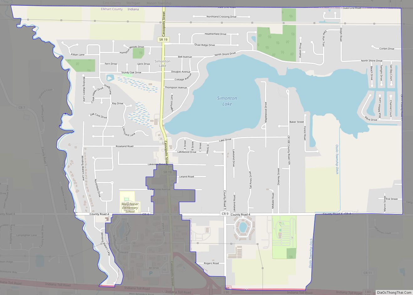
Online Interactive Map
Click on ![]() to view map in "full screen" mode.
to view map in "full screen" mode.
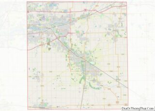
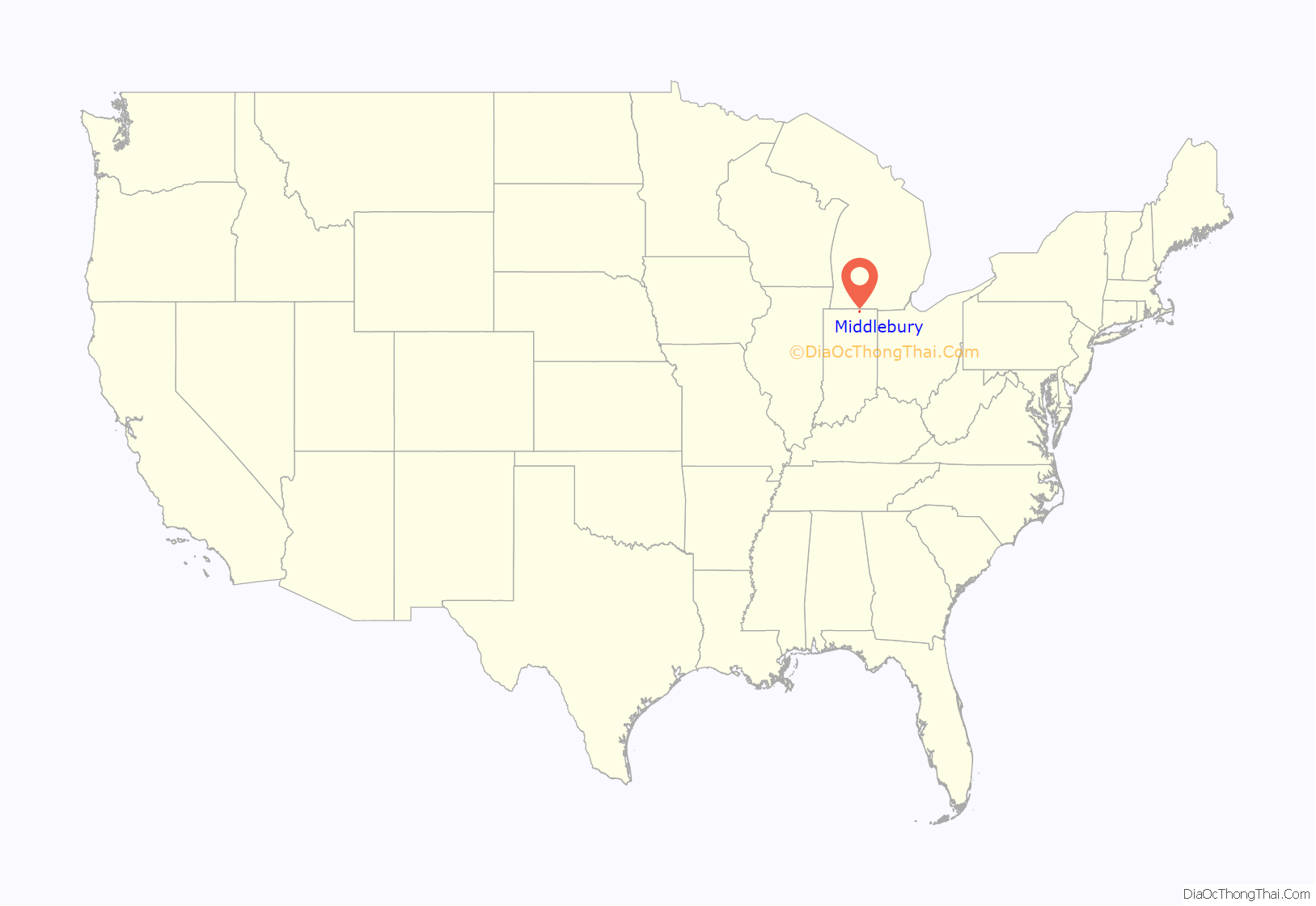
Middlebury location map. Where is Middlebury town?
History
Before the Europeans came to the region, the Miami and later the Potawatomi ruled the area. That changed in 1832, when the first settlers came from Middlebury, Vermont. They chose this specific area because the rolling hills reminded them of Vermont. Later, in 1841, the first Amish families came from Somerset County, Pennsylvania and settled in the countryside surrounding the town. Middlebury Township was organized in 1834 and the town of Middlebury was finally incorporated in 1868. In 1888, the railroad came to Middlebury and began to diversify the town’s economy to include manufacturing as well as farming.
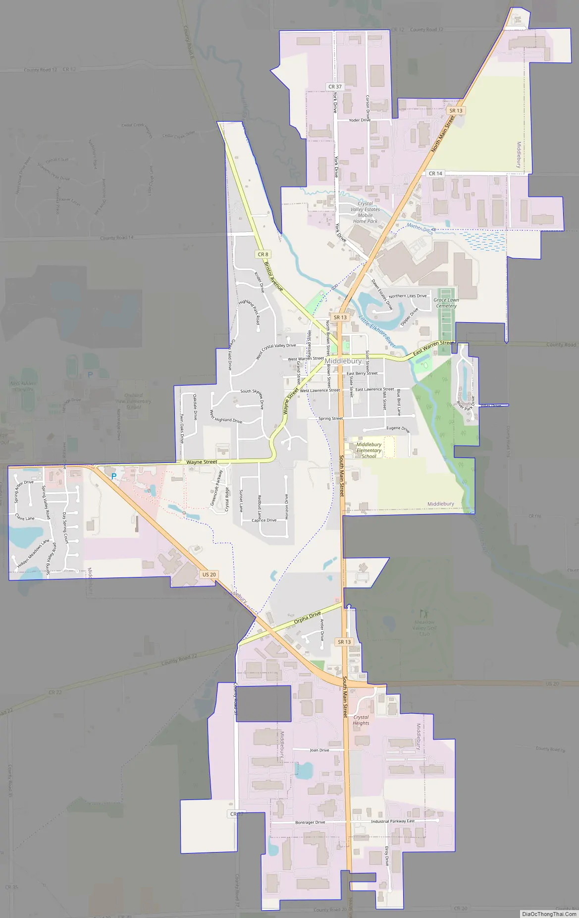
Middlebury Road Map
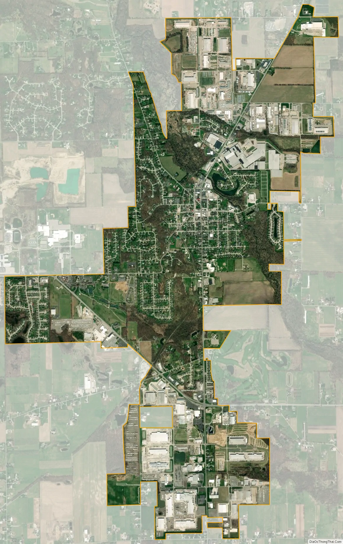
Middlebury city Satellite Map
Geography
Middlebury is located at 41°40′26″N 85°42′34″W / 41.67389°N 85.70944°W / 41.67389; -85.70944 (41.673863, -85.709443). It sits on the banks of the Little Elkhart River in the middle of a mix of rolling hills and rural farm land.
According to the 2010 census, Middlebury has a total area of 3.78 square miles (9.79 km), of which 3.76 square miles (9.74 km) (or 99.47%) is land and 0.02 square miles (0.05 km) (or 0.53%) is water.
See also
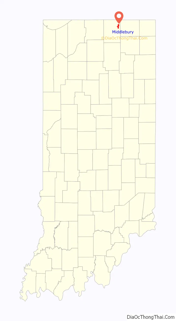
Map of Indiana State and its subdivision:- Adams
- Allen
- Bartholomew
- Benton
- Blackford
- Boone
- Brown
- Carroll
- Cass
- Clark
- Clay
- Clinton
- Crawford
- Daviess
- De Kalb
- Dearborn
- Decatur
- Delaware
- Dubois
- Elkhart
- Fayette
- Floyd
- Fountain
- Franklin
- Fulton
- Gibson
- Grant
- Greene
- Hamilton
- Hancock
- Harrison
- Hendricks
- Henry
- Howard
- Huntington
- Jackson
- Jasper
- Jay
- Jefferson
- Jennings
- Johnson
- Knox
- Kosciusko
- LaGrange
- Lake
- Lake Michigan
- LaPorte
- Lawrence
- Madison
- Marion
- Marshall
- Martin
- Miami
- Monroe
- Montgomery
- Morgan
- Newton
- Noble
- Ohio
- Orange
- Owen
- Parke
- Perry
- Pike
- Porter
- Posey
- Pulaski
- Putnam
- Randolph
- Ripley
- Rush
- Saint Joseph
- Scott
- Shelby
- Spencer
- Starke
- Steuben
- Sullivan
- Switzerland
- Tippecanoe
- Tipton
- Union
- Vanderburgh
- Vermillion
- Vigo
- Wabash
- Warren
- Warrick
- Washington
- Wayne
- Wells
- White
- Whitley
- Alabama
- Alaska
- Arizona
- Arkansas
- California
- Colorado
- Connecticut
- Delaware
- District of Columbia
- Florida
- Georgia
- Hawaii
- Idaho
- Illinois
- Indiana
- Iowa
- Kansas
- Kentucky
- Louisiana
- Maine
- Maryland
- Massachusetts
- Michigan
- Minnesota
- Mississippi
- Missouri
- Montana
- Nebraska
- Nevada
- New Hampshire
- New Jersey
- New Mexico
- New York
- North Carolina
- North Dakota
- Ohio
- Oklahoma
- Oregon
- Pennsylvania
- Rhode Island
- South Carolina
- South Dakota
- Tennessee
- Texas
- Utah
- Vermont
- Virginia
- Washington
- West Virginia
- Wisconsin
- Wyoming