Ogden Dunes is a town in Portage Township, Porter County, in the U.S. state of Indiana. It is located on the shore of Lake Michigan, within Indiana Dunes National Park and nearly surrounded by the city of Portage. The population was 1,110 at the 2010 census. It is named for multi-millionaire Francis A. Ogden, who owned the land there before his death in 1914. His main interest in the land where the dunes are was the sand which could be scooped up and sold, with more sand being replenished naturally over time.
Many residents of Ogden Dunes helped preserve parts of the Indiana Dunes.
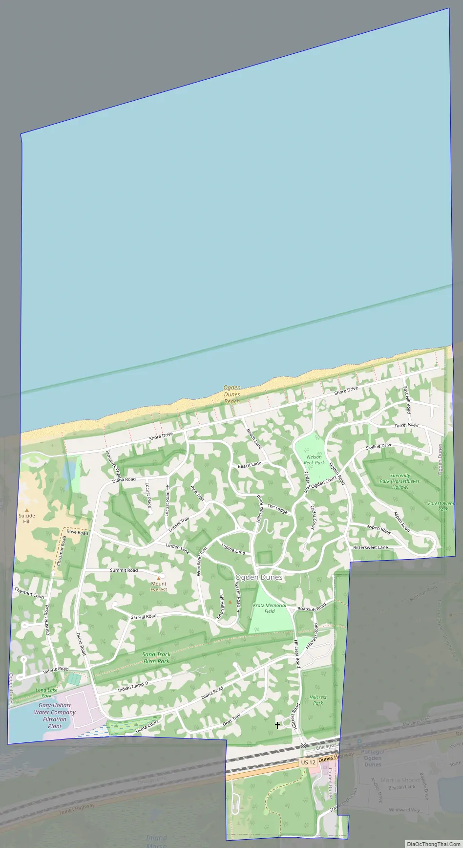
The town is the site of the Portage / Ogden Dunes station, which is served by South Shore Line passenger trains to and from Chicago. The principal thoroughfare serving the town is U.S. Route 12, which passes along the town’s southern edge and connects it to nearby communities such as Gary to the west and Burns Harbor to the east.
Ogden Dunes has been reported as having the highest rate of Lyme disease in Indiana.
| Name: | Ogden Dunes town |
|---|---|
| LSAD Code: | 43 |
| LSAD Description: | town (suffix) |
| State: | Indiana |
| County: | Porter County |
| Elevation: | 610 ft (186 m) |
| Total Area: | 1.46 sq mi (3.78 km²) |
| Land Area: | 0.74 sq mi (1.91 km²) |
| Water Area: | 0.72 sq mi (1.87 km²) |
| Total Population: | 1,168 |
| Population Density: | 1,586.96/sq mi (612.54/km²) |
| ZIP code: | 46368 |
| Area code: | 219 |
| FIPS code: | 1856088 |
| GNISfeature ID: | 449814 |
Online Interactive Map
Click on ![]() to view map in "full screen" mode.
to view map in "full screen" mode.
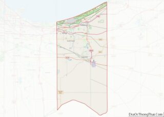
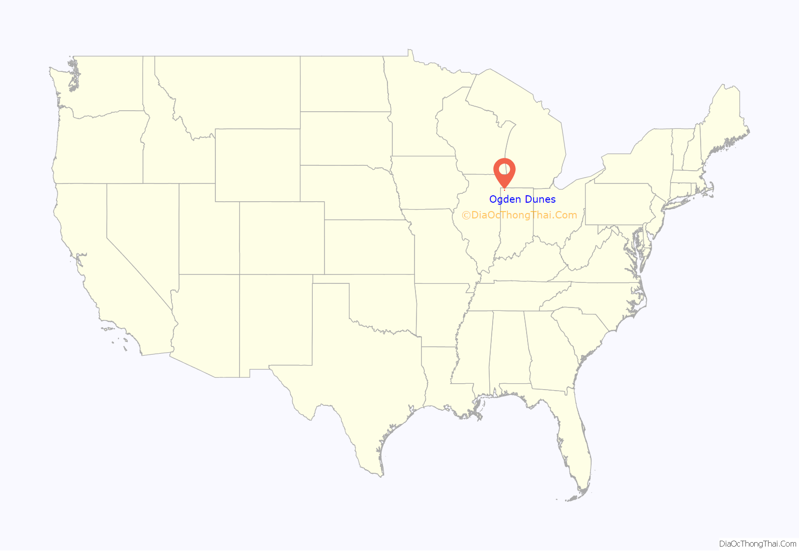
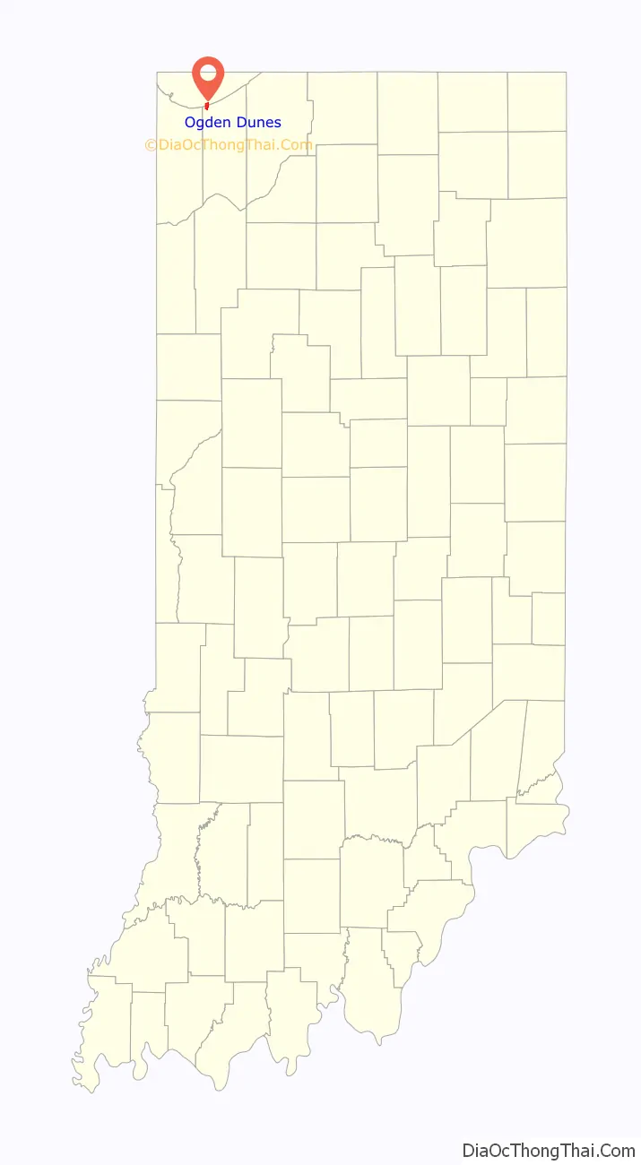
Ogden Dunes location map. Where is Ogden Dunes town?
History
Samuel Reck purchased the land from the estate of Francis Ogden in 1923. The town was platted a year later. The town had 50 residents in 1930. By the 1950s, there were almost 800 residents and 1,000 in 1991. The town was incorporated in 1925 to establish long term right of way across the New York Central Railroad tracks. The developers planned to create a resort community with a golf course, clubhouse and hotel. As development lagged, plans were dropped. Sand roads served the community until cinders placed on main street in 1931.
In the later 1920s Ogden Dunes was noted for having the largest ski jump in the country. International skiing competitions were held on this 30-story high, 500-foot long slide until it was dismantled in 1932. In 1927, the Grand Beach Ski Club, later the Ogden Dunes Ski Club, bought a piece of land on one of the high dunes in the town. They constructed a 192 feet (59 m)-tall ski jump. The first meet was held on January 22, 1928. For the next four years, meets were held in Ogden Dunes. The longest jump ever reported on this structure was 195 feet. In 1932, the Norwegian Olympic Team of Birger Rund, Hans Beck, and Kaare Wahlberg (gold, silver, and bronze medalists) came to Ogden Dunes to try the tower. During the Great Depression the Ski Club had financial setbacks; combined with little snow, the club looked to sell the tower.
- In 1935, a ski club in Rockford, Illinois, purchased the tower and moved it that summer. The Rockford Ski Club built ski jump at along the Kishwaukee River (Rockford Rotary County Forest Preserve) near the end 1920’s. It was expanded in 1936 by adding the steel inrun tower from Ogden Dunes.
- Moving the tower was repeated a third time in 1955 when the tower was moved to Eau Claire, Wisconsin and erected at Hendrickson Hill along the Chippewa River in what is now the University of Wisconsin–Eau Claire Campus. In 1968-69 Hendrickson Hill the hill was abandoned and the steel tower was once again dismantled and reassembled in its new location at Silver Mine Hill, 4.5 miles (7.2 km) downstream on the Chippewa River. The ski jump is still used at this site.
Two early houses (11008,11009) on Ski Hill Road are simple yet stylish homes built on the steep and lovely wooded hills of Ogden Dunes. Later structures along the beach include two outstanding houses (11001, 11004), which reflect the area’s emergence as a fashionable and exclusive residential area in Porter County.
Structures of historic significance
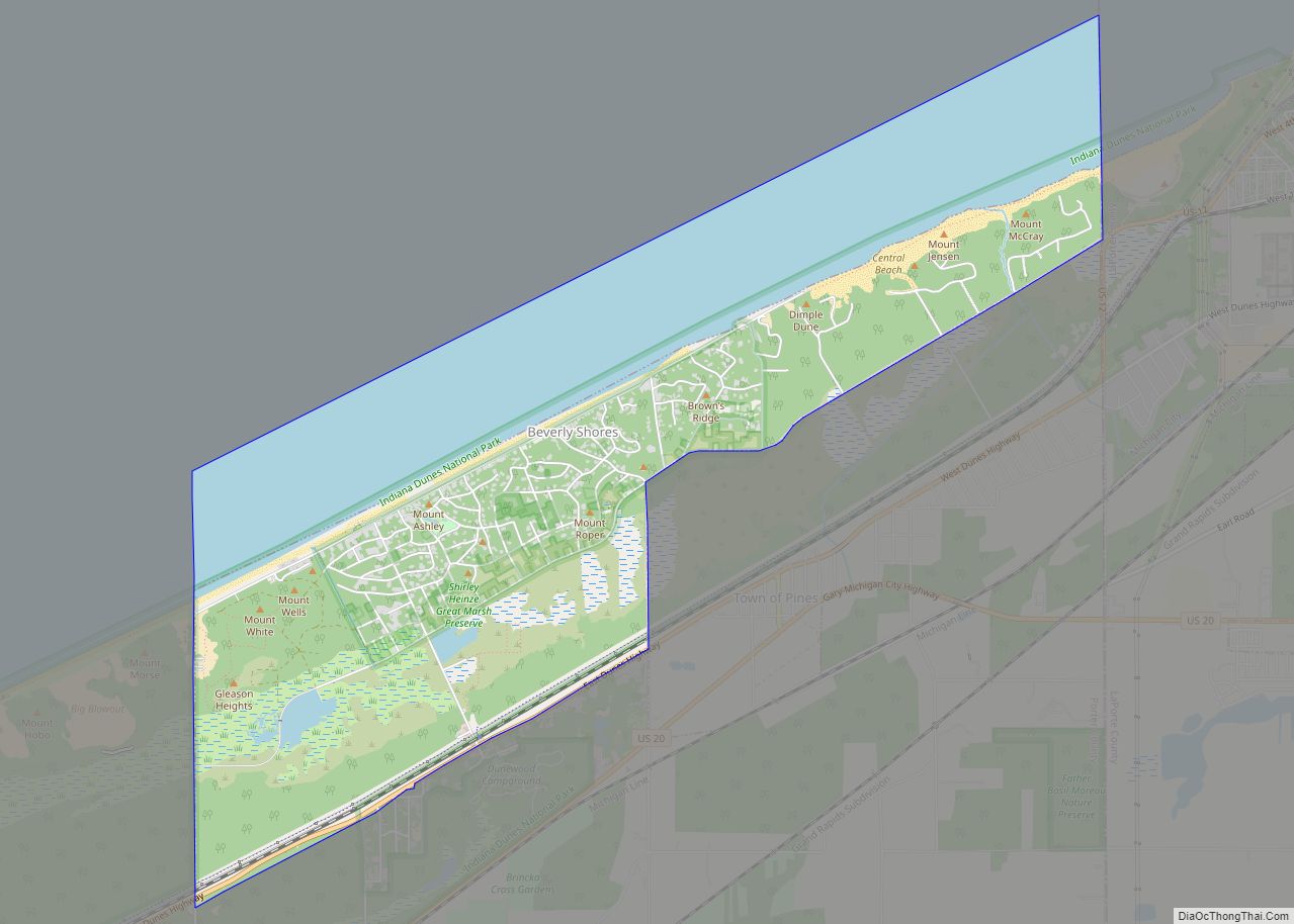
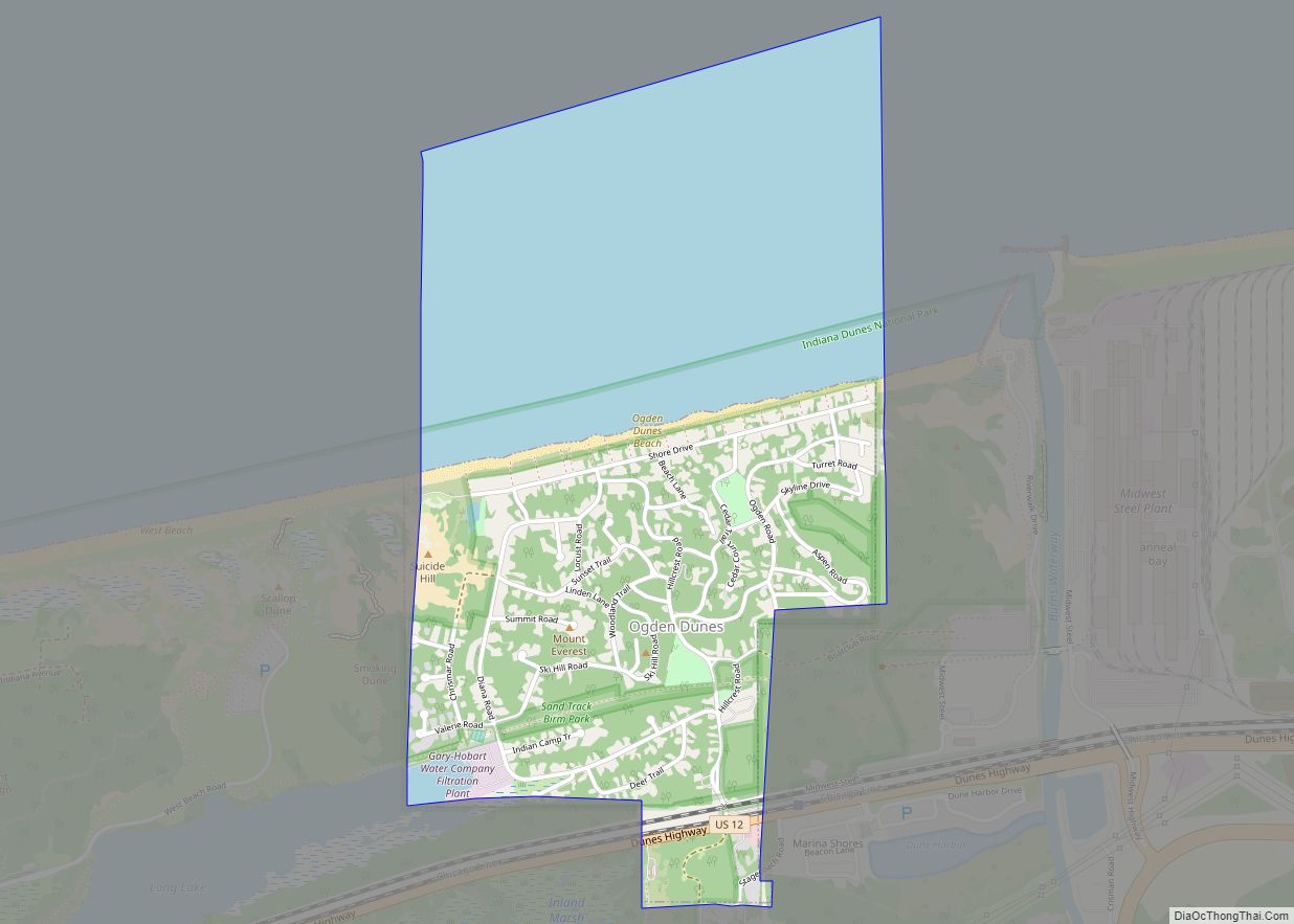
Ogden Dunes Road Map
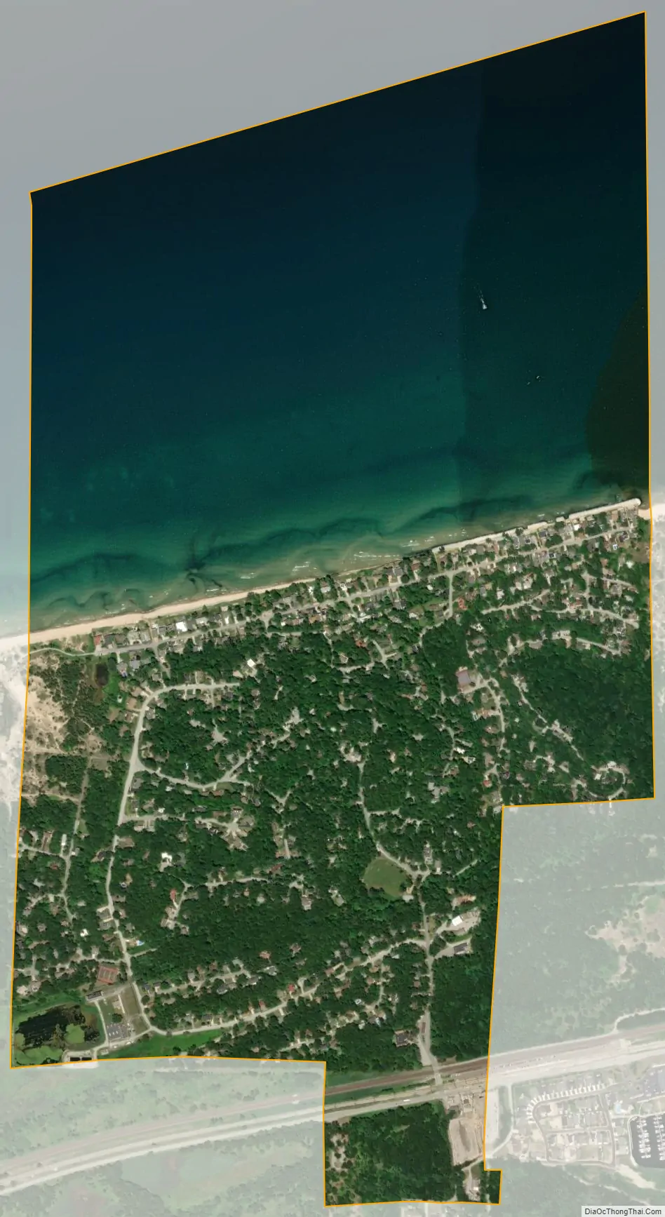
Ogden Dunes city Satellite Map
Geography
Ogden Dunes is located at 41°37′27″N 87°11′29″W / 41.62417°N 87.19139°W / 41.62417; -87.19139 (41.624250, −87.191338).
According to the 2010 census, Ogden Dunes has a total area of 1.46 square miles (3.78 km), of which 0.74 square miles (1.92 km) (or 50.68%) is land and 0.72 square miles (1.86 km) (or 49.32%) is water.
Ogden Dunes is in Portage Township, Porter County, Indiana. It is an exclusively a residential community. Neighboring Ogden Dunes are several similar enclaves within Indiana Dunes National Park: Miller Beach to the west, Beverly Shores and Dune Acres to the east. Like Ogden Dunes, a considerable portion of the residences in these communities are occupied as summer or weekend homes by Chicagoans.
See also
Map of Indiana State and its subdivision:- Adams
- Allen
- Bartholomew
- Benton
- Blackford
- Boone
- Brown
- Carroll
- Cass
- Clark
- Clay
- Clinton
- Crawford
- Daviess
- De Kalb
- Dearborn
- Decatur
- Delaware
- Dubois
- Elkhart
- Fayette
- Floyd
- Fountain
- Franklin
- Fulton
- Gibson
- Grant
- Greene
- Hamilton
- Hancock
- Harrison
- Hendricks
- Henry
- Howard
- Huntington
- Jackson
- Jasper
- Jay
- Jefferson
- Jennings
- Johnson
- Knox
- Kosciusko
- LaGrange
- Lake
- Lake Michigan
- LaPorte
- Lawrence
- Madison
- Marion
- Marshall
- Martin
- Miami
- Monroe
- Montgomery
- Morgan
- Newton
- Noble
- Ohio
- Orange
- Owen
- Parke
- Perry
- Pike
- Porter
- Posey
- Pulaski
- Putnam
- Randolph
- Ripley
- Rush
- Saint Joseph
- Scott
- Shelby
- Spencer
- Starke
- Steuben
- Sullivan
- Switzerland
- Tippecanoe
- Tipton
- Union
- Vanderburgh
- Vermillion
- Vigo
- Wabash
- Warren
- Warrick
- Washington
- Wayne
- Wells
- White
- Whitley
- Alabama
- Alaska
- Arizona
- Arkansas
- California
- Colorado
- Connecticut
- Delaware
- District of Columbia
- Florida
- Georgia
- Hawaii
- Idaho
- Illinois
- Indiana
- Iowa
- Kansas
- Kentucky
- Louisiana
- Maine
- Maryland
- Massachusetts
- Michigan
- Minnesota
- Mississippi
- Missouri
- Montana
- Nebraska
- Nevada
- New Hampshire
- New Jersey
- New Mexico
- New York
- North Carolina
- North Dakota
- Ohio
- Oklahoma
- Oregon
- Pennsylvania
- Rhode Island
- South Carolina
- South Dakota
- Tennessee
- Texas
- Utah
- Vermont
- Virginia
- Washington
- West Virginia
- Wisconsin
- Wyoming