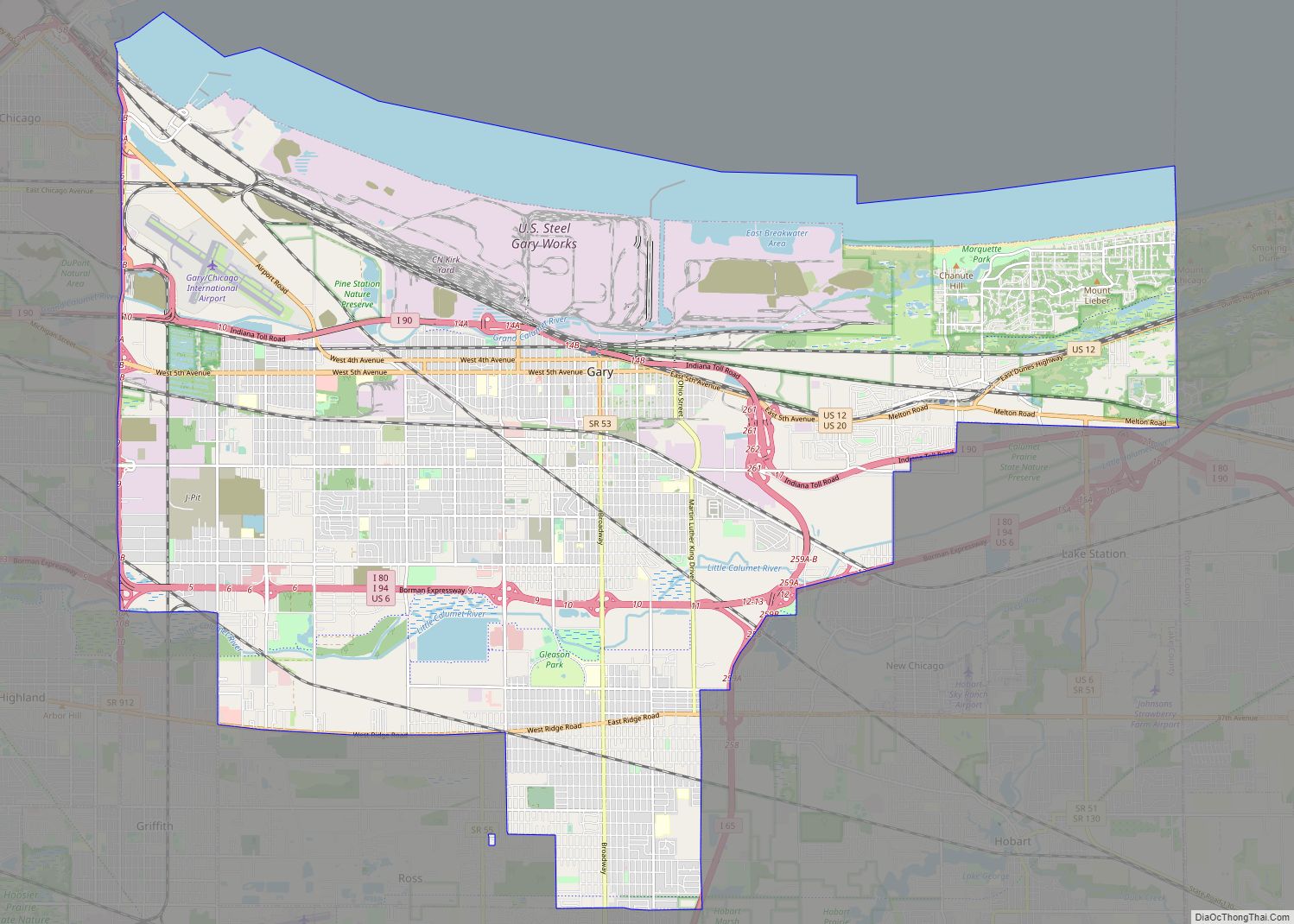
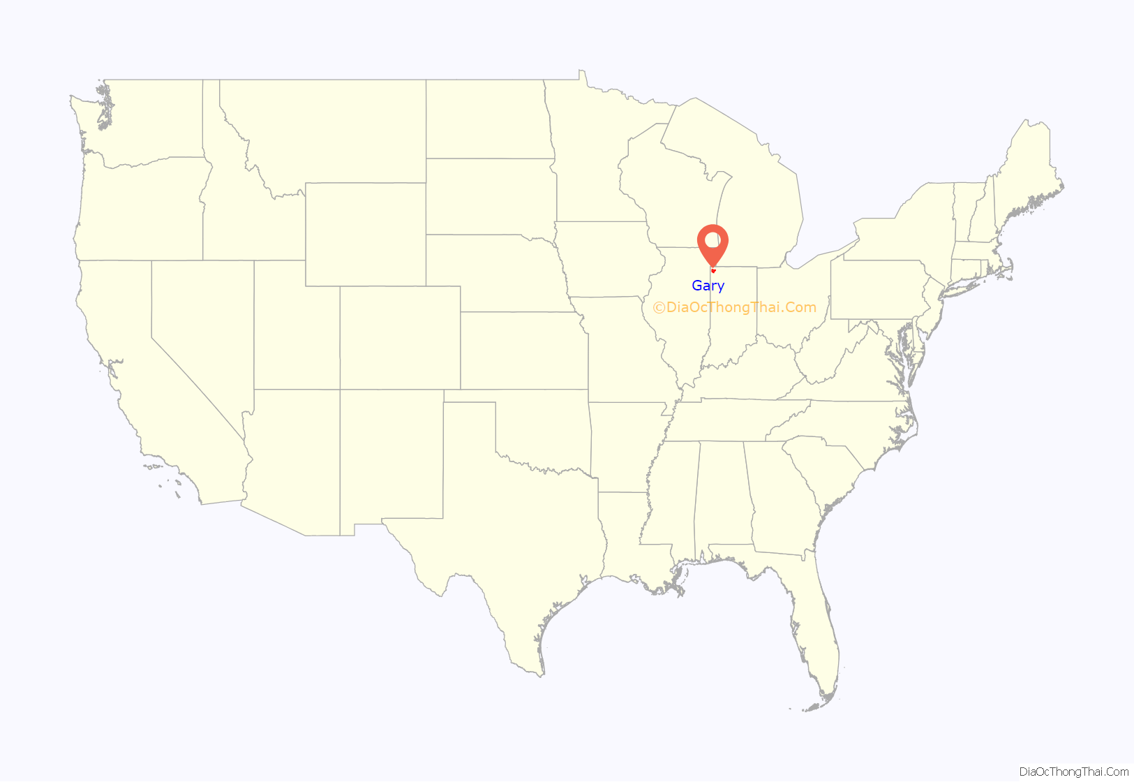
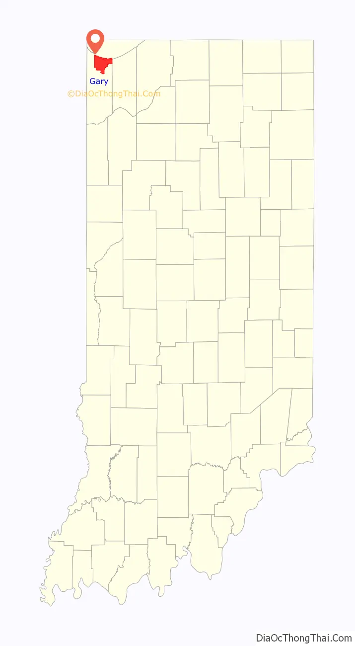
Gary is a city in Lake County, Indiana, United States. The city has been historically dominated by major industrial activity and is home to U.S. Steel’s Gary Works, the largest steel mill complex in North America. Gary is located along the southern shore of Lake Michigan about 25 miles (40 km) east of downtown Chicago, Illinois. The city is adjacent to the Indiana Dunes National Park, and is within the Chicago metropolitan area.
Gary was named after lawyer Elbert Henry Gary, who was the founding chairman of the United States Steel Corporation. U.S. Steel had established the city as a company town to serve its steel mills. Although initially a very diverse city, after white flight in the 1970s, the city of Gary held the nation’s highest percentage of African Americans for several decades.
As of the 2020 census the city’s population was 70,093, making it Indiana‘s ninth-largest city. Like other Rust Belt cities, Gary’s once thriving steel industry has been significantly affected by the disappearance of local manufacturing jobs since the 1970s. As a result of this economic shift, the city’s population has decreased drastically, having lost 61% of its population since 1960. Because of its large losses in population and deteriorating economy, Gary is often cited as an example of industrial decline and urban decay in America.
Gary is serviced by the Gary/Chicago International Airport, an alternative airport to the Chicago region’s two larger airports. The city’s public transport is provided by the Gary Public Transportation Corporation and the South Shore Line passenger railway, which connects to the Chicago transit system. It is also home to a professional baseball team, the Gary SouthShore RailCats. In addition to its large steel mills, the city is known for being the birthplace of the Jackson family, a family of well-known entertainers whose members include singer Michael Jackson.
| Name: | Gary city |
|---|---|
| LSAD Code: | 25 |
| LSAD Description: | city (suffix) |
| State: | Indiana |
| County: | Lake County |
| Incorporated: | July 14, 1906 |
| Elevation: | 607 ft (185 m) |
| Total Area: | 50.60 sq mi (131.05 km²) |
| Land Area: | 49.87 sq mi (129.15 km²) |
| Water Area: | 0.73 sq mi (1.89 km²) |
| Total Population: | 69,093 |
| Population Density: | 1,385.55/sq mi (534.97/km²) |
| Area code: | 219 |
| FIPS code: | 1827000 |
| GNISfeature ID: | 2394863 |
Online Interactive Map
Click on ![]() to view map in "full screen" mode.
to view map in "full screen" mode.
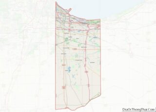
Gary location map. Where is Gary city?
History
Founding and early years
Gary, Indiana, was founded in 1906 by the United States Steel Corporation as the home for its new plant, Gary Works. The city was named after lawyer Elbert Henry Gary, who was the founding chairman of the United States Steel Corporation.
Gary was the site of civil unrest in the steel strike of 1919. On October 4, 1919, a riot broke out on Broadway, the main north-south street through downtown Gary, between steel workers and strike breakers brought in from outside. Three days later, Indiana governor James P. Goodrich declared martial law. Shortly thereafter, over 4,000 federal troops under the command of Major General Leonard Wood arrived to restore order.
The jobs offered by the steel industry provided Gary with very rapid growth and a diverse population within the first 26 years of its founding. According to the 1920 United States Census, 29.7% of Gary’s population at the time was classified as foreign-born, mostly from eastern European countries, with another 30.8% classified as native-born with at least one foreign-born parent. By the 1930 United States Census, the first census in which Gary’s population exceeded 100,000, the city was the fifth largest in Indiana and comparable in size to South Bend, Fort Wayne, and Evansville. At that time, 78.7% of the population was classified as white, with 19.3% of the population classified as foreign-born and another 25.9% as native-born with at least one foreign-born parent. In addition to white internal migrants, Gary had attracted numerous African-American migrants from the South in the Great Migration, and 17.8% of the population was classified as black. 3.5% were classified as Mexican (now likely to be identified as Hispanic, as some were likely American citizens in addition to immigrants).
Post-World War II
Gary’s fortunes have risen and fallen with those of the steel industry. The growth of the steel industry brought prosperity to the community. Broadway was known as a commercial center for the region. Department stores and architecturally significant movie houses were built in the downtown area and the Glen Park neighborhood.
In the 1960s, like many other American urban centers reliant on one particular industry, Gary entered a spiral of decline. Gary’s decline was brought on by the growing overseas competitiveness in the steel industry, which had caused U.S. Steel to lay off many workers from the Gary area. The U.S. Steel Gary Works employed over 30,000 in 1970, declined to just 6,000 by 1990, and further declined to 5,100 in August 2015. Attempts to shore up the city’s economy with major construction projects, such as a Holiday Inn hotel and the Genesis Convention Center, failed to reverse the decline.
1968 riots
In July 1968 riots broke out in Gary. A sniper killed ten people; three were police officers. 3,000 National Guard members came in to restore order to the city. Curfews were enforced and a ban on gasoline and liquor sales helped calm the violence. Over 110 people were arrested, at least 3 stores were set on fire, and at least 15 fire-bombings were reported.
Racial changes
A rapid racial change occurred in Gary during the late 20th century. These population changes resulted in political change which reflected the racial demographics of Gary: the Black and Hispanic share of the city’s population increased from 21% in 1930, 39% in 1960, to 53% in 1970. Black and Hispanic were primarily living in the Midtown section just south of downtown (per the 1950 Census, 97% of the black population of Gary was living in this neighborhood). Gary had one of the nation’s first African-American mayors, Richard G. Hatcher, and hosted the groundbreaking 1972 National Black Political Convention.
In the late 1990s and early 2000s, Gary had the highest percentage of African-Americans of U.S. cities with a population of 100,000 or more, 84% (as of the 2000 U.S. census). This no longer applies to Gary since the population of the city has now fallen well below 100,000 residents. As of 2013, the Gary Department of Redevelopment has estimated that one-third of all homes in the city are unoccupied and/or abandoned.
U.S. Steel
U.S. Steel continues to be a major steel producer, but with only a fraction of its former level of employment. While Gary has failed to reestablish a manufacturing base since its population peak, two casinos opened along the Gary lakeshore in the 1990s, although this has been aggravated by the state closing of Cline Avenue, an important access to the area. Today, Gary faces the difficulties of a Rust Belt city, including poorly run city management, unemployment, and decaying infrastructure.
Recent history
Gary has closed several of its schools within the last ten years. While some of the school buildings have been reused, most remain unused since their closing. As of 2014, Gary is considering closing additional schools in response to budget deficits.
Gary chief of police Thomas Houston was convicted of excessive force and abuse of authority in 2008; he died in 2010 while serving a three-year, five-month federal prison sentence.
In April 2011, 75-year-old mayor Rudolph M. Clay announced that he would suspend his campaign for reelection as he was being treated for prostate cancer. He endorsed rival Karen Freeman-Wilson, who won the Democratic mayoral primary in May 2011. Freeman-Wilson won election with 87 percent of the vote and her term began in January 2012; she is the first woman elected mayor in the city’s history. She was reelected in 2015. She was defeated in her bid for a third term in the 2019 Democratic primary by Lake County Assessor Jerome Prince. Since no challengers filed for the November 2019 general election, Prince’s nomination is effectively tantamount to election, and officially succeeded Freeman-Wilson on January 1, 2020, two days after he was sworn in as the city’s 21st mayor on December 30, 2019.
In May 2021, a $300 million Hard Rock Casino location opened in the city. Branded as Hard Rock Casino Northern Indiana, the location includes memorabilia from local natives Jackson 5 and a 1,950-seat Hard Rock Live performance hall.
National Register of Historic Places
The following single properties and national historic districts are listed on the National Register of Historic Places:
- American Sheet and Tin Mill Apartment Building
- Louis J. Bailey Branch Library-Gary International Institute
- Combs Addition Historic District
- Ralph Waldo Emerson School
- Eskilson Historic District
- Gary Bathing Beach Aquatorium
- Gary City Center Historic District
- Gary Land Company Building
- Gary Public Schools Memorial Auditorium
- Jackson-Monroe Terraces Historic District
- Jefferson Street Historic District
- Knights of Columbus Building
- Lincoln Street Historic District
- Horace Mann Historic District
- Miller Town Hall
- Monroe Terrace Historic District
- Morningside Historic District
- Polk Street Concrete Cottage Historic District
- Polk Street Terraces Historic District
- Theodore Roosevelt High School
- Barney Sablotney House
- St. Augustine’s Episcopal Church
- Van Buren Terrace Historic District
- West Fifth Avenue Apartments Historic District
- St. John’s Evangelical Lutheran Church and School
Gary Road Map
Gary city Satellite Map

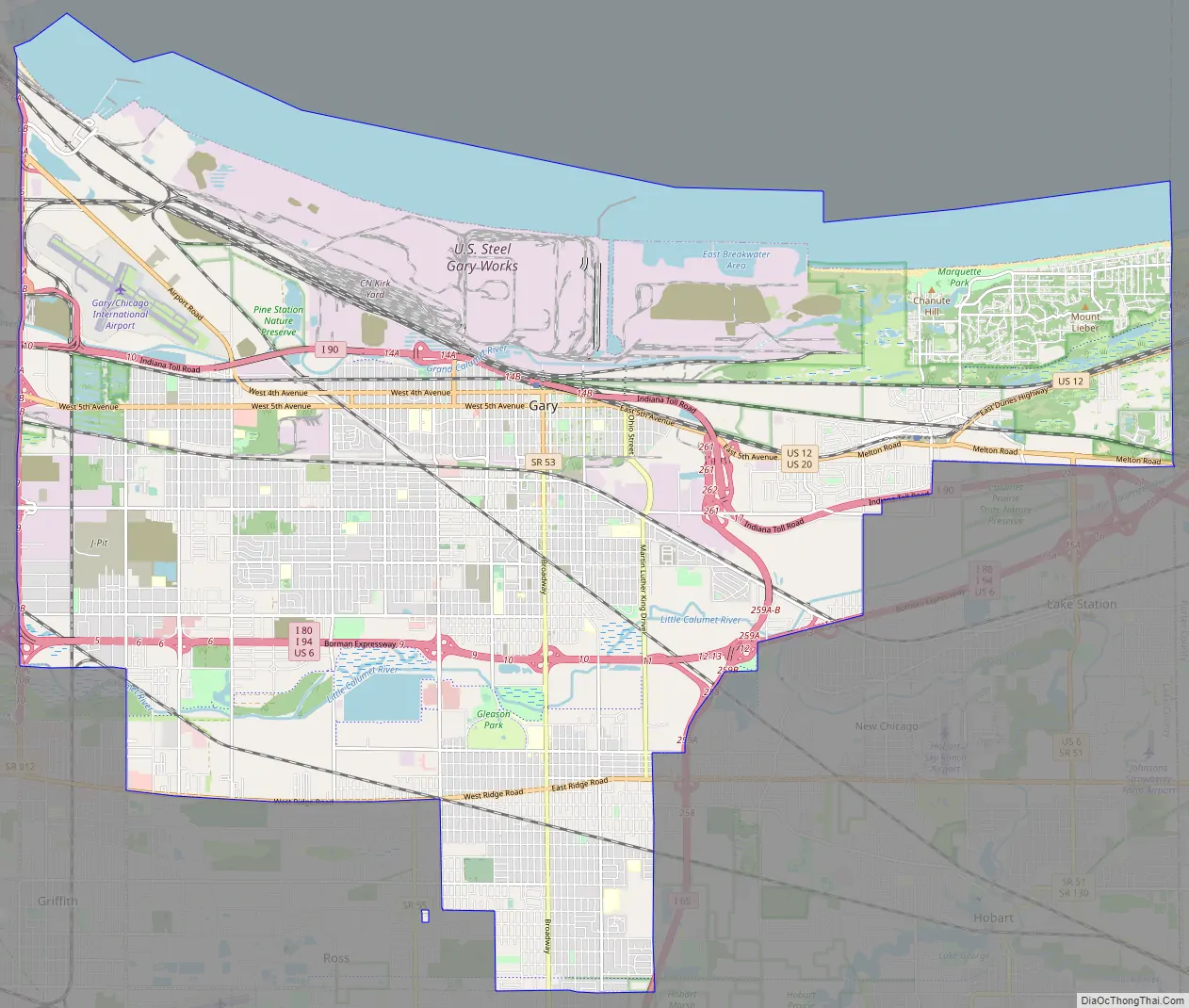
Geography
The city is located at the southern end of the former lake bed of the prehistoric Lake Chicago and the current Lake Michigan. Most of the city’s soil, to nearly one foot below the surface, is pure sand. The sand beneath Gary, and on its beaches, is of such volume and quality that for over a century companies have mined it, especially for the manufacture of glass.
According to the 2010 census, Gary has a total area of 57.18 square miles (148.10 km), of which 49.87 square miles (129.16 km) (or 87.22%) is land and 7.31 square miles (18.93 km) (or 12.78%) is water.
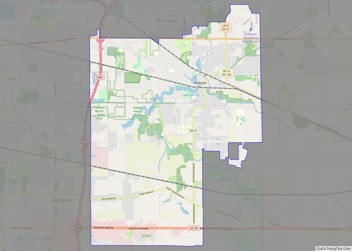
Gary is “T” shaped, with its northern border on Lake Michigan. In the northwesternmost section, Gary borders Hammond and East Chicago; 165th Street, one of several roads connecting Hammond and Gary, has been walled off from Gary since 1981, initially due to a toxic flood. Miller Beach, Gary’s easternmost neighborhood, borders Lake Station and Portage. Gary’s southernmost section borders Griffith, Hobart, Merrillville, and unincorporated Ross. Gary is about 30 miles (48 km) from the Chicago Loop.
Climate
Gary is listed by the Köppen-Geiger climate classification system as humid continental (Dfa). In July and August, the warmest months, high temperatures average 84 °F (29 °C) and peak just above 100 °F (38 °C), and low temperatures average 63 °F (17 °C). In January and February, the coldest months, high temperatures average around 29 °F (−2 °C) and low temperatures average 13 °F (−11 °C), with at least a few days of temperatures dipping below 0 °F (−18 °C).
The weather in Gary is greatly regulated by its proximity to Lake Michigan. Weather varies yearly. In the summer months Gary is humid. The city’s yearly precipitation averages about 40 inches. Summer is the rainiest season. Winters vary but are predominantly snowy. Snowfall in Gary averages approximately 25 inches per year. Sometimes large blizzards hit because of “lake effect snow”, a phenomenon whereby large amounts of water evaporated from the lake deposit onto the shoreline areas as inordinate amounts of snow.
See also
Map of Indiana State and its subdivision:- Adams
- Allen
- Bartholomew
- Benton
- Blackford
- Boone
- Brown
- Carroll
- Cass
- Clark
- Clay
- Clinton
- Crawford
- Daviess
- De Kalb
- Dearborn
- Decatur
- Delaware
- Dubois
- Elkhart
- Fayette
- Floyd
- Fountain
- Franklin
- Fulton
- Gibson
- Grant
- Greene
- Hamilton
- Hancock
- Harrison
- Hendricks
- Henry
- Howard
- Huntington
- Jackson
- Jasper
- Jay
- Jefferson
- Jennings
- Johnson
- Knox
- Kosciusko
- LaGrange
- Lake
- Lake Michigan
- LaPorte
- Lawrence
- Madison
- Marion
- Marshall
- Martin
- Miami
- Monroe
- Montgomery
- Morgan
- Newton
- Noble
- Ohio
- Orange
- Owen
- Parke
- Perry
- Pike
- Porter
- Posey
- Pulaski
- Putnam
- Randolph
- Ripley
- Rush
- Saint Joseph
- Scott
- Shelby
- Spencer
- Starke
- Steuben
- Sullivan
- Switzerland
- Tippecanoe
- Tipton
- Union
- Vanderburgh
- Vermillion
- Vigo
- Wabash
- Warren
- Warrick
- Washington
- Wayne
- Wells
- White
- Whitley
- Alabama
- Alaska
- Arizona
- Arkansas
- California
- Colorado
- Connecticut
- Delaware
- District of Columbia
- Florida
- Georgia
- Hawaii
- Idaho
- Illinois
- Indiana
- Iowa
- Kansas
- Kentucky
- Louisiana
- Maine
- Maryland
- Massachusetts
- Michigan
- Minnesota
- Mississippi
- Missouri
- Montana
- Nebraska
- Nevada
- New Hampshire
- New Jersey
- New Mexico
- New York
- North Carolina
- North Dakota
- Ohio
- Oklahoma
- Oregon
- Pennsylvania
- Rhode Island
- South Carolina
- South Dakota
- Tennessee
- Texas
- Utah
- Vermont
- Virginia
- Washington
- West Virginia
- Wisconsin
- Wyoming