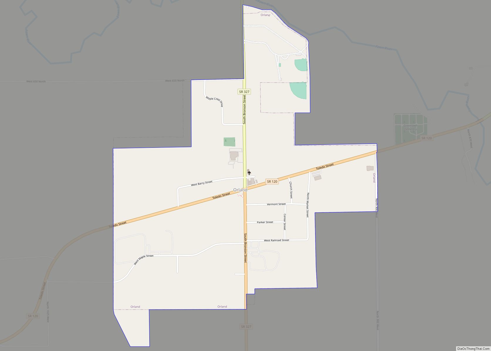
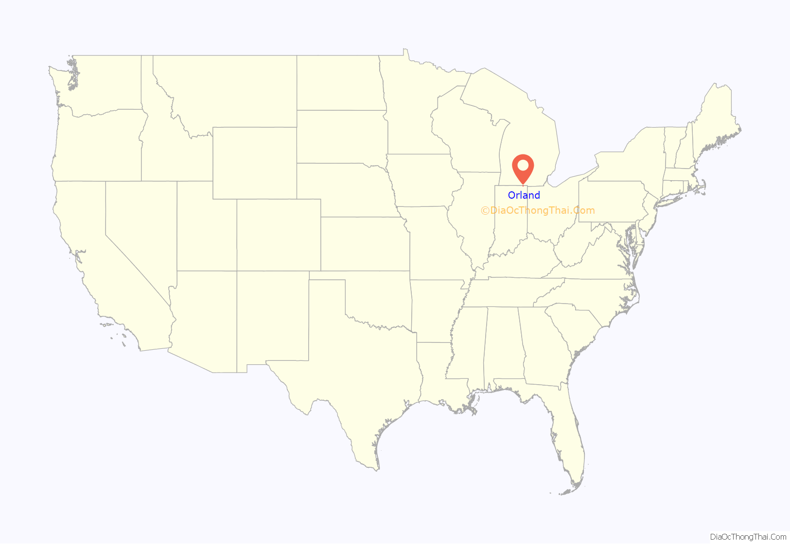
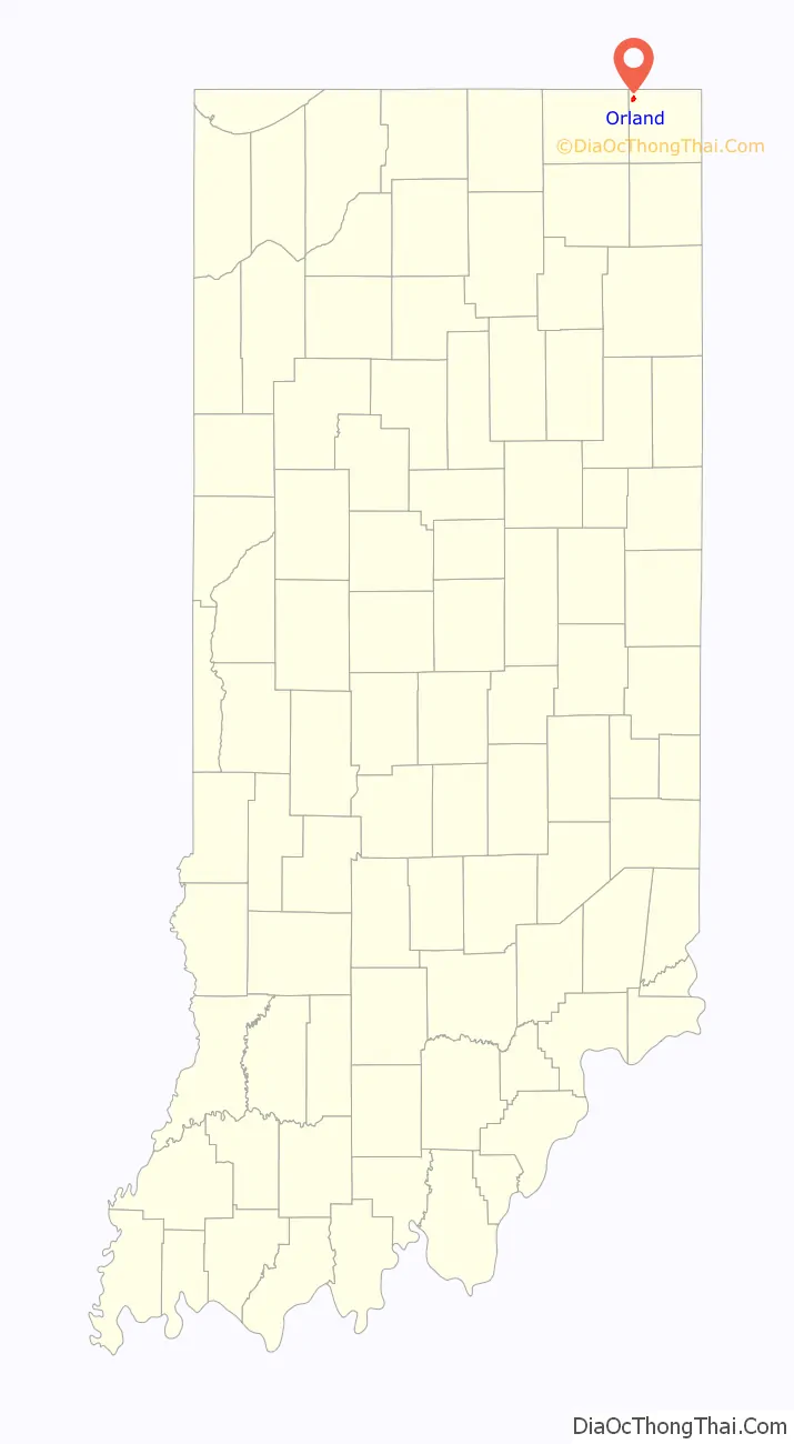
Orland is a town located in the northwest corner of Steuben County, Indiana in Millgrove Township at the intersection of State Road 120 and State Road 327. The population was 434 at the 2010 census.
| Name: | Orland town |
|---|---|
| LSAD Code: | 43 |
| LSAD Description: | town (suffix) |
| State: | Indiana |
| County: | Steuben County |
| Elevation: | 955 ft (291 m) |
| Total Area: | 0.69 sq mi (1.78 km²) |
| Land Area: | 0.69 sq mi (1.78 km²) |
| Water Area: | 0.00 sq mi (0.00 km²) |
| Total Population: | 389 |
| Population Density: | 567.06/sq mi (219.01/km²) |
| ZIP code: | 46776 |
| Area code: | 260 |
| FIPS code: | 1857006 |
| GNISfeature ID: | 440699 |
Online Interactive Map
Click on ![]() to view map in "full screen" mode.
to view map in "full screen" mode.
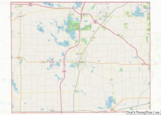
Orland location map. Where is Orland town?
History
Orland is recognized as the first settlement in Steuben County, populated by immigrants from Vermont and originally known as Vermont Settlement. Each year in late July, Orland celebrates this heritage with the Vermont Settlement Festival. Orland was settled in 1834 after a Vermont man named John Stocker had gone prospecting for his family and the families of his neighbors. Stocker chose this particular piece of land because of the rich burr-oak openings he found. Pioneers coming from Windham County, Vermont arrived shortly thereafter and built a Baptist church. The town established a post office in 1837.
In the decades leading up to the Civil War, Orland was a stop on the Underground Railroad, sheltering and protecting runaway slaves until they could complete the journey to Windsor, Upper Canada. The home of Russell Brown was said to contain a secret apartment on the second floor, complete with a separate stairway, in which 15 to 20 slaves might hide. S. U. Clark’s hotel also was said to have a secret hiding place behind a basement cupboard, while the Butler family south of Orland “fed and sheltered scores of them and then took them on to other stations.”
At one time or another during the period leading up to the Civil War, Brown, Clark, Benjamin Waterhouse, and Captain Samuel Barry were arrested for violating the Fugitive Slave Act of 1850. Both Waterhouse and Barry were convicted, with Barry serving one hour in jail and paying a $30 fine (although other sources put the fine at $1000).
Fawn River State Fish Hatchery was listed on the National Register of Historic Places in 1997.
During the 2019–20 coronavirus pandemic, confirmed cases of COVID-19 were reported on May 2, 2020, at a local meat processing plant run by Miller Poultry which resulted in sanitation of the plant & the implementation of safety measures such as temperature checks, social distancing & available personal protective equipment for workers.
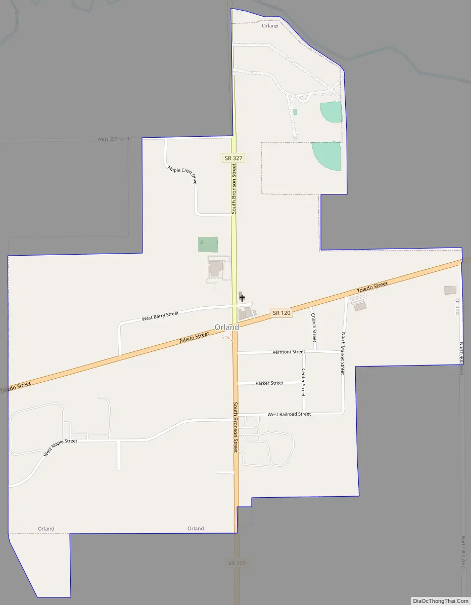
Orland Road Map
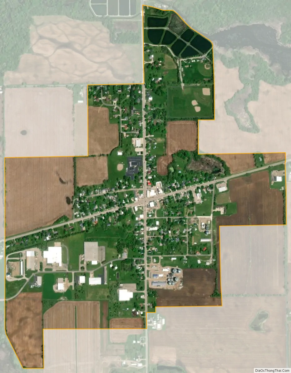
Orland city Satellite Map
Geography
Orland is located at 41°43′50″N 85°10′11″W / 41.73056°N 85.16972°W / 41.73056; -85.16972.
According to the 2010 census, Orland has a total area of 0.66 square miles (1.71 km), all land.
See also
Map of Indiana State and its subdivision:- Adams
- Allen
- Bartholomew
- Benton
- Blackford
- Boone
- Brown
- Carroll
- Cass
- Clark
- Clay
- Clinton
- Crawford
- Daviess
- De Kalb
- Dearborn
- Decatur
- Delaware
- Dubois
- Elkhart
- Fayette
- Floyd
- Fountain
- Franklin
- Fulton
- Gibson
- Grant
- Greene
- Hamilton
- Hancock
- Harrison
- Hendricks
- Henry
- Howard
- Huntington
- Jackson
- Jasper
- Jay
- Jefferson
- Jennings
- Johnson
- Knox
- Kosciusko
- LaGrange
- Lake
- Lake Michigan
- LaPorte
- Lawrence
- Madison
- Marion
- Marshall
- Martin
- Miami
- Monroe
- Montgomery
- Morgan
- Newton
- Noble
- Ohio
- Orange
- Owen
- Parke
- Perry
- Pike
- Porter
- Posey
- Pulaski
- Putnam
- Randolph
- Ripley
- Rush
- Saint Joseph
- Scott
- Shelby
- Spencer
- Starke
- Steuben
- Sullivan
- Switzerland
- Tippecanoe
- Tipton
- Union
- Vanderburgh
- Vermillion
- Vigo
- Wabash
- Warren
- Warrick
- Washington
- Wayne
- Wells
- White
- Whitley
- Alabama
- Alaska
- Arizona
- Arkansas
- California
- Colorado
- Connecticut
- Delaware
- District of Columbia
- Florida
- Georgia
- Hawaii
- Idaho
- Illinois
- Indiana
- Iowa
- Kansas
- Kentucky
- Louisiana
- Maine
- Maryland
- Massachusetts
- Michigan
- Minnesota
- Mississippi
- Missouri
- Montana
- Nebraska
- Nevada
- New Hampshire
- New Jersey
- New Mexico
- New York
- North Carolina
- North Dakota
- Ohio
- Oklahoma
- Oregon
- Pennsylvania
- Rhode Island
- South Carolina
- South Dakota
- Tennessee
- Texas
- Utah
- Vermont
- Virginia
- Washington
- West Virginia
- Wisconsin
- Wyoming