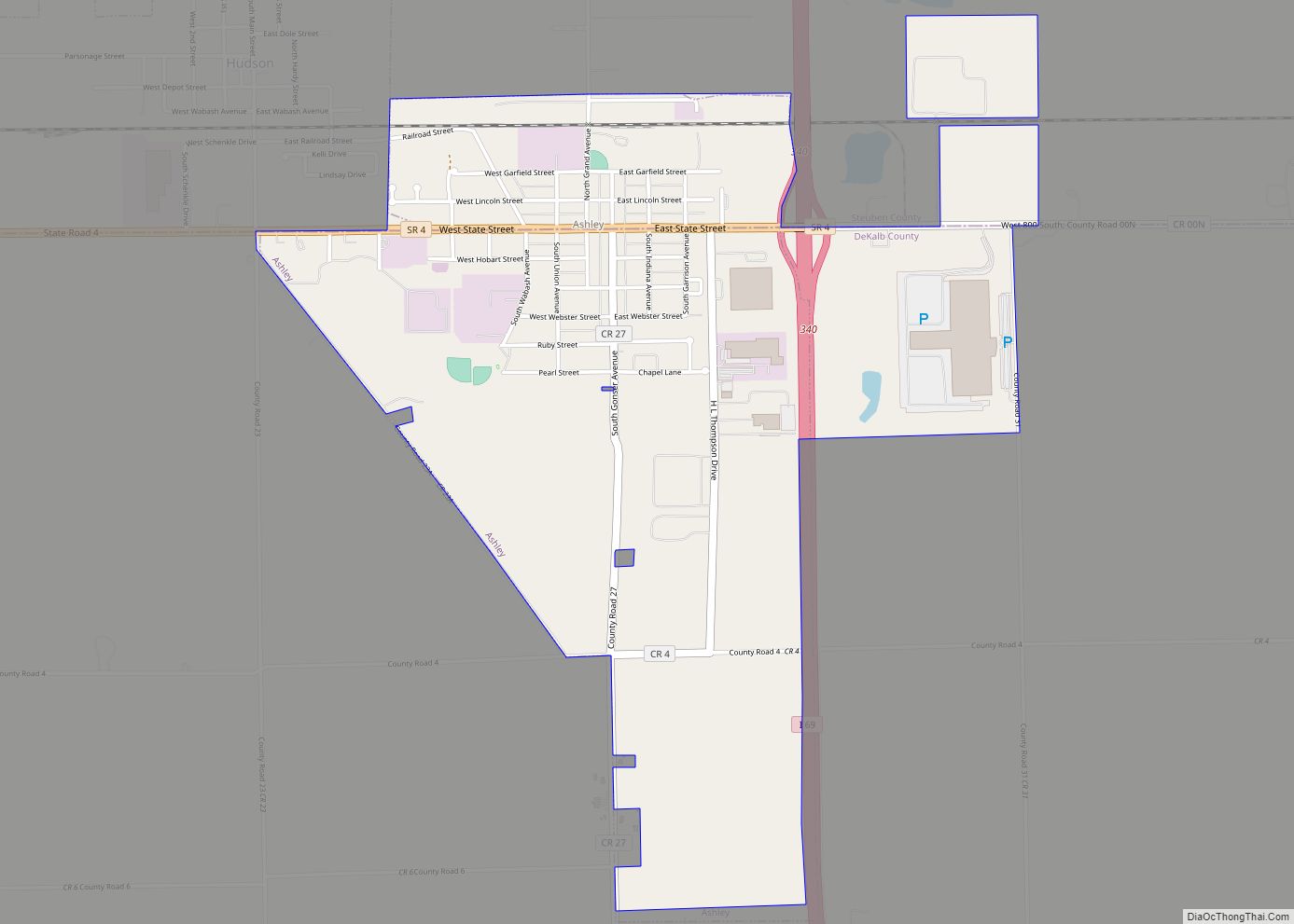
Hamilton is a town located on the border of Steuben County, Indiana and DeKalb County, Indiana. In Steuben County, it is in Otsego Township, and in DeKalb County it is in Franklin Township. The population was 1,532 at the 2010 census.
| Name: | Hamilton town |
|---|---|
| LSAD Code: | 43 |
| LSAD Description: | town (suffix) |
| State: | Indiana |
| County: | DeKalb County, Steuben County |
| Elevation: | 902 ft (275 m) |
| Total Area: | 3.05 sq mi (7.91 km²) |
| Land Area: | 2.10 sq mi (5.44 km²) |
| Water Area: | 0.95 sq mi (2.47 km²) |
| Total Population: | 1,529 |
| Population Density: | 727.75/sq mi (281.02/km²) |
| ZIP code: | 46742 |
| Area code: | 260 |
| FIPS code: | 1830594 |
| GNISfeature ID: | 435635 |
| Website: | http://hamiltonindiana.org/ |
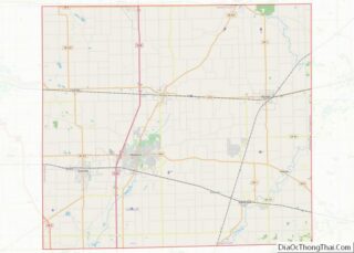
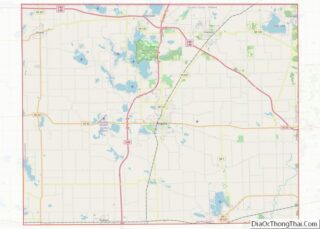
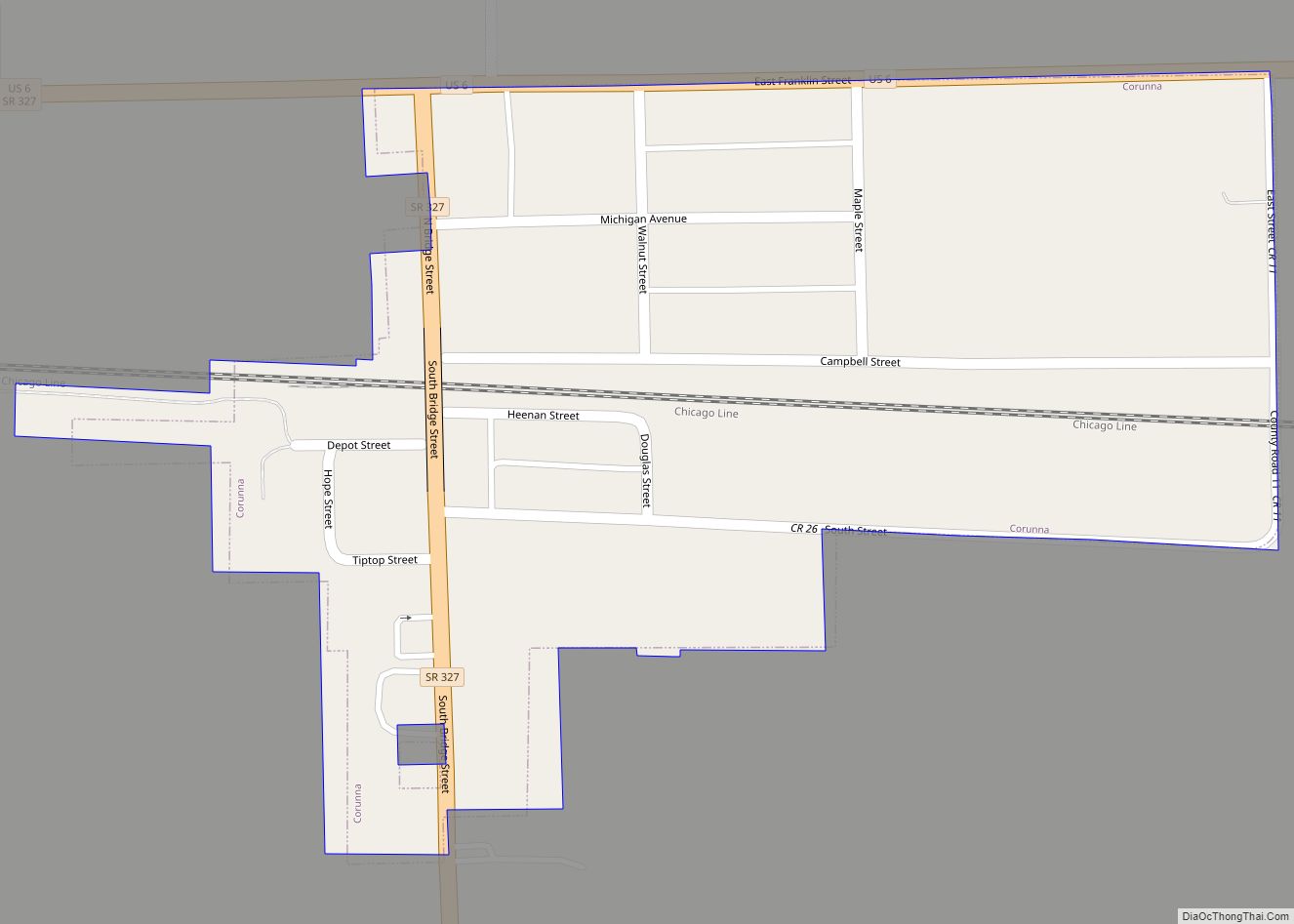
Online Interactive Map
Click on ![]() to view map in "full screen" mode.
to view map in "full screen" mode.
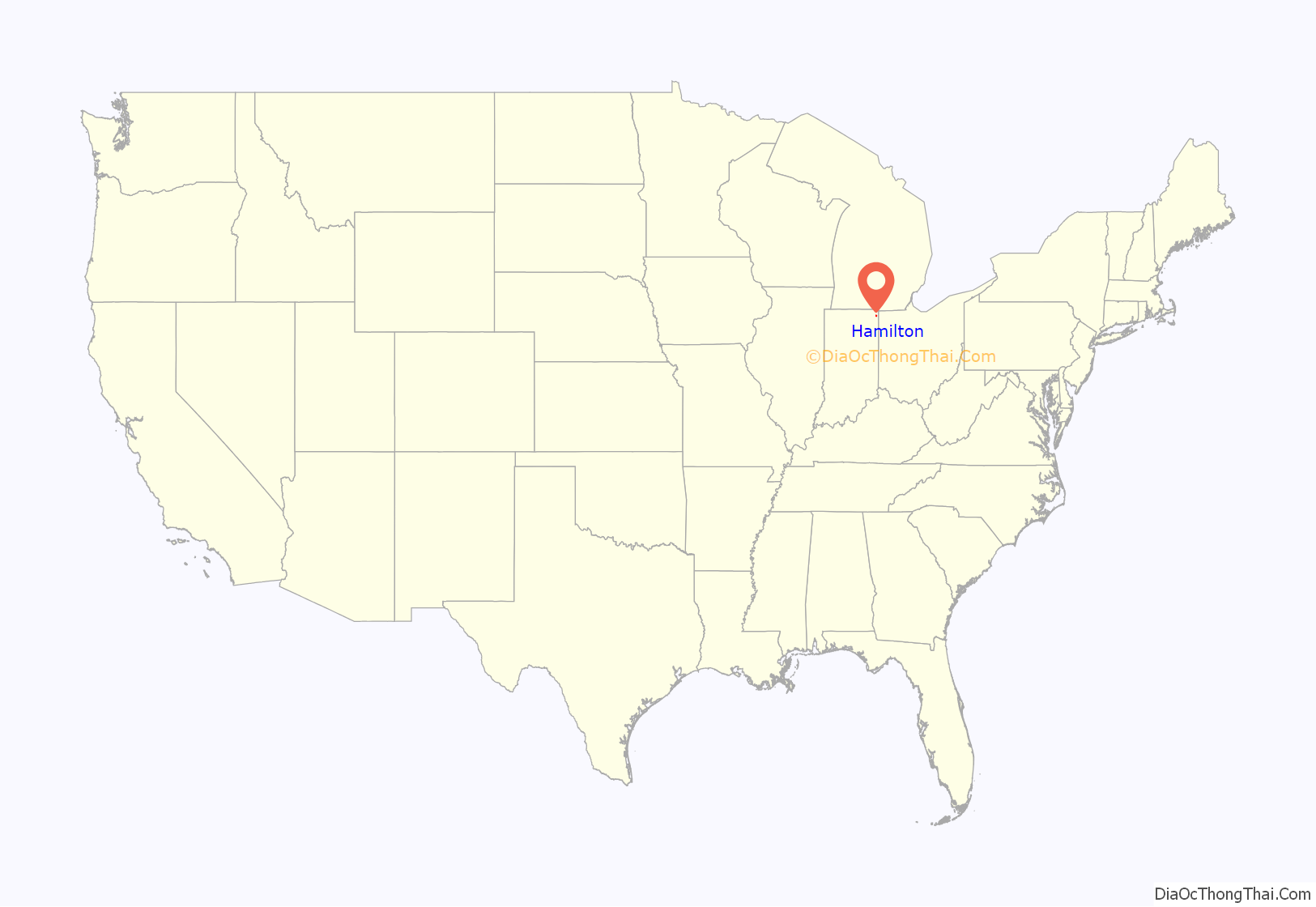
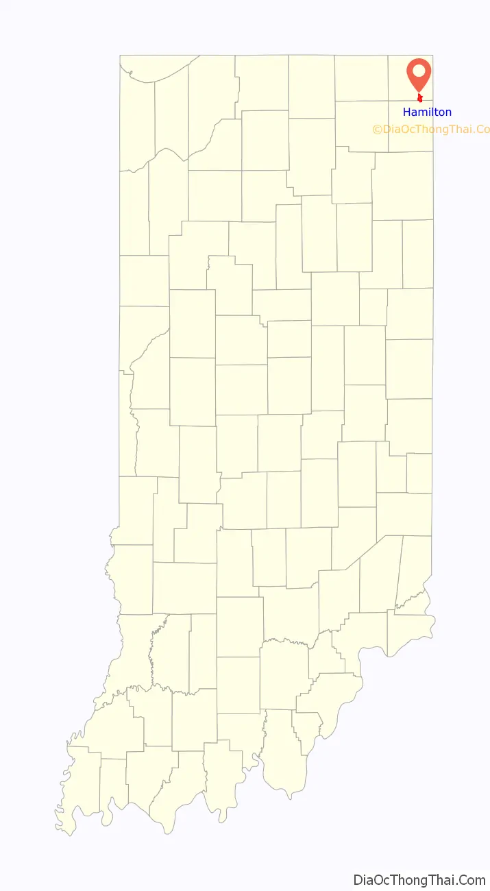
Hamilton location map. Where is Hamilton town?
History
In the late 1830s, the land that present-day Hamilton was built on was sold by the owner Niconar Munson to Dr. Samuel Tuttle, who was the first to plat the town. The original name of the town was “Enterprise”. Dr. Tuttle went to New York shortly thereafter, where he met Fisher Howe, president of a syndicate of capitalists. Dr. Tuttle sold all but one-sixteenth of the plat to him for $15,000. In the spring of 1838, Howe sent Sidney Gambia, an agent, to Enterprise to sell goods and develop the settlement. However, Enterprise was heavily ladened with illness that year, to such an extent that it became known for it. To improve the settlement’s reputation, the name was changed to Hamilton. Eventually the town was sold to Sidney Gambia for $1 (and for other terms), and the name was officially recorded as the Town of Hamilton in 1844.
A post office was established under the name Enterprise in 1837, and was renamed to Hamilton in 1844. The post office remains in operation.
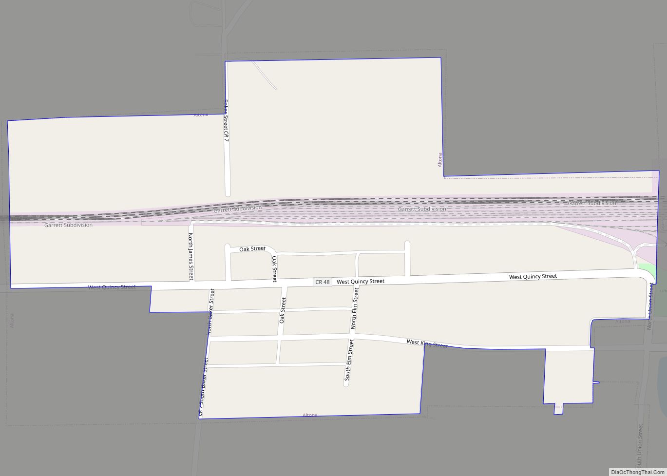
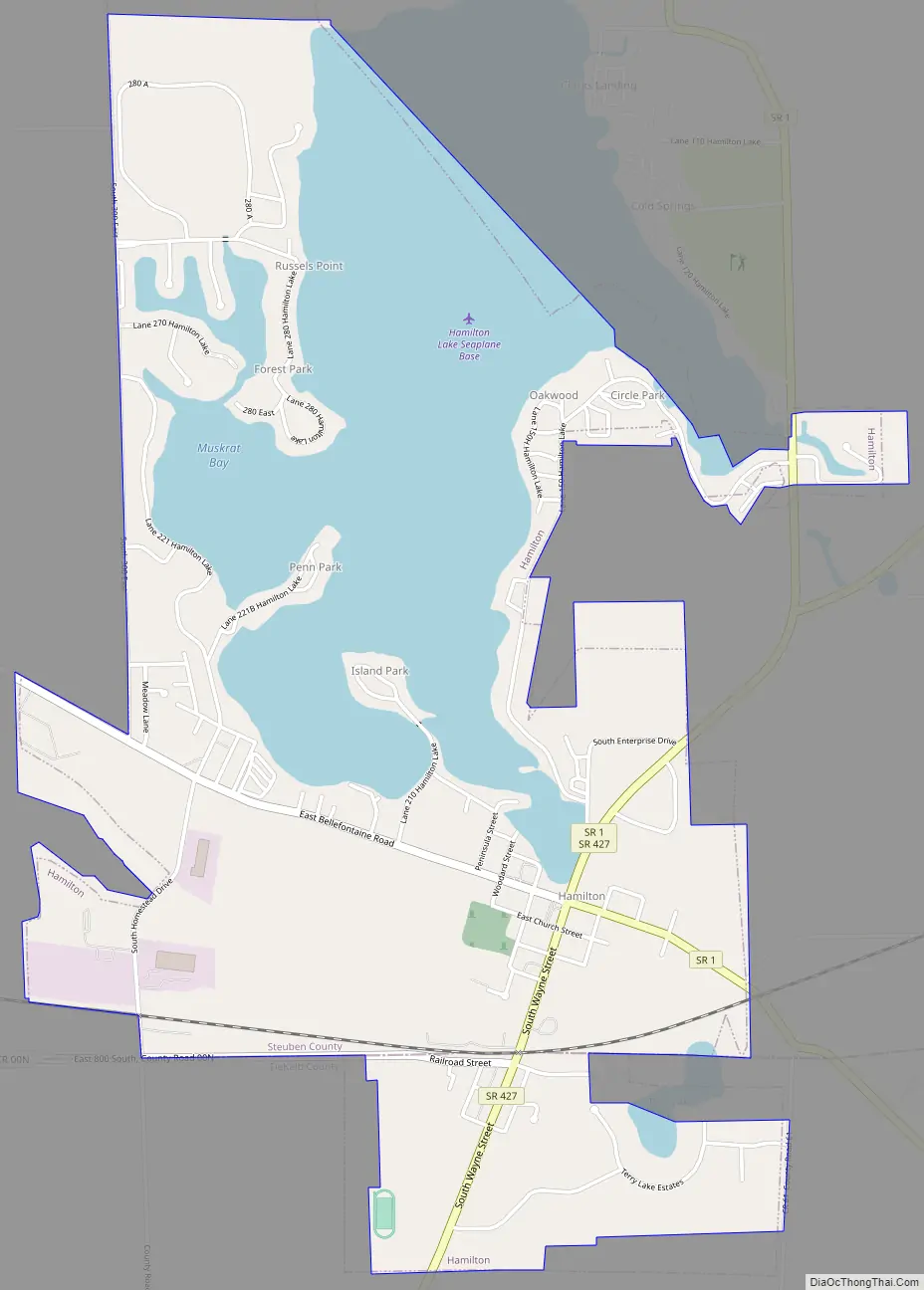
Hamilton Road Map
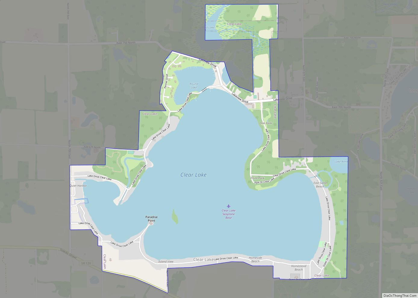
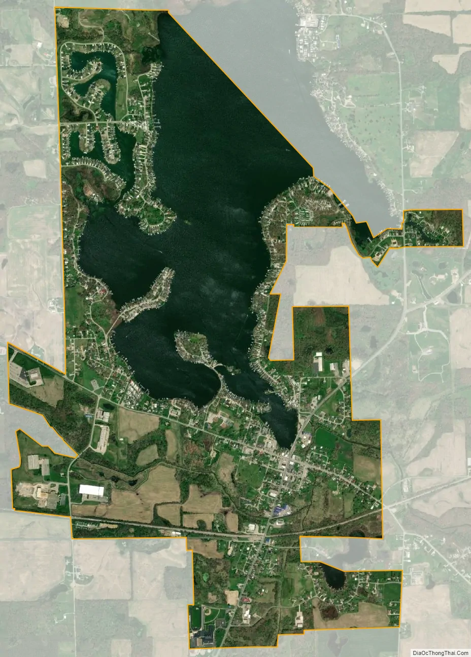
Hamilton city Satellite Map
Geography
Hamilton is located at 41°32′5″N 84°54′59″W / 41.53472°N 84.91639°W / 41.53472; -84.91639 (41.534845, -84.916515).
According to the 2010 census, Hamilton has a total area of 3.15 square miles (8.16 km), of which 2.39 square miles (6.19 km) (or 75.87%) is land and 0.76 square miles (1.97 km) (or 24.13%) is water.
The town is served by Indiana Highway 1, Indiana Highway 427, and Bellefontaine Road, which connects to Old US 27 in Pleasant Lake. The town is mainly a resort town that sees an influx of vacationers known colloquially as “lakers” during the summer months. The town is served by the Hamilton Police Department and the Hamilton Volunteer Fire Department. The main feature of the town is its namesake lake which the town was built around. Author Edward Eager vacationed here as a child in the 1920s, and featured the lake and local places like the hotel at Cold Harbor in one of his children’s books, “Magic by the Lake”.
A few years ago, the Flegal Brothers Gravel Pit, located on the Northwest end of the lake, was shut down and sold. After getting the go-ahead from state and federal officials, the closed pits were allowed to flood and then the portion of land separating the old gravel pit from the lake was removed and the newly created additions to the lake were named Crystal Bay and Crystal Cove and were sold off to a developer for the construction of new homes.
See also
Map of Indiana State and its subdivision:- Adams
- Allen
- Bartholomew
- Benton
- Blackford
- Boone
- Brown
- Carroll
- Cass
- Clark
- Clay
- Clinton
- Crawford
- Daviess
- De Kalb
- Dearborn
- Decatur
- Delaware
- Dubois
- Elkhart
- Fayette
- Floyd
- Fountain
- Franklin
- Fulton
- Gibson
- Grant
- Greene
- Hamilton
- Hancock
- Harrison
- Hendricks
- Henry
- Howard
- Huntington
- Jackson
- Jasper
- Jay
- Jefferson
- Jennings
- Johnson
- Knox
- Kosciusko
- LaGrange
- Lake
- Lake Michigan
- LaPorte
- Lawrence
- Madison
- Marion
- Marshall
- Martin
- Miami
- Monroe
- Montgomery
- Morgan
- Newton
- Noble
- Ohio
- Orange
- Owen
- Parke
- Perry
- Pike
- Porter
- Posey
- Pulaski
- Putnam
- Randolph
- Ripley
- Rush
- Saint Joseph
- Scott
- Shelby
- Spencer
- Starke
- Steuben
- Sullivan
- Switzerland
- Tippecanoe
- Tipton
- Union
- Vanderburgh
- Vermillion
- Vigo
- Wabash
- Warren
- Warrick
- Washington
- Wayne
- Wells
- White
- Whitley
- Alabama
- Alaska
- Arizona
- Arkansas
- California
- Colorado
- Connecticut
- Delaware
- District of Columbia
- Florida
- Georgia
- Hawaii
- Idaho
- Illinois
- Indiana
- Iowa
- Kansas
- Kentucky
- Louisiana
- Maine
- Maryland
- Massachusetts
- Michigan
- Minnesota
- Mississippi
- Missouri
- Montana
- Nebraska
- Nevada
- New Hampshire
- New Jersey
- New Mexico
- New York
- North Carolina
- North Dakota
- Ohio
- Oklahoma
- Oregon
- Pennsylvania
- Rhode Island
- South Carolina
- South Dakota
- Tennessee
- Texas
- Utah
- Vermont
- Virginia
- Washington
- West Virginia
- Wisconsin
- Wyoming