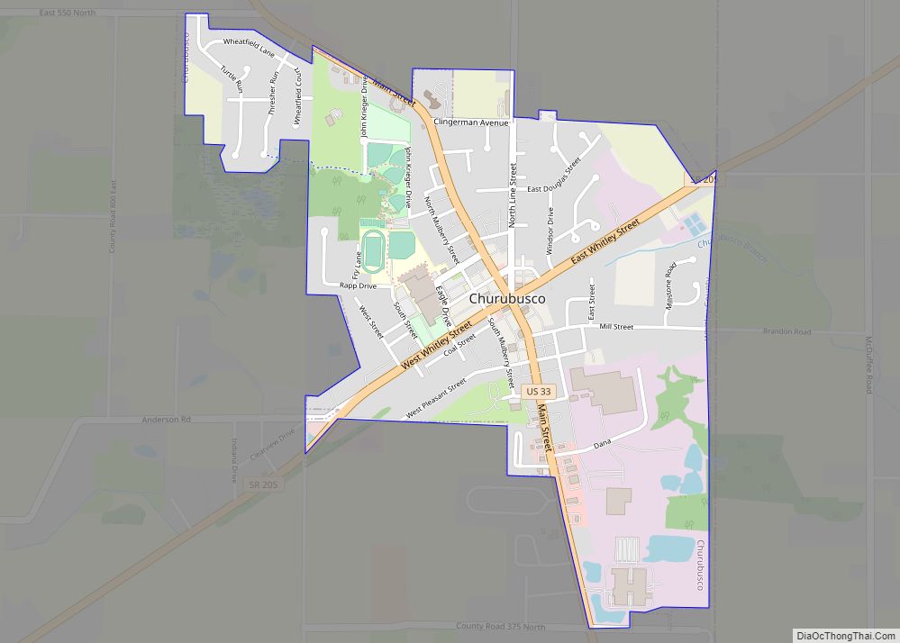
South Whitley is a town in Cleveland Township, Whitley County, in the U.S. state of Indiana. The population was 1,751 at the 2010 census. South Whitley is a town in the Midwestern tradition of red brick buildings and tree-lined streets.
| Name: | South Whitley town |
|---|---|
| LSAD Code: | 43 |
| LSAD Description: | town (suffix) |
| State: | Indiana |
| County: | Whitley County |
| Elevation: | 804 ft (245 m) |
| Total Area: | 0.87 sq mi (2.25 km²) |
| Land Area: | 0.85 sq mi (2.21 km²) |
| Water Area: | 0.02 sq mi (0.05 km²) |
| Total Population: | 1,818 |
| Population Density: | 2,133.80/sq mi (823.97/km²) |
| ZIP code: | 46787 |
| Area code: | 260 |
| FIPS code: | 1871612 |
| GNISfeature ID: | 443869 |
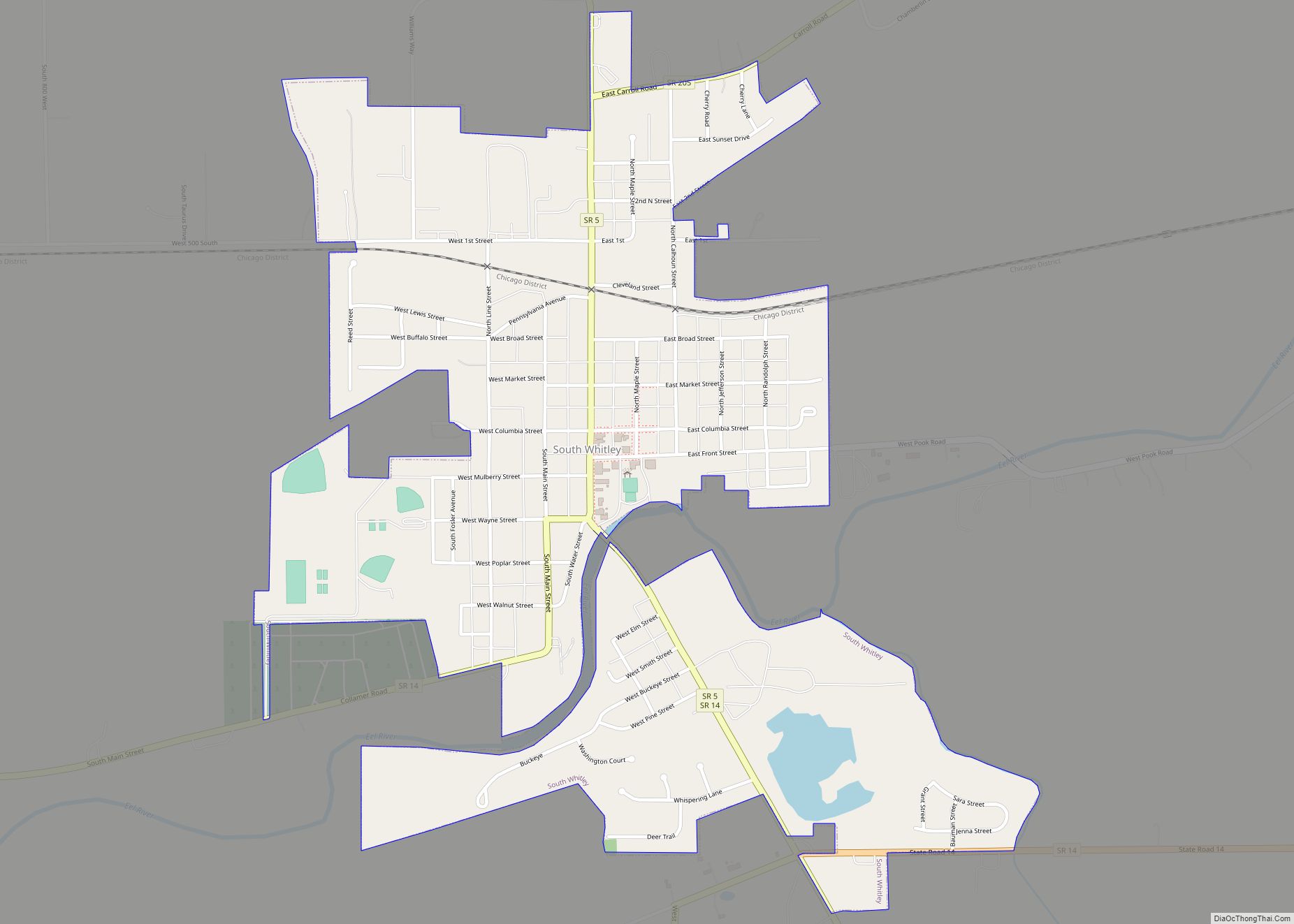
Online Interactive Map
Click on ![]() to view map in "full screen" mode.
to view map in "full screen" mode.
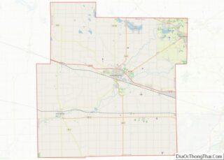
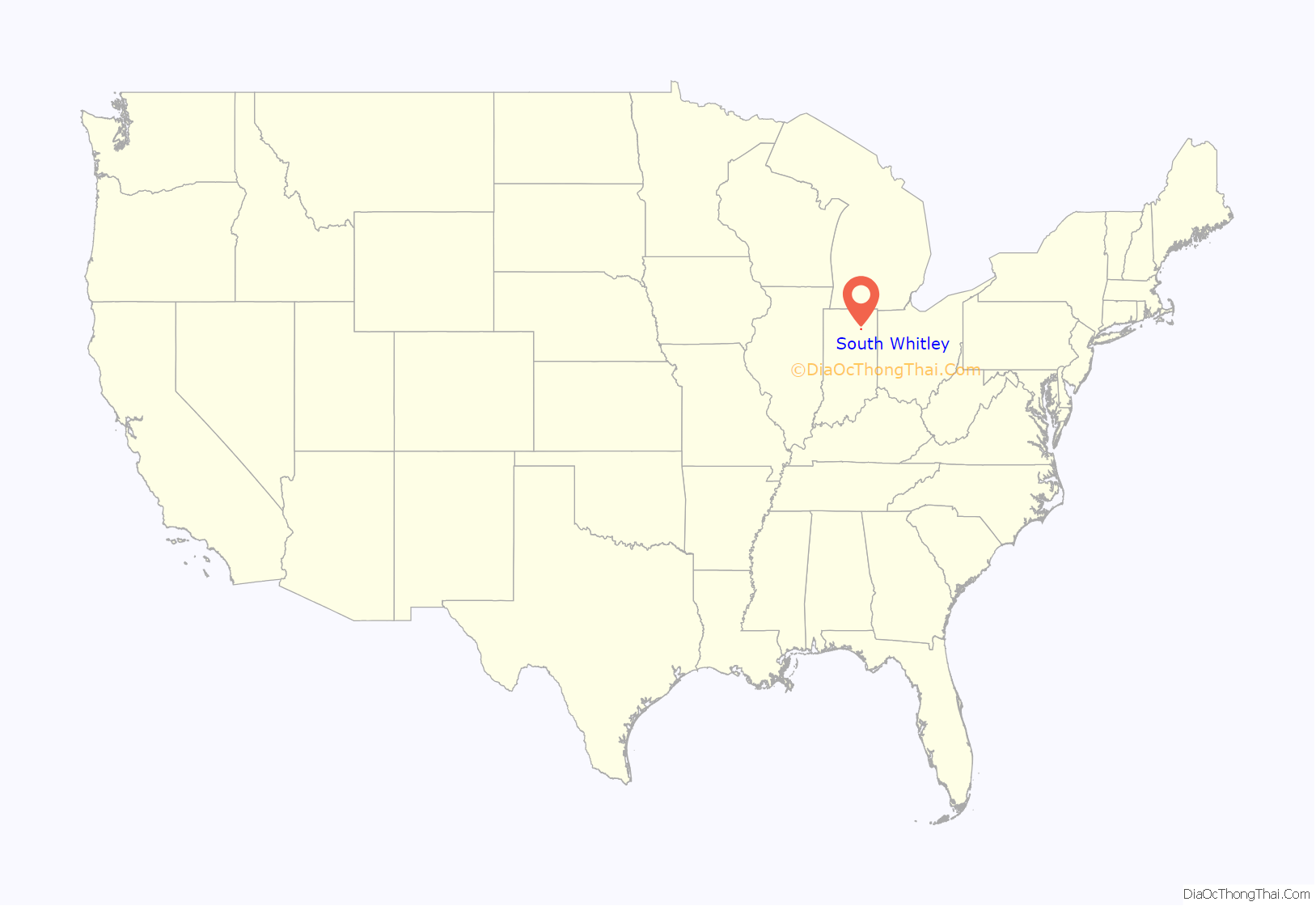
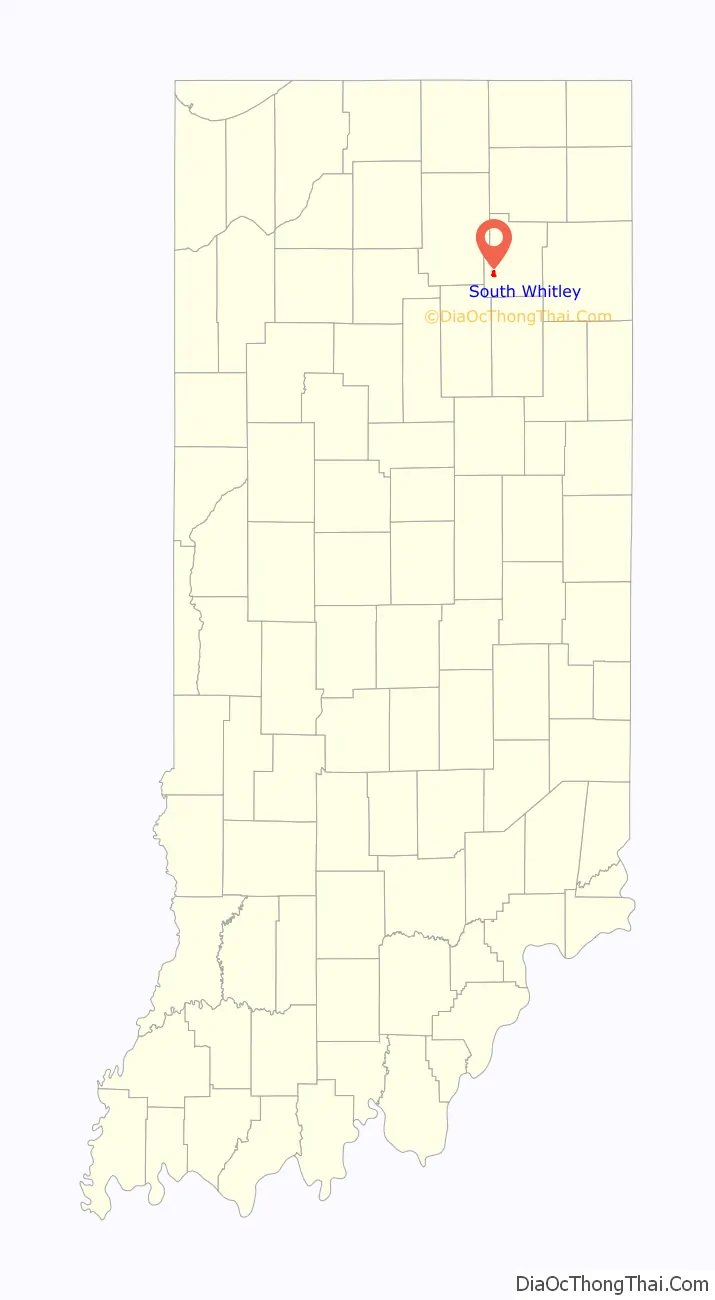
South Whitley location map. Where is South Whitley town?
History
South Whitley was originally called Springfield, and under the latter name was laid out in 1837. A post office was established that year under the name Whitley. The post office was renamed to South Whitley in 1842, and still operates today.
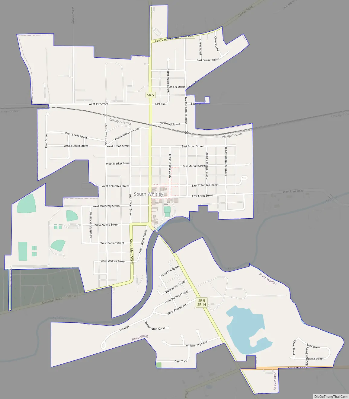
South Whitley Road Map
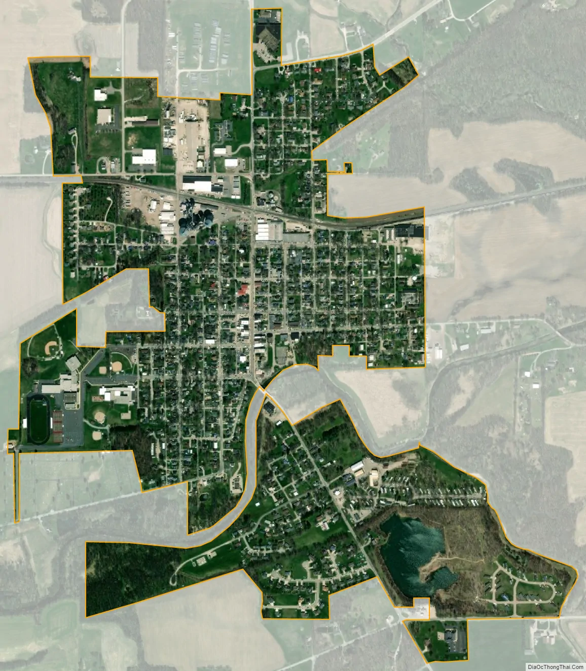
South Whitley city Satellite Map
Geography
According to the 2010 census, South Whitley has a total area of 0.91 square miles (2.36 km), all land.
See also
Map of Indiana State and its subdivision:- Adams
- Allen
- Bartholomew
- Benton
- Blackford
- Boone
- Brown
- Carroll
- Cass
- Clark
- Clay
- Clinton
- Crawford
- Daviess
- De Kalb
- Dearborn
- Decatur
- Delaware
- Dubois
- Elkhart
- Fayette
- Floyd
- Fountain
- Franklin
- Fulton
- Gibson
- Grant
- Greene
- Hamilton
- Hancock
- Harrison
- Hendricks
- Henry
- Howard
- Huntington
- Jackson
- Jasper
- Jay
- Jefferson
- Jennings
- Johnson
- Knox
- Kosciusko
- LaGrange
- Lake
- Lake Michigan
- LaPorte
- Lawrence
- Madison
- Marion
- Marshall
- Martin
- Miami
- Monroe
- Montgomery
- Morgan
- Newton
- Noble
- Ohio
- Orange
- Owen
- Parke
- Perry
- Pike
- Porter
- Posey
- Pulaski
- Putnam
- Randolph
- Ripley
- Rush
- Saint Joseph
- Scott
- Shelby
- Spencer
- Starke
- Steuben
- Sullivan
- Switzerland
- Tippecanoe
- Tipton
- Union
- Vanderburgh
- Vermillion
- Vigo
- Wabash
- Warren
- Warrick
- Washington
- Wayne
- Wells
- White
- Whitley
- Alabama
- Alaska
- Arizona
- Arkansas
- California
- Colorado
- Connecticut
- Delaware
- District of Columbia
- Florida
- Georgia
- Hawaii
- Idaho
- Illinois
- Indiana
- Iowa
- Kansas
- Kentucky
- Louisiana
- Maine
- Maryland
- Massachusetts
- Michigan
- Minnesota
- Mississippi
- Missouri
- Montana
- Nebraska
- Nevada
- New Hampshire
- New Jersey
- New Mexico
- New York
- North Carolina
- North Dakota
- Ohio
- Oklahoma
- Oregon
- Pennsylvania
- Rhode Island
- South Carolina
- South Dakota
- Tennessee
- Texas
- Utah
- Vermont
- Virginia
- Washington
- West Virginia
- Wisconsin
- Wyoming