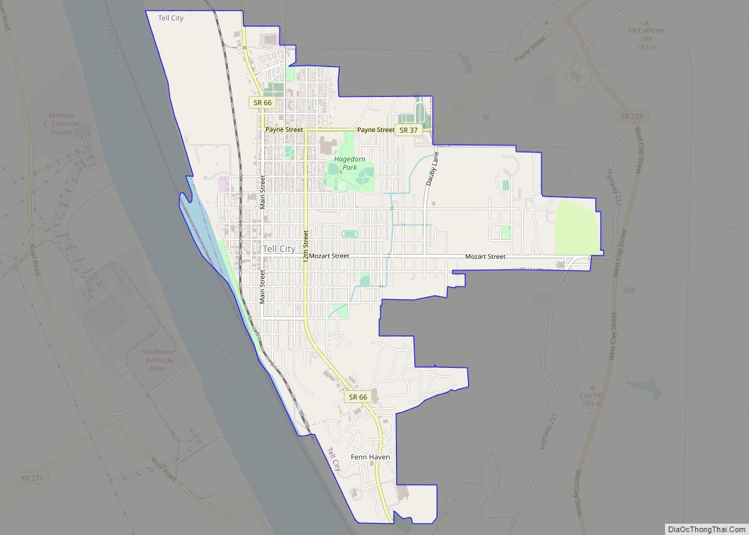
Tell City is a city in Troy Township, Perry County, in the U.S. state of Indiana. It is along the Ohio River. The population was 7,272 at the 2010 census. The city is the county seat of Perry County.
| Name: | Tell City city |
|---|---|
| LSAD Code: | 25 |
| LSAD Description: | city (suffix) |
| State: | Indiana |
| County: | Perry County |
| Founded: | August 1858 |
| Elevation: | 420 ft (128 m) |
| Total Area: | 4.65 sq mi (12.04 km²) |
| Land Area: | 4.53 sq mi (11.74 km²) |
| Water Area: | 0.12 sq mi (0.30 km²) 2.37% |
| Total Population: | 7,506 |
| Population Density: | 1,655.49/sq mi (639.22/km²) |
| ZIP code: | 47586 |
| Area code: | 812 |
| FIPS code: | 1875248 |
| GNISfeature ID: | 451548 |
| Website: | tellcity.in.gov |
Online Interactive Map
Click on ![]() to view map in "full screen" mode.
to view map in "full screen" mode.
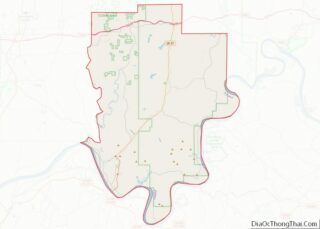
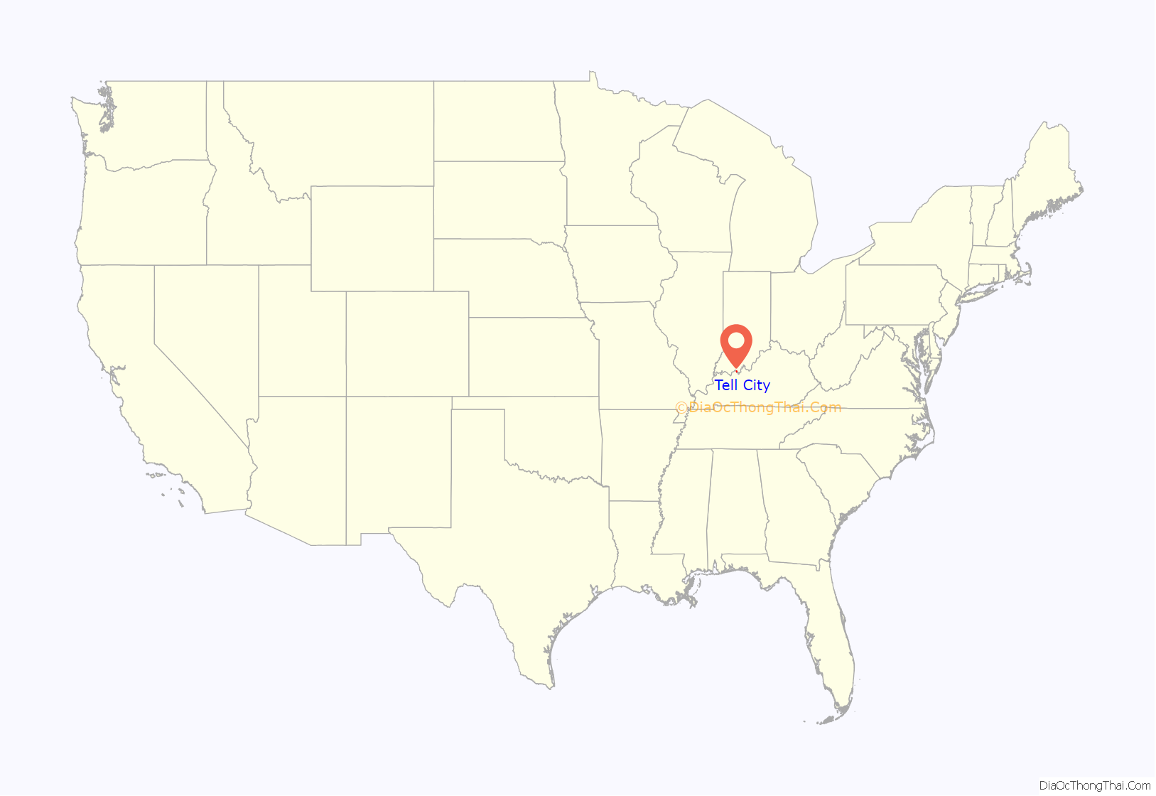
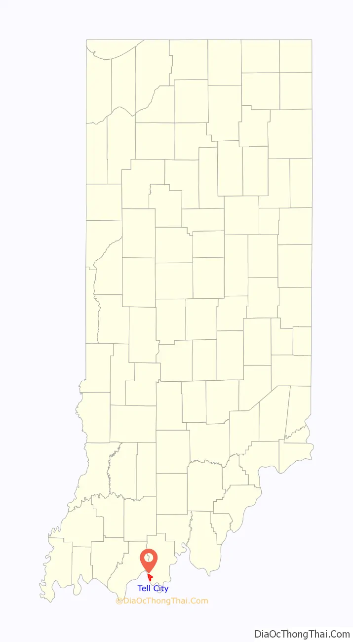
Tell City location map. Where is Tell City city?
History
Tell City traces its 150+ year old roots to a meeting in Cincinnati, Ohio in November 1856. A group of Swiss-German immigrants met in Cincinnati to organize a society known as the “Swiss Colonization Society.” The society’s purpose was to obtain affordable homesteads for mechanics, shopkeepers, factory workers, and small farmers in a location where all could live in harmony.
The Society decided to purchase a tract of land three miles (5 km) square to be surveyed as a city plot. The group was sent out to purchase the land and told to keep in mind they should find a healthful climate, fertile soil, good water, ample timber, as well as a location near a navigable river and a railroad, if possible. Purchase of a suitable site was made in July 1857. The tract, containing 4,152 acres (16.80 km), was laid out in 392 town blocks with 7,328 building lots and 294 garden lots.
Before the settlers arrived, a name for the new town was selected. Initially called Helvetia, it was soon renamed Tell City, a name easier to pronounce and remember for English-speaking people. It was named for the legendary Swiss hero and liberator, William Tell.
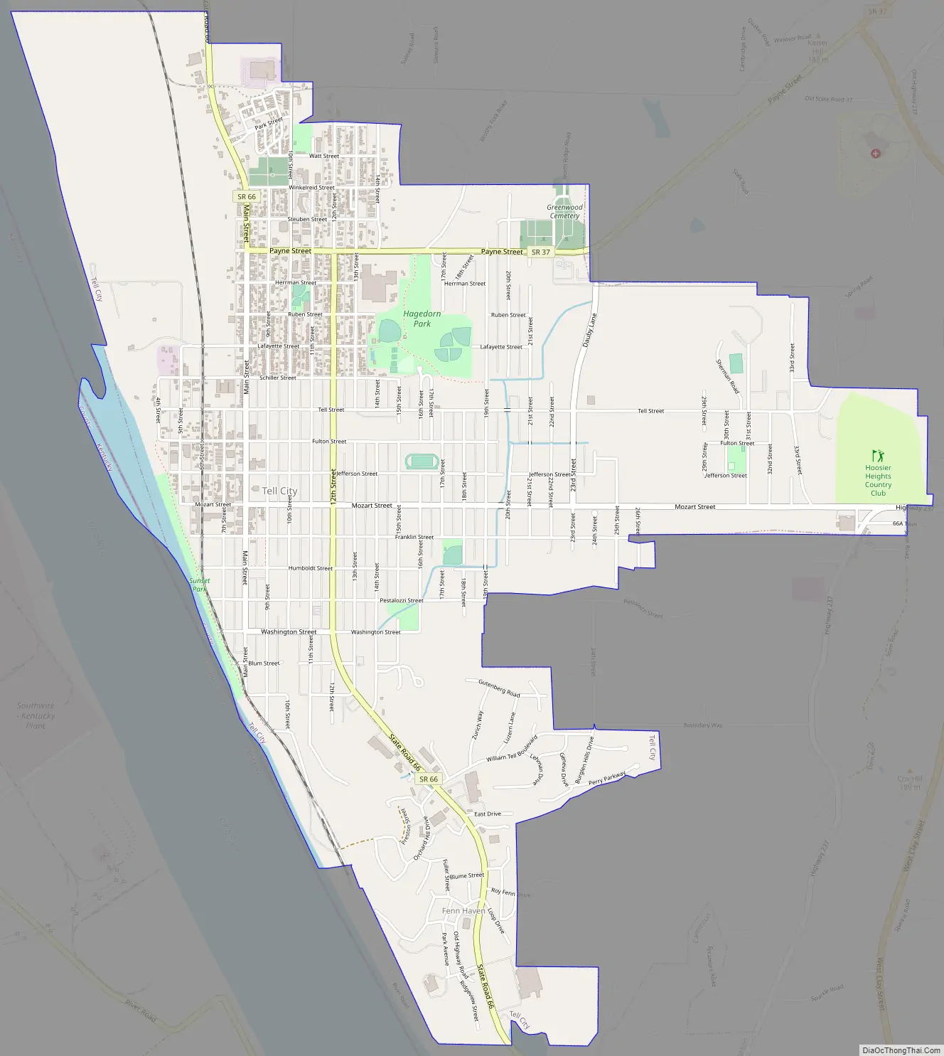
Indicative of the foresightedness of Tell City’s founders are the wide streets. They are named for great persons of the military, arts, letters and science: DeKalb, Watt, Winkelreid, Steuben, Payne, Herrman, Reubens, Lafayette, Schiller, Tell, Fulton, Jefferson, Mozart, Franklin, Humboldt, Pestalozzi, Washington, Blum and Gutenberg.
The Tell City post office has been in operation since 1858.
With 100 years of recorded history, the citizens of Tell City held a centennial celebration August 10–17, 1958 in honor of the early settlers and the founding of Tell City. After the success of the Centennial, the Tell City Historical Society decided they would sponsor a festival in 1959 to determine if the community would support it as an annual event. The festival, named Schweizer Fest (Swiss Fest), was a great success. Today, the festival remains one of Indiana’s longest-running community festivals.
On March 17, 1960, Northwest Orient Airlines Flight 710, a Lockheed Electra turboprop airliner flying from Chicago to Miami lost a wing due to aerodynamic flutter and crashed in southern Indiana near Tell City. All 63 on board, including the crew, perished. The victims were impacted in a 30-foot-deep (9.1 m) crater, which became their final resting place. A monument with the names of the victims and the date of the tragedy marks the grave.
Tell City Road Map
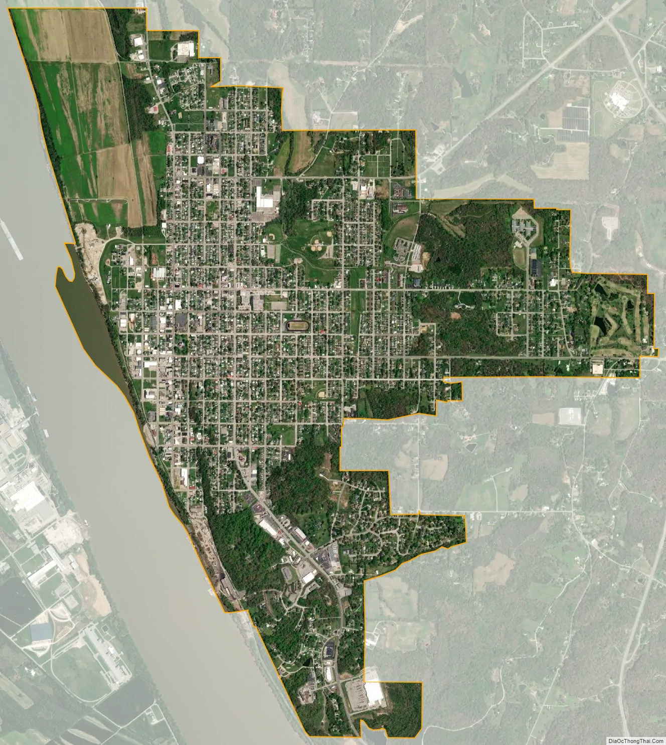
Tell City city Satellite Map
Geography
Tell City is located at 37°57′11″N 86°45′41″W / 37.953036°N 86.761372°W / 37.953036; -86.761372.
According to the 2010 census, Tell City has a total area of 4.635 square miles (12.00 km), of which 4.53 square miles (11.73 km) (or 97.73%) is land and 0.105 square miles (0.27 km) (or 2.27%) is water.
See also
Map of Indiana State and its subdivision:- Adams
- Allen
- Bartholomew
- Benton
- Blackford
- Boone
- Brown
- Carroll
- Cass
- Clark
- Clay
- Clinton
- Crawford
- Daviess
- De Kalb
- Dearborn
- Decatur
- Delaware
- Dubois
- Elkhart
- Fayette
- Floyd
- Fountain
- Franklin
- Fulton
- Gibson
- Grant
- Greene
- Hamilton
- Hancock
- Harrison
- Hendricks
- Henry
- Howard
- Huntington
- Jackson
- Jasper
- Jay
- Jefferson
- Jennings
- Johnson
- Knox
- Kosciusko
- LaGrange
- Lake
- Lake Michigan
- LaPorte
- Lawrence
- Madison
- Marion
- Marshall
- Martin
- Miami
- Monroe
- Montgomery
- Morgan
- Newton
- Noble
- Ohio
- Orange
- Owen
- Parke
- Perry
- Pike
- Porter
- Posey
- Pulaski
- Putnam
- Randolph
- Ripley
- Rush
- Saint Joseph
- Scott
- Shelby
- Spencer
- Starke
- Steuben
- Sullivan
- Switzerland
- Tippecanoe
- Tipton
- Union
- Vanderburgh
- Vermillion
- Vigo
- Wabash
- Warren
- Warrick
- Washington
- Wayne
- Wells
- White
- Whitley
- Alabama
- Alaska
- Arizona
- Arkansas
- California
- Colorado
- Connecticut
- Delaware
- District of Columbia
- Florida
- Georgia
- Hawaii
- Idaho
- Illinois
- Indiana
- Iowa
- Kansas
- Kentucky
- Louisiana
- Maine
- Maryland
- Massachusetts
- Michigan
- Minnesota
- Mississippi
- Missouri
- Montana
- Nebraska
- Nevada
- New Hampshire
- New Jersey
- New Mexico
- New York
- North Carolina
- North Dakota
- Ohio
- Oklahoma
- Oregon
- Pennsylvania
- Rhode Island
- South Carolina
- South Dakota
- Tennessee
- Texas
- Utah
- Vermont
- Virginia
- Washington
- West Virginia
- Wisconsin
- Wyoming