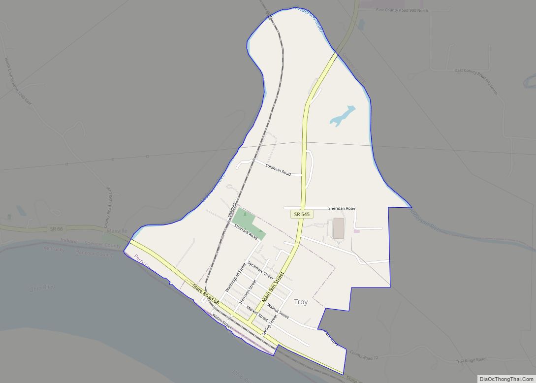
Troy is a town in Troy Township, Perry County, Indiana, along the Ohio River near the mouth of the Anderson River. It is the second oldest city in Indiana. The population was 385 at the 2010 census.
| Name: | Troy town |
|---|---|
| LSAD Code: | 43 |
| LSAD Description: | town (suffix) |
| State: | Indiana |
| County: | Perry County |
| Elevation: | 472 ft (144 m) |
| Total Area: | 1.13 sq mi (2.93 km²) |
| Land Area: | 1.13 sq mi (2.93 km²) |
| Water Area: | 0.00 sq mi (0.00 km²) |
| Total Population: | 347 |
| Population Density: | 306.54/sq mi (118.31/km²) |
| ZIP code: | 47588 |
| Area code: | 812, 930 |
| FIPS code: | 1876634 |
| GNISfeature ID: | 444924 |
Online Interactive Map
Click on ![]() to view map in "full screen" mode.
to view map in "full screen" mode.
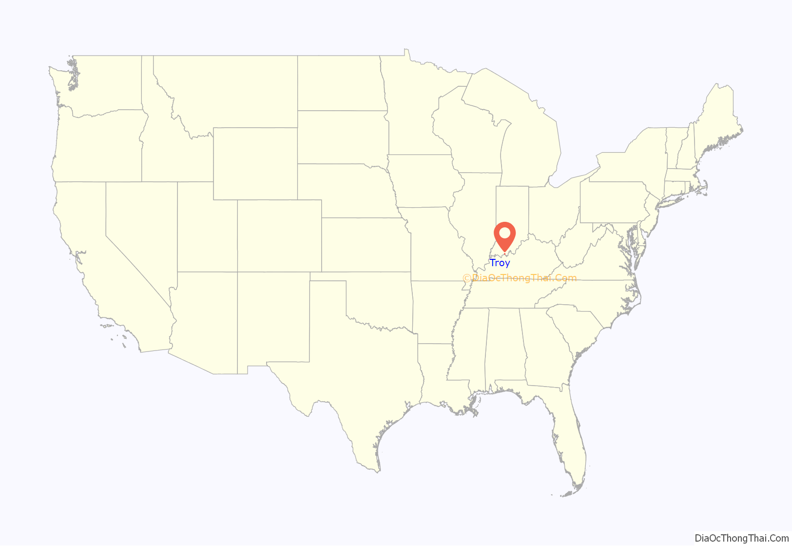
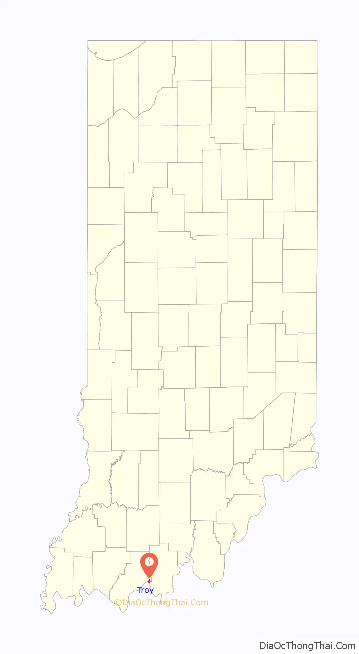
Troy location map. Where is Troy town?
History
Troy was laid out in 1815. Troy was an early county seat of Perry County. A post office has been in operation at Troy since 1818.
Future president Abraham Lincoln worked the ferry across the Ohio River at Troy with his father in his youth.
The Nester House was listed on the National Register of Historic Places in 1990.
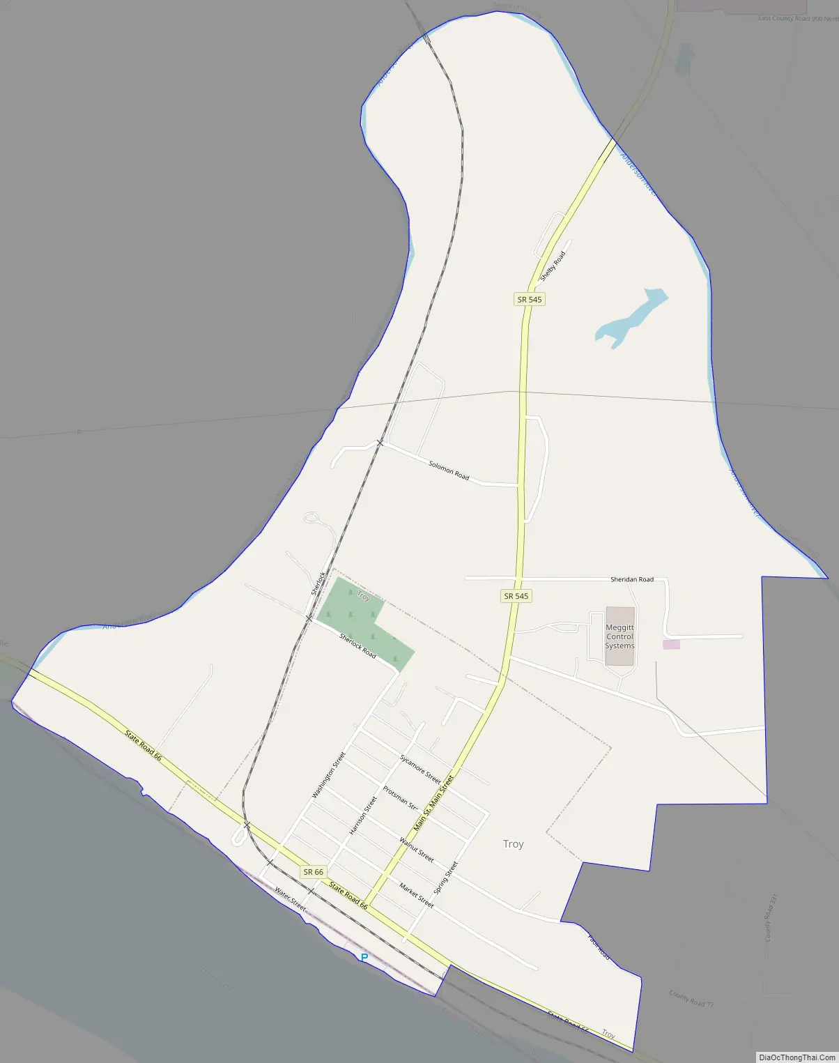
Troy Road Map
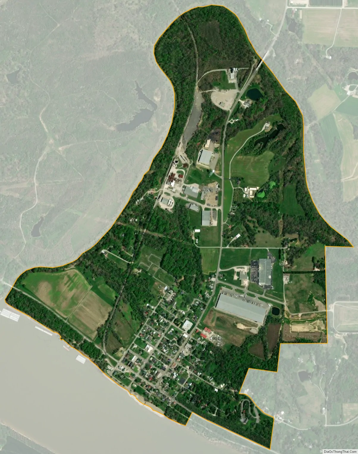
Troy city Satellite Map
Geography
Troy is located at 37°59′38″N 86°47′58″W / 37.99389°N 86.79944°W / 37.99389; -86.79944 (37.993975, -86.799397).
According to the 2010 census, Troy has a total area of 0.32 square miles (0.83 km), all land.
See also
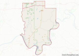
Map of Indiana State and its subdivision:- Adams
- Allen
- Bartholomew
- Benton
- Blackford
- Boone
- Brown
- Carroll
- Cass
- Clark
- Clay
- Clinton
- Crawford
- Daviess
- De Kalb
- Dearborn
- Decatur
- Delaware
- Dubois
- Elkhart
- Fayette
- Floyd
- Fountain
- Franklin
- Fulton
- Gibson
- Grant
- Greene
- Hamilton
- Hancock
- Harrison
- Hendricks
- Henry
- Howard
- Huntington
- Jackson
- Jasper
- Jay
- Jefferson
- Jennings
- Johnson
- Knox
- Kosciusko
- LaGrange
- Lake
- Lake Michigan
- LaPorte
- Lawrence
- Madison
- Marion
- Marshall
- Martin
- Miami
- Monroe
- Montgomery
- Morgan
- Newton
- Noble
- Ohio
- Orange
- Owen
- Parke
- Perry
- Pike
- Porter
- Posey
- Pulaski
- Putnam
- Randolph
- Ripley
- Rush
- Saint Joseph
- Scott
- Shelby
- Spencer
- Starke
- Steuben
- Sullivan
- Switzerland
- Tippecanoe
- Tipton
- Union
- Vanderburgh
- Vermillion
- Vigo
- Wabash
- Warren
- Warrick
- Washington
- Wayne
- Wells
- White
- Whitley
- Alabama
- Alaska
- Arizona
- Arkansas
- California
- Colorado
- Connecticut
- Delaware
- District of Columbia
- Florida
- Georgia
- Hawaii
- Idaho
- Illinois
- Indiana
- Iowa
- Kansas
- Kentucky
- Louisiana
- Maine
- Maryland
- Massachusetts
- Michigan
- Minnesota
- Mississippi
- Missouri
- Montana
- Nebraska
- Nevada
- New Hampshire
- New Jersey
- New Mexico
- New York
- North Carolina
- North Dakota
- Ohio
- Oklahoma
- Oregon
- Pennsylvania
- Rhode Island
- South Carolina
- South Dakota
- Tennessee
- Texas
- Utah
- Vermont
- Virginia
- Washington
- West Virginia
- Wisconsin
- Wyoming