Vevay (/ˈviːviː/ VEE-vee) is a town located in Jefferson Township and the county seat of Switzerland County, Indiana, United States, along the Ohio River. The population was 1,683 at the 2010 census.
| Name: | Vevay town |
|---|---|
| LSAD Code: | 43 |
| LSAD Description: | town (suffix) |
| State: | Indiana |
| County: | Switzerland County |
| Elevation: | 482 ft (147 m) |
| Total Area: | 1.55 sq mi (4.01 km²) |
| Land Area: | 1.45 sq mi (3.76 km²) |
| Water Area: | 0.10 sq mi (0.26 km²) |
| Total Population: | 1,741 |
| Population Density: | 1,199.86/sq mi (463.37/km²) |
| ZIP code: | 47043 |
| Area code: | 812 |
| FIPS code: | 1879010 |
| GNISfeature ID: | 445270 |
| Website: | www.vevayin.com |
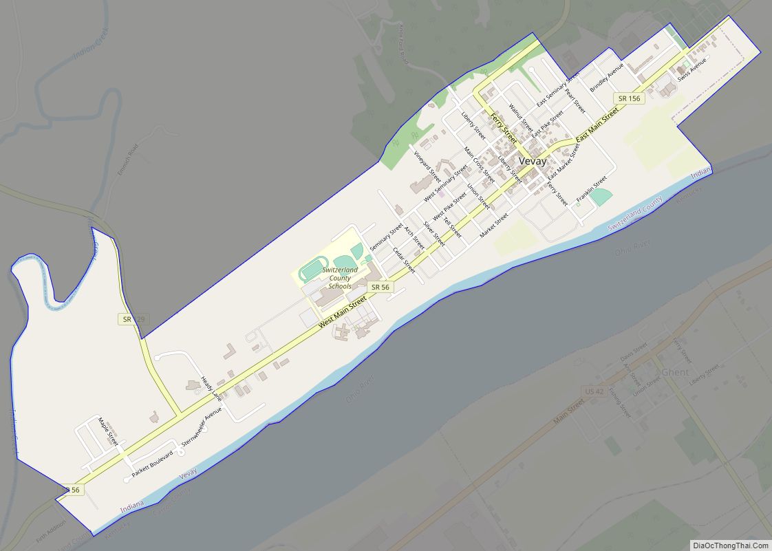
Online Interactive Map
Click on ![]() to view map in "full screen" mode.
to view map in "full screen" mode.
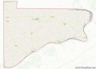
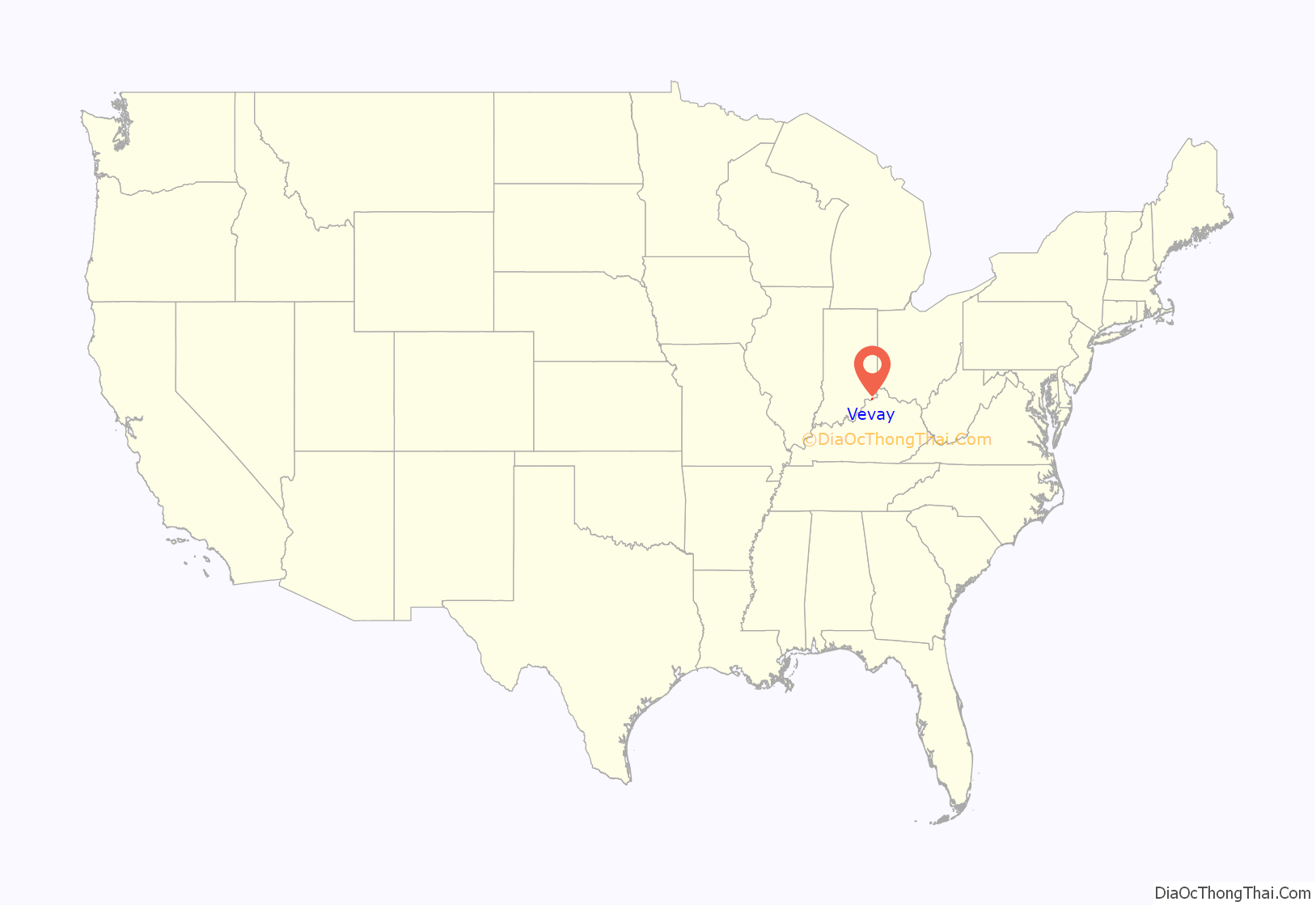
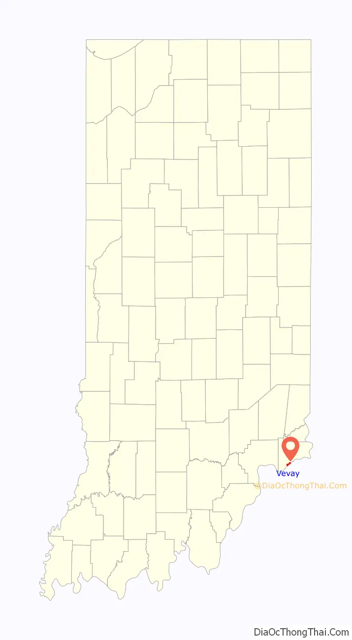
Vevay location map. Where is Vevay town?
History
The first settlers who arrived in 1802 were Swiss immigrants intending on cultivating grapes and producing wine. It was named after the Swiss town of Vevey. The town was platted in 1813. When Switzerland County was formed in 1814, Vevay was made the county seat.
The Vevay post office has been in operation since 1816. The community was incorporated as a town in 1836. Vevay collected a reputation of being home to the first commercial winery in the United States; However, the first certified commercial winery was established in Nicholasville, Kentucky in 1799 by Swiss immigrant John Dufour. The Edward and George Cary Eggleston House, Old Hoosier Theatre, Benjamin Schenck Mansion, and Switzerland County Courthouse are listed on the National Register of Historic Places.
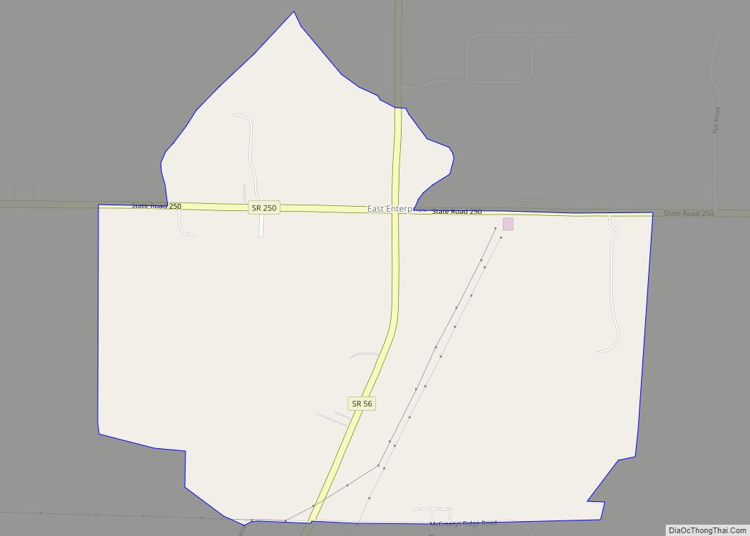
Vevay Road Map
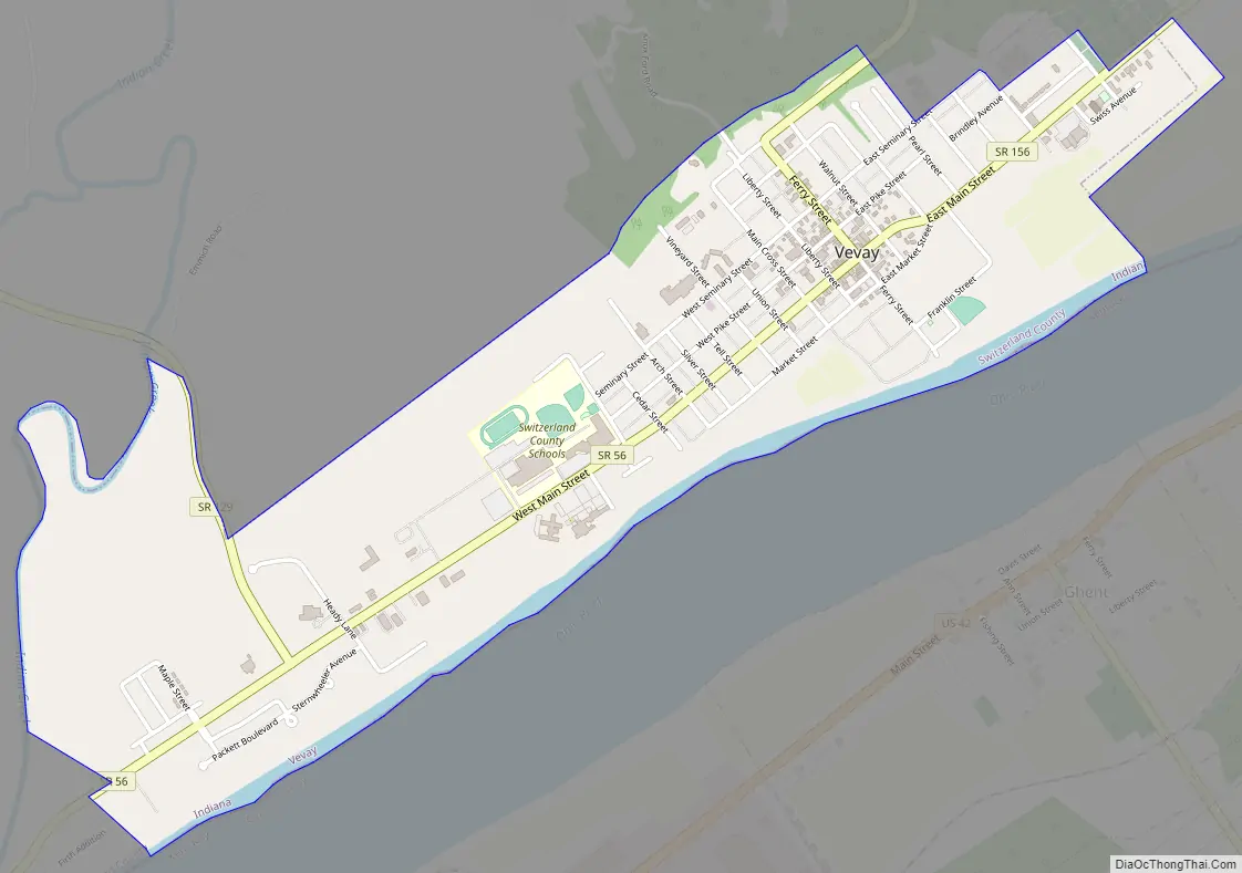
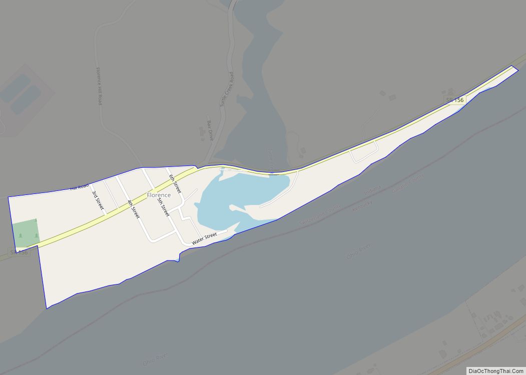
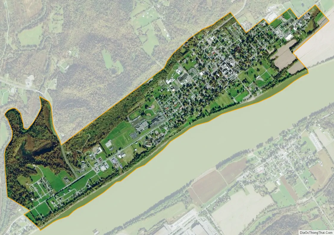
Vevay city Satellite Map
Geography
Vevay is located at 38°44′45″N 85°4′16″W / 38.74583°N 85.07111°W / 38.74583; -85.07111 (38.745837, -85.071044), along the Ohio River and Indiana State Road 56/156.
According to the 2010 census, Vevay has a total area of 1.547 square miles (4.01 km), of which 1.45 square miles (3.76 km) (or 93.73%) is land and 0.097 square miles (0.25 km) (or 6.27%) is water.
Climate
The climate in this area is characterized by hot, humid summers and generally mild to cool winters. According to the Köppen Climate Classification system, Vevay has a humid subtropical climate, abbreviated “Cfa” on climate maps.
See also
Map of Indiana State and its subdivision:- Adams
- Allen
- Bartholomew
- Benton
- Blackford
- Boone
- Brown
- Carroll
- Cass
- Clark
- Clay
- Clinton
- Crawford
- Daviess
- De Kalb
- Dearborn
- Decatur
- Delaware
- Dubois
- Elkhart
- Fayette
- Floyd
- Fountain
- Franklin
- Fulton
- Gibson
- Grant
- Greene
- Hamilton
- Hancock
- Harrison
- Hendricks
- Henry
- Howard
- Huntington
- Jackson
- Jasper
- Jay
- Jefferson
- Jennings
- Johnson
- Knox
- Kosciusko
- LaGrange
- Lake
- Lake Michigan
- LaPorte
- Lawrence
- Madison
- Marion
- Marshall
- Martin
- Miami
- Monroe
- Montgomery
- Morgan
- Newton
- Noble
- Ohio
- Orange
- Owen
- Parke
- Perry
- Pike
- Porter
- Posey
- Pulaski
- Putnam
- Randolph
- Ripley
- Rush
- Saint Joseph
- Scott
- Shelby
- Spencer
- Starke
- Steuben
- Sullivan
- Switzerland
- Tippecanoe
- Tipton
- Union
- Vanderburgh
- Vermillion
- Vigo
- Wabash
- Warren
- Warrick
- Washington
- Wayne
- Wells
- White
- Whitley
- Alabama
- Alaska
- Arizona
- Arkansas
- California
- Colorado
- Connecticut
- Delaware
- District of Columbia
- Florida
- Georgia
- Hawaii
- Idaho
- Illinois
- Indiana
- Iowa
- Kansas
- Kentucky
- Louisiana
- Maine
- Maryland
- Massachusetts
- Michigan
- Minnesota
- Mississippi
- Missouri
- Montana
- Nebraska
- Nevada
- New Hampshire
- New Jersey
- New Mexico
- New York
- North Carolina
- North Dakota
- Ohio
- Oklahoma
- Oregon
- Pennsylvania
- Rhode Island
- South Carolina
- South Dakota
- Tennessee
- Texas
- Utah
- Vermont
- Virginia
- Washington
- West Virginia
- Wisconsin
- Wyoming