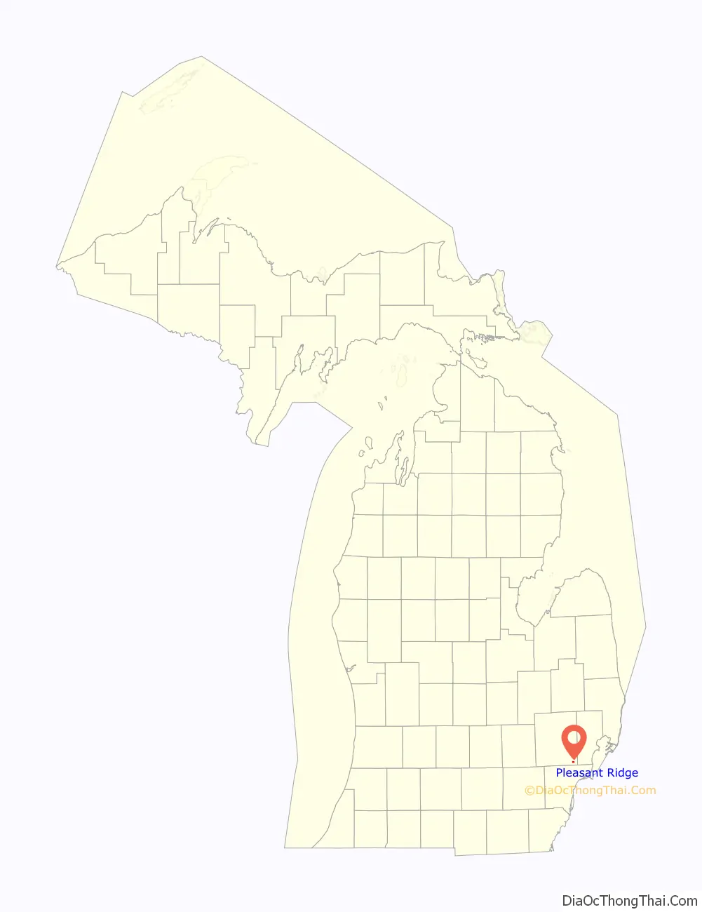
Pleasant Ridge is a city in Oakland County in the U.S. state of Michigan. The population was 2,627 at the 2020 census.
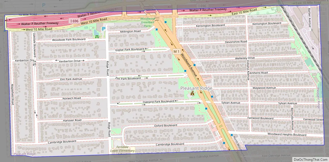
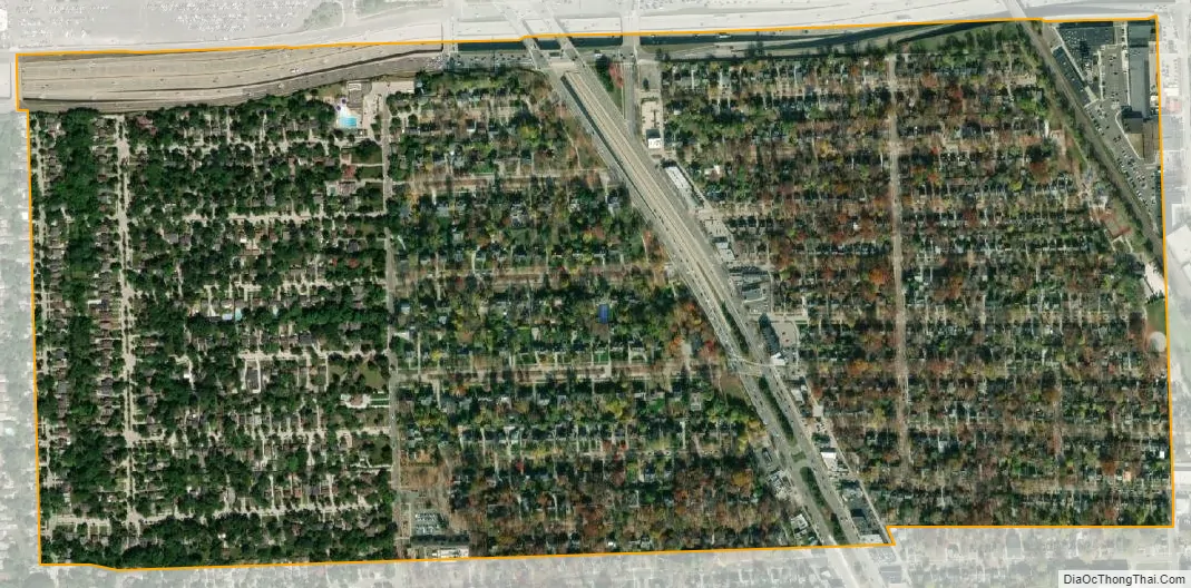
Located along the Woodward Corridor and Interstate 696, Pleasant Ridge is a northern suburb of Metro Detroit and is about 1.5 miles (2.4 km) north of the city of Detroit. With a land area of 0.57 square miles (1.48 km), Pleasant Ridge is the fifth-smallest city by land area in the state of Michigan after the cities of Sylvan Lake, Keego Harbor, Petersburg, and Clarkston.
| Name: | Pleasant Ridge city |
|---|---|
| LSAD Code: | 25 |
| LSAD Description: | city (suffix) |
| State: | Michigan |
| County: | Oakland County |
| Founded: | 1913 |
| Incorporated: | 1921 (village) 1927 (city) |
| Elevation: | 650 ft (195 m) |
| Land Area: | 0.57 sq mi (1.48 km²) |
| Water Area: | 0.00 sq mi (0.00 km²) |
| Population Density: | 4,608.77/sq mi (1,779.46/km²) |
| Area code: | 248 |
| FIPS code: | 2664900 |
| GNISfeature ID: | 0635117 |
Online Interactive Map
Click on ![]() to view map in "full screen" mode.
to view map in "full screen" mode.
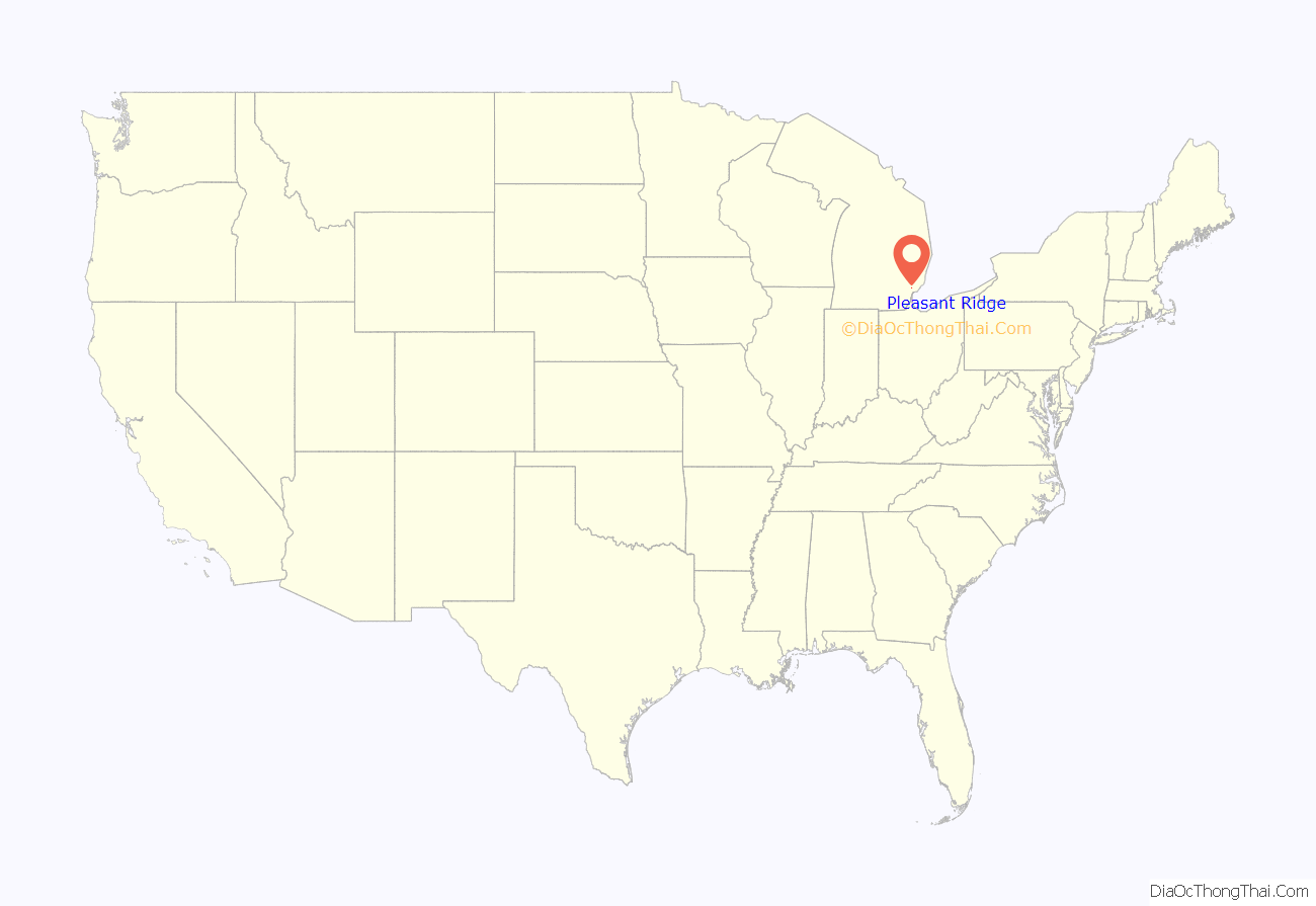
Pleasant Ridge location map. Where is Pleasant Ridge city?
History
Pleasant Ridge began when Burt Taylor subdivided the Mayday farm in 1913. The community incorporated as a village within Royal Oak Township in 1921 and again as an autonomous city in 1927. The origin of the name is believed to derive from the main thoroughfare of Ridge Road.
One of the more notable establishments within the city was Hedge’s Wigwam, which was a Native American-themed restaurant that operated from 1927 until 1967.
Pleasant Ridge was actively involved in resisting the construction of the middle segment of Interstate 696 in the early 1960s.
Historic districts
- Pleasant Ridge East Historic District
- Pleasant Ridge Historic District
Same-sex households
Pleasant Ridge is bordered on the south by the city of Ferndale, which is considered the center of the LGBT community in the Metro Detroit region. The city of Pleasant Ridge is among the top cities in the nation with same-sex couple households, with at least 60 per 1,000 according to figures from the United States Census Bureau. A study by the Williams Institute from the University of California, Los Angeles recorded 59.55 same-sex couples for every 1,000 households in the city of Pleasant Ridge, while the state as a whole ranked low with only 5.6 for every 1,000 households. However, the study did not record the number of homosexual residents, only the number of same-sex households. The study listed Pleasant Ridge as having the highest same-sex household ratio in the state, ahead of Ferndale with 35.0 same-sex couples for every 1,000 households.
These numbers rank Pleasant Ridge as having the seventh-highest same-sex household ratio in the nation. Cities in the nation with a higher ratio include Provincetown, Massachusetts; Wilton Manors, Florida; Palm Springs, California; Rehoboth Beach, Delaware; Guerneville, California; and West Hollywood, California.
Pleasant Ridge Road Map
Pleasant Ridge city Satellite Map
Geography
According to the U.S. Census Bureau, the city has a total area of 0.57 square miles (1.48 km), all land.
The portion of the city located west of Woodward Avenue (M-1) includes the Pleasant Ridge Historic District and its spacious residential homes, while an area of more modest homes is located east of Woodward.
Major highways
- I-696 (Walter P. Ruether Highway) forms the entire northern border of the city. The Detroit Zoo is located on the opposite side of the highway in the cities of Huntington Woods and Royal Oak.
- M-1 (Woodward Avenue) is part of the Woodward Corridor that runs south–north through the center of the city.
See also
Map of Michigan State and its subdivision:- Alcona
- Alger
- Allegan
- Alpena
- Antrim
- Arenac
- Baraga
- Barry
- Bay
- Benzie
- Berrien
- Branch
- Calhoun
- Cass
- Charlevoix
- Cheboygan
- Chippewa
- Clare
- Clinton
- Crawford
- Delta
- Dickinson
- Eaton
- Emmet
- Genesee
- Gladwin
- Gogebic
- Grand Traverse
- Gratiot
- Hillsdale
- Houghton
- Huron
- Ingham
- Ionia
- Iosco
- Iron
- Isabella
- Jackson
- Kalamazoo
- Kalkaska
- Kent
- Keweenaw
- Lake
- Lake Hurron
- Lake Michigan
- Lake St. Clair
- Lake Superior
- Lapeer
- Leelanau
- Lenawee
- Livingston
- Luce
- Mackinac
- Macomb
- Manistee
- Marquette
- Mason
- Mecosta
- Menominee
- Midland
- Missaukee
- Monroe
- Montcalm
- Montmorency
- Muskegon
- Newaygo
- Oakland
- Oceana
- Ogemaw
- Ontonagon
- Osceola
- Oscoda
- Otsego
- Ottawa
- Presque Isle
- Roscommon
- Saginaw
- Saint Clair
- Saint Joseph
- Sanilac
- Schoolcraft
- Shiawassee
- Tuscola
- Van Buren
- Washtenaw
- Wayne
- Wexford
- Alabama
- Alaska
- Arizona
- Arkansas
- California
- Colorado
- Connecticut
- Delaware
- District of Columbia
- Florida
- Georgia
- Hawaii
- Idaho
- Illinois
- Indiana
- Iowa
- Kansas
- Kentucky
- Louisiana
- Maine
- Maryland
- Massachusetts
- Michigan
- Minnesota
- Mississippi
- Missouri
- Montana
- Nebraska
- Nevada
- New Hampshire
- New Jersey
- New Mexico
- New York
- North Carolina
- North Dakota
- Ohio
- Oklahoma
- Oregon
- Pennsylvania
- Rhode Island
- South Carolina
- South Dakota
- Tennessee
- Texas
- Utah
- Vermont
- Virginia
- Washington
- West Virginia
- Wisconsin
- Wyoming


