Vandalia is a city in northeastern Audrain and extending into southeastern Ralls Counties in the U.S. state of Missouri. The population was 3,553 at the 2020 census, which includes about 1,000 prisoners incarcerated at the prison located within the city limits.
The Audrain County portion of Vandalia is part of the Mexico Micropolitan Statistical Area, while the Ralls County portion is part of the Hannibal Micropolitan Statistical Area.
| Name: | Vandalia city |
|---|---|
| LSAD Code: | 25 |
| LSAD Description: | city (suffix) |
| State: | Missouri |
| County: | Audrain County, Ralls County |
| Elevation: | 764 ft (233 m) |
| Total Area: | 2.25 sq mi (5.82 km²) |
| Land Area: | 2.24 sq mi (5.81 km²) |
| Water Area: | 0.01 sq mi (0.01 km²) |
| Total Population: | 3,553 |
| Population Density: | 1,583.33/sq mi (611.44/km²) |
| ZIP code: | 63382 |
| Area code: | 573 |
| FIPS code: | 2975688 |
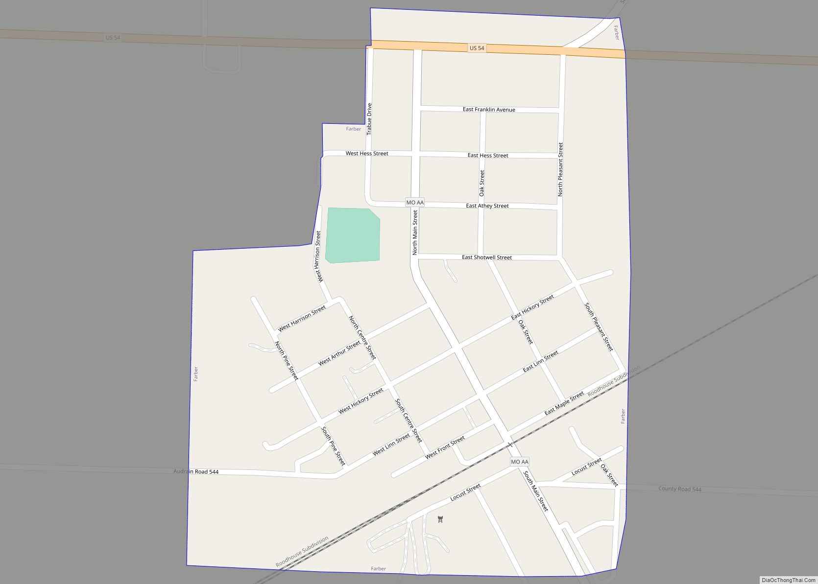
Online Interactive Map
Click on ![]() to view map in "full screen" mode.
to view map in "full screen" mode.
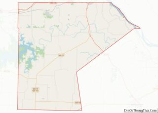
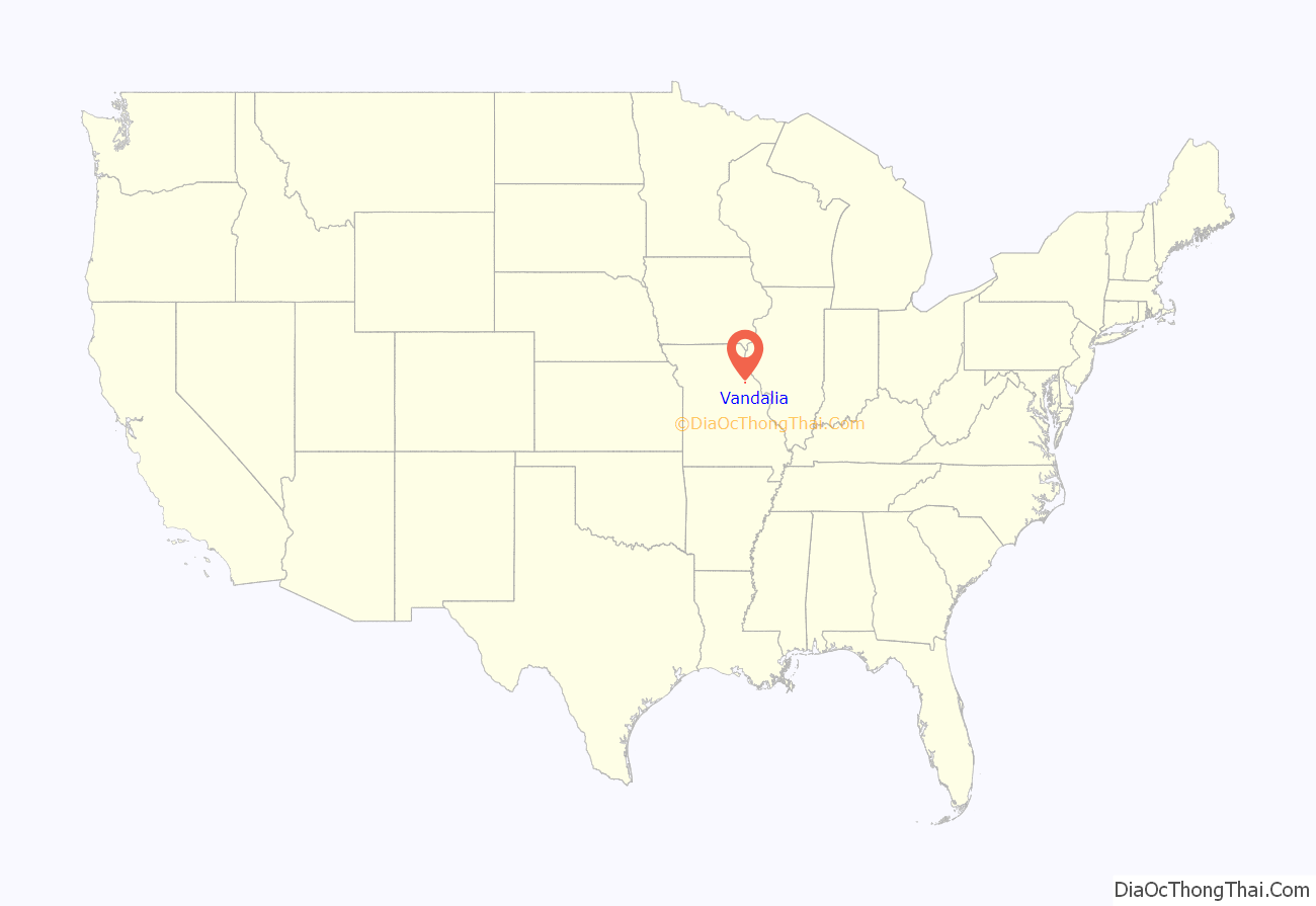
Vandalia location map. Where is Vandalia city?

History
Vandalia was laid off by Aaron McPike and Judge Harmen Caldwell in 1870 and platted in 1871. The city was named after Vandalia, Illinois. Aaron McPike transferred the lumber used to build the first homes from Louisiana, Missouri. A post office called Vandalia has been in operation since 1871.
The Lincoln School was listed on the National Register of Historic Places in 1996.
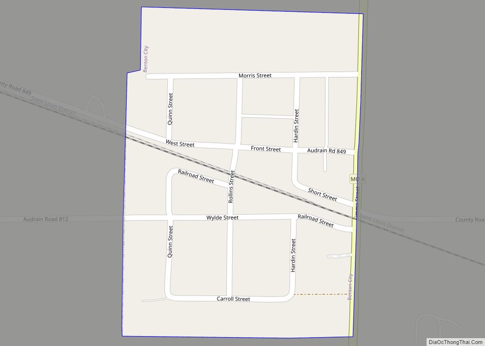
Vandalia Road Map
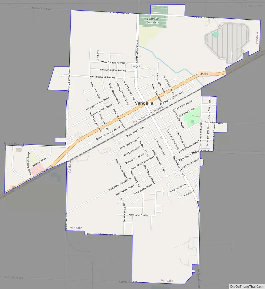
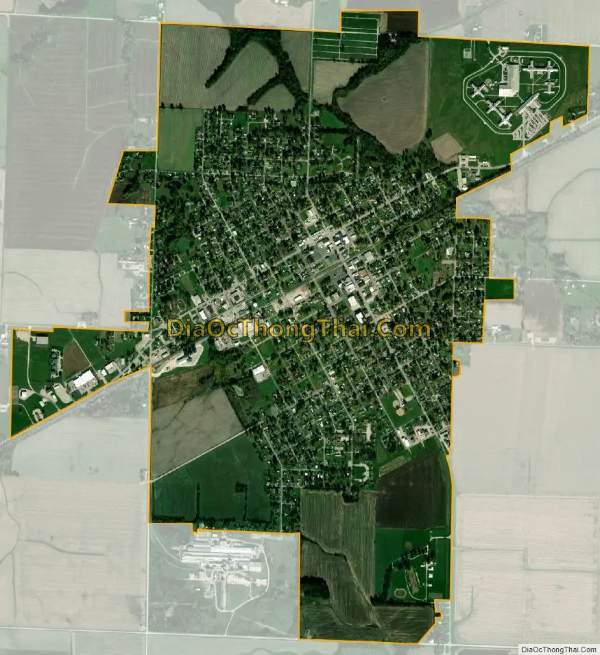
Vandalia city Satellite Map
Geography
Vandalia is located on US Route 54 in the northeastern corner of Audrain County about 15 miles west of Bowling Green.
Vandalia is about 27 miles from the Mississippi River, 30 miles southwest of Hannibal and 100 miles northwest of St. Louis. The Gateway Western Railroad line runs through the town. U.S. Route 54 connects Vandalia with Illinois to the east and Jefferson City and the Lake of the Ozarks to the south and west.
According to the United States Census Bureau, the city has a total area of 2.25 square miles (5.83 km), of which, 2.24 square miles (5.80 km) is land and 0.01 square miles (0.03 km) is water.
Climate
See also
Map of Missouri State and its subdivision:- Adair
- Andrew
- Atchison
- Audrain
- Barry
- Barton
- Bates
- Benton
- Bollinger
- Boone
- Buchanan
- Butler
- Caldwell
- Callaway
- Camden
- Cape Girardeau
- Carroll
- Carter
- Cass
- Cedar
- Chariton
- Christian
- Clark
- Clay
- Clinton
- Cole
- Cooper
- Crawford
- Dade
- Dallas
- Daviess
- De Kalb
- Dent
- Douglas
- Dunklin
- Franklin
- Gasconade
- Gentry
- Greene
- Grundy
- Harrison
- Henry
- Hickory
- Holt
- Howard
- Howell
- Iron
- Jackson
- Jasper
- Jefferson
- Johnson
- Knox
- Laclede
- Lafayette
- Lawrence
- Lewis
- Lincoln
- Linn
- Livingston
- Macon
- Madison
- Maries
- Marion
- McDonald
- Mercer
- Miller
- Mississippi
- Moniteau
- Monroe
- Montgomery
- Morgan
- New Madrid
- Newton
- Nodaway
- Oregon
- Osage
- Ozark
- Pemiscot
- Perry
- Pettis
- Phelps
- Pike
- Platte
- Polk
- Pulaski
- Putnam
- Ralls
- Randolph
- Ray
- Reynolds
- Ripley
- Saint Charles
- Saint Clair
- Saint Francois
- Saint Louis
- Sainte Genevieve
- Saline
- Schuyler
- Scotland
- Scott
- Shannon
- Shelby
- Stoddard
- Stone
- Sullivan
- Taney
- Texas
- Vernon
- Warren
- Washington
- Wayne
- Webster
- Worth
- Wright
- Alabama
- Alaska
- Arizona
- Arkansas
- California
- Colorado
- Connecticut
- Delaware
- District of Columbia
- Florida
- Georgia
- Hawaii
- Idaho
- Illinois
- Indiana
- Iowa
- Kansas
- Kentucky
- Louisiana
- Maine
- Maryland
- Massachusetts
- Michigan
- Minnesota
- Mississippi
- Missouri
- Montana
- Nebraska
- Nevada
- New Hampshire
- New Jersey
- New Mexico
- New York
- North Carolina
- North Dakota
- Ohio
- Oklahoma
- Oregon
- Pennsylvania
- Rhode Island
- South Carolina
- South Dakota
- Tennessee
- Texas
- Utah
- Vermont
- Virginia
- Washington
- West Virginia
- Wisconsin
- Wyoming