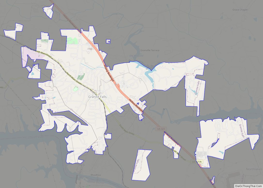
Granite Falls is a town in Caldwell County, North Carolina, United States. The population was 4,722 at the 2010 census. It is part of the Hickory–Lenoir–Morganton Metropolitan Statistical Area.
| Name: | Granite Falls town |
|---|---|
| LSAD Code: | 43 |
| LSAD Description: | town (suffix) |
| State: | North Carolina |
| County: | Caldwell County |
| Elevation: | 1,194 ft (364 m) |
| Total Area: | 4.98 sq mi (12.90 km²) |
| Land Area: | 4.94 sq mi (12.79 km²) |
| Water Area: | 0.04 sq mi (0.11 km²) |
| Total Population: | 4,965 |
| Population Density: | 1,005.67/sq mi (388.33/km²) |
| ZIP code: | 28630 |
| Area code: | 828 |
| FIPS code: | 3727420 |
| GNISfeature ID: | 1020491 |
| Website: | granitefallsnc.com |
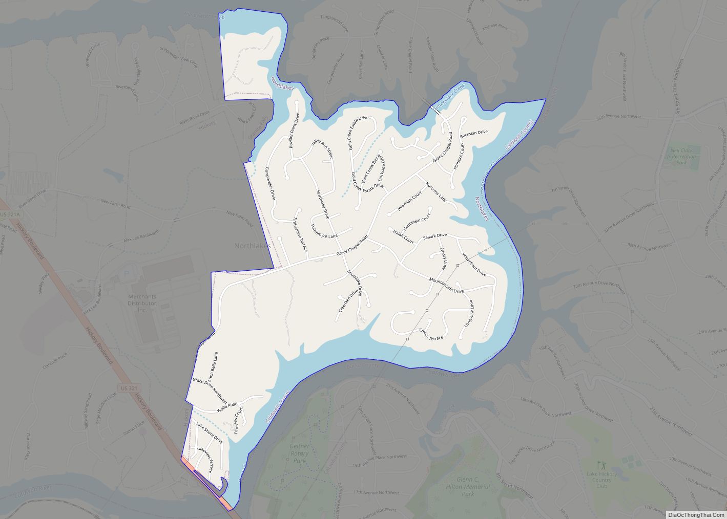
Online Interactive Map
Click on ![]() to view map in "full screen" mode.
to view map in "full screen" mode.
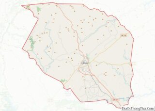
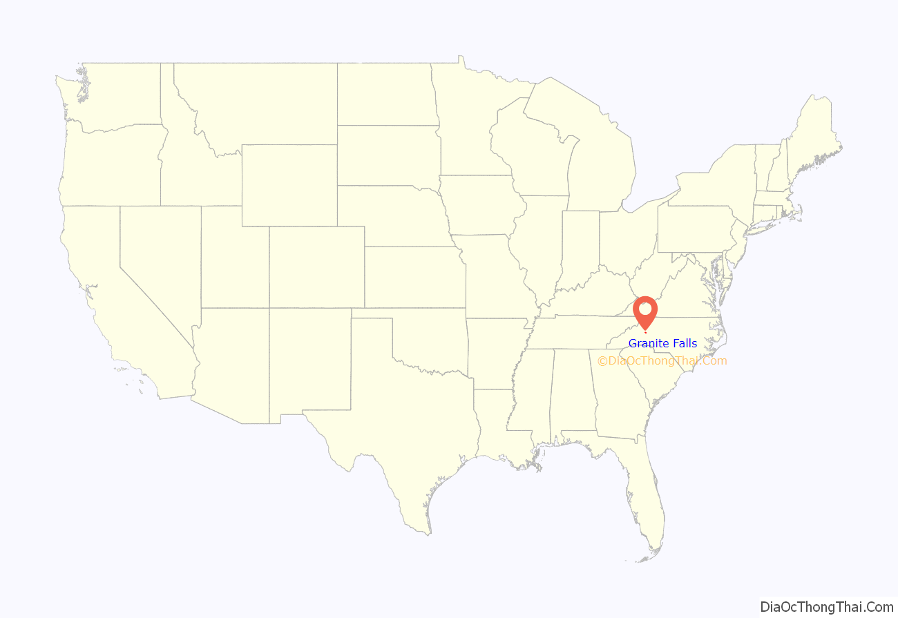
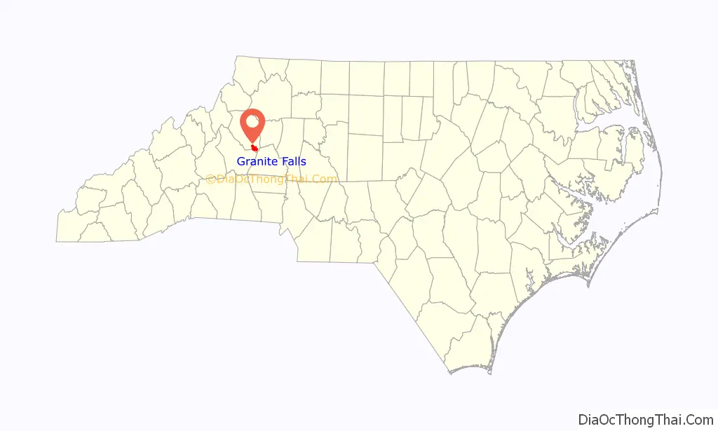
Granite Falls location map. Where is Granite Falls town?
History
The name Granite Falls comes from the waters that splash over the granite boulders spanning Gunpowder Creek. In 1791, pioneer Andrew Baird saw that he could operate an iron works beside Gunpowder Creek, and in doing so, became owner of all the land now occupied by the Town of Granite Falls. The community would start to form from that point. Granite Falls was incorporated as a town in 1899. Before its incorporation, Granite Falls went by many other names such as Baird’s Forge, Catawba View, Lovelady, and Granite.
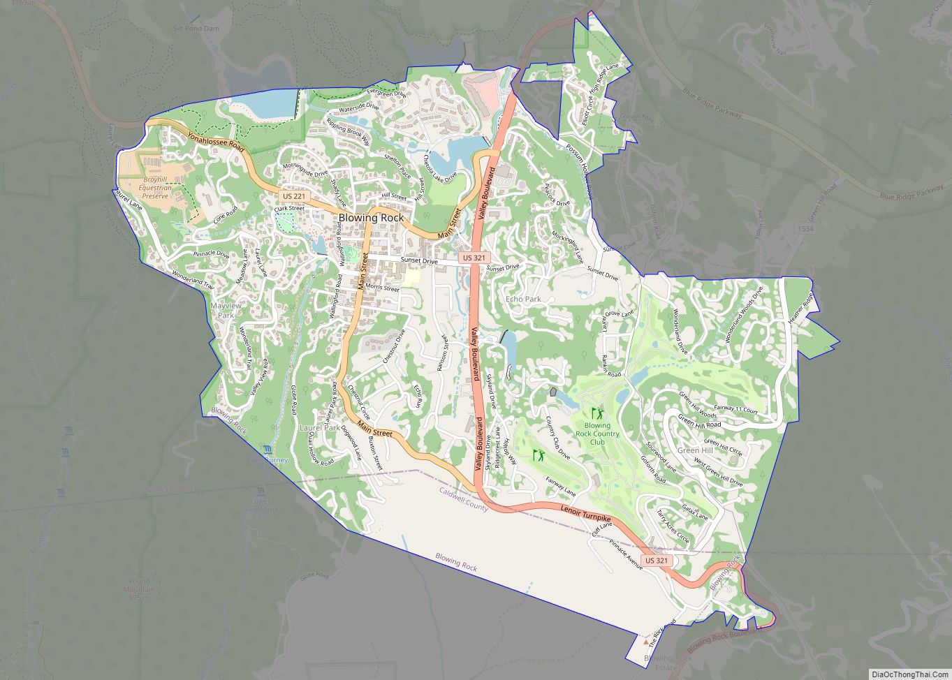
Granite Falls Road Map
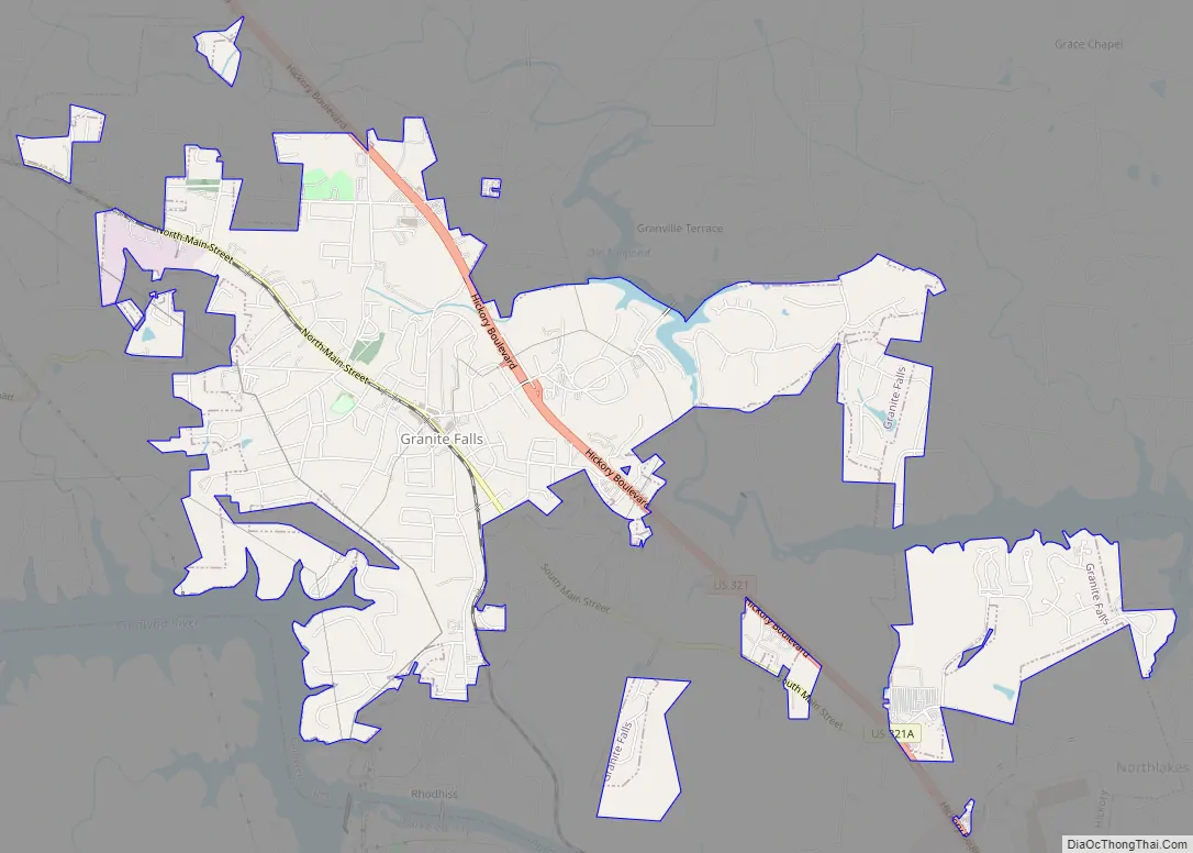
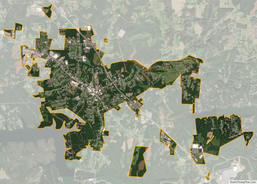
Granite Falls city Satellite Map
Geography
Granite Falls is located near the southern border of Caldwell County at 35°48′1″N 81°25′59″W / 35.80028°N 81.43306°W / 35.80028; -81.43306 (35.800345, -81.432929). It is bordered to the south by the town of Rhodhiss, to the southwest by Rhodhiss Lake on the Catawba River (Lake Hickory), and to the west by the town of Sawmills. The center of town is located on a ridge between the Catawba River to the west and Gunpowder Creek, a tributary of the Catawba, to the east.
U.S. Route 321 (Hickory Boulevard) is a four-lane highway that passes through the eastern side of town; it leads 6 miles (10 km) southeast to the center of Hickory and 10 miles (16 km) northwest to Lenoir, the Caldwell County seat. US 321 Alternate runs through the center of Granite Falls as North and South Main Street.
According to the United States Census Bureau, the town has a total area of 5.3 square miles (13.6 km), of which 5.2 square miles (13.5 km) is land and 0.04 square miles (0.1 km), or 0.84%, is water.
See also
Map of North Carolina State and its subdivision:- Alamance
- Alexander
- Alleghany
- Anson
- Ashe
- Avery
- Beaufort
- Bertie
- Bladen
- Brunswick
- Buncombe
- Burke
- Cabarrus
- Caldwell
- Camden
- Carteret
- Caswell
- Catawba
- Chatham
- Cherokee
- Chowan
- Clay
- Cleveland
- Columbus
- Craven
- Cumberland
- Currituck
- Dare
- Davidson
- Davie
- Duplin
- Durham
- Edgecombe
- Forsyth
- Franklin
- Gaston
- Gates
- Graham
- Granville
- Greene
- Guilford
- Halifax
- Harnett
- Haywood
- Henderson
- Hertford
- Hoke
- Hyde
- Iredell
- Jackson
- Johnston
- Jones
- Lee
- Lenoir
- Lincoln
- Macon
- Madison
- Martin
- McDowell
- Mecklenburg
- Mitchell
- Montgomery
- Moore
- Nash
- New Hanover
- Northampton
- Onslow
- Orange
- Pamlico
- Pasquotank
- Pender
- Perquimans
- Person
- Pitt
- Polk
- Randolph
- Richmond
- Robeson
- Rockingham
- Rowan
- Rutherford
- Sampson
- Scotland
- Stanly
- Stokes
- Surry
- Swain
- Transylvania
- Tyrrell
- Union
- Vance
- Wake
- Warren
- Washington
- Watauga
- Wayne
- Wilkes
- Wilson
- Yadkin
- Yancey
- Alabama
- Alaska
- Arizona
- Arkansas
- California
- Colorado
- Connecticut
- Delaware
- District of Columbia
- Florida
- Georgia
- Hawaii
- Idaho
- Illinois
- Indiana
- Iowa
- Kansas
- Kentucky
- Louisiana
- Maine
- Maryland
- Massachusetts
- Michigan
- Minnesota
- Mississippi
- Missouri
- Montana
- Nebraska
- Nevada
- New Hampshire
- New Jersey
- New Mexico
- New York
- North Carolina
- North Dakota
- Ohio
- Oklahoma
- Oregon
- Pennsylvania
- Rhode Island
- South Carolina
- South Dakota
- Tennessee
- Texas
- Utah
- Vermont
- Virginia
- Washington
- West Virginia
- Wisconsin
- Wyoming