Northlakes is an unincorporated community and census-designated place (CDP) in Caldwell County, North Carolina, United States. It is part of the Hickory–Lenoir–Morganton Metropolitan Statistical Area.
| Name: | Northlakes CDP |
|---|---|
| LSAD Code: | 57 |
| LSAD Description: | CDP (suffix) |
| State: | North Carolina |
| County: | Caldwell County |
| Elevation: | 932 ft (284 m) |
| Total Area: | 1.91 sq mi (4.94 km²) |
| Land Area: | 1.49 sq mi (3.86 km²) |
| Water Area: | 0.42 sq mi (1.08 km²) |
| Total Population: | 1,543 |
| Population Density: | 1,034.18/sq mi (399.31/km²) |
| Area code: | 828 |
| FIPS code: | 3747695 |
| GNISfeature ID: | 1867436 |
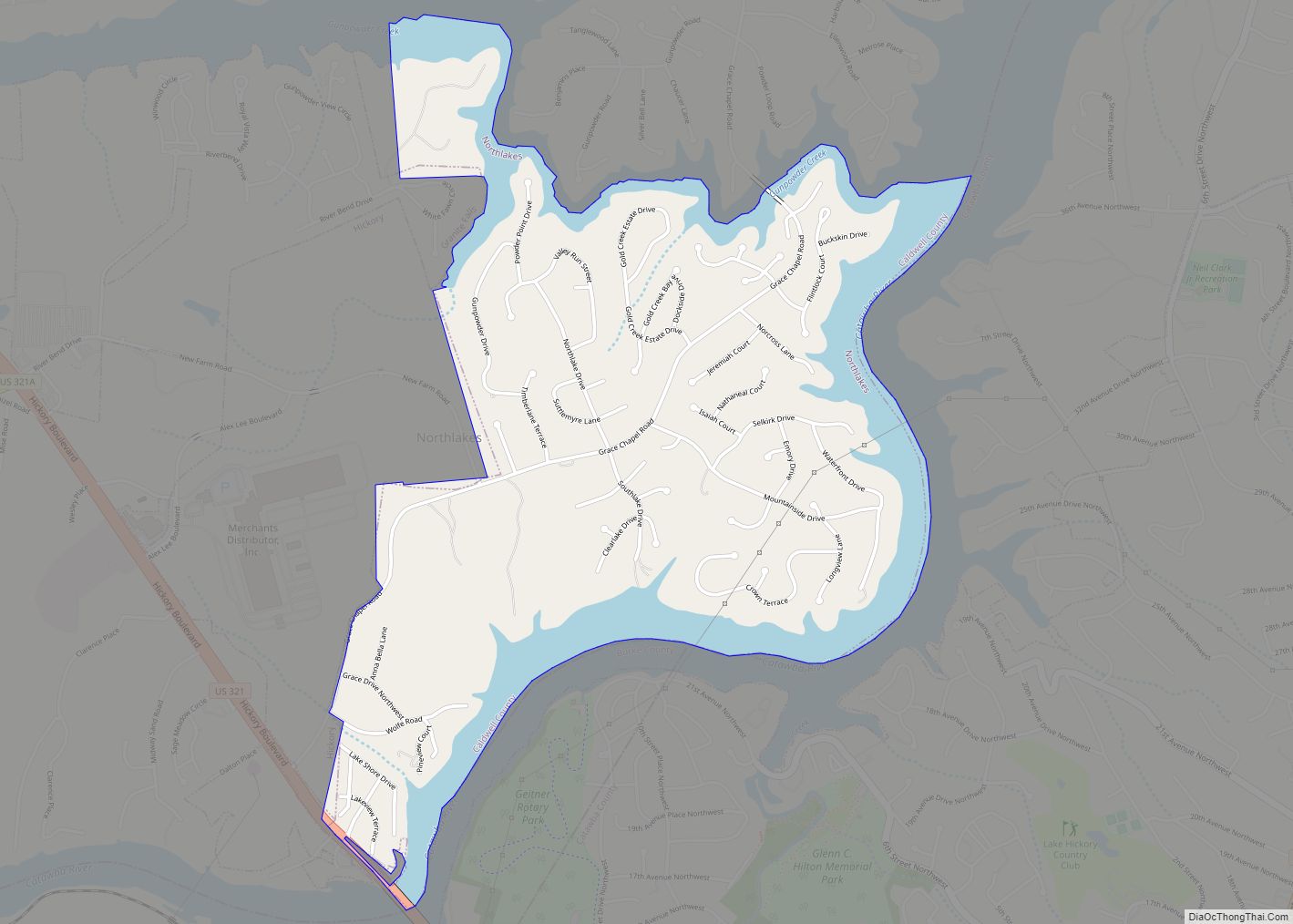
Online Interactive Map
Click on ![]() to view map in "full screen" mode.
to view map in "full screen" mode.
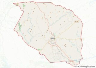
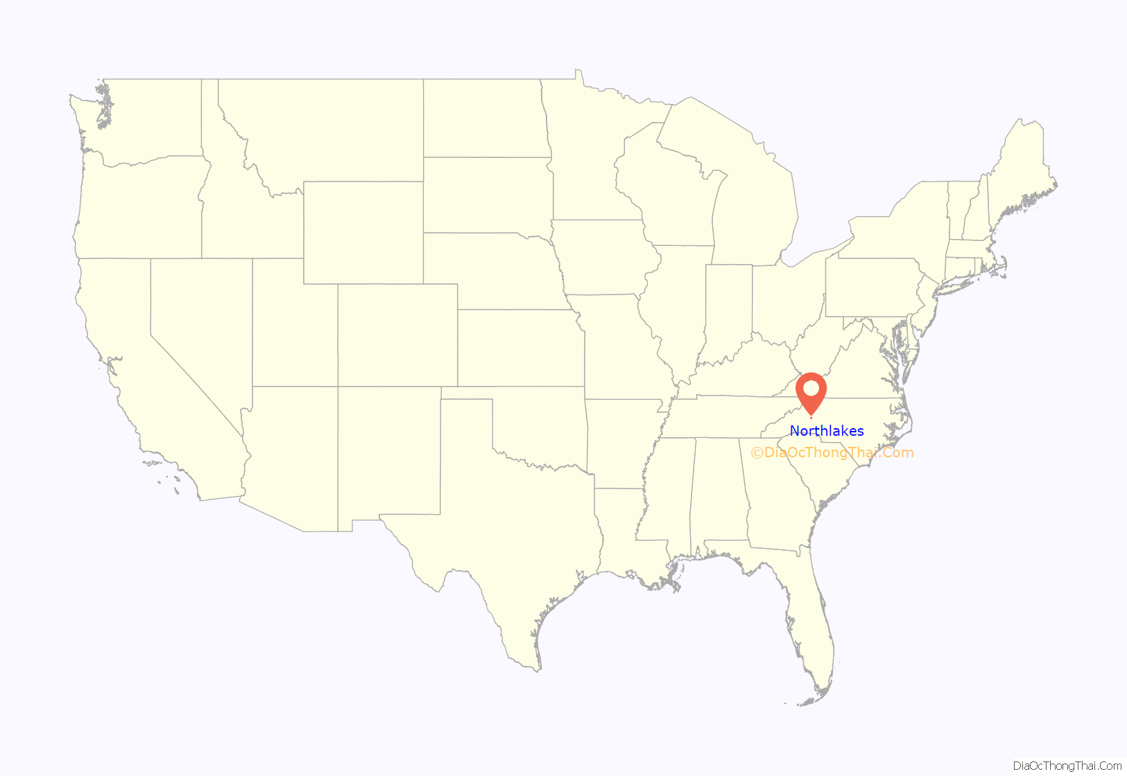
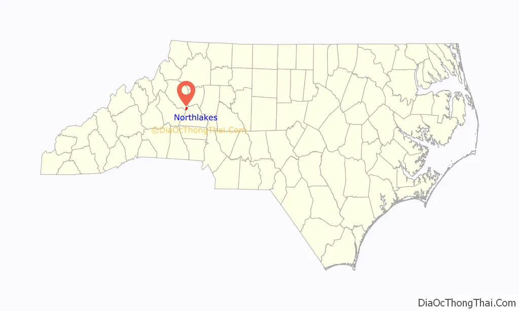
Northlakes location map. Where is Northlakes CDP?
Northlakes Road Map
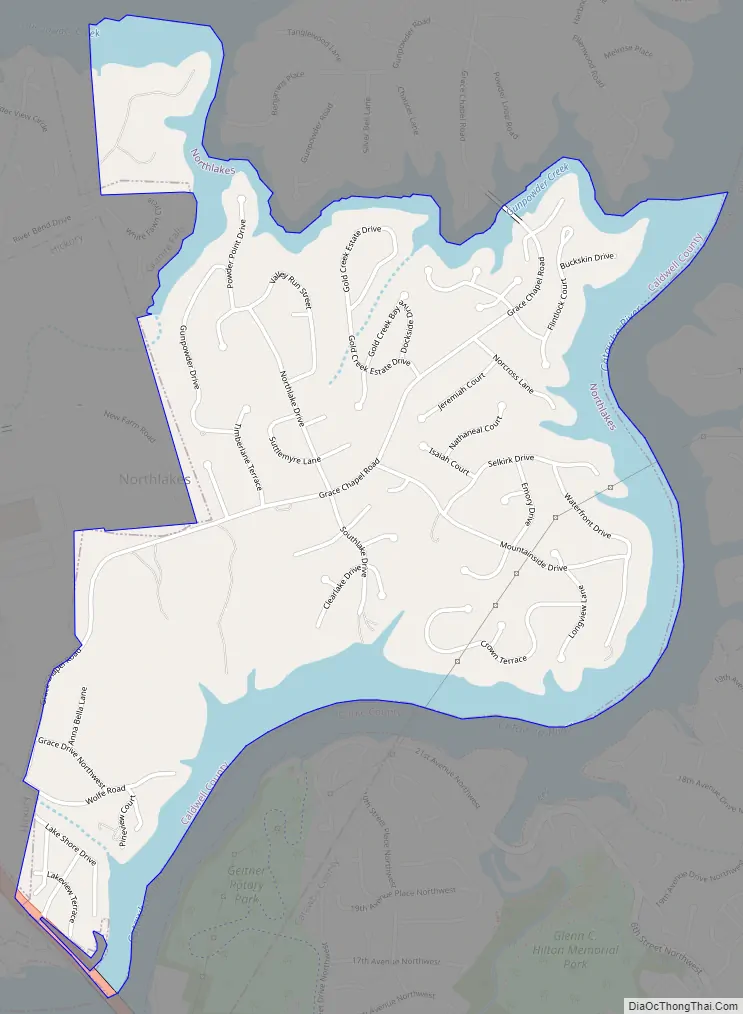
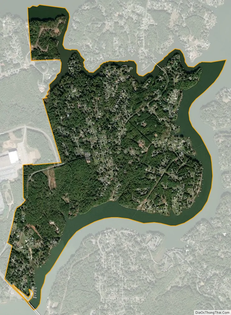
Northlakes city Satellite Map
Geography
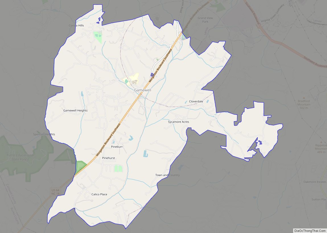
Northlakes is located at the southeastern end of Caldwell County at 35°46′22″N 81°22′02″W / 35.772746°N 81.367325°W / 35.772746; -81.367325. It is bordered to the southeast by Lake Hickory, a reservoir on the Catawba River. The river forms the Caldwell County line, with Burke and Catawba counties on the opposite side. The city of Hickory is on the opposite side of Lake Hickory and also borders Northlakes to the west. A portion of the town of Granite Falls borders Northlakes to the northwest. The northern edge of the community is Gunpowder Creek, inundated to form an arm of Lake Hickory.
According to the United States Census Bureau, the CDP has a total area of 1.9 square miles (4.9 km), of which 1.5 square miles (3.9 km) is land and 0.4 square miles (1.0 km), or 21.24%, is water.
See also
Map of North Carolina State and its subdivision:- Alamance
- Alexander
- Alleghany
- Anson
- Ashe
- Avery
- Beaufort
- Bertie
- Bladen
- Brunswick
- Buncombe
- Burke
- Cabarrus
- Caldwell
- Camden
- Carteret
- Caswell
- Catawba
- Chatham
- Cherokee
- Chowan
- Clay
- Cleveland
- Columbus
- Craven
- Cumberland
- Currituck
- Dare
- Davidson
- Davie
- Duplin
- Durham
- Edgecombe
- Forsyth
- Franklin
- Gaston
- Gates
- Graham
- Granville
- Greene
- Guilford
- Halifax
- Harnett
- Haywood
- Henderson
- Hertford
- Hoke
- Hyde
- Iredell
- Jackson
- Johnston
- Jones
- Lee
- Lenoir
- Lincoln
- Macon
- Madison
- Martin
- McDowell
- Mecklenburg
- Mitchell
- Montgomery
- Moore
- Nash
- New Hanover
- Northampton
- Onslow
- Orange
- Pamlico
- Pasquotank
- Pender
- Perquimans
- Person
- Pitt
- Polk
- Randolph
- Richmond
- Robeson
- Rockingham
- Rowan
- Rutherford
- Sampson
- Scotland
- Stanly
- Stokes
- Surry
- Swain
- Transylvania
- Tyrrell
- Union
- Vance
- Wake
- Warren
- Washington
- Watauga
- Wayne
- Wilkes
- Wilson
- Yadkin
- Yancey
- Alabama
- Alaska
- Arizona
- Arkansas
- California
- Colorado
- Connecticut
- Delaware
- District of Columbia
- Florida
- Georgia
- Hawaii
- Idaho
- Illinois
- Indiana
- Iowa
- Kansas
- Kentucky
- Louisiana
- Maine
- Maryland
- Massachusetts
- Michigan
- Minnesota
- Mississippi
- Missouri
- Montana
- Nebraska
- Nevada
- New Hampshire
- New Jersey
- New Mexico
- New York
- North Carolina
- North Dakota
- Ohio
- Oklahoma
- Oregon
- Pennsylvania
- Rhode Island
- South Carolina
- South Dakota
- Tennessee
- Texas
- Utah
- Vermont
- Virginia
- Washington
- West Virginia
- Wisconsin
- Wyoming