Tryon is a town in Polk County, on the southwestern border of North Carolina, United States. As of the 2020 census, the city population was 1,562. Located in the escarpment of the Blue Ridge Mountains, today the area is affluent and a center for outdoor pursuits, equestrian activity, and fine arts.
Tryon Peak and the Town of Tryon are named for William Tryon, Governor of North Carolina from 1765 to 1771. He was honored for his negotiation with the Cherokee for a treaty during a period of conflict following the French and Indian War.
| Name: | Tryon town |
|---|---|
| LSAD Code: | 43 |
| LSAD Description: | town (suffix) |
| State: | North Carolina |
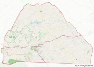
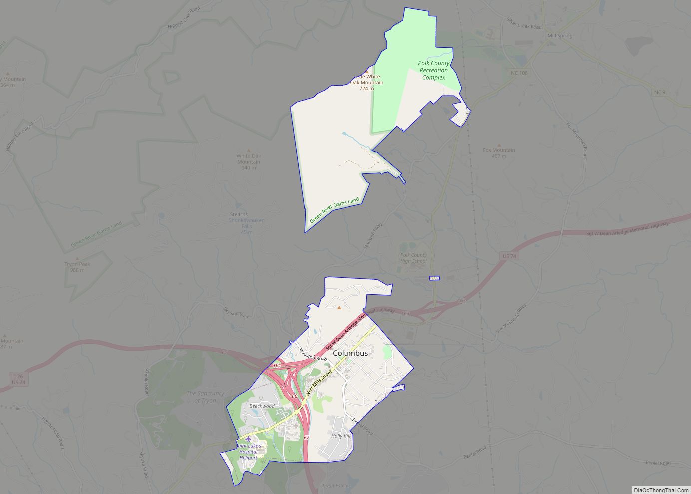
| County: | Polk County |
| Elevation: | 1,102 ft (336 m) |
| Total Area: | 2.00 sq mi (5.17 km²) |
| Land Area: | 2.00 sq mi (5.17 km²) |
| Water Area: | 0.00 sq mi (0.00 km²) |
| Total Population: | 1,562 |
| Population Density: | 782.17/sq mi (301.94/km²) |
| ZIP code: | 28782 |
| Area code: | 828 |
| FIPS code: | 3768580 |
| GNISfeature ID: | 0996284 |
| Website: | tryon-nc.com |
Online Interactive Map
Click on ![]() to view map in "full screen" mode.
to view map in "full screen" mode.
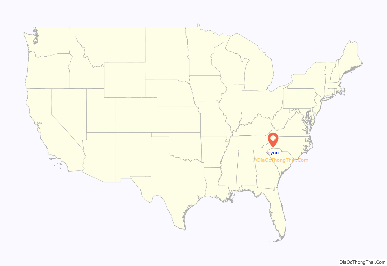
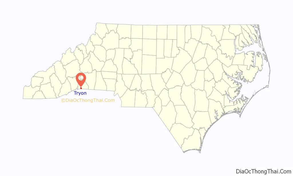
Tryon location map. Where is Tryon town?
History
Cherokee hunting ground
The area which Tryon now occupies was originally part of the Cherokee hunting grounds of Western North Carolina. Archaeological evidence dates indigenous peoples’ occupation of the site to the end of the last ice age, more than 11,000 years ago. Successive cultures occupied the river valleys. Semi-permanent villages appeared in the area by about 8,000 B.C.
They later developed towns with a democratic political structure, developing religion, domesticated crops, pottery and skilled, powerful archery. The culture developed cultivated vegetables, and hunted and fished. Each historic Cherokee village had a peace chief, war chief, and priest.
Spanish discovery
Having landed near present-day Panama City, Florida on May 30, 1539, Spanish explorer Hernando de Soto reputedly traveled up to the area of present-day Spartanburg, South Carolina and then north into western North Carolina. Traveling on horses, de Soto and 1,000 men arrived in North Carolina in mid-May, 1540. In search of gold, de Soto explored the area of Asheville area and met with the Cherokee in their village of Xuala, the area now known as Tryon. After a day or two, de Soto continued his journey with provisions provided by the Cherokee.
Luys Hernandez de Biedma, one of de Soto’s officers, wrote of a group of Spanish men who made their way to Xuala on May 21, 1540:
From there, de Soto went to Gauxuile (since developed as Asheville), which in Cherokee meant “The place where they race,” named for the walk around the perimeter of the village.
Early English settlement, French and Indian War
In the earliest periods of settlement, the British traders and Cherokee enjoyed peaceful relations. Most of the British colonists settled in the coastal areas, where they had more contact with Algonquian-speaking peoples. A treaty signed in 1730 resulted in a greater influx of white traders and settlers to Cherokee territory. An early home, Seven Hearths, was built in 1740, and it is reputedly the oldest clapboard house in the county. It was moved to its present location in 1934. A log cabin that served as quarters for enslaved African Americans was also built about 1740. It was moved and rebuilt next to Seven Hearths in the 1930s.
The French and Indian War, the North American front of the Seven Years War, primarily between England and France, ended the peace that had existed between the Cherokee and the English settlers. Both the French and the English recruited Native American allies to aid their militias. The French were allied with the Creek people (Muscogee), traditional competitors of the Cherokee. The French tried to make allies of the Cherokee as well, who had been affiliated with the British because of their trading history. The French encouraged the Shawnee to raid settlements of the English.
As conflict and tension increased, the British built defensive forts along the frontier, including the “Block House” near the future Tryon. Tensions with the Cherokee continued after Britain defeated France in the large war. The Cherokee were resisting repeated incursions into their territory by English colonists.
In 1767 William Tryon, governor of the North Carolina Colony from 1765 to 1771), traveled to the area and negotiated a peace treaty with the Cherokee. They established a boundary line between a location near Greenville, South Carolina, the highest point on White Oak Mountain (renamed Tryon Peak by the settlers). Settlers, though, did not commit to the boundary. With the outbreak of the Revolutionary War, some Cherokee hoped to expel the white settlers from their lands.
In the spring of 1776, Cherokee met on Round Mountain and planned an attack on the “Block House”, Earl’s Fort in Landrum, South Carolina, and Young’s Fort near the current town of Mill Spring, North Carolina. Aware of the plans, a Cherokee named Skyuka went to the “Block House”, where he warned his friend Capt. Thomas Howard of the impending attacks. Howard and the assembled local militia took a trail toward Round Mountain, where they met and defeated the Cherokee at a gap in the valley, now known as Howard Gap. Settlers honored Skyuka by the naming of Skyuka Creek, Skyuka Road, and the YMCA Camp Skyuka on Mount Tryon.
Post office
In 1839 a post office was established at the Top of Howard Gap and Holberts cove rds run by the Thompson Family named the Tryon Post office ,In early Polk what is now the Saluda township was called the Tryon township, present day Tryon was in the Columbus Township ;until Tryon city was established in 1885 both were named after Governor Tryon.
Rail service and hospitality
By 1877 the railroad provided regular transportation from South Carolina seaports around Charleston, SC to North Carolina, Tennessee, and the Ohio Valley. The particular spot that became the town of Tryon was the point where construction of the railroad to Asheville stopped for two years. West of Tryon, the railroad ascends the Blue Ridge along the Saluda Grade, which was the steepest railroad grade in the country before it became inactive.
At the peak of railroad expansion in 1885, Tryon was incorporated. By the 1890s, the railway made six daily stops in Tryon. The current depot building, built in 1922, is the third depot built. After expansion of individual automobile use, railroads restructured their offerings and passenger service to Tryon ended in 1968.
Oak Hall, originally built as the Tryon Hotel in 1881, is located on a bluff that looks over Trade Street. It had notable guests into the 20th century, such as Henry Ford, Thomas Edison, British film actor David Niven, Sherlock Holmes actor William Gillette, writer F. Scott Fitzgerald, composer George Gershwin, First Lady Mrs. Calvin Coolidge, Lady Nancy Astor, and Mrs. George C. Marshall, wife of the World War II general. The hotel was redeveloped as a condominium complex in the early 21st century.
Appreciative of the ice cream served at Misseldine’s drug store (previously located at the bank site on Trade Street), F. Scott Fitzgerald wrote the following ditty,
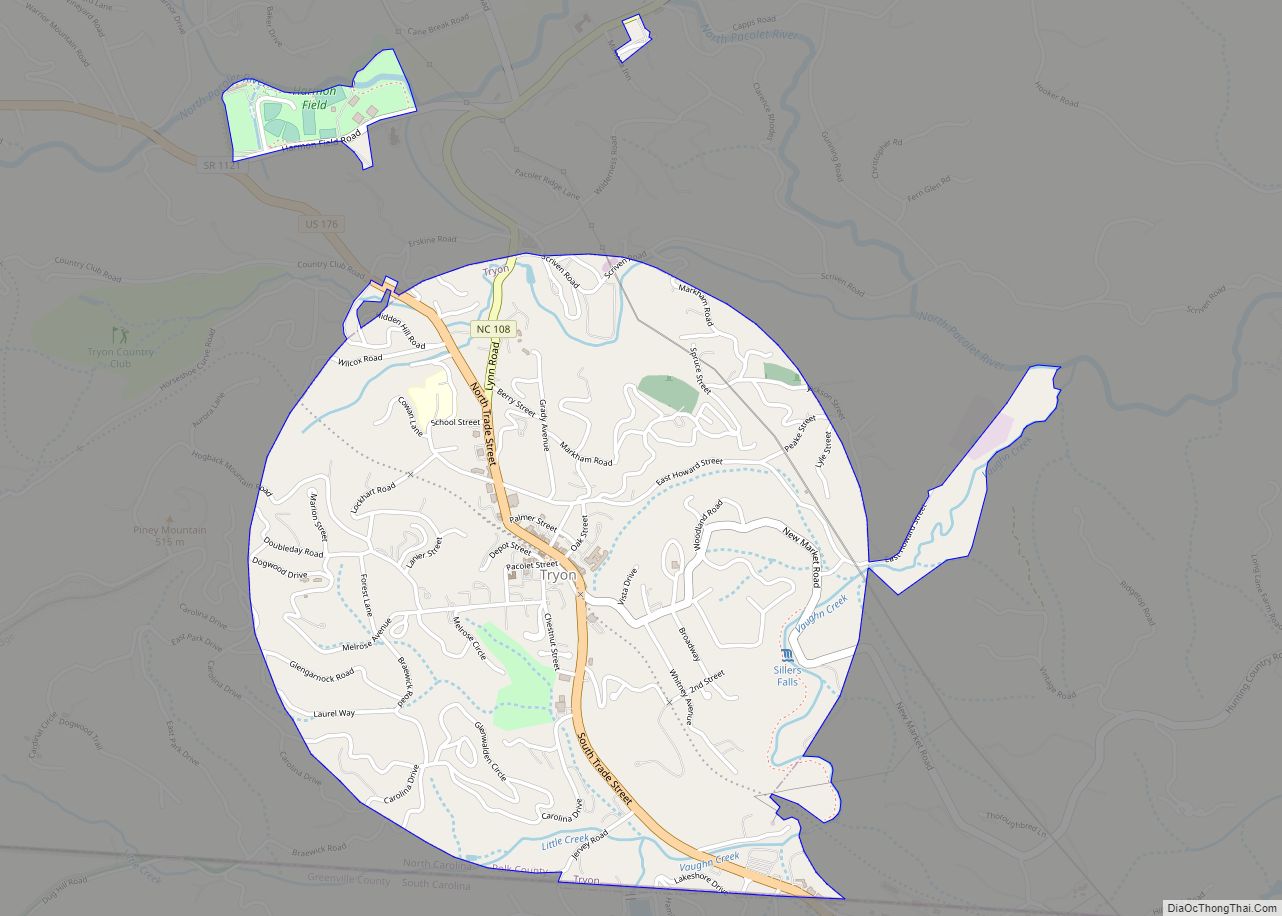
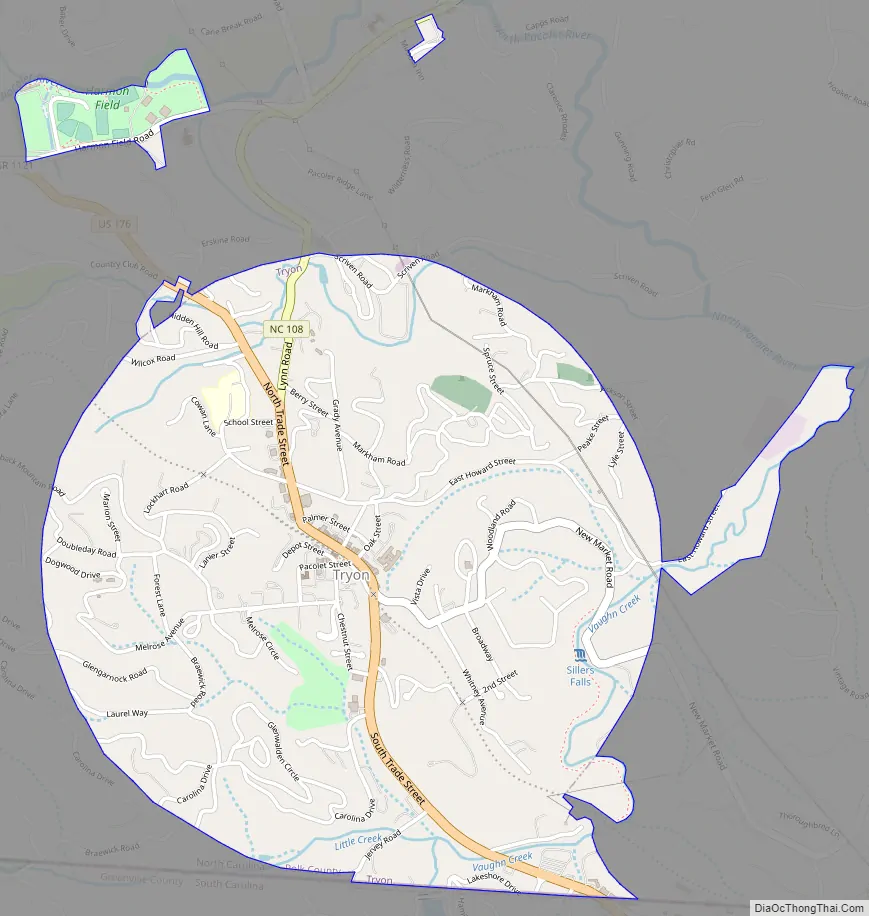
Tryon Road Map
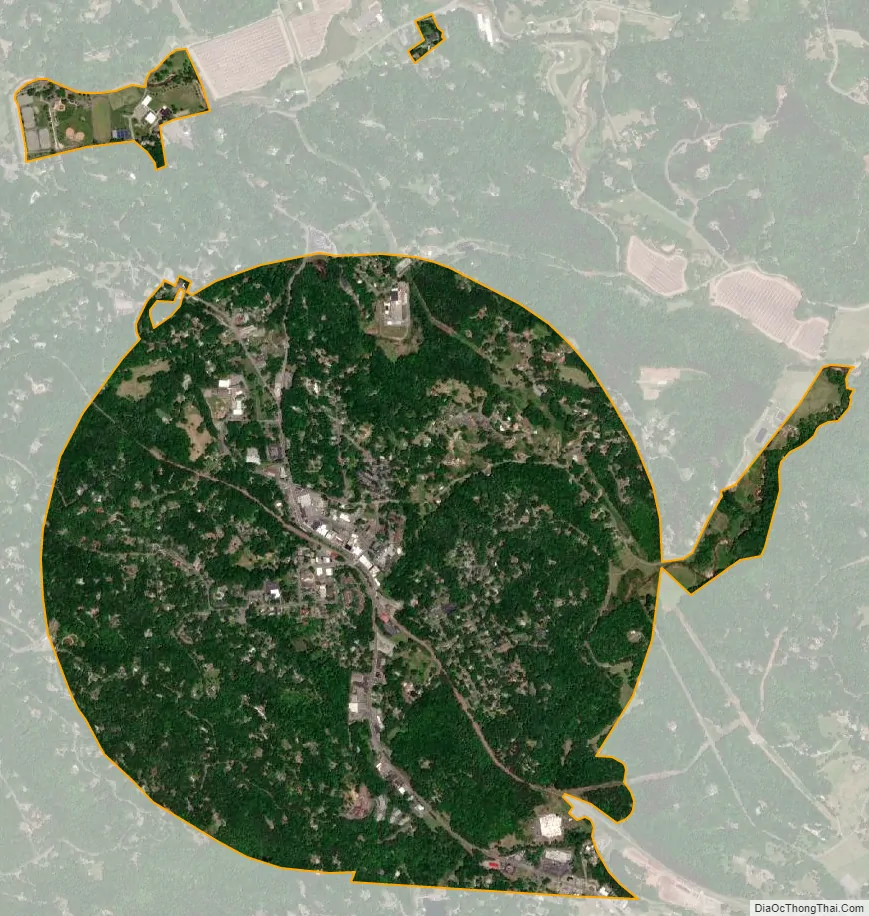
Tryon city Satellite Map
Geography
The elevation of the town is 1,067 feet (325 m) above sea level. The town’s original boundary was established as a circle with a radius of three quarters of a mile. According to the United States Census Bureau, the town has a total area of 1.8 square miles (4.7 km), all land.
Climate
Tryon is located near a “thermal belt”, an area generally free of dew and frost, which provides an enjoyable climate year-round.
The mountain climate attracted many of Tryon’s visitors as it developed as a resort, and residents, some of whom have second homes here. In this region of the Blue Ridge mountains, air may be warmer on the slopes than in the base of a valley, particularly in the spring and fall. It has longer periods of warm weather throughout the year, producing greater crop yields. Tryon has a climate similar to comparable areas of the Piedmont.
See also
Map of North Carolina State and its subdivision:- Alamance
- Alexander
- Alleghany
- Anson
- Ashe
- Avery
- Beaufort
- Bertie
- Bladen
- Brunswick
- Buncombe
- Burke
- Cabarrus
- Caldwell
- Camden
- Carteret
- Caswell
- Catawba
- Chatham
- Cherokee
- Chowan
- Clay
- Cleveland
- Columbus
- Craven
- Cumberland
- Currituck
- Dare
- Davidson
- Davie
- Duplin
- Durham
- Edgecombe
- Forsyth
- Franklin
- Gaston
- Gates
- Graham
- Granville
- Greene
- Guilford
- Halifax
- Harnett
- Haywood
- Henderson
- Hertford
- Hoke
- Hyde
- Iredell
- Jackson
- Johnston
- Jones
- Lee
- Lenoir
- Lincoln
- Macon
- Madison
- Martin
- McDowell
- Mecklenburg
- Mitchell
- Montgomery
- Moore
- Nash
- New Hanover
- Northampton
- Onslow
- Orange
- Pamlico
- Pasquotank
- Pender
- Perquimans
- Person
- Pitt
- Polk
- Randolph
- Richmond
- Robeson
- Rockingham
- Rowan
- Rutherford
- Sampson
- Scotland
- Stanly
- Stokes
- Surry
- Swain
- Transylvania
- Tyrrell
- Union
- Vance
- Wake
- Warren
- Washington
- Watauga
- Wayne
- Wilkes
- Wilson
- Yadkin
- Yancey
- Alabama
- Alaska
- Arizona
- Arkansas
- California
- Colorado
- Connecticut
- Delaware
- District of Columbia
- Florida
- Georgia
- Hawaii
- Idaho
- Illinois
- Indiana
- Iowa
- Kansas
- Kentucky
- Louisiana
- Maine
- Maryland
- Massachusetts
- Michigan
- Minnesota
- Mississippi
- Missouri
- Montana
- Nebraska
- Nevada
- New Hampshire
- New Jersey
- New Mexico
- New York
- North Carolina
- North Dakota
- Ohio
- Oklahoma
- Oregon
- Pennsylvania
- Rhode Island
- South Carolina
- South Dakota
- Tennessee
- Texas
- Utah
- Vermont
- Virginia
- Washington
- West Virginia
- Wisconsin
- Wyoming