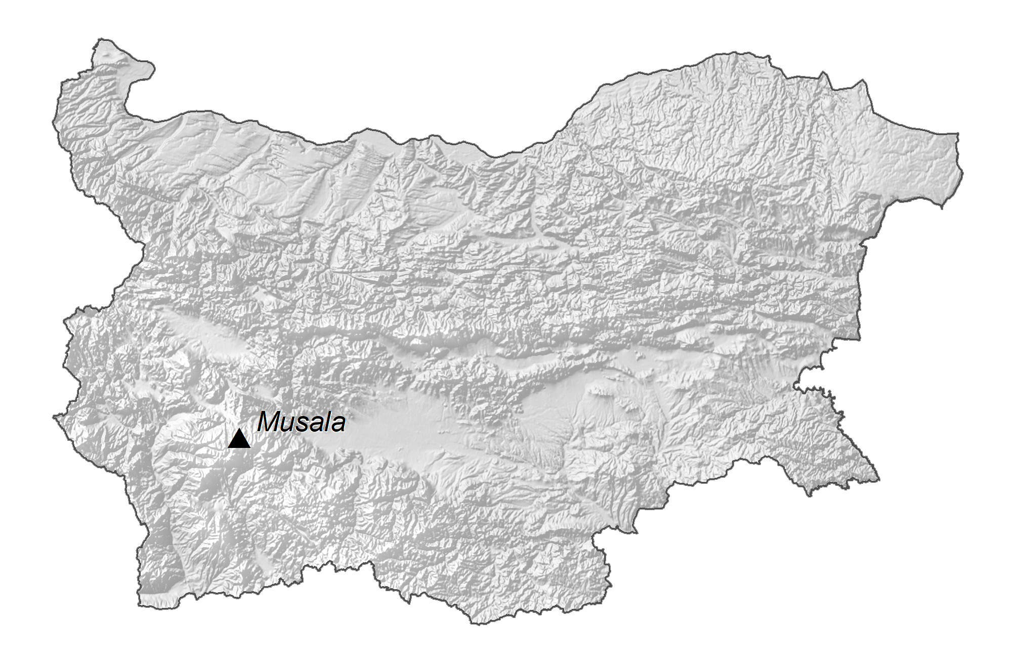
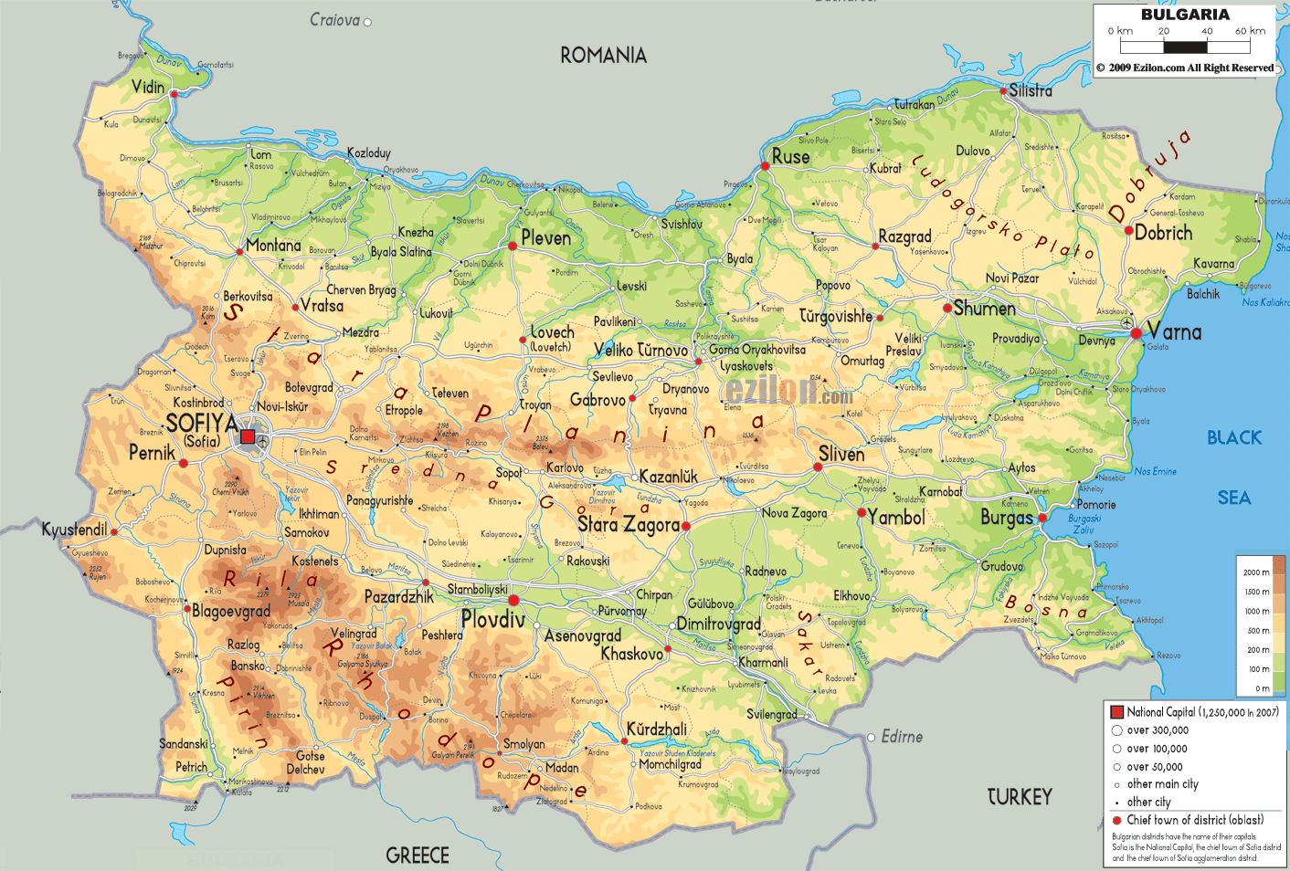
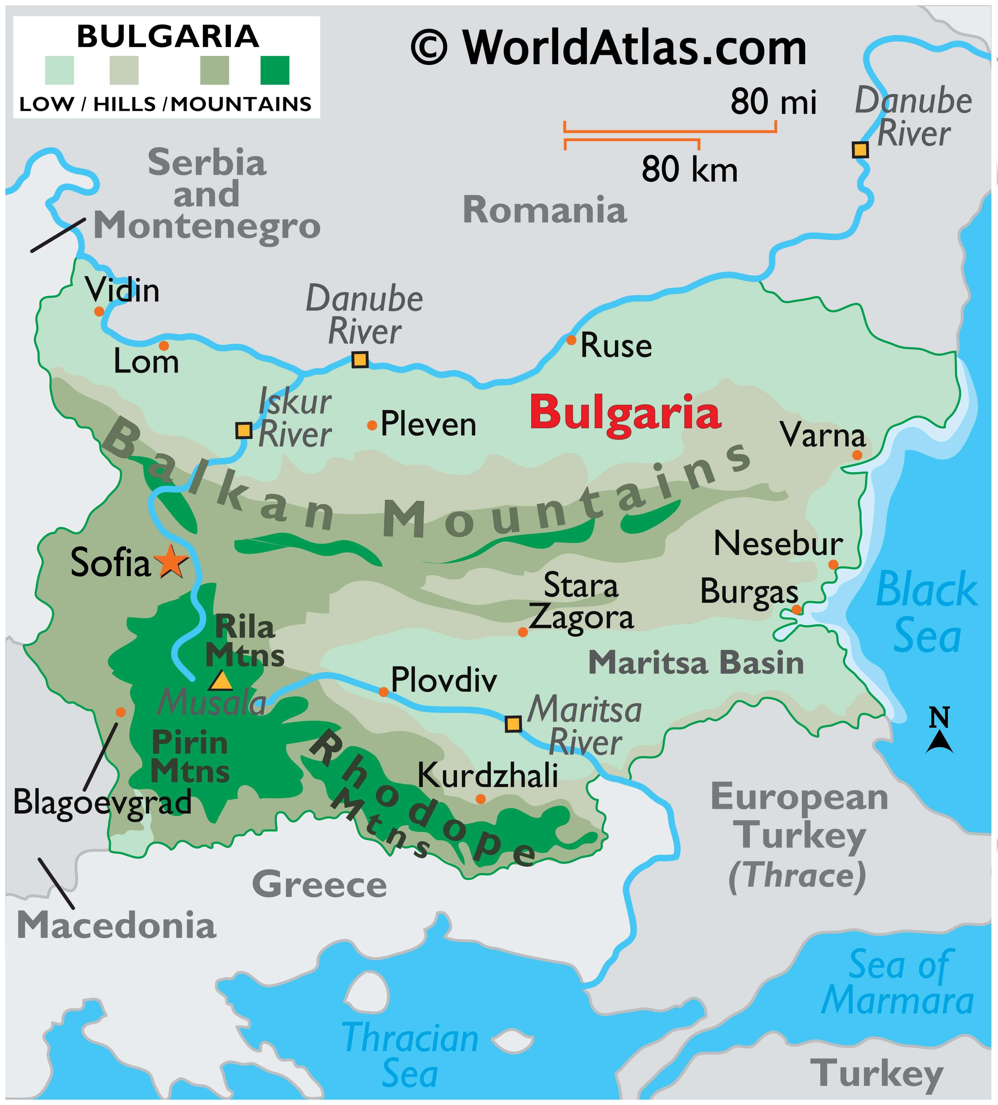
Noted for its diversity, Bulgaria’s landscape ranges from mountainous peaks covered in snow to valleys and lowlands giving way to the coast of the Black Sea. The Balkan Mountains cut across the central part of the country, while the Rhodope Mountains run through southern Bulgaria, along its border with Greece. The highest point in the country, located in the Rila Mountains, is Musala Mt., at 9,594 ft. (2,925 m). Moving on north of the Balkan Mountains the fertile lowlands of the Danubian Plain slope gradually down to the Danube River. The south-eastern lowlands (Maritsa Basin), drained by a series of small rivers, slope to the Black Sea. Major rivers include the Danube River, as it forms the northern border with Romania, and the Iskur, Maritsa, Struma, Tundzha and Yantra rivers.
| Flag: |  |
|---|---|
| Legal Name: | Republic of Bulgaria |
| Capital Value: | Sofia |
| Official languages: | Bulgarian |
| Demonym(s): |
|
| Government: | Unitary parliamentary republic |
| Legislature: | National Assembly |
| Total Area: | 110,879 km² |
| Land Area: | 108,489 km² |
| Water Area: | 2,390 km² |
| Population: | 6,975,761 |
| Density: | 63/km (163.2/sq mi) (154th) |
| GDP: | $67.93 Billion |
| GDP Per Capita: | $9,737.60 |
| Currency Value: | Leva (BGN) |
| Driving side: | right |
| Calling code: | +359 |
| Internet TLD: |
|
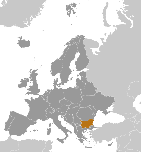
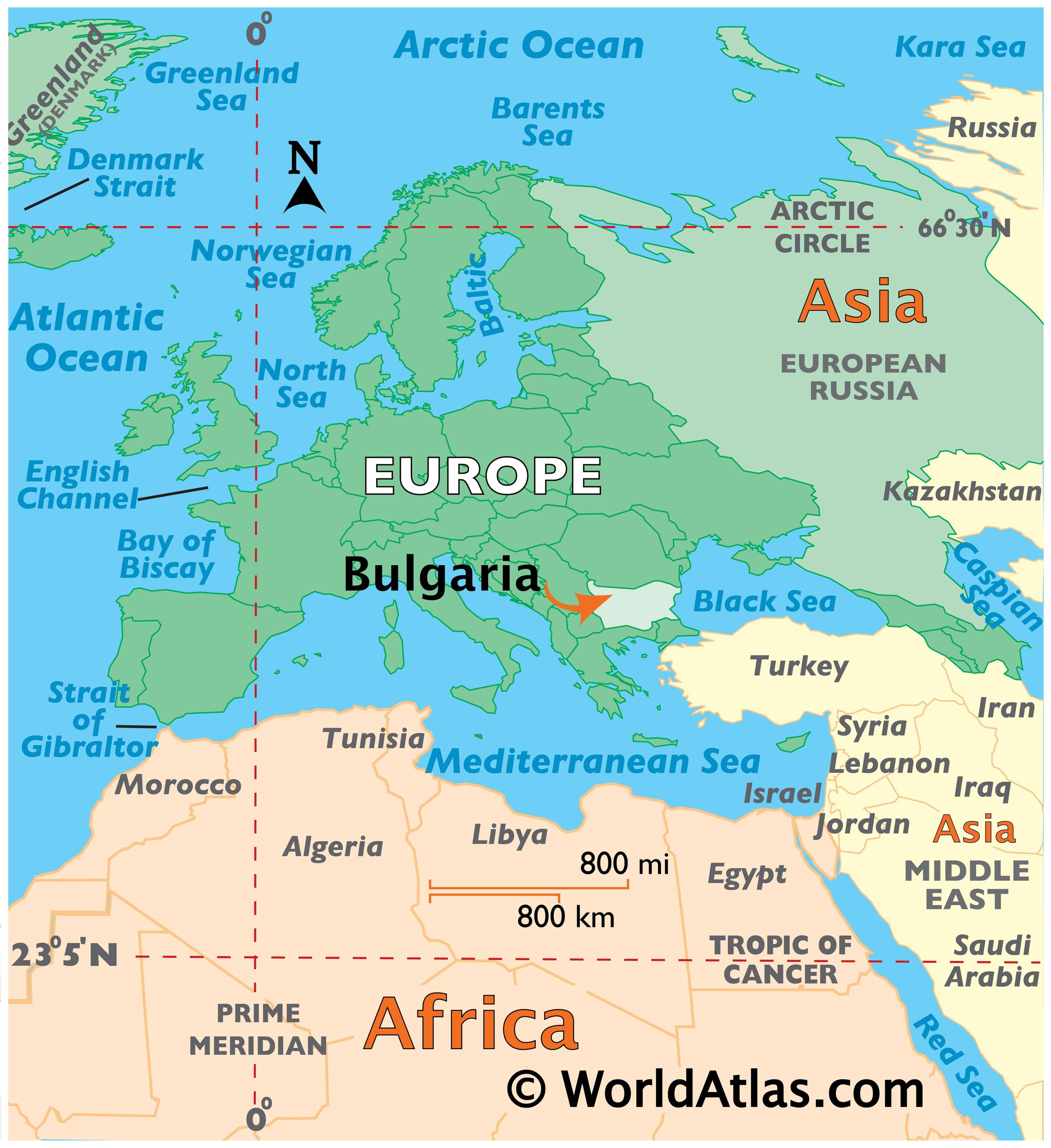
Bulgaria is a country located in Southeastern Europe. It is bordered by Romania to the north, Serbia and North Macedonia to the west, Greece and Turkey to the south, and the Black Sea to the east. Its capital city is Sofia. The country is home to a variety of mountain ranges, including the Balkan, Rhodope, and Pirin Mountains. It also has a rich cultural heritage, with many ancient sites, including the Thracian Tomb of Sveshtari and the UNESCO World Heritage Site Rila Monastery.
Explore Bulgaria with this Interactive Map
Discover the beauty of Bulgaria with this interactive map. You can explore its cities, towns, highways, elevation, and satellite image of the country. It includes major mountain chains like the Balkan, Rhodope, and Pirin Mountains. Get to know more about Bulgaria with this map and find out why it is a great place to visit.
Online Interactive Political Map
Click on ![]() to view map in "full screen" mode.
to view map in "full screen" mode.
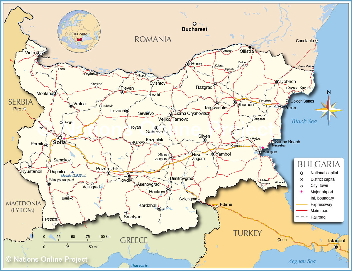
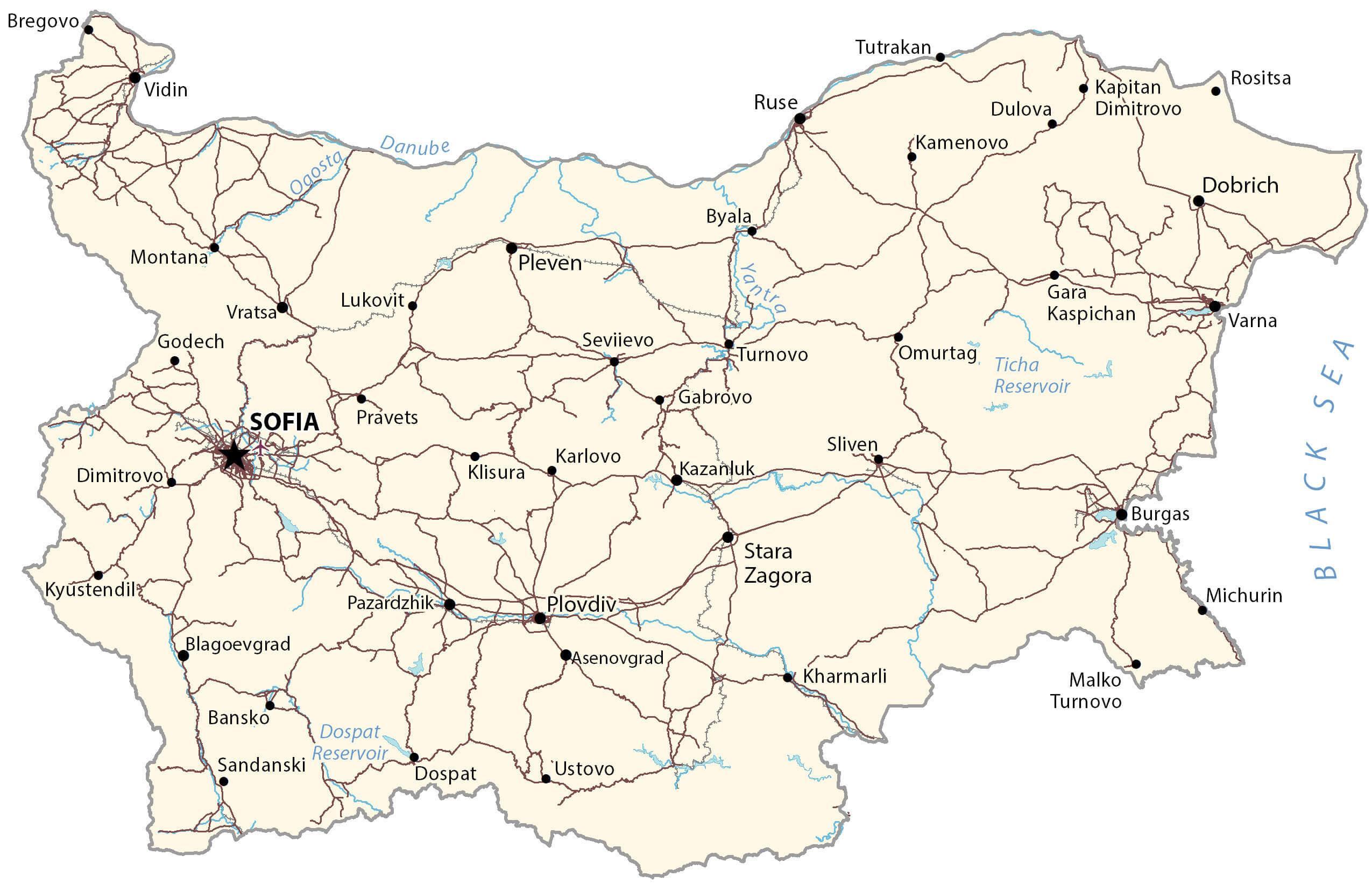
Bulgaria (officially, the Republic of Bulgaria) is divided into 28 provinces (oblasti, sing. oblast). In alphabetical order, the provinces are: Blagoevgrad, Burgas, Dobrich, Gabrovo, Haskovo, Kardzhali, Kyustendil, Lovech, Montana, Pazardzhik, Pernik, Pleven, Plovdiv, Razgrad, Ruse, Shumen, Silistra, Sliven, Smolyan, Sofia, Sofia-Grad (Sofia City), Stara Zagora, Targovishte, Varna, Veliko-Tarnovo, Vidin, Vratsa and Yambol. These provinces are further subdivided into a total of 265 municipalities.
With an area of 110,999 sq. km, Bulgaria is the 16th largest country in Europe. Located on the slopes of the Vitosha Mountains and the Sofia Valley, at the center of the Balkan Peninsula is, Sofia – the capital, the largest and the most populous city of Bulgaria. It is the main cultural and commercial center of the country.
Location Maps
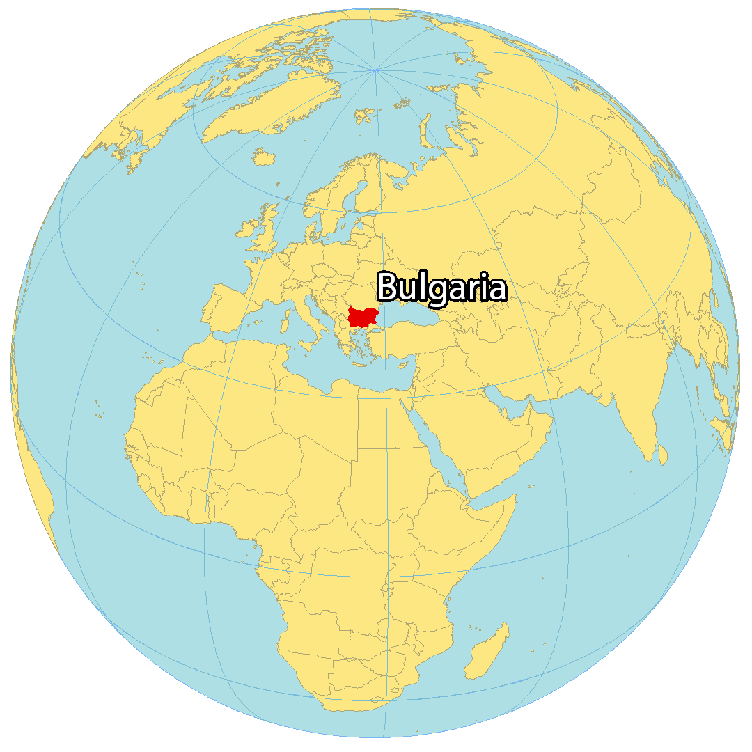
Where is Bulgaria?
Bulgaria is a country located in Southeast Europe. It borders Romania to the north, Serbia and North Macedonia to the west, as well as Greece and Turkey to the south. Its coastline along the Black Sea (the Bulgarian Riviera) is approximately 378 kilometers long. Bulgaria is part of the Balkans, occupying the eastern region.
Sofia is the capital and largest city in Bulgaria. Other heavily populated cities include Plovdiv, Varna, and Burgas. Approximately 7 million people reside in Bulgaria with about 1.25 million people in the capital city of Sofia.
High Definition Political Map of Bulgaria

Physical Map of Bulgaria
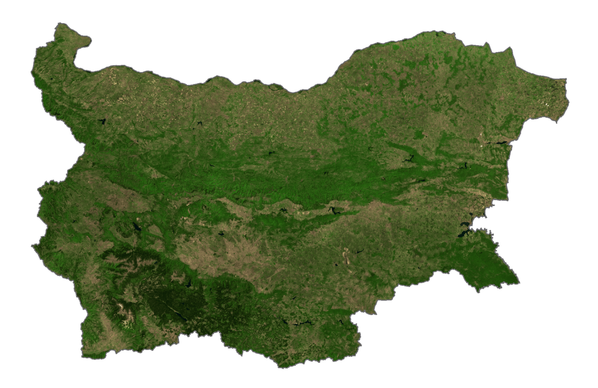
Bulgaria Satellite Map
Elevation Map