Troy is a city in Madison County, Illinois, United States. The population was 10,960 at the 2020 census, up from 9,888 in 2010.
Troy is part of the St. Louis Metropolitan Statistical Area. Its namesake in Lincoln County, Missouri, is also part of this MSA, making it (along with the two O’Fallons in Illinois and Missouri) one of the few pairs of like-named municipalities to be part of the same MSA.
| Name: | Troy city |
|---|---|
| LSAD Code: | 25 |
| LSAD Description: | city (suffix) |
| State: | Illinois |
| County: | Madison County |
| Elevation: | 558 ft (170 m) |
| Total Area: | 5.67 sq mi (14.69 km²) |
| Land Area: | 5.62 sq mi (14.56 km²) |
| Water Area: | 0.05 sq mi (0.14 km²) |
| Total Population: | 10,960 |
| Population Density: | 1,950.18/sq mi (752.96/km²) |
| ZIP code: | 62294 |
| Area code: | 618 |
| FIPS code: | 1776199 |
| GNISfeature ID: | 2397061 |
| Website: | www.troyil.us |
Online Interactive Map
Click on ![]() to view map in "full screen" mode.
to view map in "full screen" mode.
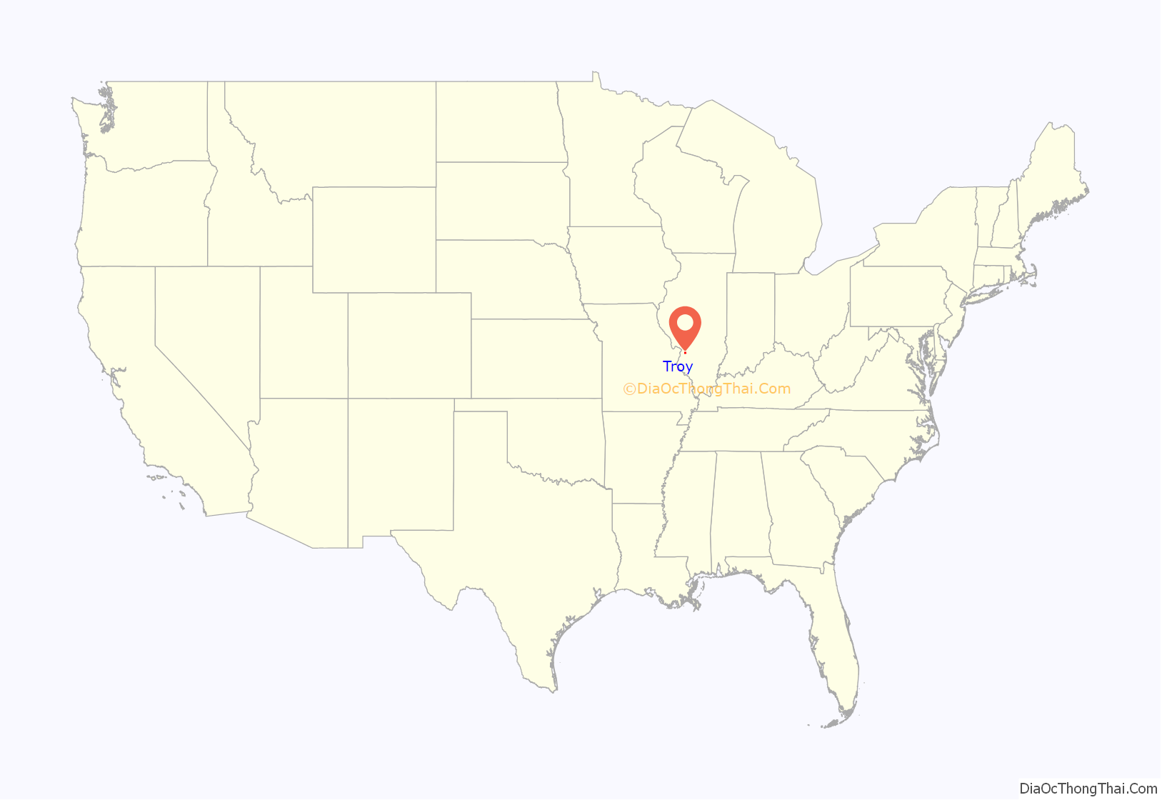
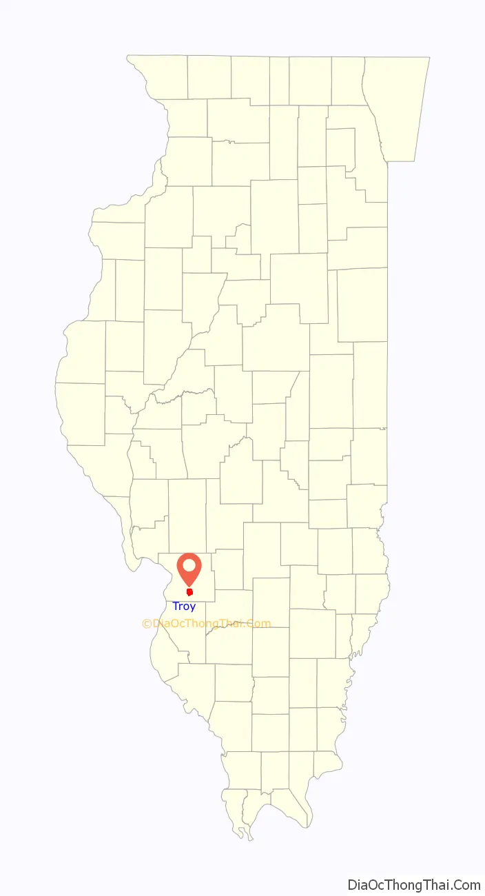
Troy location map. Where is Troy city?
History
Troy was platted in 1819. It was incorporated as a town on February 18, 1857, and as a city in 1892.
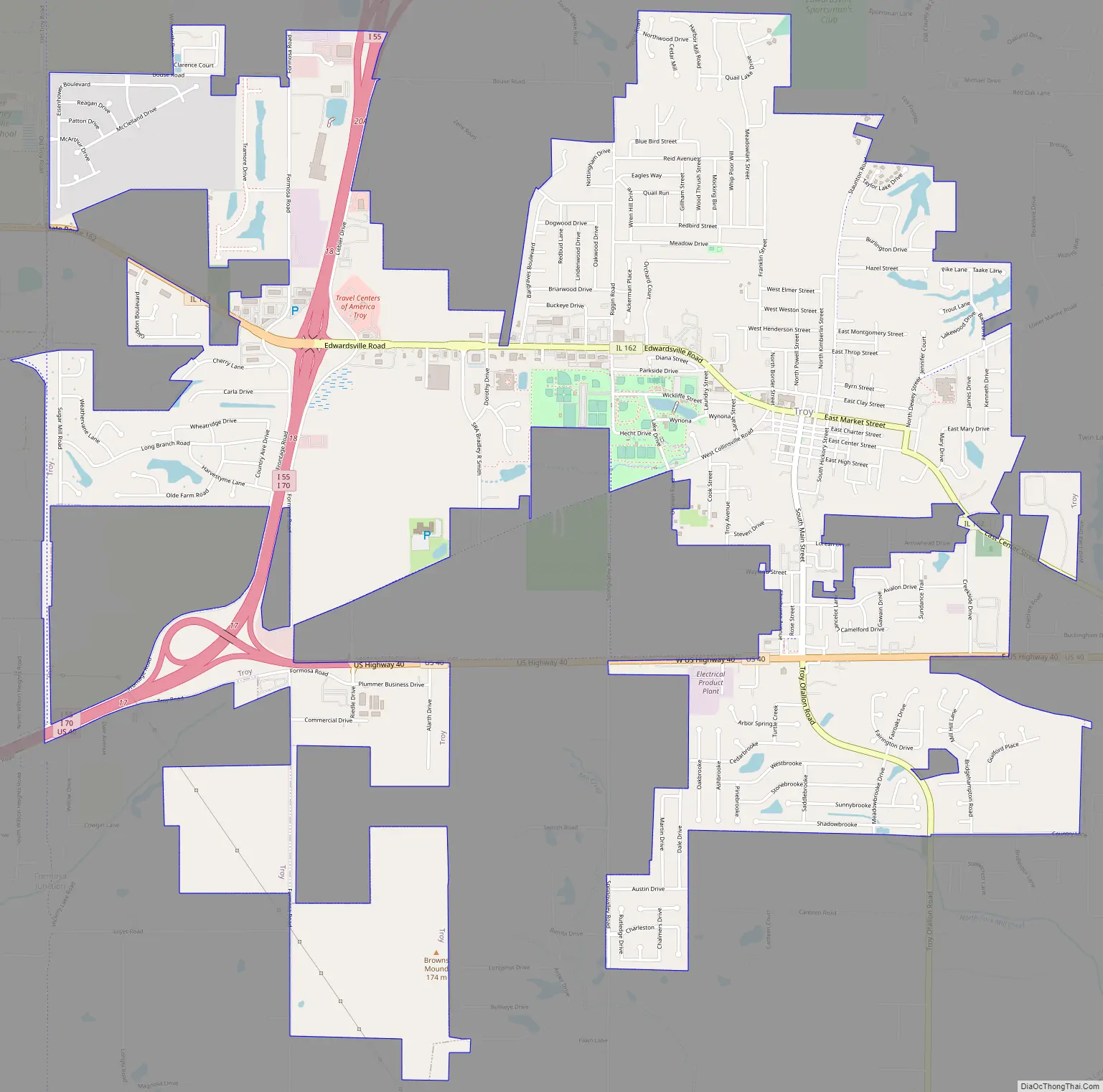
Troy Road Map
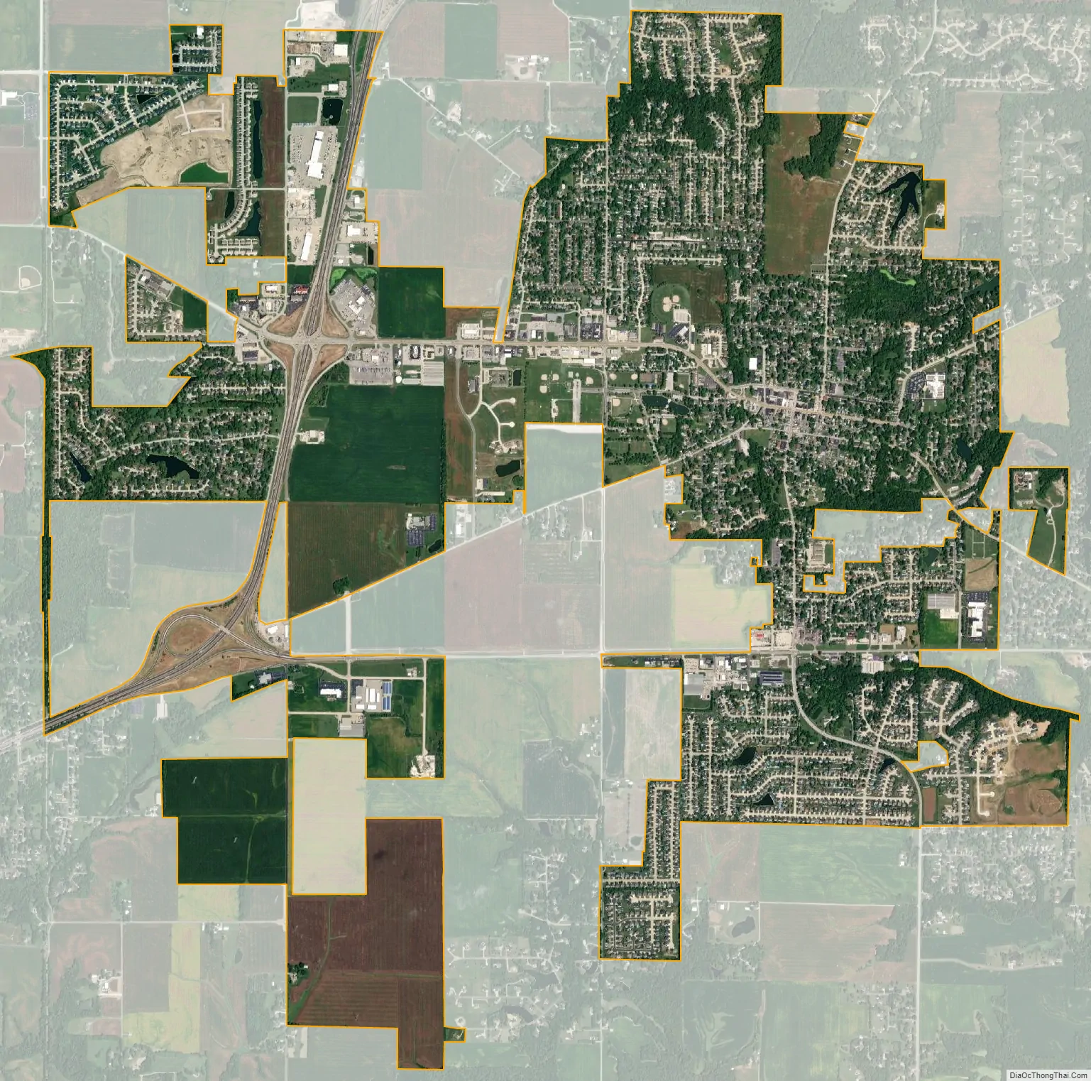
Troy city Satellite Map
Geography
Troy is located in south-central Madison County at 38°43′45″N 89°53′30″W / 38.72917°N 89.89167°W / 38.72917; -89.89167 (38.729236, -89.891733). It is bordered to the west by Maryville and to the northwest by Glen Carbon.
Interstates 55 and 70 pass through the west side of Troy, with access from exits 17 and 18. The highways together lead southwest 20 miles (32 km) to St. Louis, while diverging just north of Troy: I-55 leads north 75 miles (121 km) to Springfield, the state capital, while I-70 leads east 50 miles (80 km) to Vandalia. U.S. Route 40 passes through the south side of Troy, joining I-55 and I-70 at the western edge of the city and leading east 11 miles (18 km) to Highland. Illinois Route 162 passes through the center of Troy as Center Street, Market Street, and Edwardsville Road, leading east 2.5 miles (4.0 km) to US 40 and west 4 miles (6 km) to the north part of Maryville.
According to the U.S. Census Bureau, Troy has a total area of 5.67 square miles (14.69 km), of which 5.62 square miles (14.56 km) are land and 0.05 square miles (0.13 km), or 0.92%, are water. Most of the city drains eastward into tributaries of Silver Creek, a south-flowing tributary of the Kaskaskia River. The westernmost part of the city drains to Canteen Creek, which flows southwest to the Mississippi River valley at East St. Louis.
See also
Map of Illinois State and its subdivision:- Adams
- Alexander
- Bond
- Boone
- Brown
- Bureau
- Calhoun
- Carroll
- Cass
- Champaign
- Christian
- Clark
- Clay
- Clinton
- Coles
- Cook
- Crawford
- Cumberland
- De Kalb
- De Witt
- Douglas
- Dupage
- Edgar
- Edwards
- Effingham
- Fayette
- Ford
- Franklin
- Fulton
- Gallatin
- Greene
- Grundy
- Hamilton
- Hancock
- Hardin
- Henderson
- Henry
- Iroquois
- Jackson
- Jasper
- Jefferson
- Jersey
- Jo Daviess
- Johnson
- Kane
- Kankakee
- Kendall
- Knox
- La Salle
- Lake
- Lake Michigan
- Lawrence
- Lee
- Livingston
- Logan
- Macon
- Macoupin
- Madison
- Marion
- Marshall
- Mason
- Massac
- McDonough
- McHenry
- McLean
- Menard
- Mercer
- Monroe
- Montgomery
- Morgan
- Moultrie
- Ogle
- Peoria
- Perry
- Piatt
- Pike
- Pope
- Pulaski
- Putnam
- Randolph
- Richland
- Rock Island
- Saint Clair
- Saline
- Sangamon
- Schuyler
- Scott
- Shelby
- Stark
- Stephenson
- Tazewell
- Union
- Vermilion
- Wabash
- Warren
- Washington
- Wayne
- White
- Whiteside
- Will
- Williamson
- Winnebago
- Woodford
- Alabama
- Alaska
- Arizona
- Arkansas
- California
- Colorado
- Connecticut
- Delaware
- District of Columbia
- Florida
- Georgia
- Hawaii
- Idaho
- Illinois
- Indiana
- Iowa
- Kansas
- Kentucky
- Louisiana
- Maine
- Maryland
- Massachusetts
- Michigan
- Minnesota
- Mississippi
- Missouri
- Montana
- Nebraska
- Nevada
- New Hampshire
- New Jersey
- New Mexico
- New York
- North Carolina
- North Dakota
- Ohio
- Oklahoma
- Oregon
- Pennsylvania
- Rhode Island
- South Carolina
- South Dakota
- Tennessee
- Texas
- Utah
- Vermont
- Virginia
- Washington
- West Virginia
- Wisconsin
- Wyoming


