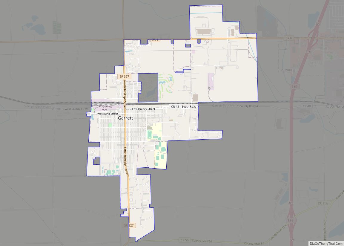
Garrett is a city in Keyser Township, DeKalb County, Indiana, United States. The population was 6,286 at the 2010 census.
| Name: | Garrett city |
|---|---|
| LSAD Code: | 25 |
| LSAD Description: | city (suffix) |
| State: | Indiana |
| County: | DeKalb County |
| Elevation: | 879 ft (268 m) |
| Total Area: | 4.17 sq mi (10.79 km²) |
| Land Area: | 4.17 sq mi (10.79 km²) |
| Water Area: | 0.00 sq mi (0.00 km²) |
| Total Population: | 6,542 |
| Population Density: | 1,570.33/sq mi (606.37/km²) |
| ZIP code: | 46738 |
| Area code: | 260 |
| FIPS code: | 1826386 |
| GNISfeature ID: | 0434969 |
| Website: | http://www.garrettindiana.us |
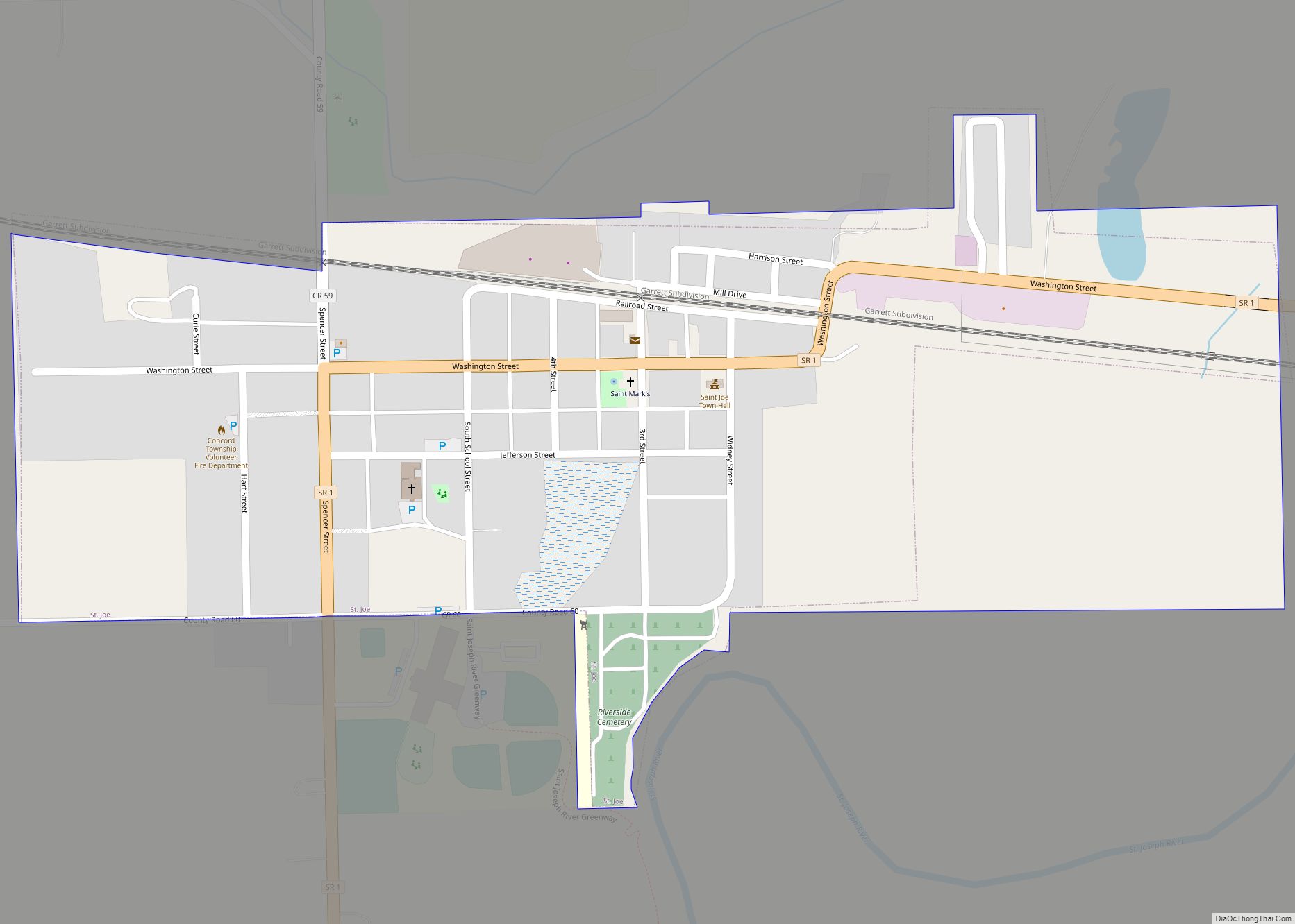
Online Interactive Map
Click on ![]() to view map in "full screen" mode.
to view map in "full screen" mode.
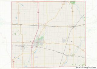
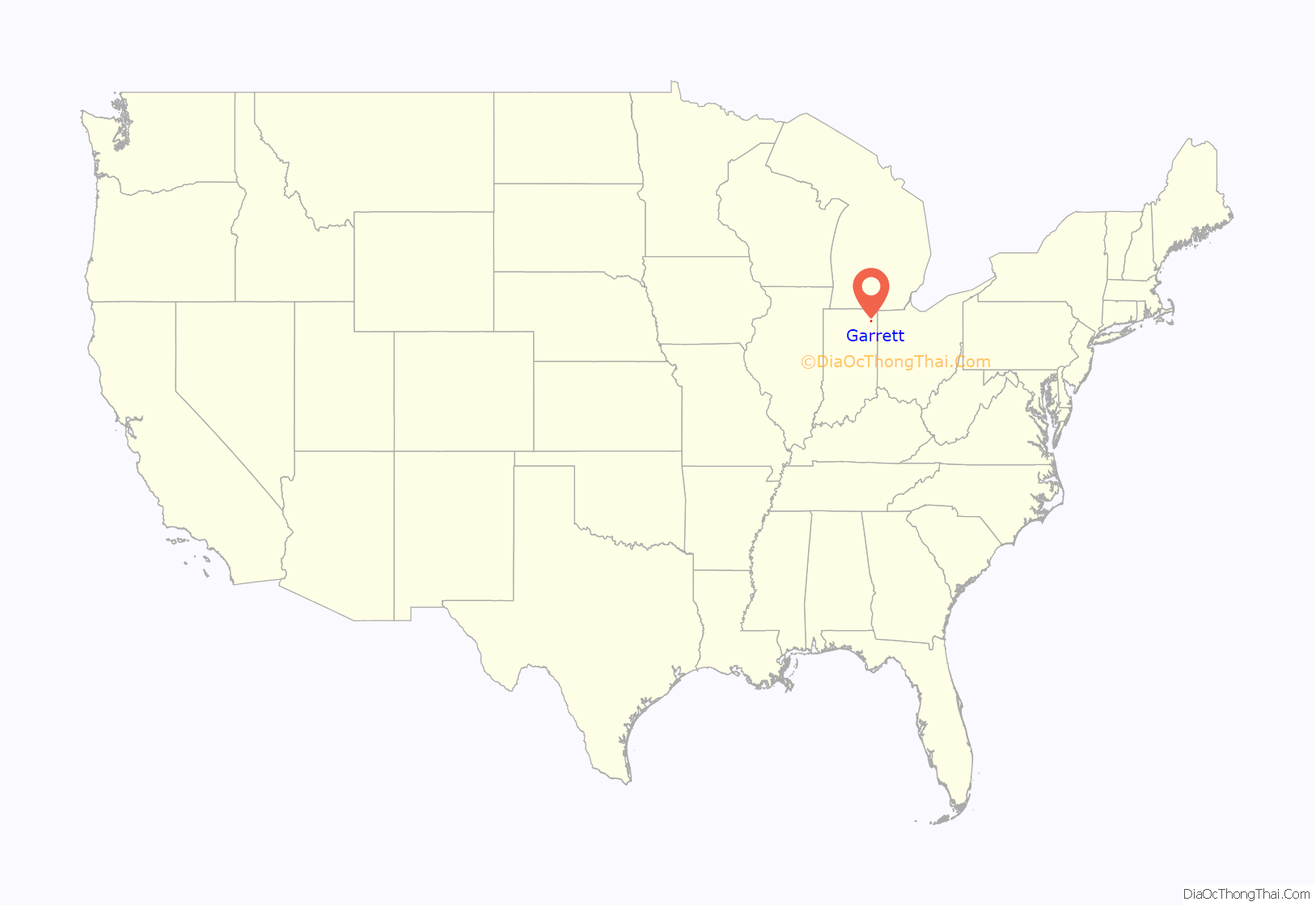
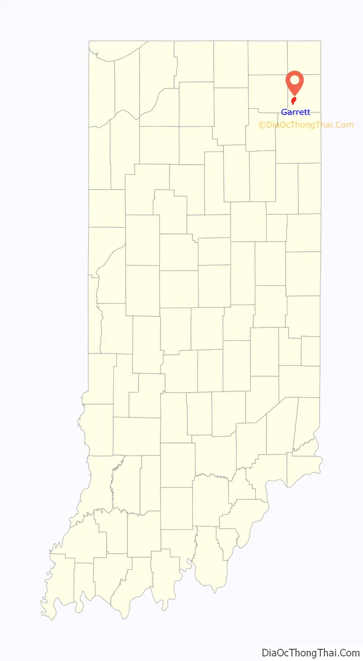
Garrett location map. Where is Garrett city?
History
Garrett was platted in 1875 when the Baltimore and Ohio Railroad was extended to that point. It was named for John W. Garrett (1820–1884), president of the Baltimore and Ohio Railroad from 1858 to 1884. Garrett was incorporated as a city in 1875.
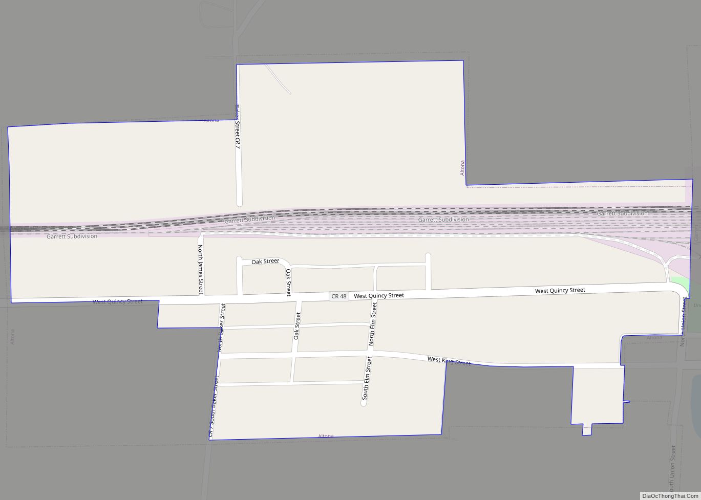
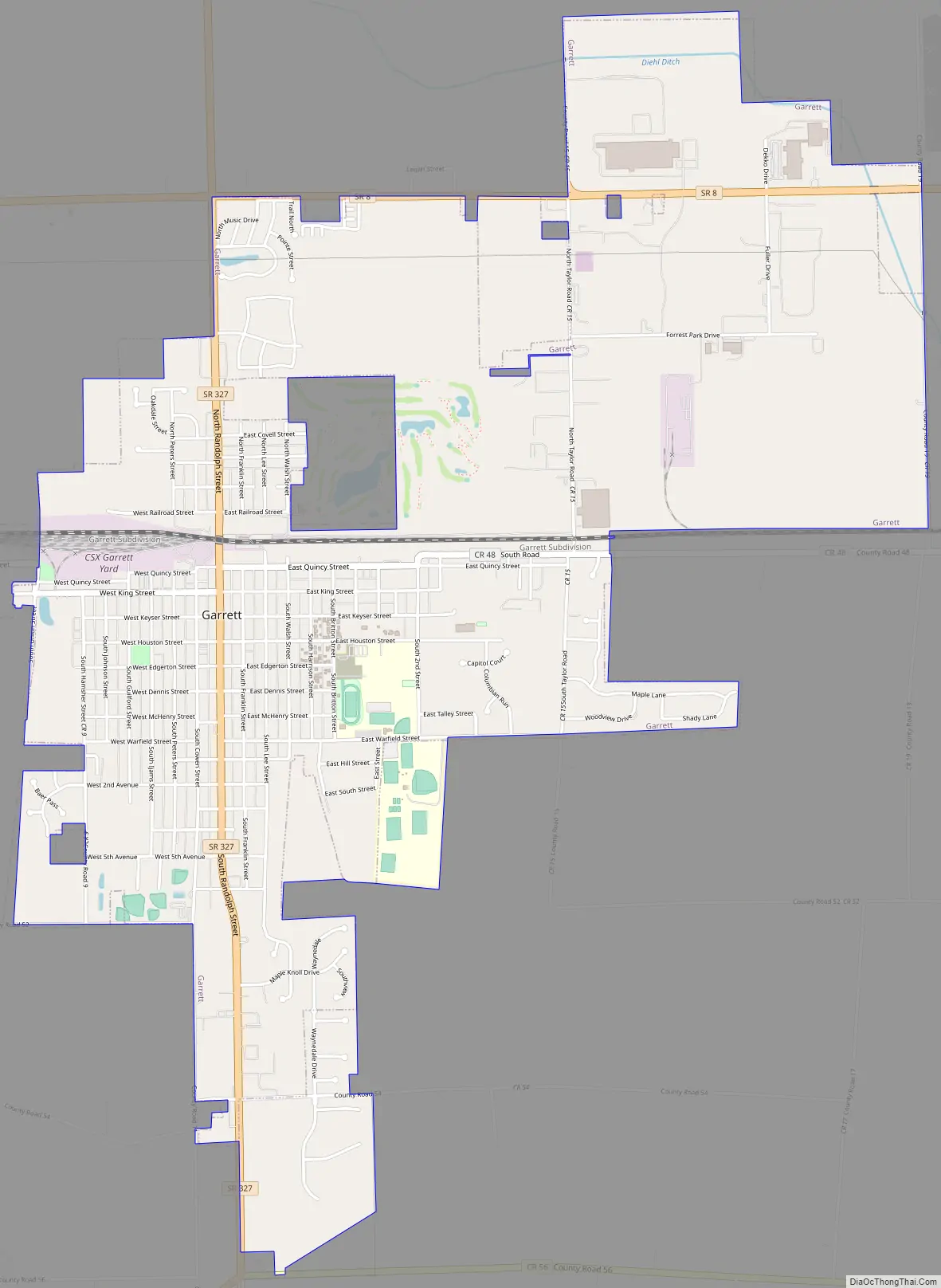
Garrett Road Map
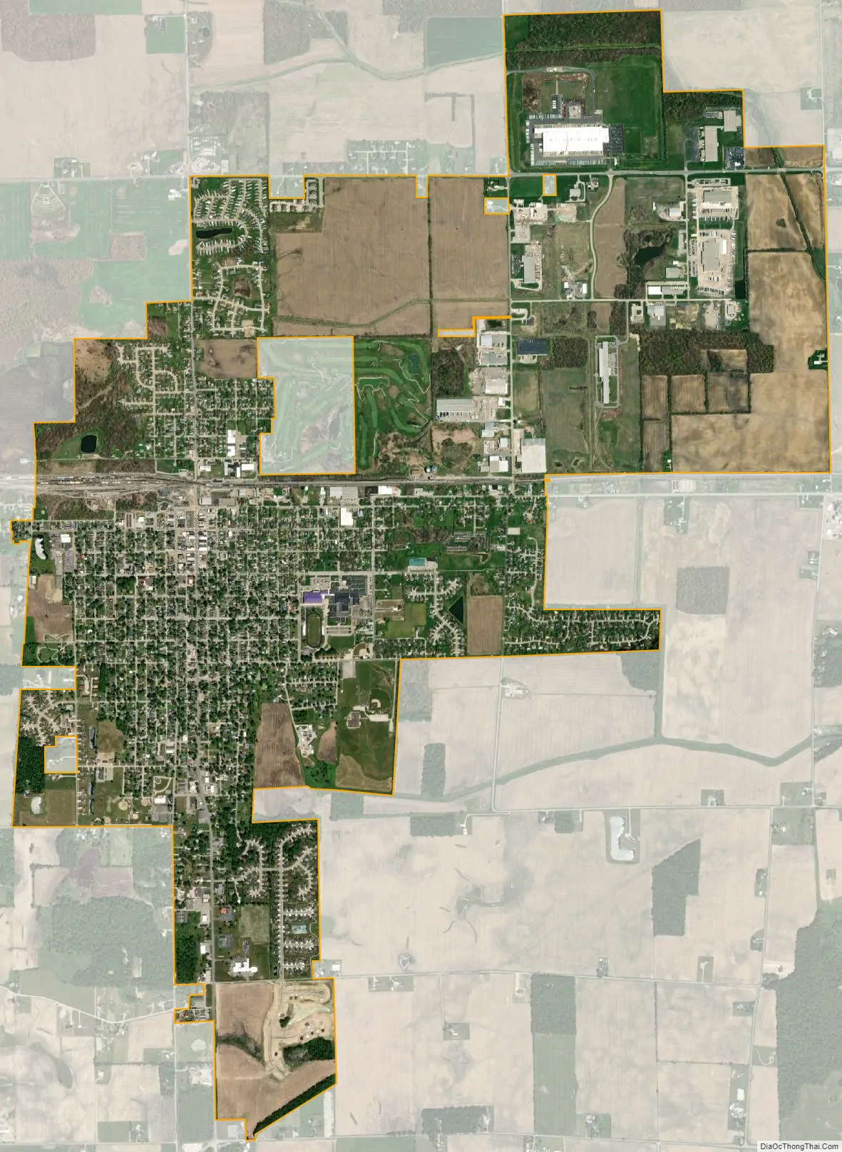
Garrett city Satellite Map
Geography
Garrett is located at 41°20′52″N 85°8′1″W / 41.34778°N 85.13361°W / 41.34778; -85.13361 (41.347903, -85.133700).
According to the 2010 census, Garrett has a total area of 3.85 square miles (9.97 km), all land.
Garrett sits just west of Auburn, a larger town and county seat of DeKalb County. Both Garrett and Auburn are about 15 miles north of Fort Wayne.
See also
Map of Indiana State and its subdivision:- Adams
- Allen
- Bartholomew
- Benton
- Blackford
- Boone
- Brown
- Carroll
- Cass
- Clark
- Clay
- Clinton
- Crawford
- Daviess
- De Kalb
- Dearborn
- Decatur
- Delaware
- Dubois
- Elkhart
- Fayette
- Floyd
- Fountain
- Franklin
- Fulton
- Gibson
- Grant
- Greene
- Hamilton
- Hancock
- Harrison
- Hendricks
- Henry
- Howard
- Huntington
- Jackson
- Jasper
- Jay
- Jefferson
- Jennings
- Johnson
- Knox
- Kosciusko
- LaGrange
- Lake
- Lake Michigan
- LaPorte
- Lawrence
- Madison
- Marion
- Marshall
- Martin
- Miami
- Monroe
- Montgomery
- Morgan
- Newton
- Noble
- Ohio
- Orange
- Owen
- Parke
- Perry
- Pike
- Porter
- Posey
- Pulaski
- Putnam
- Randolph
- Ripley
- Rush
- Saint Joseph
- Scott
- Shelby
- Spencer
- Starke
- Steuben
- Sullivan
- Switzerland
- Tippecanoe
- Tipton
- Union
- Vanderburgh
- Vermillion
- Vigo
- Wabash
- Warren
- Warrick
- Washington
- Wayne
- Wells
- White
- Whitley
- Alabama
- Alaska
- Arizona
- Arkansas
- California
- Colorado
- Connecticut
- Delaware
- District of Columbia
- Florida
- Georgia
- Hawaii
- Idaho
- Illinois
- Indiana
- Iowa
- Kansas
- Kentucky
- Louisiana
- Maine
- Maryland
- Massachusetts
- Michigan
- Minnesota
- Mississippi
- Missouri
- Montana
- Nebraska
- Nevada
- New Hampshire
- New Jersey
- New Mexico
- New York
- North Carolina
- North Dakota
- Ohio
- Oklahoma
- Oregon
- Pennsylvania
- Rhode Island
- South Carolina
- South Dakota
- Tennessee
- Texas
- Utah
- Vermont
- Virginia
- Washington
- West Virginia
- Wisconsin
- Wyoming