Metamora is an unincorporated town and census-designated place in Metamora Township, Franklin County, Indiana. The town was once a stop along the Whitewater Canal and is now primarily dependent on tourism. As of the 2010 census, it had a population of 188.
| Name: | Metamora CDP |
|---|---|
| LSAD Code: | 57 |
| LSAD Description: | CDP (suffix) |
| State: | Indiana |
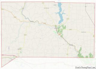
| County: | Franklin County |
| Elevation: | 718 ft (219 m) |
| Total Area: | 0.34 sq mi (0.87 km²) |
| Land Area: | 0.34 sq mi (0.87 km²) |
| Water Area: | 0.00 sq mi (0.00 km²) |
| Total Population: | 207 |
| Population Density: | 616.07/sq mi (238.01/km²) |
| ZIP code: | 47030 |
| FIPS code: | 1848563 |
| GNISfeature ID: | 439045 |
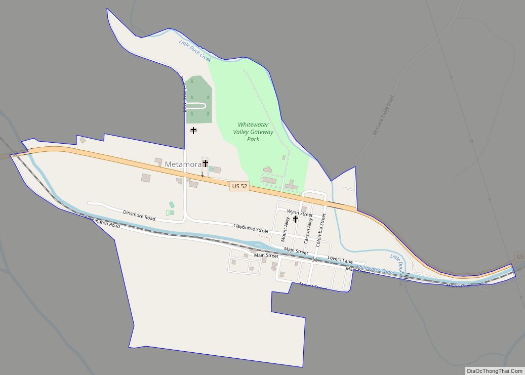
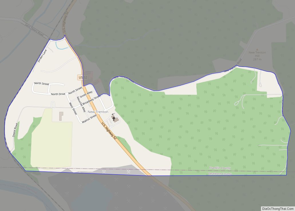
Online Interactive Map
Click on ![]() to view map in "full screen" mode.
to view map in "full screen" mode.
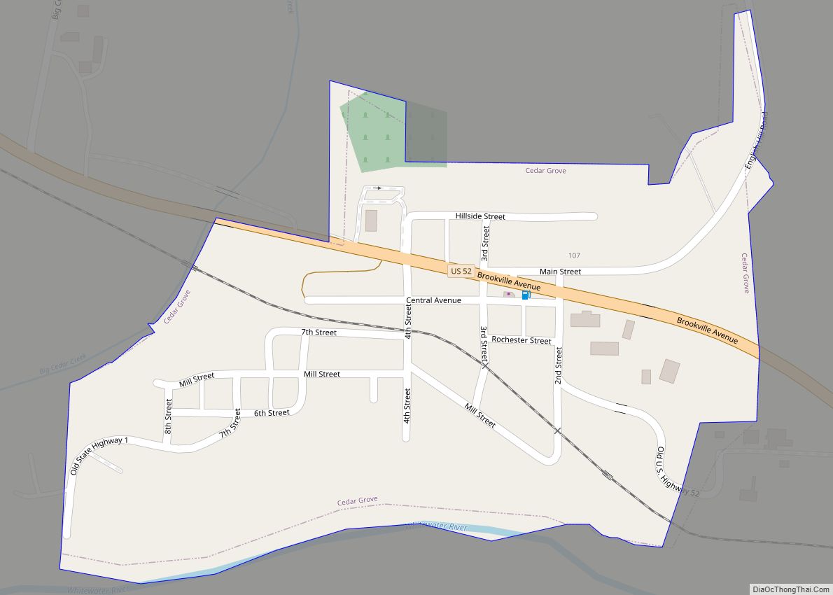
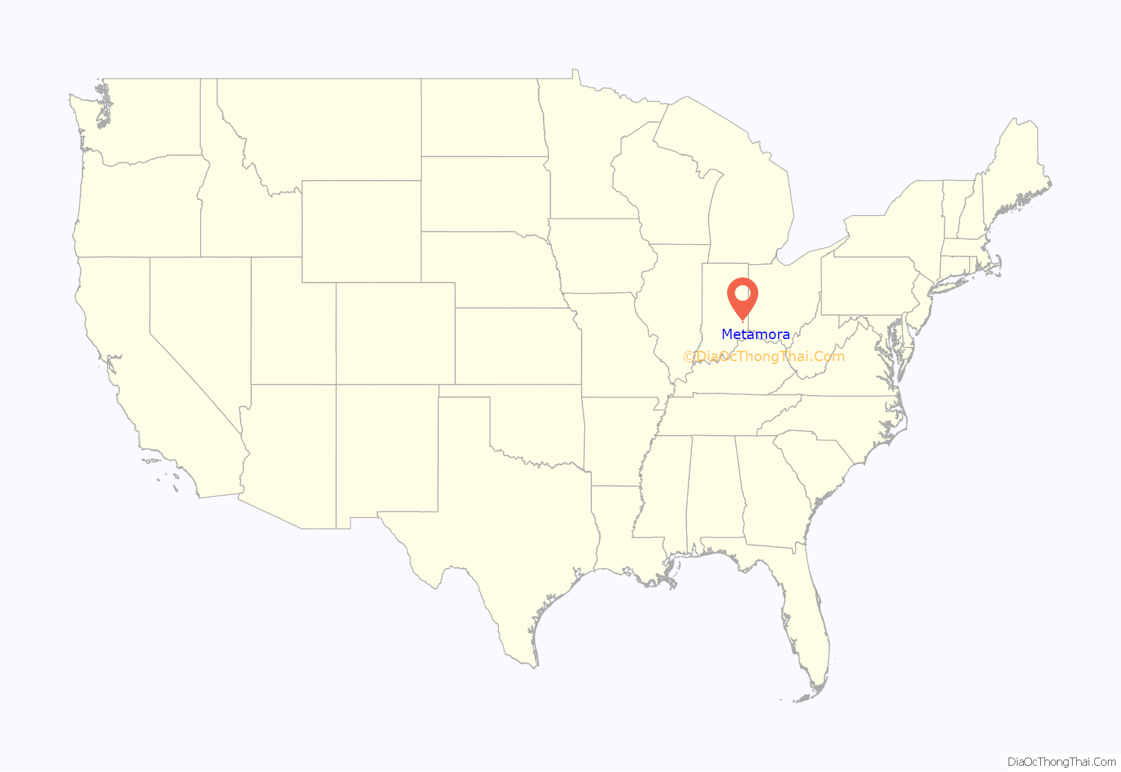
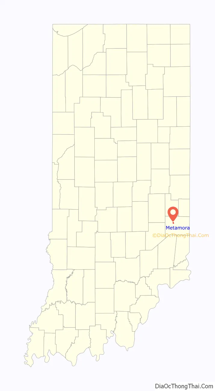
Metamora location map. Where is Metamora CDP?
History
Metamora was platted in 1838. The community derives its name from the play Metamora; or, The Last of the Wampanoags by John Augustus Stone.
The Whitewater Canal only carried boats from 1839 to 1865, but the canal was maintained to supply hydraulic power until 1936. The canal was the center of industrial districts in Metamora and Brookville, 8 miles (13 km) to the east. At one time there were water-powered mills for processing cotton, grinding flour and making paper. Metamora is the location of Indiana’s oldest and still operating grist mill. Metamora is also home to the only existing wooden aqueduct in the United States (the Duck Creek Aqueduct), with a historical review of the canal history which fueled the southeastern Indiana economy until its displacement by the railroad. The canal is named after the nearby Whitewater River.
The Metamora Historic District and Whitewater Canal Historic District are listed on the National Register of Historic Places.
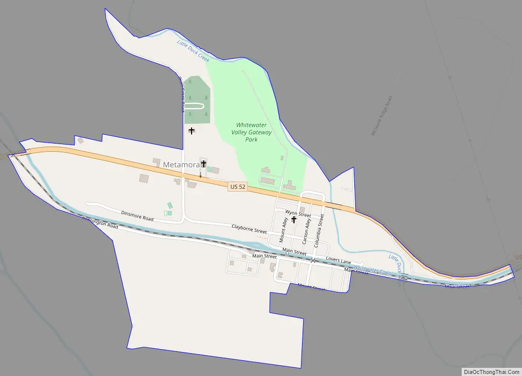
Metamora Road Map
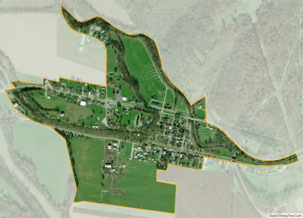
Metamora city Satellite Map
Geography
Metamora is located at 39°26′59″N 85°08′22″W / 39.44972°N 85.13944°W / 39.44972; -85.13944, in the valley of the Whitewater River in southeastern Indiana. It is situated on U.S. Route 52, 37 miles (60 km) northwest of Cincinnati, Ohio, and 59 miles (95 km) southeast of Indianapolis.
According to the U.S. Census Bureau, the CDP has a total area of 0.35 square miles (0.9 km), all land.
See also
Map of Indiana State and its subdivision:- Adams
- Allen
- Bartholomew
- Benton
- Blackford
- Boone
- Brown
- Carroll
- Cass
- Clark
- Clay
- Clinton
- Crawford
- Daviess
- De Kalb
- Dearborn
- Decatur
- Delaware
- Dubois
- Elkhart
- Fayette
- Floyd
- Fountain
- Franklin
- Fulton
- Gibson
- Grant
- Greene
- Hamilton
- Hancock
- Harrison
- Hendricks
- Henry
- Howard
- Huntington
- Jackson
- Jasper
- Jay
- Jefferson
- Jennings
- Johnson
- Knox
- Kosciusko
- LaGrange
- Lake
- Lake Michigan
- LaPorte
- Lawrence
- Madison
- Marion
- Marshall
- Martin
- Miami
- Monroe
- Montgomery
- Morgan
- Newton
- Noble
- Ohio
- Orange
- Owen
- Parke
- Perry
- Pike
- Porter
- Posey
- Pulaski
- Putnam
- Randolph
- Ripley
- Rush
- Saint Joseph
- Scott
- Shelby
- Spencer
- Starke
- Steuben
- Sullivan
- Switzerland
- Tippecanoe
- Tipton
- Union
- Vanderburgh
- Vermillion
- Vigo
- Wabash
- Warren
- Warrick
- Washington
- Wayne
- Wells
- White
- Whitley
- Alabama
- Alaska
- Arizona
- Arkansas
- California
- Colorado
- Connecticut
- Delaware
- District of Columbia
- Florida
- Georgia
- Hawaii
- Idaho
- Illinois
- Indiana
- Iowa
- Kansas
- Kentucky
- Louisiana
- Maine
- Maryland
- Massachusetts
- Michigan
- Minnesota
- Mississippi
- Missouri
- Montana
- Nebraska
- Nevada
- New Hampshire
- New Jersey
- New Mexico
- New York
- North Carolina
- North Dakota
- Ohio
- Oklahoma
- Oregon
- Pennsylvania
- Rhode Island
- South Carolina
- South Dakota
- Tennessee
- Texas
- Utah
- Vermont
- Virginia
- Washington
- West Virginia
- Wisconsin
- Wyoming