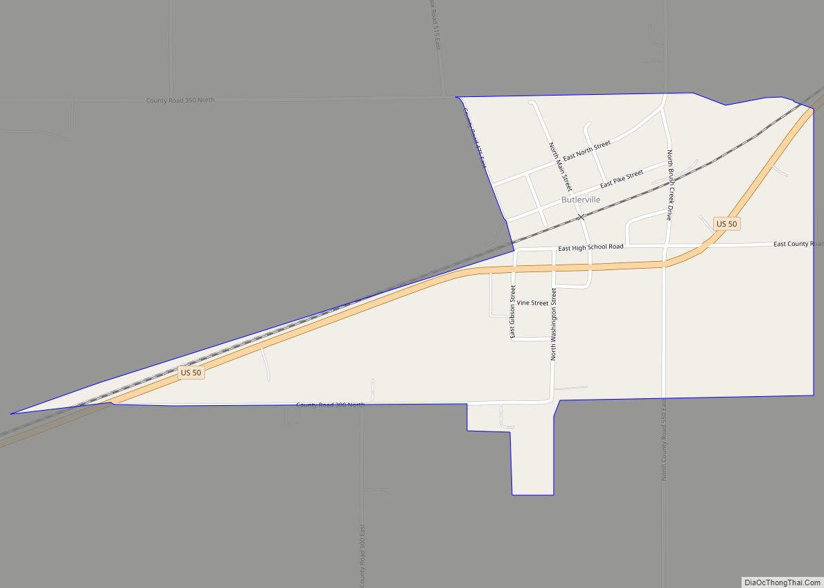
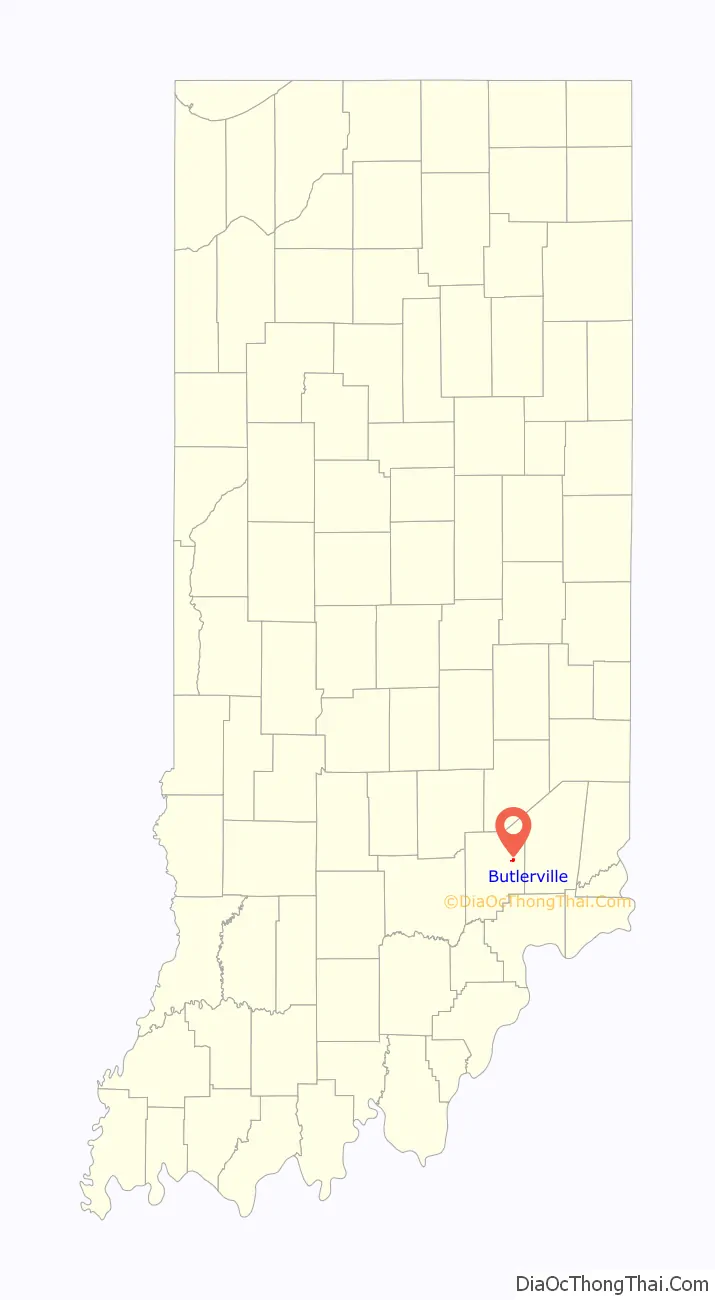
Butlerville is an unincorporated community and census-designated place (CDP) in central Campbell Township, Jennings County, Indiana, United States. As of the 2010 census it had a population of 282.
| Name: | Butlerville CDP |
|---|---|
| LSAD Code: | 57 |
| LSAD Description: | CDP (suffix) |
| State: | Indiana |
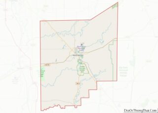
| County: | Jennings County |
| Elevation: | 807 ft (246 m) |
| Total Area: | 0.37 sq mi (0.97 km²) |
| Land Area: | 0.37 sq mi (0.97 km²) |
| Water Area: | 0.00 sq mi (0.00 km²) |
| Total Population: | 300 |
| Population Density: | 804.29/sq mi (310.76/km²) |
| ZIP code: | 47223 |
| FIPS code: | 1809622 |
| GNISfeature ID: | 431906 |
Online Interactive Map
Click on ![]() to view map in "full screen" mode.
to view map in "full screen" mode.
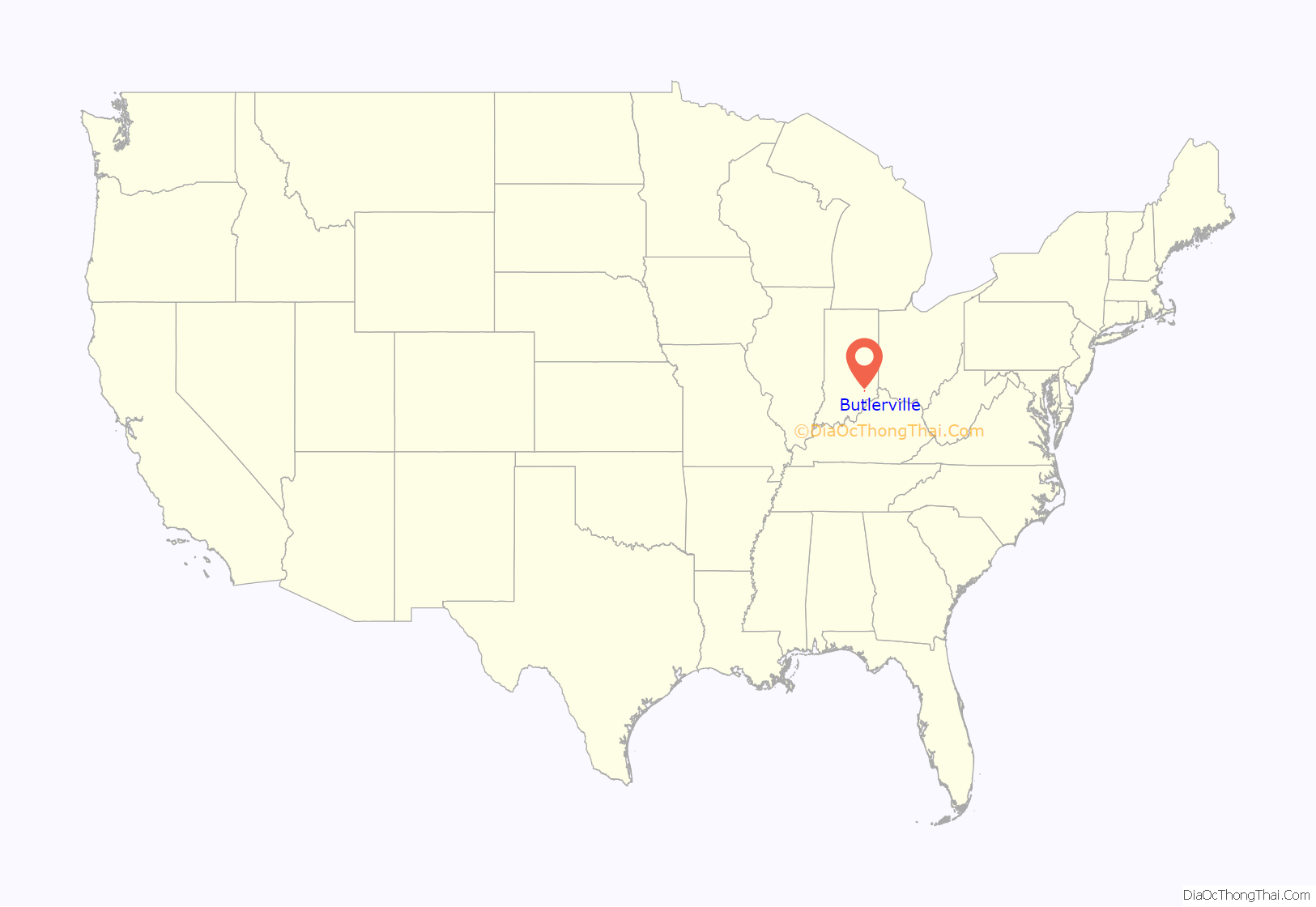
Butlerville location map. Where is Butlerville CDP?
History
The Butlerville post office was established in 1851. An early settler being a former resident of Butlerville, Ohio, caused the name to be selected. Butlerville was legally platted in 1853.
Hannah Milhous Nixon, mother of President Richard Nixon, was born near Butlerville.
The community was home to Butlerville High School, home of the Bulldogs; which graduated classes from ~1910 thru 1950. Today, the community is serviced by Jennings County High School.
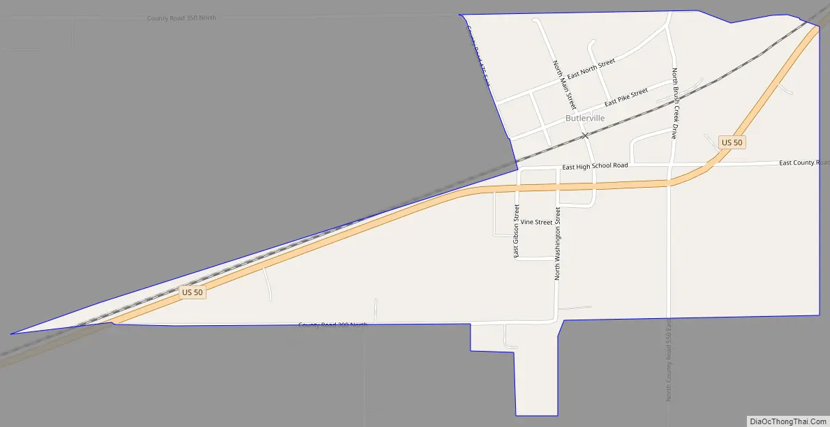
Butlerville Road Map
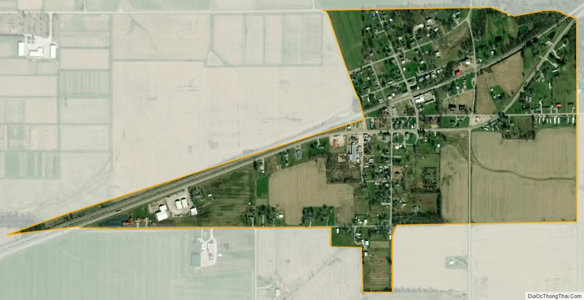
Butlerville city Satellite Map
Geography
Butlerville lies along U.S. Route 50, 7 miles (11 km) east-northeast of the town of Vernon, the county seat of Jennings County.
Its elevation is 807 feet (246 m), and it is located at 39°2′4″N 85°30′46″W / 39.03444°N 85.51278°W / 39.03444; -85.51278 (39.0344983, -85.5127432). Although Butlerville is unincorporated, it has a post office, with the ZIP code of 47223.
The community is bordered to the west by Southeast Purdue Agricultural Center.
See also
Map of Indiana State and its subdivision:- Adams
- Allen
- Bartholomew
- Benton
- Blackford
- Boone
- Brown
- Carroll
- Cass
- Clark
- Clay
- Clinton
- Crawford
- Daviess
- De Kalb
- Dearborn
- Decatur
- Delaware
- Dubois
- Elkhart
- Fayette
- Floyd
- Fountain
- Franklin
- Fulton
- Gibson
- Grant
- Greene
- Hamilton
- Hancock
- Harrison
- Hendricks
- Henry
- Howard
- Huntington
- Jackson
- Jasper
- Jay
- Jefferson
- Jennings
- Johnson
- Knox
- Kosciusko
- LaGrange
- Lake
- Lake Michigan
- LaPorte
- Lawrence
- Madison
- Marion
- Marshall
- Martin
- Miami
- Monroe
- Montgomery
- Morgan
- Newton
- Noble
- Ohio
- Orange
- Owen
- Parke
- Perry
- Pike
- Porter
- Posey
- Pulaski
- Putnam
- Randolph
- Ripley
- Rush
- Saint Joseph
- Scott
- Shelby
- Spencer
- Starke
- Steuben
- Sullivan
- Switzerland
- Tippecanoe
- Tipton
- Union
- Vanderburgh
- Vermillion
- Vigo
- Wabash
- Warren
- Warrick
- Washington
- Wayne
- Wells
- White
- Whitley
- Alabama
- Alaska
- Arizona
- Arkansas
- California
- Colorado
- Connecticut
- Delaware
- District of Columbia
- Florida
- Georgia
- Hawaii
- Idaho
- Illinois
- Indiana
- Iowa
- Kansas
- Kentucky
- Louisiana
- Maine
- Maryland
- Massachusetts
- Michigan
- Minnesota
- Mississippi
- Missouri
- Montana
- Nebraska
- Nevada
- New Hampshire
- New Jersey
- New Mexico
- New York
- North Carolina
- North Dakota
- Ohio
- Oklahoma
- Oregon
- Pennsylvania
- Rhode Island
- South Carolina
- South Dakota
- Tennessee
- Texas
- Utah
- Vermont
- Virginia
- Washington
- West Virginia
- Wisconsin
- Wyoming