Charlestown is a city located within Charlestown Township, in Clark County, Indiana, United States. The population was 7,775 at the 2020 census.
| Name: | Charlestown city |
|---|---|
| LSAD Code: | 25 |
| LSAD Description: | city (suffix) |
| State: | Indiana |
| County: | Clark County |
| Elevation: | 591 ft (180 m) |
| Total Area: | 11.49 sq mi (29.75 km²) |
| Land Area: | 11.45 sq mi (29.65 km²) |
| Water Area: | 0.04 sq mi (0.10 km²) |
| Total Population: | 7,775 |
| Population Density: | 679.16/sq mi (262.24/km²) |
| ZIP code: | 47111 |
| Area code: | 812 & 930 |
| FIPS code: | 1812124 |
| GNISfeature ID: | 0432425 |
| Website: | http://www.cityofcharlestown.com |
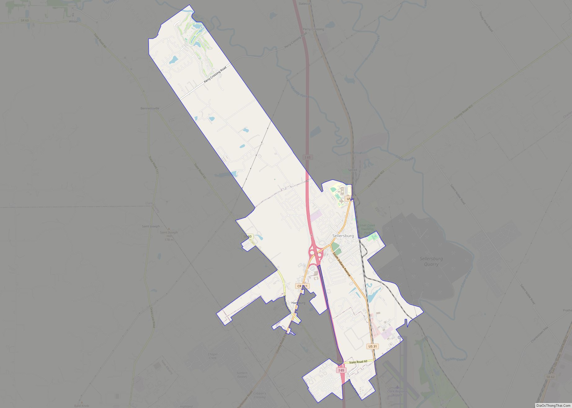
Online Interactive Map
Click on ![]() to view map in "full screen" mode.
to view map in "full screen" mode.
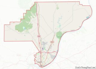
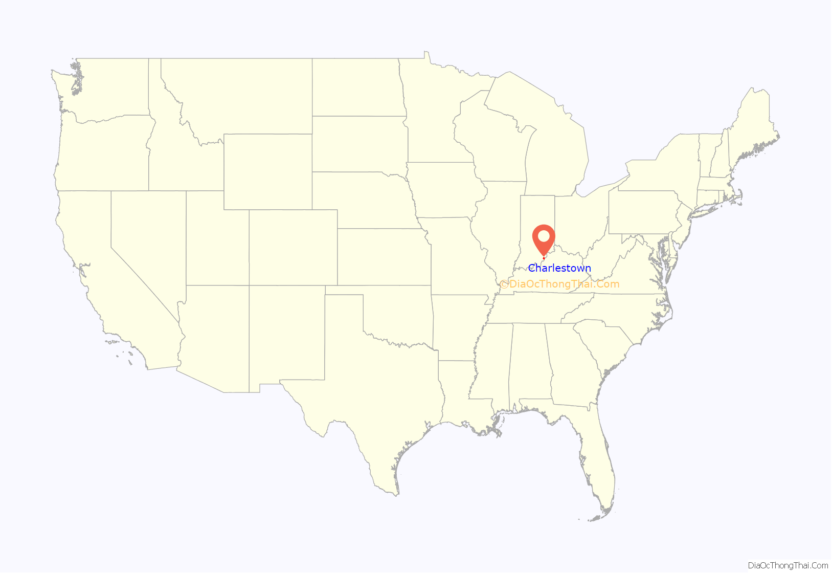
Charlestown location map. Where is Charlestown city?
History
Charlestown was established in 1808, named after one of its surveyors, Charles Beggs, upon 300 acres (1.2 km), of which 3 acres (12,000 m) was designated for a town square. It was established one mile (1.6 km) northeast of Springville, and was responsible for Springville’s demise.
Milling was important to the town, as the first mill was built in the area, on Fourteen Mile Creek, in 1804. This mill would be abandoned when John Work built a mill by use of a tunnel in 1814. Today, that mill is part of the Tunnel Mill Scout Reservation.
From 1811 to 1878 Charlestown was the county seat of Clark County, but as Jeffersonville had surpassed it economically, the county seat reverted to Jeffersonville in 1878.
In 1818 the first Grand Lodge of Free & Accepted Masons in Indiana met in Charlestown, due to Jonathan Jennings’ influence.
In 1940 the population of Charlestown was 900, but it swelled to 13,400 due to the building and operation of the Indiana Army Ammunition Plant (INAAP). This created a housing problem, as chicken, wood, and wash houses had to house all the new residents who flocked to the area for the jobs created by the INAAP. Additional problems caused by the rapid influx of new residents were improper sanitation at restaurants, inefficient sewers, gambling, panhandling, and diseases such as typhoid and malaria.
In 2014 the city announced they would be applying for a grant to redevelop Pleasant Ridge Subdivision, an impoverished area within the city. Some residents of the Pleasant Ridge Subdivision formed an association to fight against demolishing their homes via eminent domain. The City Council did not call for a vote on the issue and the grant issue failed. Starting in 2016 the city was accused of using excessive fines against homeowners in the subdivision in order to force them to sell to a private developer.
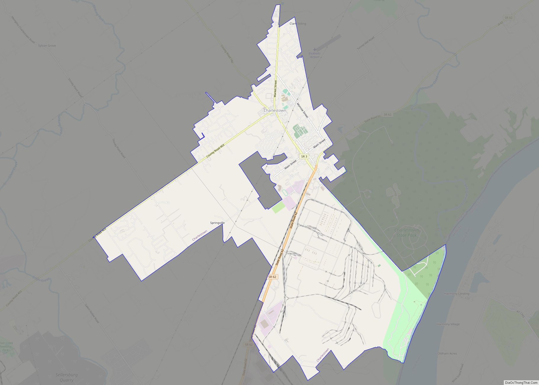
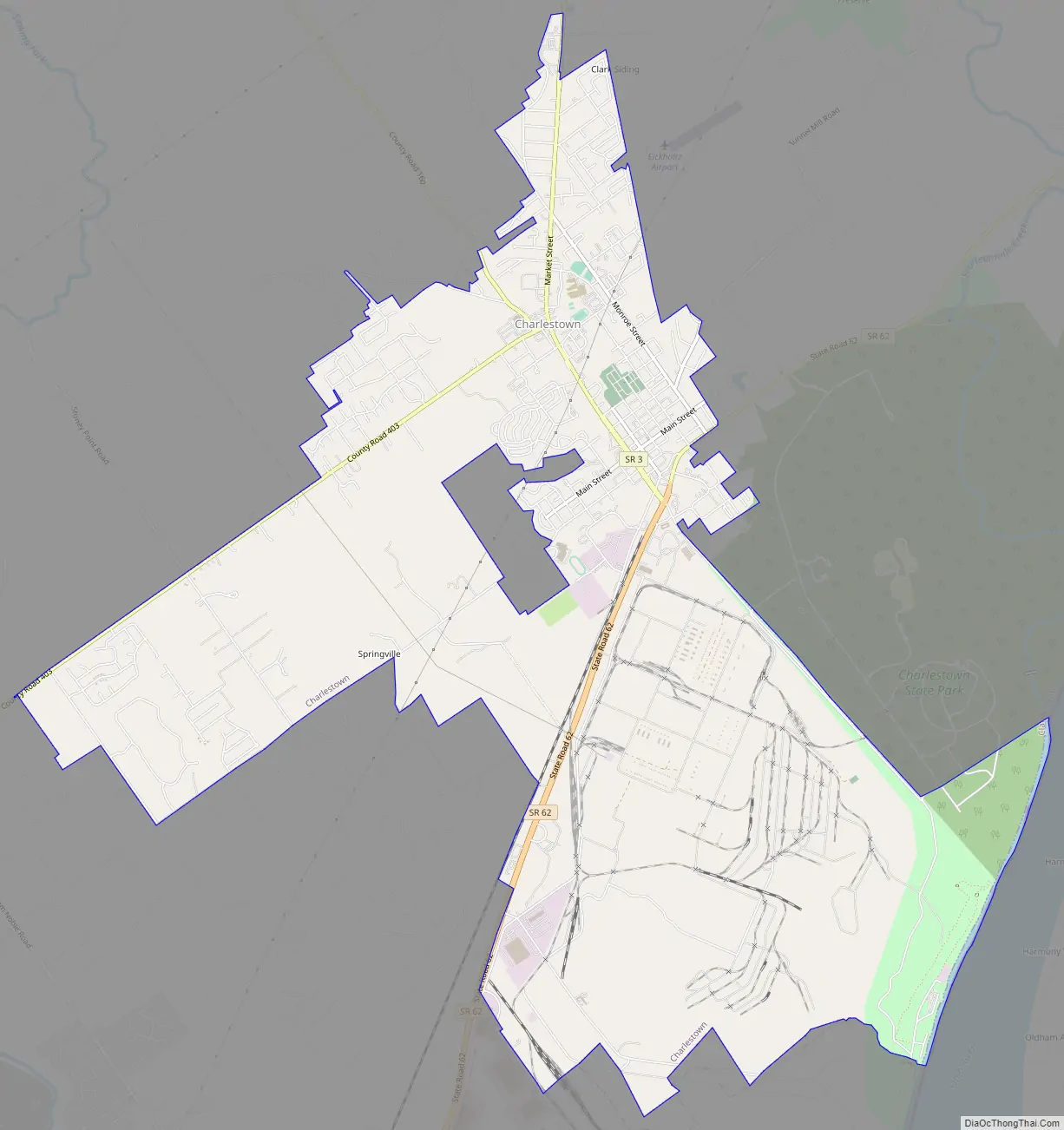
Charlestown Road Map
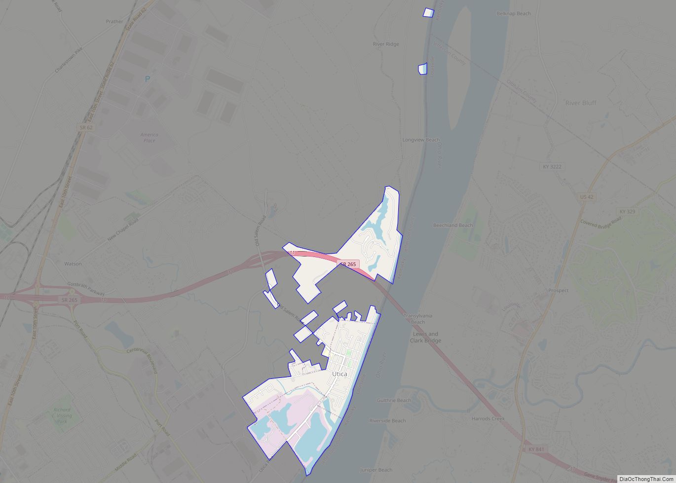
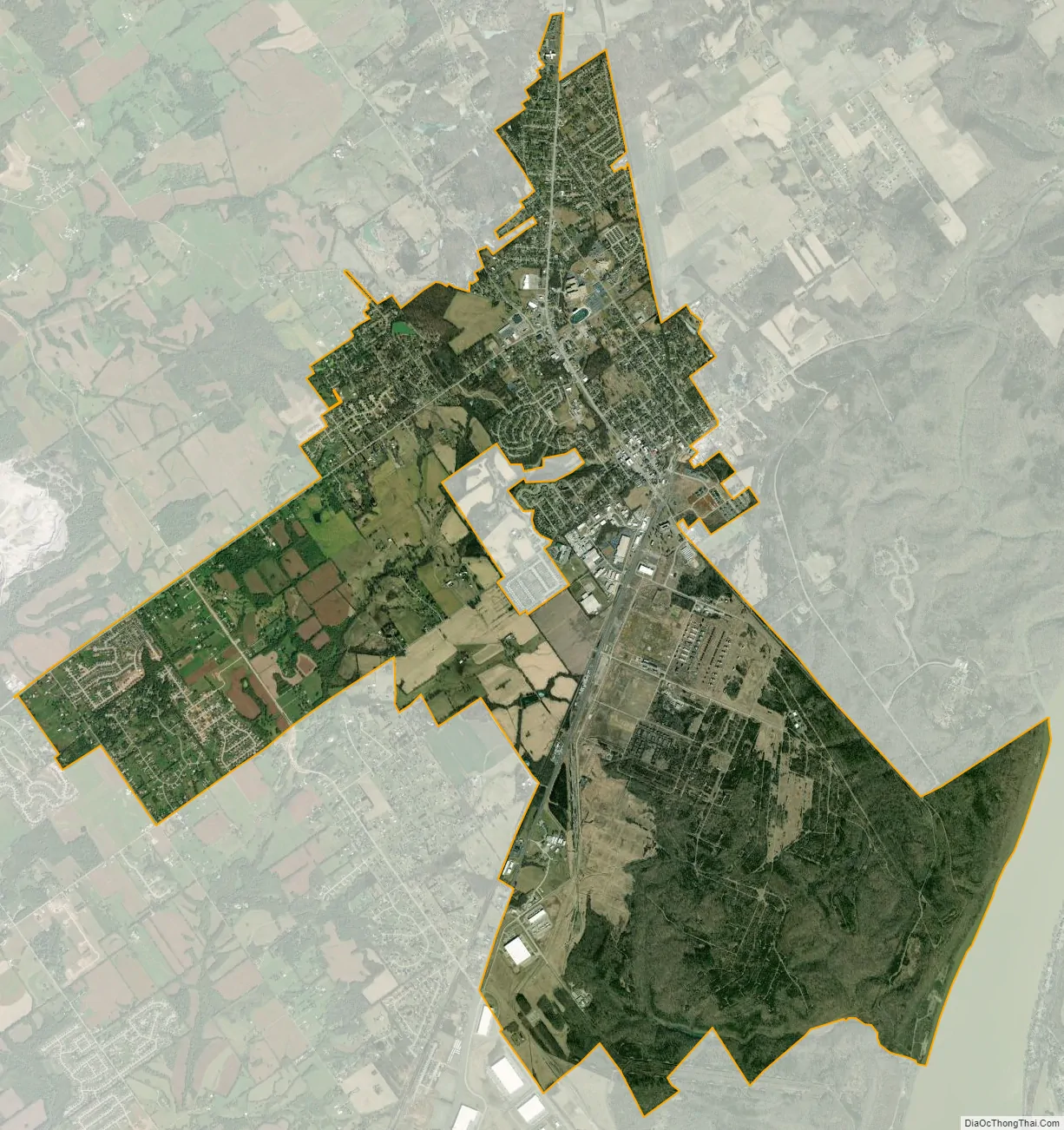
Charlestown city Satellite Map
Geography
Charlestown is located at 38°27′7″N 85°40′2″W / 38.45194°N 85.66722°W / 38.45194; -85.66722 (38.451984, -85.667224).
According to the 2010 census, Charlestown has a total area of 11.489 square miles (29.76 km), of which 11.45 square miles (29.66 km) (or 99.66%) is land and 0.039 square miles (0.10 km) (or 0.34%) is water.
See also
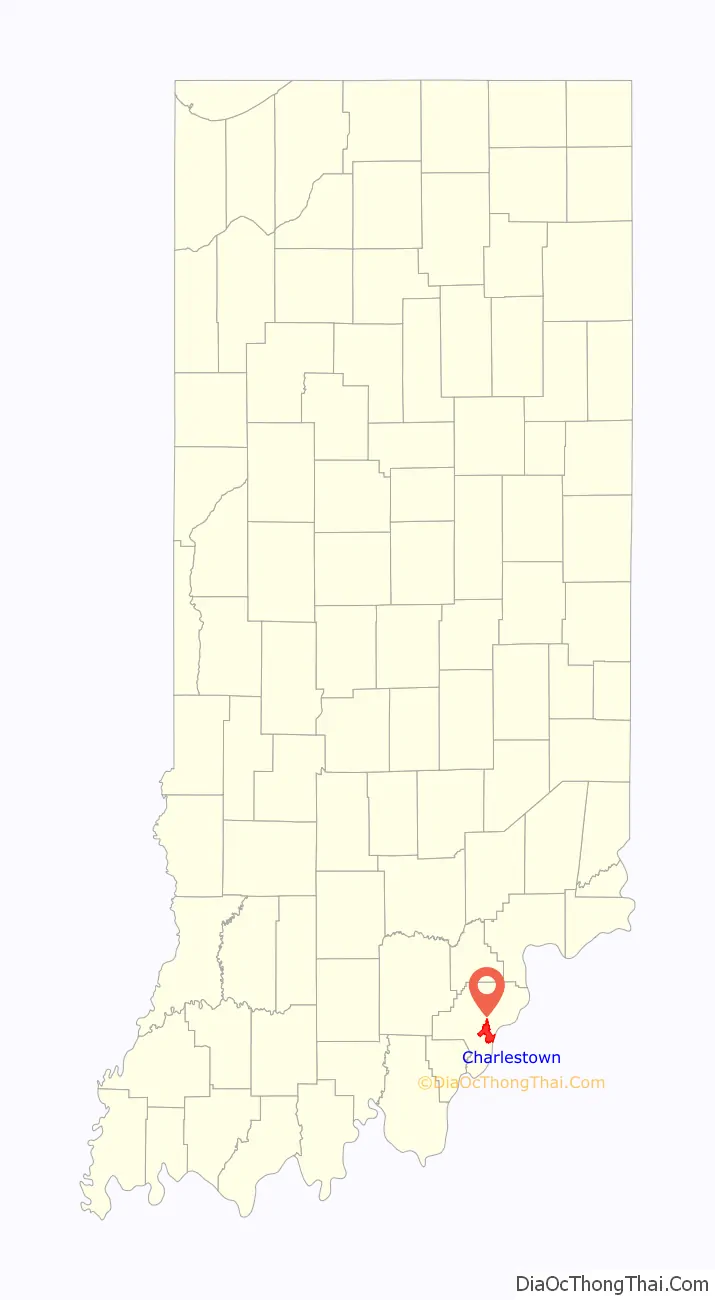
Map of Indiana State and its subdivision:- Adams
- Allen
- Bartholomew
- Benton
- Blackford
- Boone
- Brown
- Carroll
- Cass
- Clark
- Clay
- Clinton
- Crawford
- Daviess
- De Kalb
- Dearborn
- Decatur
- Delaware
- Dubois
- Elkhart
- Fayette
- Floyd
- Fountain
- Franklin
- Fulton
- Gibson
- Grant
- Greene
- Hamilton
- Hancock
- Harrison
- Hendricks
- Henry
- Howard
- Huntington
- Jackson
- Jasper
- Jay
- Jefferson
- Jennings
- Johnson
- Knox
- Kosciusko
- LaGrange
- Lake
- Lake Michigan
- LaPorte
- Lawrence
- Madison
- Marion
- Marshall
- Martin
- Miami
- Monroe
- Montgomery
- Morgan
- Newton
- Noble
- Ohio
- Orange
- Owen
- Parke
- Perry
- Pike
- Porter
- Posey
- Pulaski
- Putnam
- Randolph
- Ripley
- Rush
- Saint Joseph
- Scott
- Shelby
- Spencer
- Starke
- Steuben
- Sullivan
- Switzerland
- Tippecanoe
- Tipton
- Union
- Vanderburgh
- Vermillion
- Vigo
- Wabash
- Warren
- Warrick
- Washington
- Wayne
- Wells
- White
- Whitley
- Alabama
- Alaska
- Arizona
- Arkansas
- California
- Colorado
- Connecticut
- Delaware
- District of Columbia
- Florida
- Georgia
- Hawaii
- Idaho
- Illinois
- Indiana
- Iowa
- Kansas
- Kentucky
- Louisiana
- Maine
- Maryland
- Massachusetts
- Michigan
- Minnesota
- Mississippi
- Missouri
- Montana
- Nebraska
- Nevada
- New Hampshire
- New Jersey
- New Mexico
- New York
- North Carolina
- North Dakota
- Ohio
- Oklahoma
- Oregon
- Pennsylvania
- Rhode Island
- South Carolina
- South Dakota
- Tennessee
- Texas
- Utah
- Vermont
- Virginia
- Washington
- West Virginia
- Wisconsin
- Wyoming