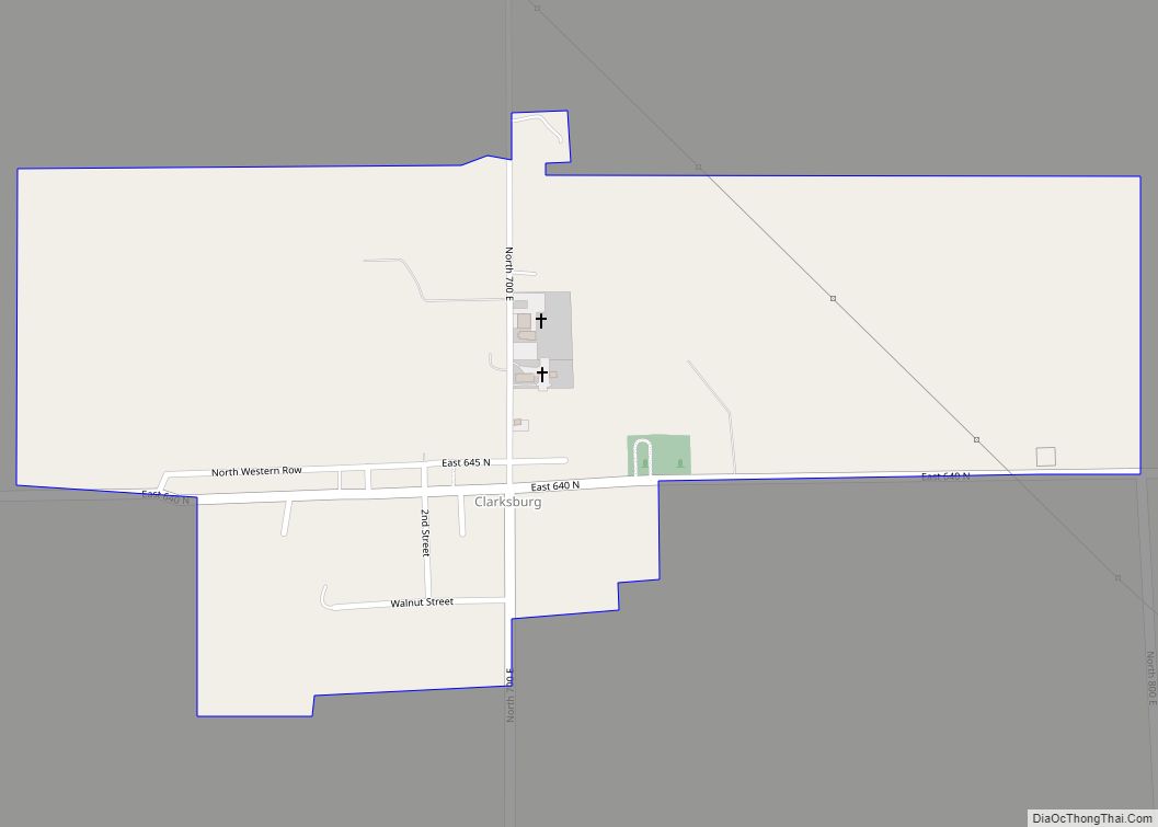
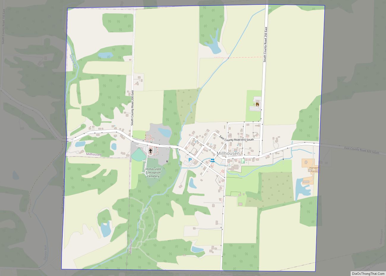
Millhousen is a town in Marion Township, Decatur County, Indiana, United States. The population was 149 at the 2020 census. Millhousen is perhaps best known for being the home of the Immaculate Conception Church, one of only four Roman Catholic churches in Decatur County, and Stone’s Family Restaurant, one of the best known restaurants in Decatur County.
| Name: | Millhousen town |
|---|---|
| LSAD Code: | 43 |
| LSAD Description: | town (suffix) |
| State: | Indiana |
| County: | Decatur County |
| Elevation: | 896 ft (273 m) |
| Total Area: | 1.01 sq mi (2.62 km²) |
| Land Area: | 1.01 sq mi (2.62 km²) |
| Water Area: | 0.00 sq mi (0.00 km²) |
| Total Population: | 149 |
| Population Density: | 147.52/sq mi (56.97/km²) |
| ZIP code: | 47261 |
| Area code: | 812 |
| FIPS code: | 1849662 |
| GNISfeature ID: | 0439237 |
| Website: | millhousen.com |
Online Interactive Map
Click on ![]() to view map in "full screen" mode.
to view map in "full screen" mode.
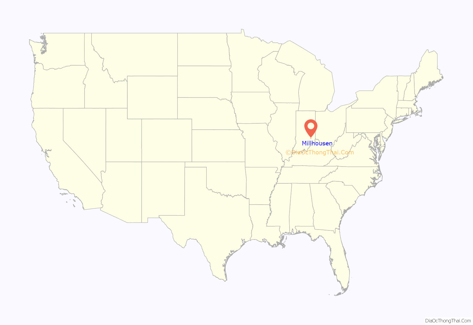
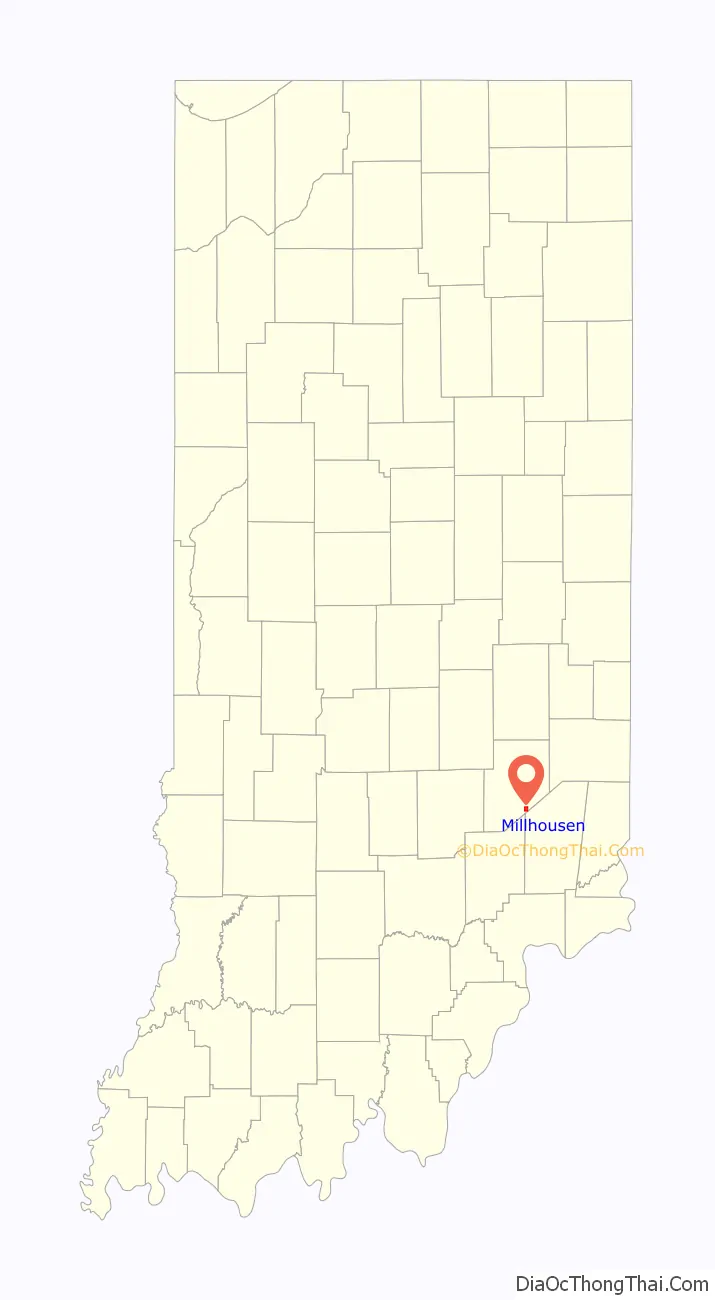
Millhousen location map. Where is Millhousen town?
History
Millhousen was platted in 1858, having been settled by a colony of German Catholics. It was named for a town of the same name in Germany.
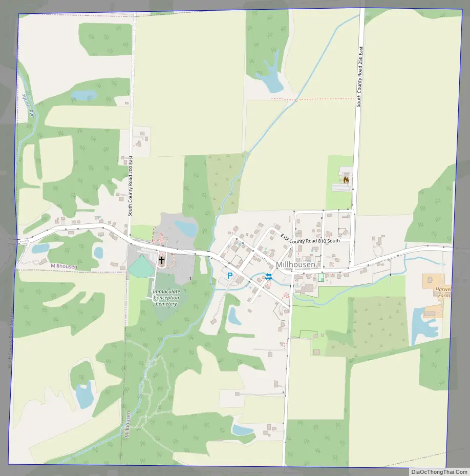
Millhousen Road Map
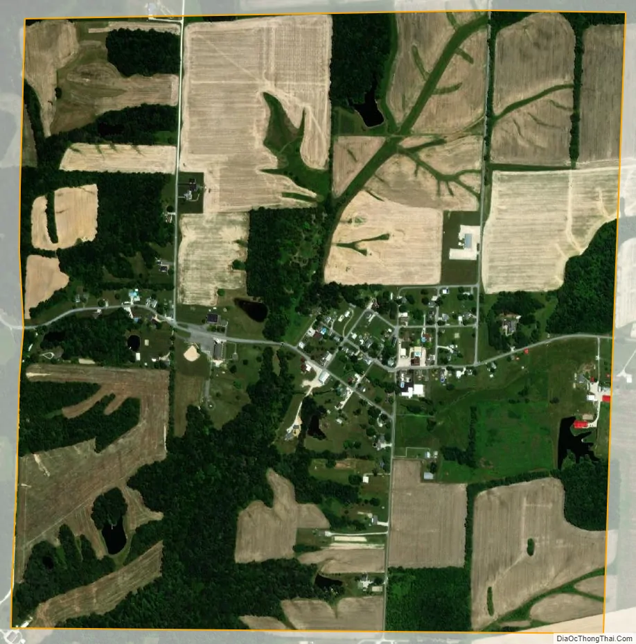
Millhousen city Satellite Map
Geography
Millhousen is located at 39°12′39″N 85°26′1″W / 39.21083°N 85.43361°W / 39.21083; -85.43361 (39.210931, -85.433678).
According to the 2010 census, Millhousen has a total area of 1.01 square miles (2.62 km), all land.
See also
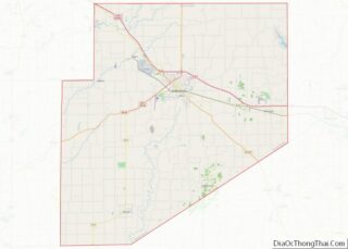
Map of Indiana State and its subdivision:- Adams
- Allen
- Bartholomew
- Benton
- Blackford
- Boone
- Brown
- Carroll
- Cass
- Clark
- Clay
- Clinton
- Crawford
- Daviess
- De Kalb
- Dearborn
- Decatur
- Delaware
- Dubois
- Elkhart
- Fayette
- Floyd
- Fountain
- Franklin
- Fulton
- Gibson
- Grant
- Greene
- Hamilton
- Hancock
- Harrison
- Hendricks
- Henry
- Howard
- Huntington
- Jackson
- Jasper
- Jay
- Jefferson
- Jennings
- Johnson
- Knox
- Kosciusko
- LaGrange
- Lake
- Lake Michigan
- LaPorte
- Lawrence
- Madison
- Marion
- Marshall
- Martin
- Miami
- Monroe
- Montgomery
- Morgan
- Newton
- Noble
- Ohio
- Orange
- Owen
- Parke
- Perry
- Pike
- Porter
- Posey
- Pulaski
- Putnam
- Randolph
- Ripley
- Rush
- Saint Joseph
- Scott
- Shelby
- Spencer
- Starke
- Steuben
- Sullivan
- Switzerland
- Tippecanoe
- Tipton
- Union
- Vanderburgh
- Vermillion
- Vigo
- Wabash
- Warren
- Warrick
- Washington
- Wayne
- Wells
- White
- Whitley
- Alabama
- Alaska
- Arizona
- Arkansas
- California
- Colorado
- Connecticut
- Delaware
- District of Columbia
- Florida
- Georgia
- Hawaii
- Idaho
- Illinois
- Indiana
- Iowa
- Kansas
- Kentucky
- Louisiana
- Maine
- Maryland
- Massachusetts
- Michigan
- Minnesota
- Mississippi
- Missouri
- Montana
- Nebraska
- Nevada
- New Hampshire
- New Jersey
- New Mexico
- New York
- North Carolina
- North Dakota
- Ohio
- Oklahoma
- Oregon
- Pennsylvania
- Rhode Island
- South Carolina
- South Dakota
- Tennessee
- Texas
- Utah
- Vermont
- Virginia
- Washington
- West Virginia
- Wisconsin
- Wyoming