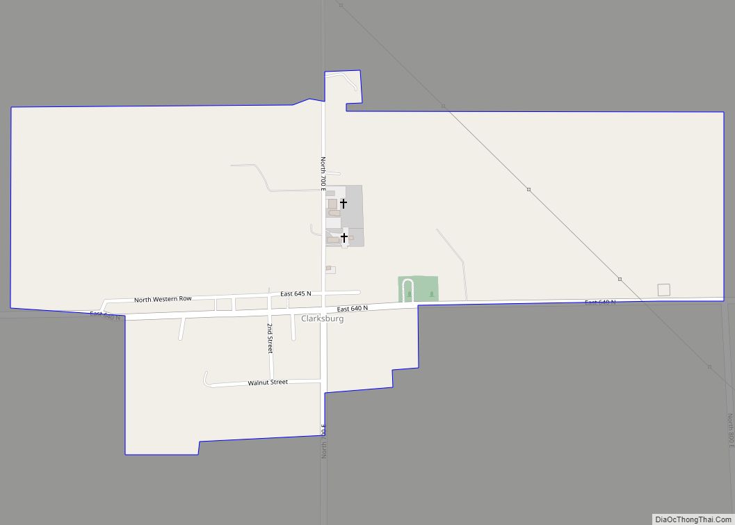
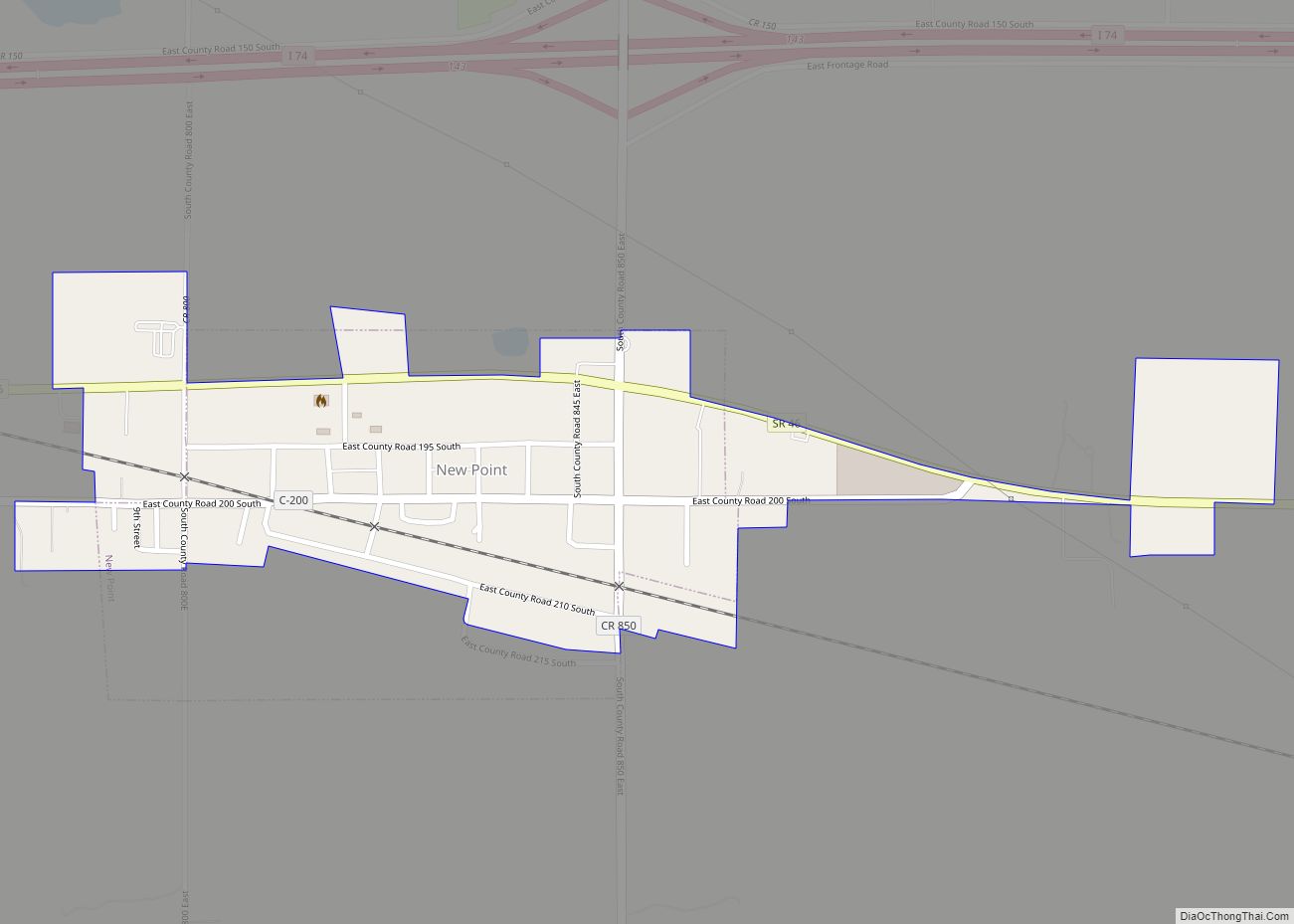
New Point is a town in Salt Creek Township, Decatur County, Indiana, United States. The population was 331 at the 2010 census.
| Name: | New Point town |
|---|---|
| LSAD Code: | 43 |
| LSAD Description: | town (suffix) |
| State: | Indiana |
| County: | Decatur County |
| Total Area: | 0.31 sq mi (0.81 km²) |
| Land Area: | 0.31 sq mi (0.81 km²) |
| Water Area: | 0.00 sq mi (0.00 km²) |
| Total Population: | 319 |
| Population Density: | 1,022.44/sq mi (394.67/km²) |
| ZIP code: | 47263 |
| Area code: | 812 |
| FIPS code: | 1853478 |
| Website: | http://www.newpointin.com |
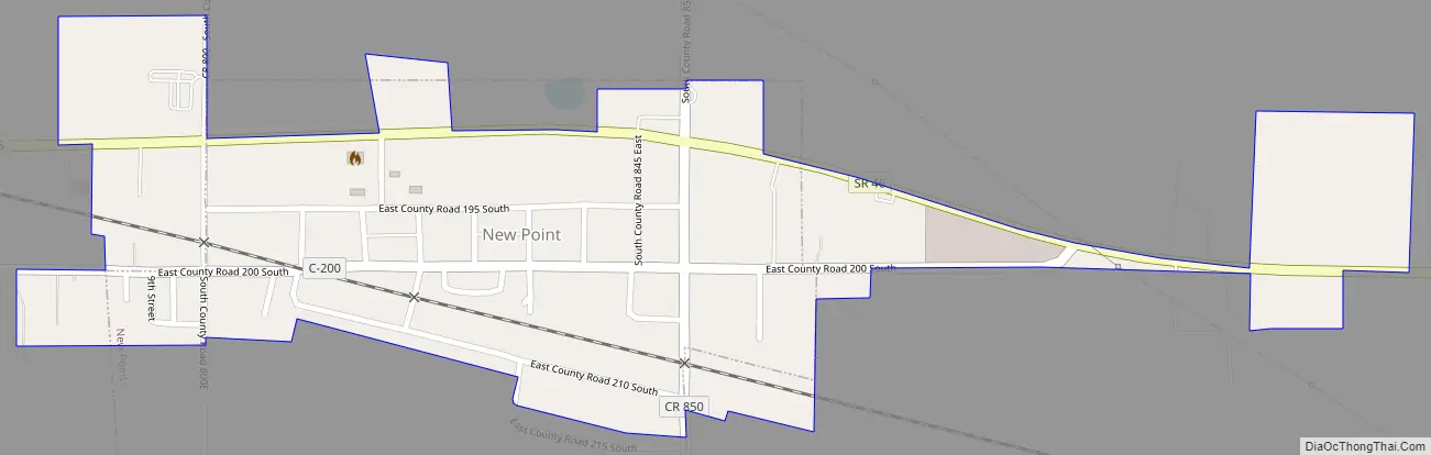
Online Interactive Map
Click on ![]() to view map in "full screen" mode.
to view map in "full screen" mode.
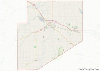
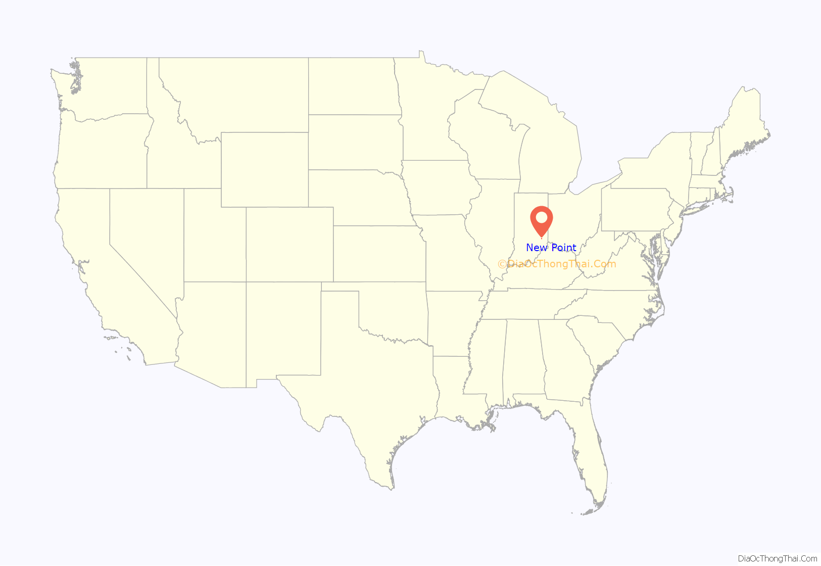
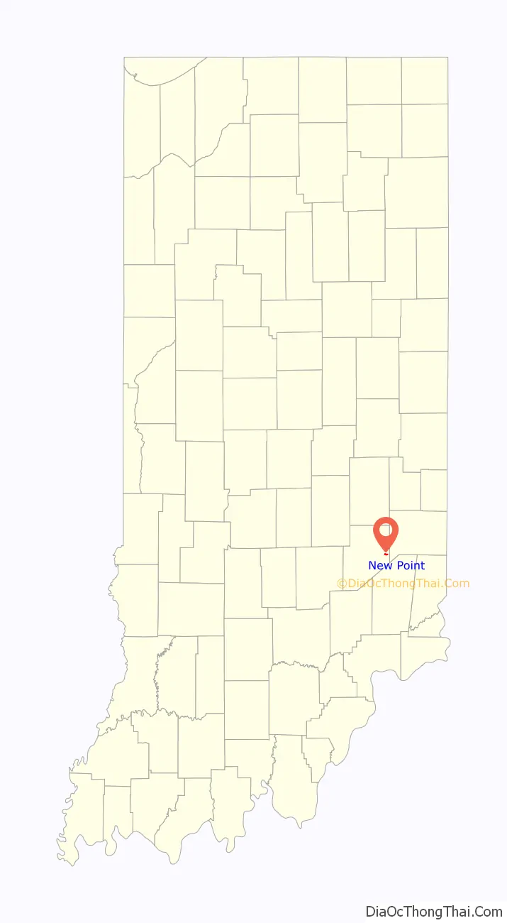
New Point location map. Where is New Point town?
History
New Point was laid out in 1859.
New Point Road Map
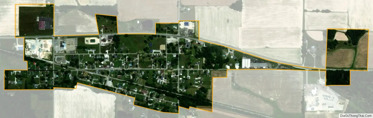
New Point city Satellite Map
Geography
The town is located approximately one-half mile south of Interstate 74 at Exit 143. (State Highway 46 runs parallel to the town on its north side.) Utilities include city water and city sewage. At the present there is no natural gas piped to the town. The closest connection is 5.5 miles to the east on State Highway 46.
New Point is located at 39°18′34″N 85°19′46″W / 39.30944°N 85.32944°W / 39.30944; -85.32944 (39.309546, -85.329376).
According to the 2010 census, New Point has a total area of 0.22 square miles (0.57 km), all land.
The town is divided geographically by an active railway running east to Cincinnati, Ohio and west to Indianapolis, Indiana. Tub Creek, a tiny stream, originates just north of New Point and runs through it from north to south.
See also
Map of Indiana State and its subdivision:- Adams
- Allen
- Bartholomew
- Benton
- Blackford
- Boone
- Brown
- Carroll
- Cass
- Clark
- Clay
- Clinton
- Crawford
- Daviess
- De Kalb
- Dearborn
- Decatur
- Delaware
- Dubois
- Elkhart
- Fayette
- Floyd
- Fountain
- Franklin
- Fulton
- Gibson
- Grant
- Greene
- Hamilton
- Hancock
- Harrison
- Hendricks
- Henry
- Howard
- Huntington
- Jackson
- Jasper
- Jay
- Jefferson
- Jennings
- Johnson
- Knox
- Kosciusko
- LaGrange
- Lake
- Lake Michigan
- LaPorte
- Lawrence
- Madison
- Marion
- Marshall
- Martin
- Miami
- Monroe
- Montgomery
- Morgan
- Newton
- Noble
- Ohio
- Orange
- Owen
- Parke
- Perry
- Pike
- Porter
- Posey
- Pulaski
- Putnam
- Randolph
- Ripley
- Rush
- Saint Joseph
- Scott
- Shelby
- Spencer
- Starke
- Steuben
- Sullivan
- Switzerland
- Tippecanoe
- Tipton
- Union
- Vanderburgh
- Vermillion
- Vigo
- Wabash
- Warren
- Warrick
- Washington
- Wayne
- Wells
- White
- Whitley
- Alabama
- Alaska
- Arizona
- Arkansas
- California
- Colorado
- Connecticut
- Delaware
- District of Columbia
- Florida
- Georgia
- Hawaii
- Idaho
- Illinois
- Indiana
- Iowa
- Kansas
- Kentucky
- Louisiana
- Maine
- Maryland
- Massachusetts
- Michigan
- Minnesota
- Mississippi
- Missouri
- Montana
- Nebraska
- Nevada
- New Hampshire
- New Jersey
- New Mexico
- New York
- North Carolina
- North Dakota
- Ohio
- Oklahoma
- Oregon
- Pennsylvania
- Rhode Island
- South Carolina
- South Dakota
- Tennessee
- Texas
- Utah
- Vermont
- Virginia
- Washington
- West Virginia
- Wisconsin
- Wyoming