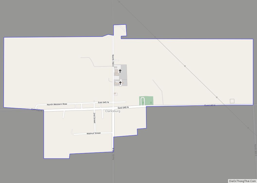
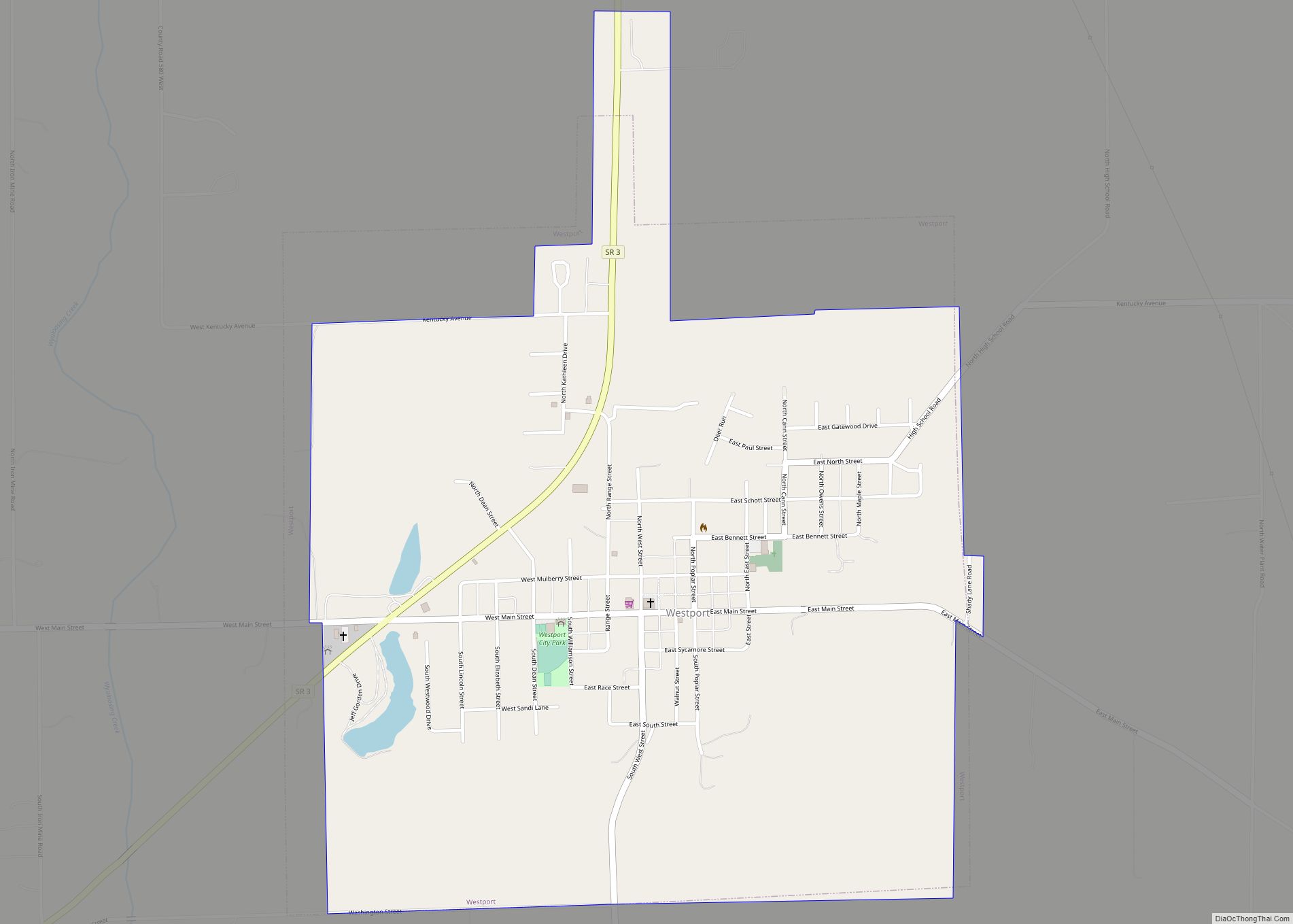
Westport is a town located in Sand Creek Township, Decatur County, Indiana. The population was 1,379 at the 2010 census. A covered bridge, built in 1880, is located about 1.5 miles east of town.
| Name: | Westport town |
|---|---|
| LSAD Code: | 43 |
| LSAD Description: | town (suffix) |
| State: | Indiana |
| County: | Decatur County |
| Elevation: | 814 ft (248 m) |
| Total Area: | 1.16 sq mi (3.01 km²) |
| Land Area: | 1.15 sq mi (2.98 km²) |
| Water Area: | 0.01 sq mi (0.03 km²) |
| Total Population: | 1,393 |
| Population Density: | 1,211.30/sq mi (467.55/km²) |
| ZIP code: | 47283 |
| Area code: | 812 |
| FIPS code: | 1883276 |
| GNISfeature ID: | 0445857 |
| Website: | http://www.westportindiana.org |
Online Interactive Map
Click on ![]() to view map in "full screen" mode.
to view map in "full screen" mode.
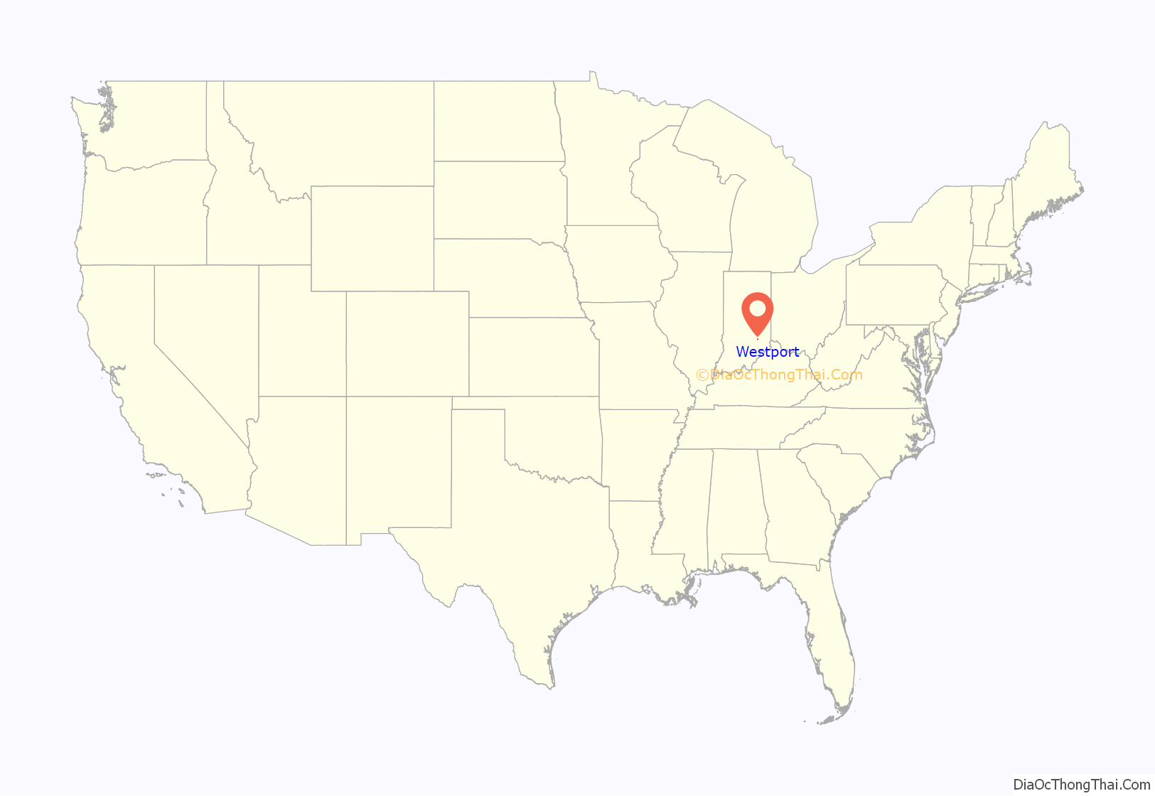
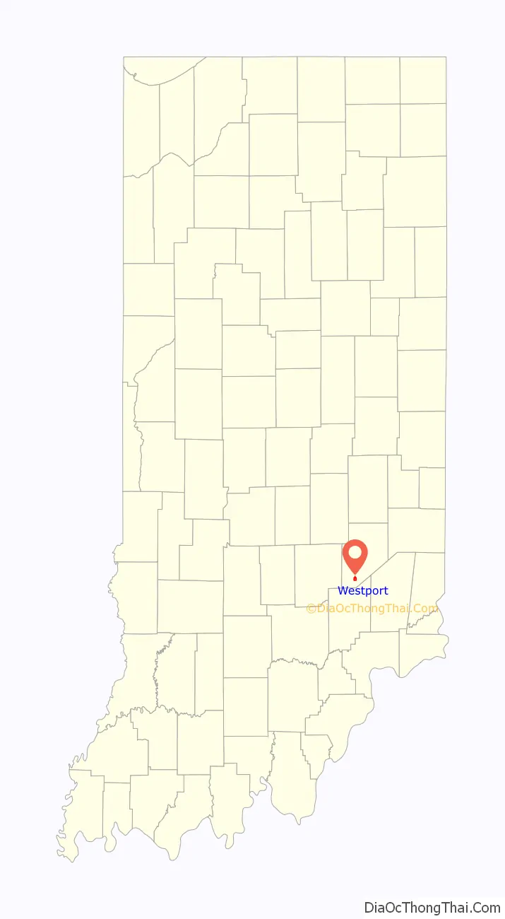
Westport location map. Where is Westport town?
History
Westport was laid out in March 1836. Simeon Sharp and Hockersmith Merryman were the founders of Westport when 20 lots were laid out based around a center point at the intersection of Main and Poplar Streets. The Westport post office was established in 1839, but first spelled West Port.
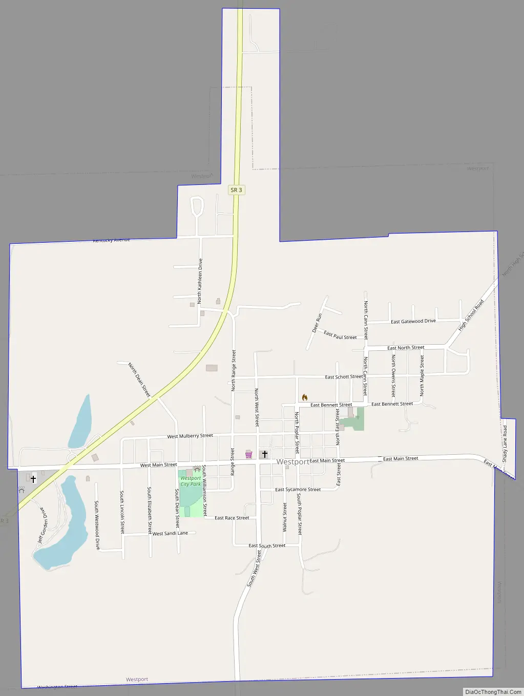
Westport Road Map
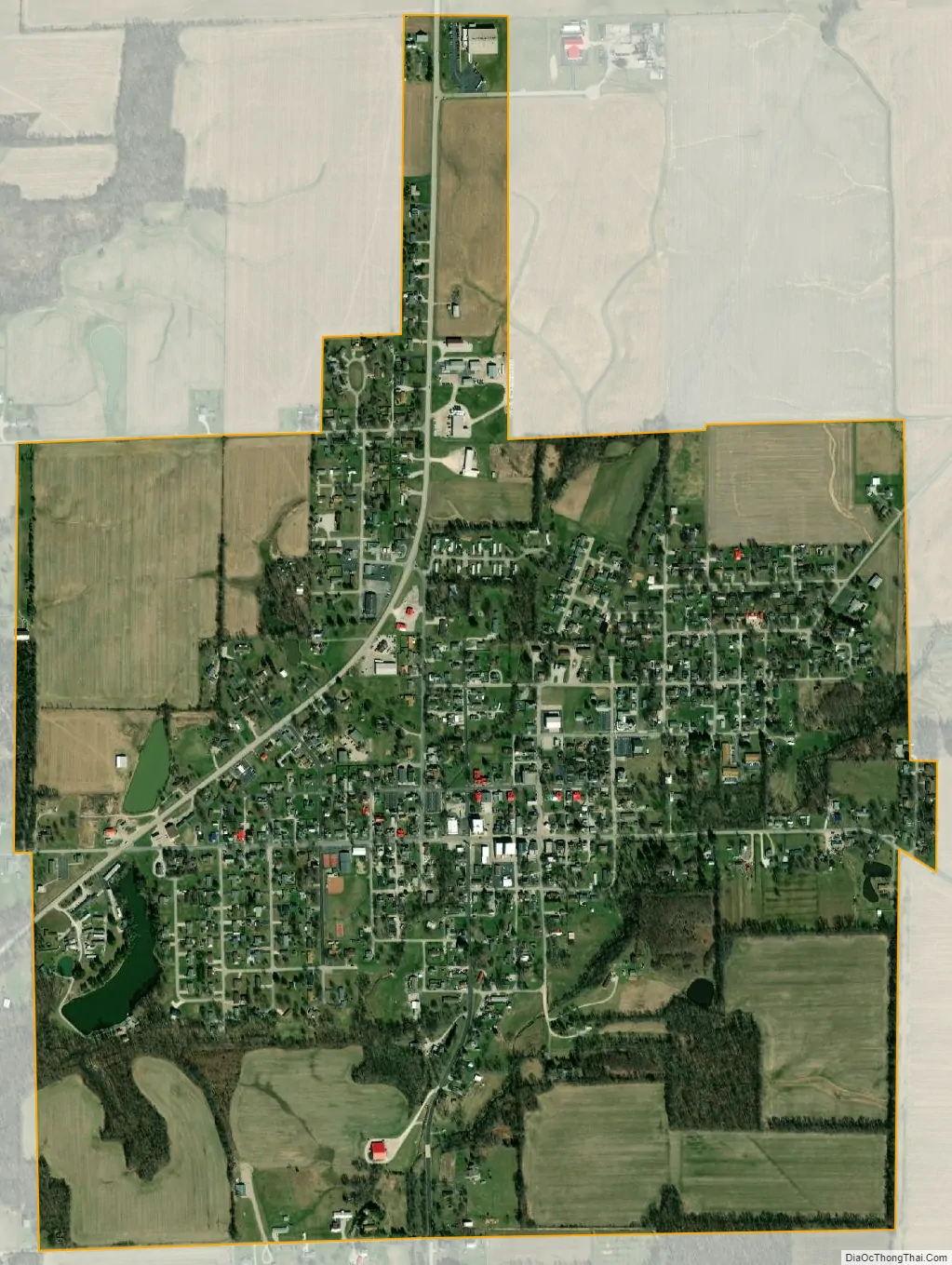
Westport city Satellite Map
Geography
Westport is located at 39°10′34″N 85°34′27″W / 39.17611°N 85.57417°W / 39.17611; -85.57417 (39.176143, -85.574167).
According to the 2010 census, Westport has a total area of 1.333 square miles (3.45 km), of which 1.32 square miles (3.42 km) (or 99.02%) is land and 0.013 square miles (0.03 km) (or 0.98%) is water.
See also
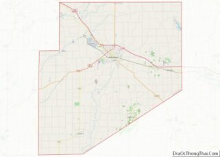
Map of Indiana State and its subdivision:- Adams
- Allen
- Bartholomew
- Benton
- Blackford
- Boone
- Brown
- Carroll
- Cass
- Clark
- Clay
- Clinton
- Crawford
- Daviess
- De Kalb
- Dearborn
- Decatur
- Delaware
- Dubois
- Elkhart
- Fayette
- Floyd
- Fountain
- Franklin
- Fulton
- Gibson
- Grant
- Greene
- Hamilton
- Hancock
- Harrison
- Hendricks
- Henry
- Howard
- Huntington
- Jackson
- Jasper
- Jay
- Jefferson
- Jennings
- Johnson
- Knox
- Kosciusko
- LaGrange
- Lake
- Lake Michigan
- LaPorte
- Lawrence
- Madison
- Marion
- Marshall
- Martin
- Miami
- Monroe
- Montgomery
- Morgan
- Newton
- Noble
- Ohio
- Orange
- Owen
- Parke
- Perry
- Pike
- Porter
- Posey
- Pulaski
- Putnam
- Randolph
- Ripley
- Rush
- Saint Joseph
- Scott
- Shelby
- Spencer
- Starke
- Steuben
- Sullivan
- Switzerland
- Tippecanoe
- Tipton
- Union
- Vanderburgh
- Vermillion
- Vigo
- Wabash
- Warren
- Warrick
- Washington
- Wayne
- Wells
- White
- Whitley
- Alabama
- Alaska
- Arizona
- Arkansas
- California
- Colorado
- Connecticut
- Delaware
- District of Columbia
- Florida
- Georgia
- Hawaii
- Idaho
- Illinois
- Indiana
- Iowa
- Kansas
- Kentucky
- Louisiana
- Maine
- Maryland
- Massachusetts
- Michigan
- Minnesota
- Mississippi
- Missouri
- Montana
- Nebraska
- Nevada
- New Hampshire
- New Jersey
- New Mexico
- New York
- North Carolina
- North Dakota
- Ohio
- Oklahoma
- Oregon
- Pennsylvania
- Rhode Island
- South Carolina
- South Dakota
- Tennessee
- Texas
- Utah
- Vermont
- Virginia
- Washington
- West Virginia
- Wisconsin
- Wyoming