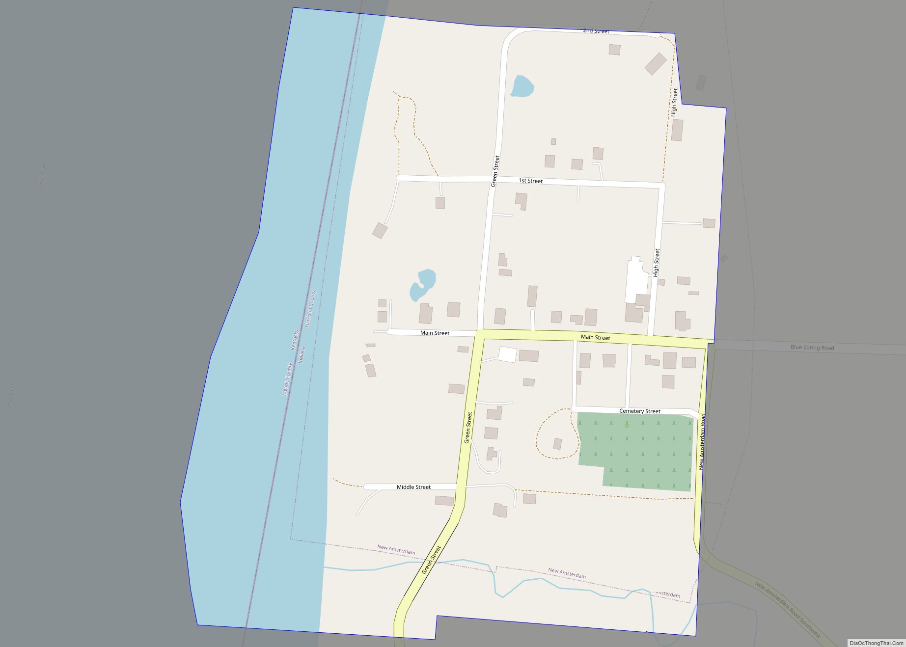
New Amsterdam is a town located in Washington Township, Harrison County, Indiana, United States, along the Ohio River. As of the 2020 census, the city population was 12. As of the 2020 Census, New Amsterdam was the smallest city, town, or Census Designated Place in the state of Indiana.
| Name: | New Amsterdam town |
|---|---|
| LSAD Code: | 43 |
| LSAD Description: | town (suffix) |
| State: | Indiana |
| County: | Harrison County |
| Elevation: | 449 ft (137 m) |
| Total Area: | 0.10 sq mi (0.26 km²) |
| Land Area: | 0.08 sq mi (0.20 km²) |
| Water Area: | 0.03 sq mi (0.07 km²) |
| Total Population: | 12 |
| Population Density: | 157.89/sq mi (61.33/km²) |
| ZIP code: | 47142 |
| Area code: | 812 |
| FIPS code: | 1852398 |
| GNISfeature ID: | 0440016 |
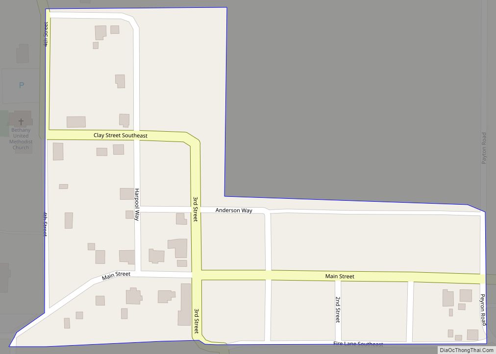
Online Interactive Map
Click on ![]() to view map in "full screen" mode.
to view map in "full screen" mode.
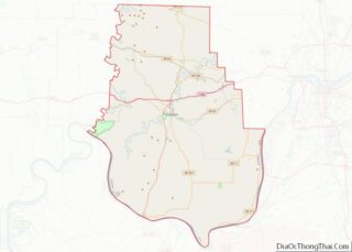
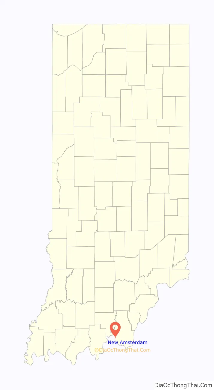
New Amsterdam location map. Where is New Amsterdam town?

History
The first settlers in what became New Amsterdam were James Riley and Jacob Youstler. Starting in 1815, they lived in New Amsterdam for several years before relocating further north. The town was formally platted on September 19, 1815, by Jacob Funk and Samuel McAdams.
The town relied on the Ohio River for its growth, as it was the main transportation route for migrating settlers as well as traders up and down river. Steamboats were active on the river during the 19th century and contributed to the growth of waterfront towns. In the 1860 census, New Amsterdam was the largest town in Harrison County.
Floods played a large part in the decline of the town. The Great Ohio River flood of 1937 destroyed 75% of the structures in the town. The only original building remaining in the town is the old country store. A marker on the second story of the building shows the height of the water in the 1937 Flood.
Today, the town has a general store, a Baptist church, a Methodist church, a town hall and a cemetery.
New Amsterdam Road Map

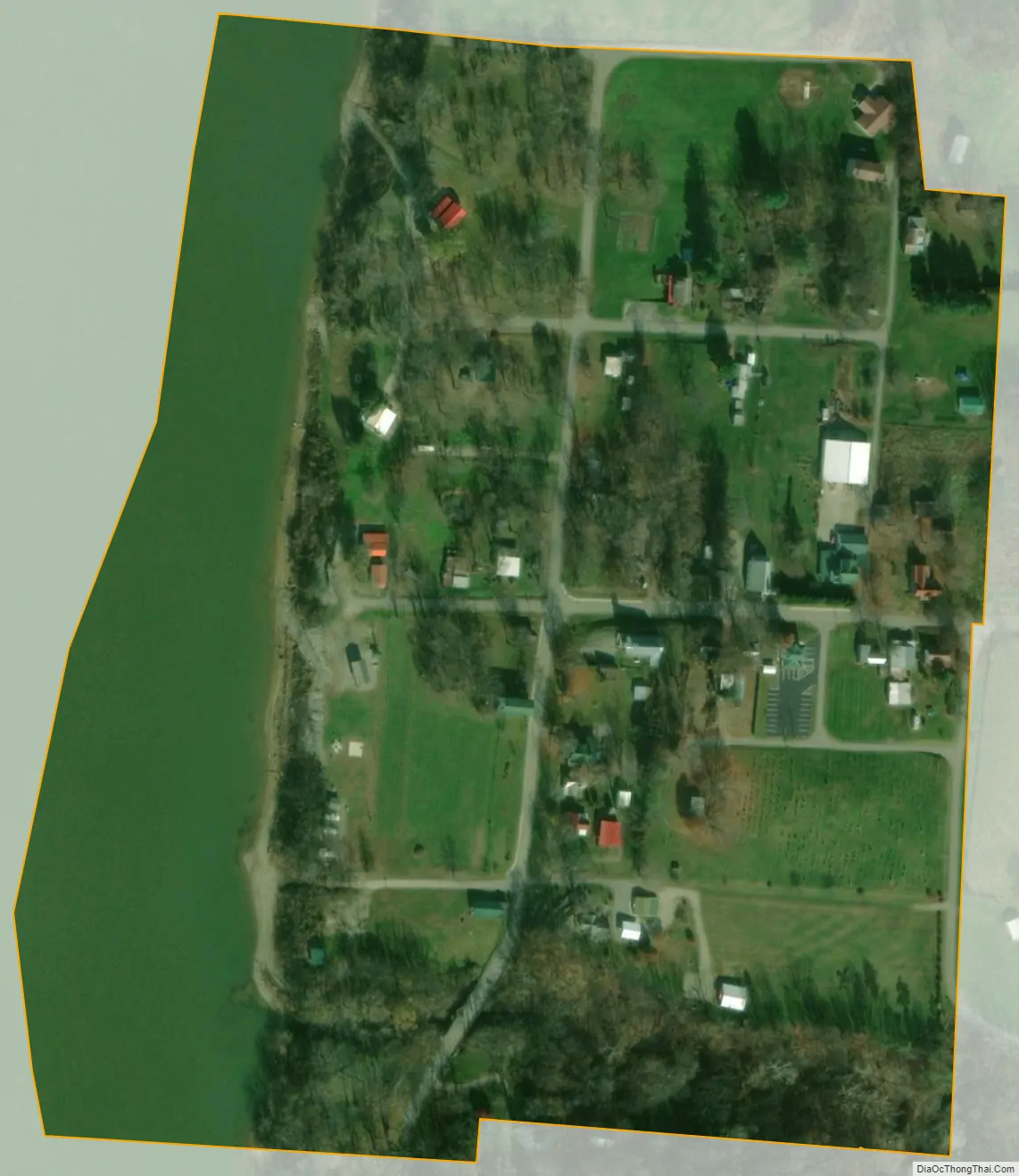
New Amsterdam city Satellite Map
Geography
New Amsterdam is located at 38°6′6″N 86°16′29″W / 38.10167°N 86.27472°W / 38.10167; -86.27472 (38.101894, -86.274821). According to the 2010 census, New Amsterdam has a total area of 0.1 square miles (0.26 km), of which 0.08 square miles (0.21 km) (or 80%) is land and 0.02 square miles (0.05 km) (or 20%) is water.
See also
Map of Indiana State and its subdivision:- Adams
- Allen
- Bartholomew
- Benton
- Blackford
- Boone
- Brown
- Carroll
- Cass
- Clark
- Clay
- Clinton
- Crawford
- Daviess
- De Kalb
- Dearborn
- Decatur
- Delaware
- Dubois
- Elkhart
- Fayette
- Floyd
- Fountain
- Franklin
- Fulton
- Gibson
- Grant
- Greene
- Hamilton
- Hancock
- Harrison
- Hendricks
- Henry
- Howard
- Huntington
- Jackson
- Jasper
- Jay
- Jefferson
- Jennings
- Johnson
- Knox
- Kosciusko
- LaGrange
- Lake
- Lake Michigan
- LaPorte
- Lawrence
- Madison
- Marion
- Marshall
- Martin
- Miami
- Monroe
- Montgomery
- Morgan
- Newton
- Noble
- Ohio
- Orange
- Owen
- Parke
- Perry
- Pike
- Porter
- Posey
- Pulaski
- Putnam
- Randolph
- Ripley
- Rush
- Saint Joseph
- Scott
- Shelby
- Spencer
- Starke
- Steuben
- Sullivan
- Switzerland
- Tippecanoe
- Tipton
- Union
- Vanderburgh
- Vermillion
- Vigo
- Wabash
- Warren
- Warrick
- Washington
- Wayne
- Wells
- White
- Whitley
- Alabama
- Alaska
- Arizona
- Arkansas
- California
- Colorado
- Connecticut
- Delaware
- District of Columbia
- Florida
- Georgia
- Hawaii
- Idaho
- Illinois
- Indiana
- Iowa
- Kansas
- Kentucky
- Louisiana
- Maine
- Maryland
- Massachusetts
- Michigan
- Minnesota
- Mississippi
- Missouri
- Montana
- Nebraska
- Nevada
- New Hampshire
- New Jersey
- New Mexico
- New York
- North Carolina
- North Dakota
- Ohio
- Oklahoma
- Oregon
- Pennsylvania
- Rhode Island
- South Carolina
- South Dakota
- Tennessee
- Texas
- Utah
- Vermont
- Virginia
- Washington
- West Virginia
- Wisconsin
- Wyoming