New Ross is a town in Walnut Township, Montgomery County, in the U.S. state of Indiana. As of the 2020 census, the town population was 309.
| Name: | New Ross town |
|---|---|
| LSAD Code: | 43 |
| LSAD Description: | town (suffix) |
| State: | Indiana |
| County: | Montgomery County |
| Elevation: | 886 ft (270 m) |
| Total Area: | 0.30 sq mi (0.77 km²) |
| Land Area: | 0.30 sq mi (0.77 km²) |
| Water Area: | 0.00 sq mi (0.00 km²) |
| Total Population: | 309 |
| Population Density: | 1,033.44/sq mi (399.62/km²) |
| ZIP code: | 47968 |
| Area code: | 765 |
| FIPS code: | 1853550 |
| GNISfeature ID: | 440106 |
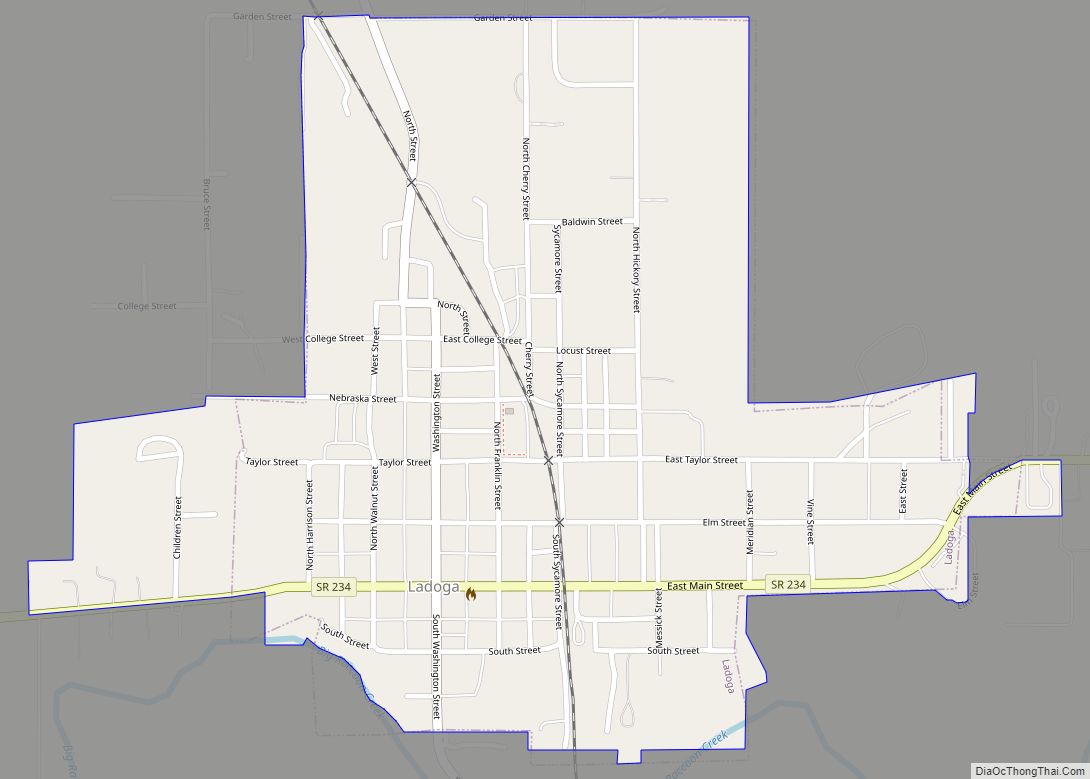
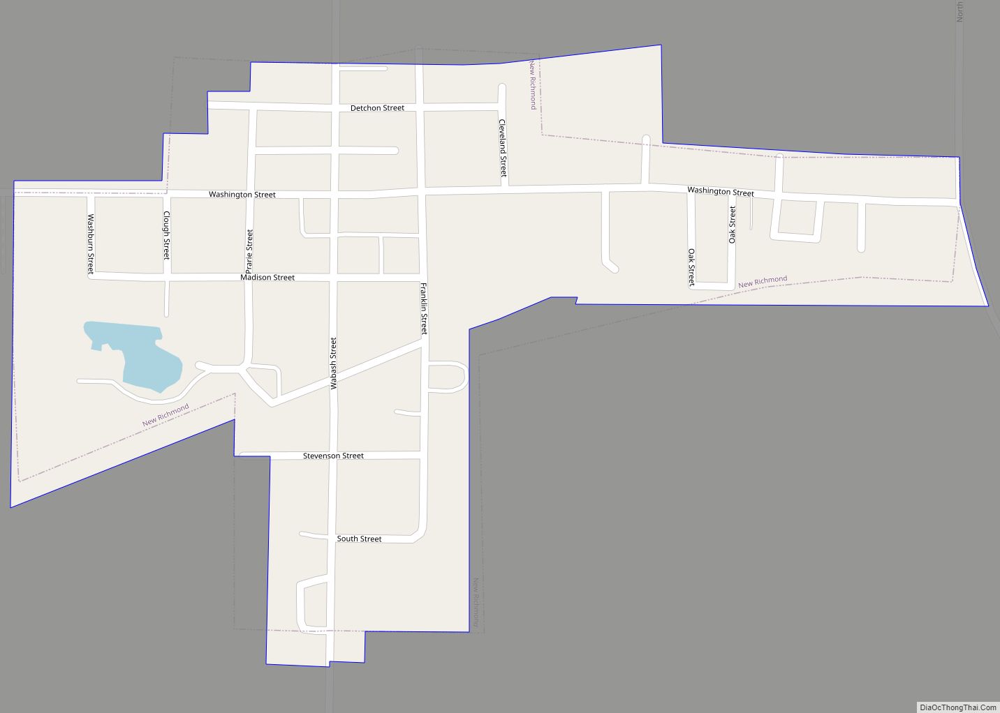
Online Interactive Map
Click on ![]() to view map in "full screen" mode.
to view map in "full screen" mode.
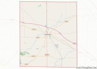
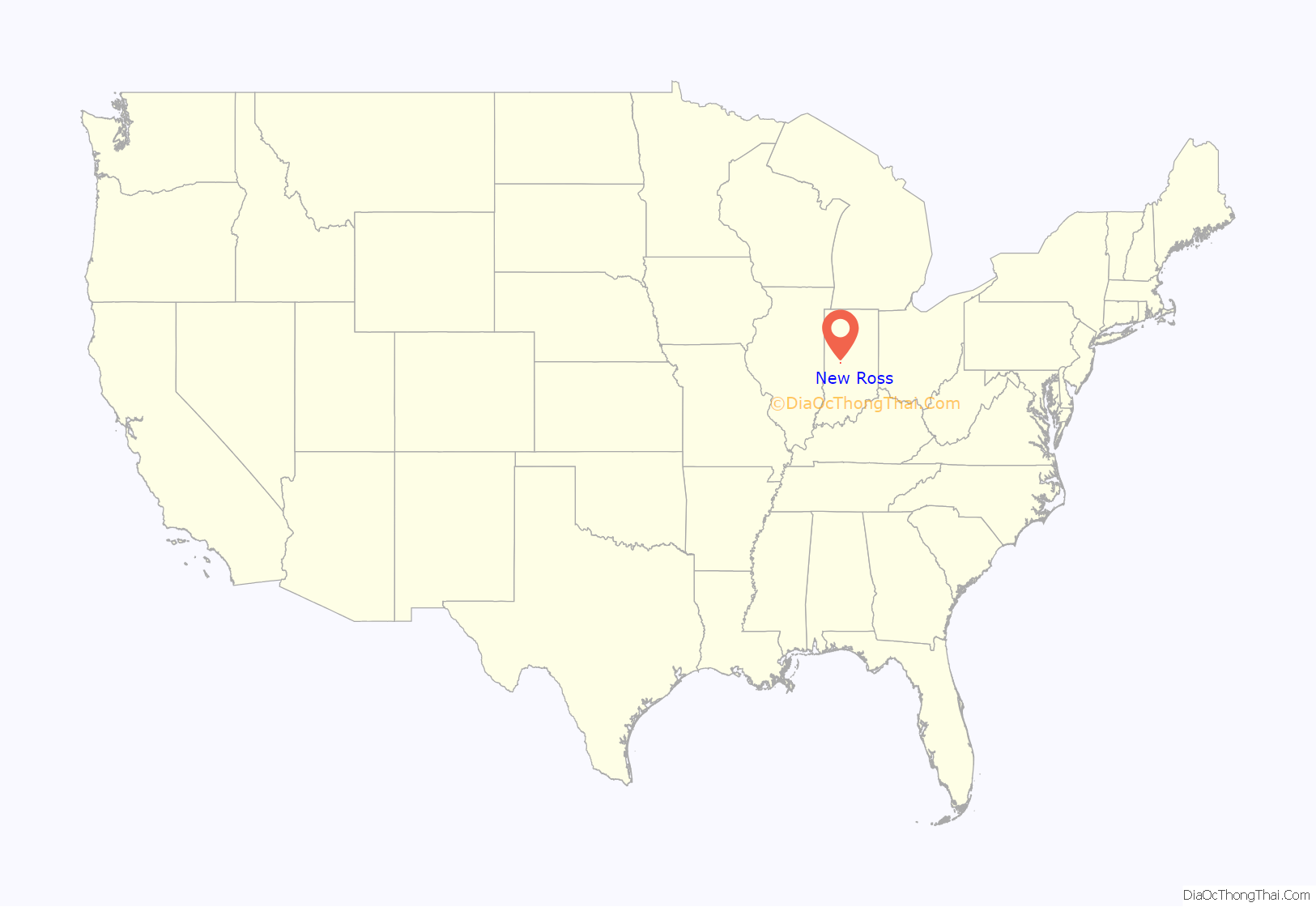
New Ross location map. Where is New Ross town?

History
In 1836–37 a post office was established in Walnut Township at the home of postmaster George Dorsey, and called the New Ross Post Office. New Ross, then called Valley City, was platted by John Browning in 1855. In about 1868, the post office was moved to Valley City and the name of the city was changed to New Ross to match the post office name. New Ross was incorporated in May 1870.
In 1874, a Methodist church was built in New Ross. It was named Brown Chapel after Rev. Thomas J. Brown, who first preached there.
In an early map from 1864, the area now known as New Ross was called “Mace”. Mace disappeared from later maps. (Note that Mace is an unincorporated area northwest of New Ross on U.S. Route 136.)
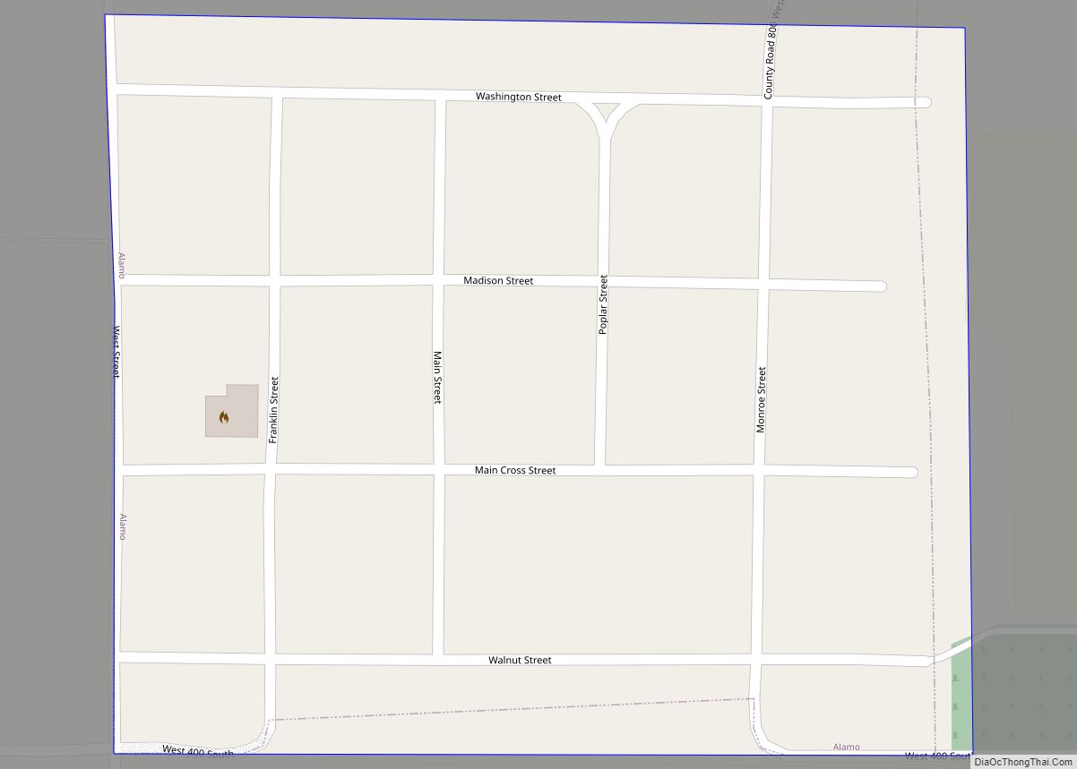
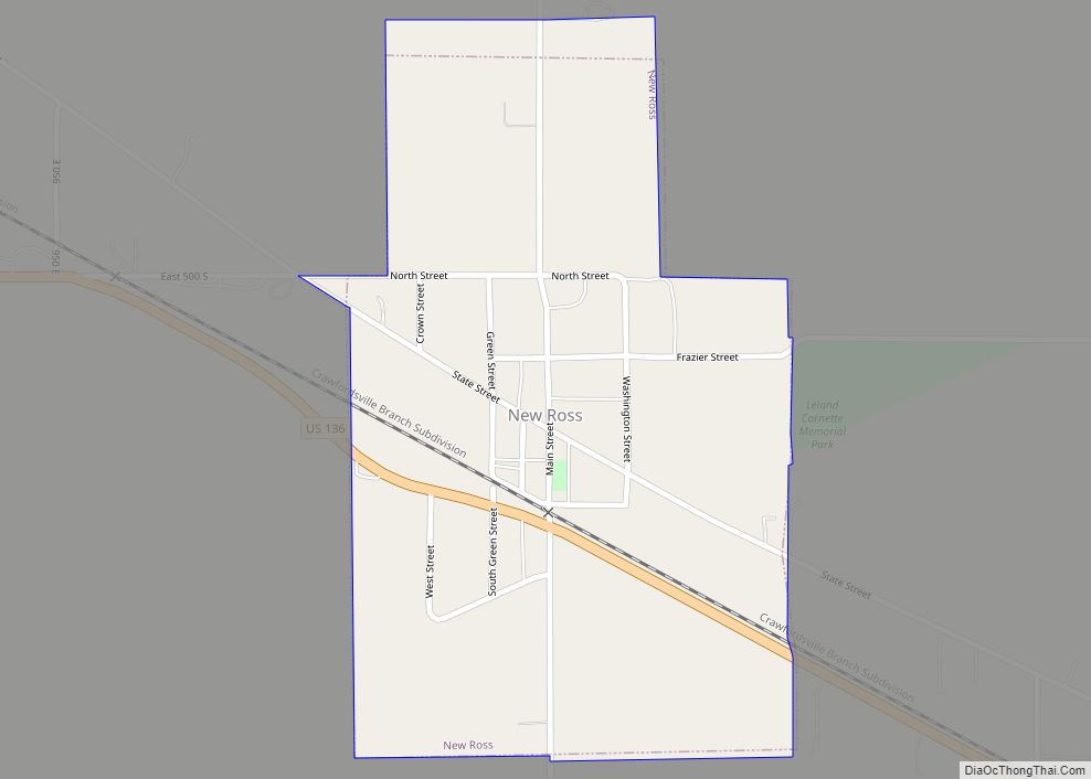
New Ross Road Map

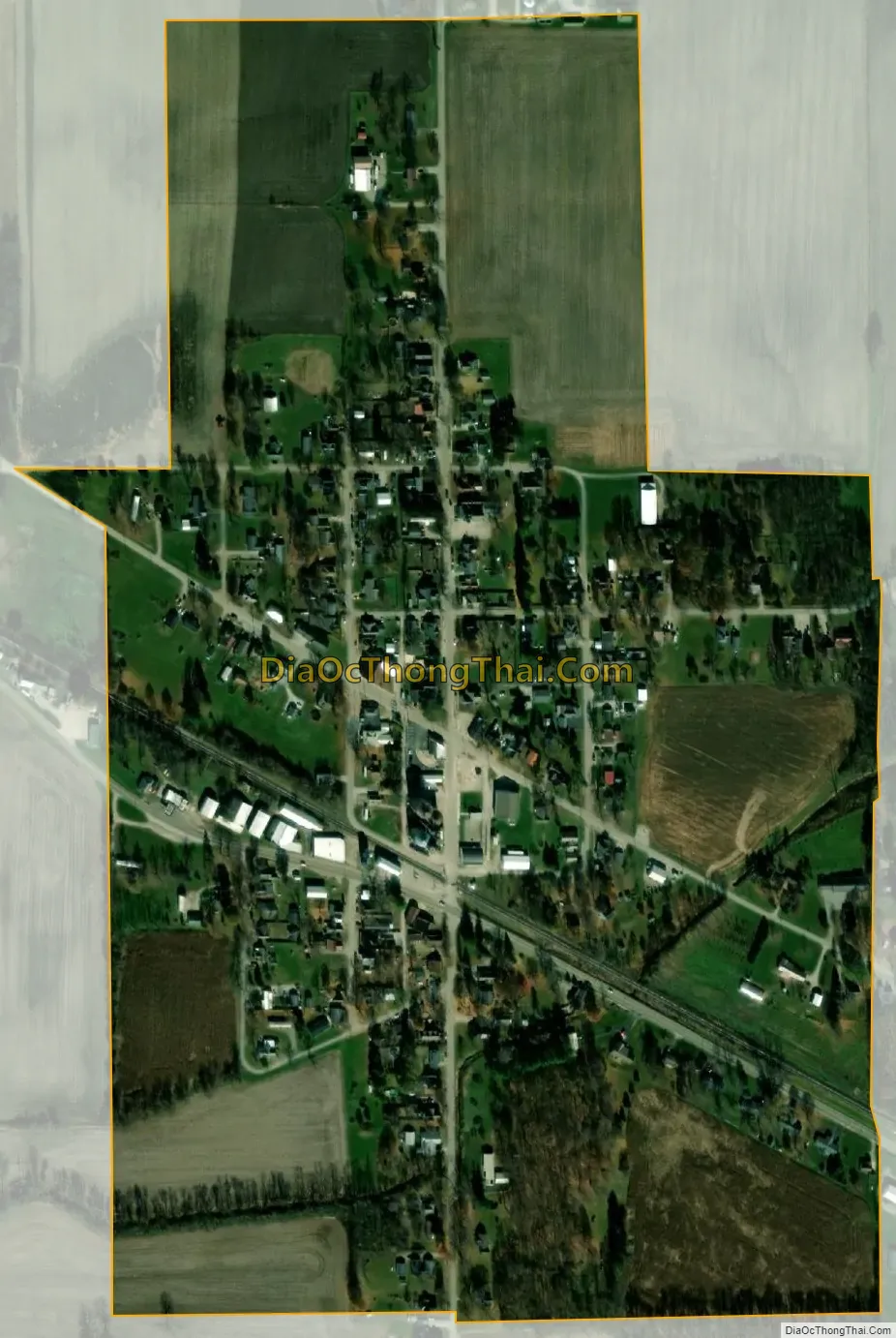
New Ross city Satellite Map
Geography
New Ross is located in southeastern Montgomery County at 39°57′52″N 86°42′54″W / 39.964573°N 86.715028°W / 39.964573; -86.715028. U.S. Route 136 passes through the town, leading northwest 11 miles (18 km) to Crawfordsville, the county seat, and southeast 33 miles (53 km) to Indianapolis.
According to the U.S. Census Bureau, New Ross has a total area of 0.30 square miles (0.78 km), all land. The town is drained by unnamed tributaries of Big Raccoon Creek, which passes just south of the town and runs southwest to the Wabash River near Montezuma.
See also
Map of Indiana State and its subdivision:- Adams
- Allen
- Bartholomew
- Benton
- Blackford
- Boone
- Brown
- Carroll
- Cass
- Clark
- Clay
- Clinton
- Crawford
- Daviess
- De Kalb
- Dearborn
- Decatur
- Delaware
- Dubois
- Elkhart
- Fayette
- Floyd
- Fountain
- Franklin
- Fulton
- Gibson
- Grant
- Greene
- Hamilton
- Hancock
- Harrison
- Hendricks
- Henry
- Howard
- Huntington
- Jackson
- Jasper
- Jay
- Jefferson
- Jennings
- Johnson
- Knox
- Kosciusko
- LaGrange
- Lake
- Lake Michigan
- LaPorte
- Lawrence
- Madison
- Marion
- Marshall
- Martin
- Miami
- Monroe
- Montgomery
- Morgan
- Newton
- Noble
- Ohio
- Orange
- Owen
- Parke
- Perry
- Pike
- Porter
- Posey
- Pulaski
- Putnam
- Randolph
- Ripley
- Rush
- Saint Joseph
- Scott
- Shelby
- Spencer
- Starke
- Steuben
- Sullivan
- Switzerland
- Tippecanoe
- Tipton
- Union
- Vanderburgh
- Vermillion
- Vigo
- Wabash
- Warren
- Warrick
- Washington
- Wayne
- Wells
- White
- Whitley
- Alabama
- Alaska
- Arizona
- Arkansas
- California
- Colorado
- Connecticut
- Delaware
- District of Columbia
- Florida
- Georgia
- Hawaii
- Idaho
- Illinois
- Indiana
- Iowa
- Kansas
- Kentucky
- Louisiana
- Maine
- Maryland
- Massachusetts
- Michigan
- Minnesota
- Mississippi
- Missouri
- Montana
- Nebraska
- Nevada
- New Hampshire
- New Jersey
- New Mexico
- New York
- North Carolina
- North Dakota
- Ohio
- Oklahoma
- Oregon
- Pennsylvania
- Rhode Island
- South Carolina
- South Dakota
- Tennessee
- Texas
- Utah
- Vermont
- Virginia
- Washington
- West Virginia
- Wisconsin
- Wyoming