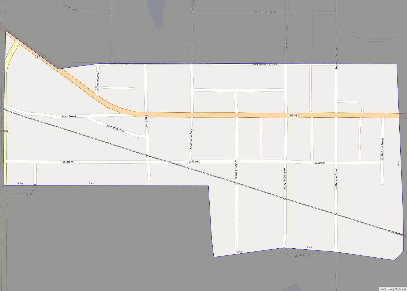
Riley, once known as Lockport, is a town in Riley Township, Vigo County, in the U.S. state of Indiana. The population was 221 at the 2010 census. It is part of the Terre Haute Metropolitan Statistical Area.
| Name: | Riley town |
|---|---|
| LSAD Code: | 43 |
| LSAD Description: | town (suffix) |
| State: | Indiana |
| County: | Vigo County |
| Elevation: | 564 ft (172 m) |
| Total Area: | 0.09 sq mi (0.23 km²) |
| Land Area: | 0.09 sq mi (0.23 km²) |
| Water Area: | 0.00 sq mi (0.00 km²) |
| Total Population: | 238 |
| Population Density: | 2,644.44/sq mi (1,025.32/km²) |
| ZIP code: | 47871 |
| Area code: | 812 |
| FIPS code: | 1864512 |
| GNISfeature ID: | 442015 |
Online Interactive Map
Click on ![]() to view map in "full screen" mode.
to view map in "full screen" mode.
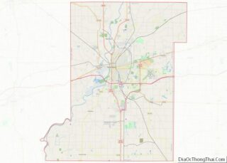
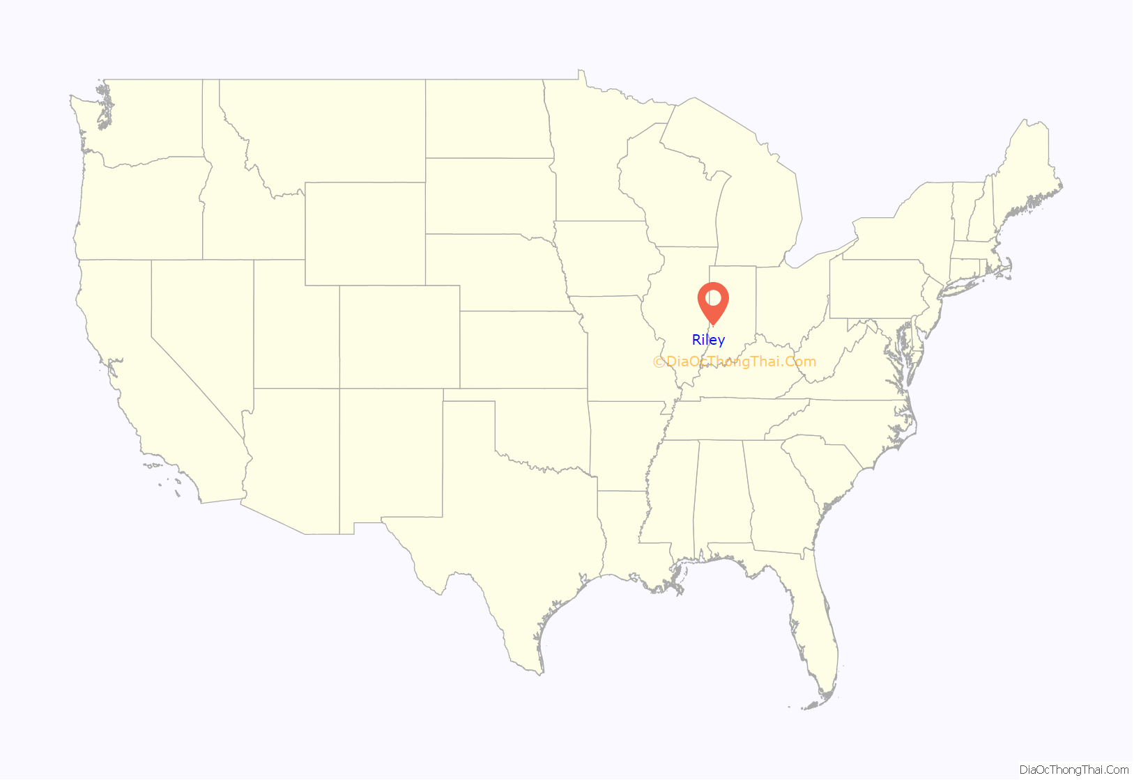
Riley location map. Where is Riley town?

History
The original town of Lockport was platted on November 23, 1836, by Nathaniel Donham. It was known as Lockport due to its importance during the building of the Wabash and Erie Canal from 1847–1850. The canal town became a significant trading point along the waterway. Though the canal closed in 1873, the building of several different railroads kept the community as a place for trade. The town originally had various mills, sawmills and tanneries, but all were burned at different times. It was also notable in the grain market.
In 1911, the town took the name of its post office and became Riley. For several decades, Riley sustained a healthy coal mining industry including a strip mine just south of town, operated by the Maumee Colleries Company as late as 1936. In the second half of the twentieth century, Riley included a small suburban residential community.
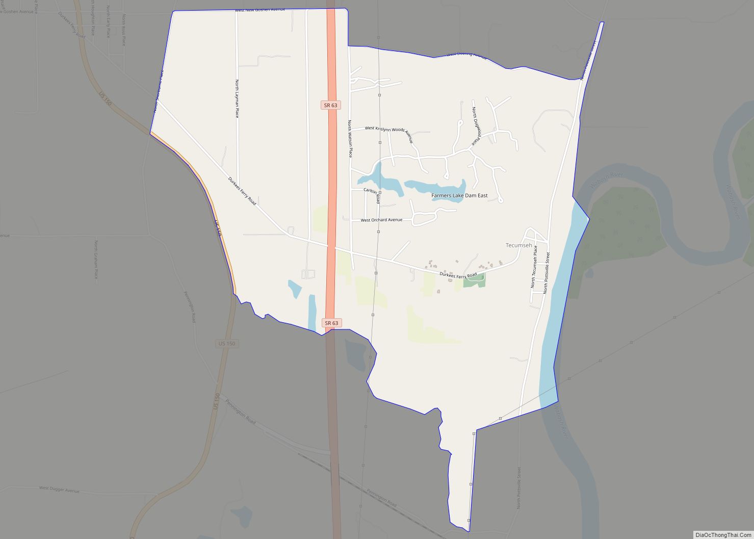
Riley Road Map
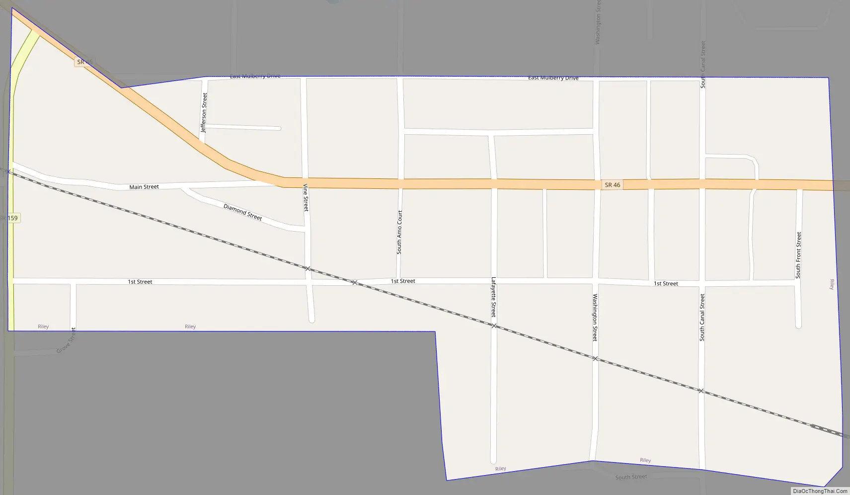
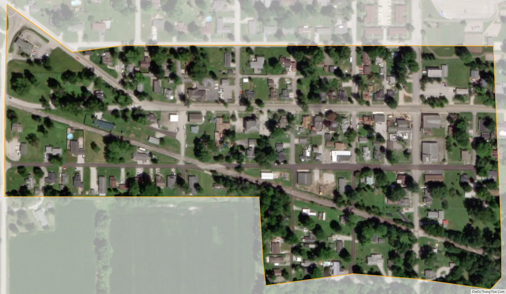
Riley city Satellite Map
Geography
Riley is located at 39°23′23″N 87°18′2″W / 39.38972°N 87.30056°W / 39.38972; -87.30056 (39.389838, -87.300420).
At one time, the Wabash and Erie Canal ran through Riley and there are remnants of locks and the canal in several places.
According to the 2010 census, Riley has a total area of 0.09 square miles (0.23 km), all land.
See also
Map of Indiana State and its subdivision:- Adams
- Allen
- Bartholomew
- Benton
- Blackford
- Boone
- Brown
- Carroll
- Cass
- Clark
- Clay
- Clinton
- Crawford
- Daviess
- De Kalb
- Dearborn
- Decatur
- Delaware
- Dubois
- Elkhart
- Fayette
- Floyd
- Fountain
- Franklin
- Fulton
- Gibson
- Grant
- Greene
- Hamilton
- Hancock
- Harrison
- Hendricks
- Henry
- Howard
- Huntington
- Jackson
- Jasper
- Jay
- Jefferson
- Jennings
- Johnson
- Knox
- Kosciusko
- LaGrange
- Lake
- Lake Michigan
- LaPorte
- Lawrence
- Madison
- Marion
- Marshall
- Martin
- Miami
- Monroe
- Montgomery
- Morgan
- Newton
- Noble
- Ohio
- Orange
- Owen
- Parke
- Perry
- Pike
- Porter
- Posey
- Pulaski
- Putnam
- Randolph
- Ripley
- Rush
- Saint Joseph
- Scott
- Shelby
- Spencer
- Starke
- Steuben
- Sullivan
- Switzerland
- Tippecanoe
- Tipton
- Union
- Vanderburgh
- Vermillion
- Vigo
- Wabash
- Warren
- Warrick
- Washington
- Wayne
- Wells
- White
- Whitley
- Alabama
- Alaska
- Arizona
- Arkansas
- California
- Colorado
- Connecticut
- Delaware
- District of Columbia
- Florida
- Georgia
- Hawaii
- Idaho
- Illinois
- Indiana
- Iowa
- Kansas
- Kentucky
- Louisiana
- Maine
- Maryland
- Massachusetts
- Michigan
- Minnesota
- Mississippi
- Missouri
- Montana
- Nebraska
- Nevada
- New Hampshire
- New Jersey
- New Mexico
- New York
- North Carolina
- North Dakota
- Ohio
- Oklahoma
- Oregon
- Pennsylvania
- Rhode Island
- South Carolina
- South Dakota
- Tennessee
- Texas
- Utah
- Vermont
- Virginia
- Washington
- West Virginia
- Wisconsin
- Wyoming