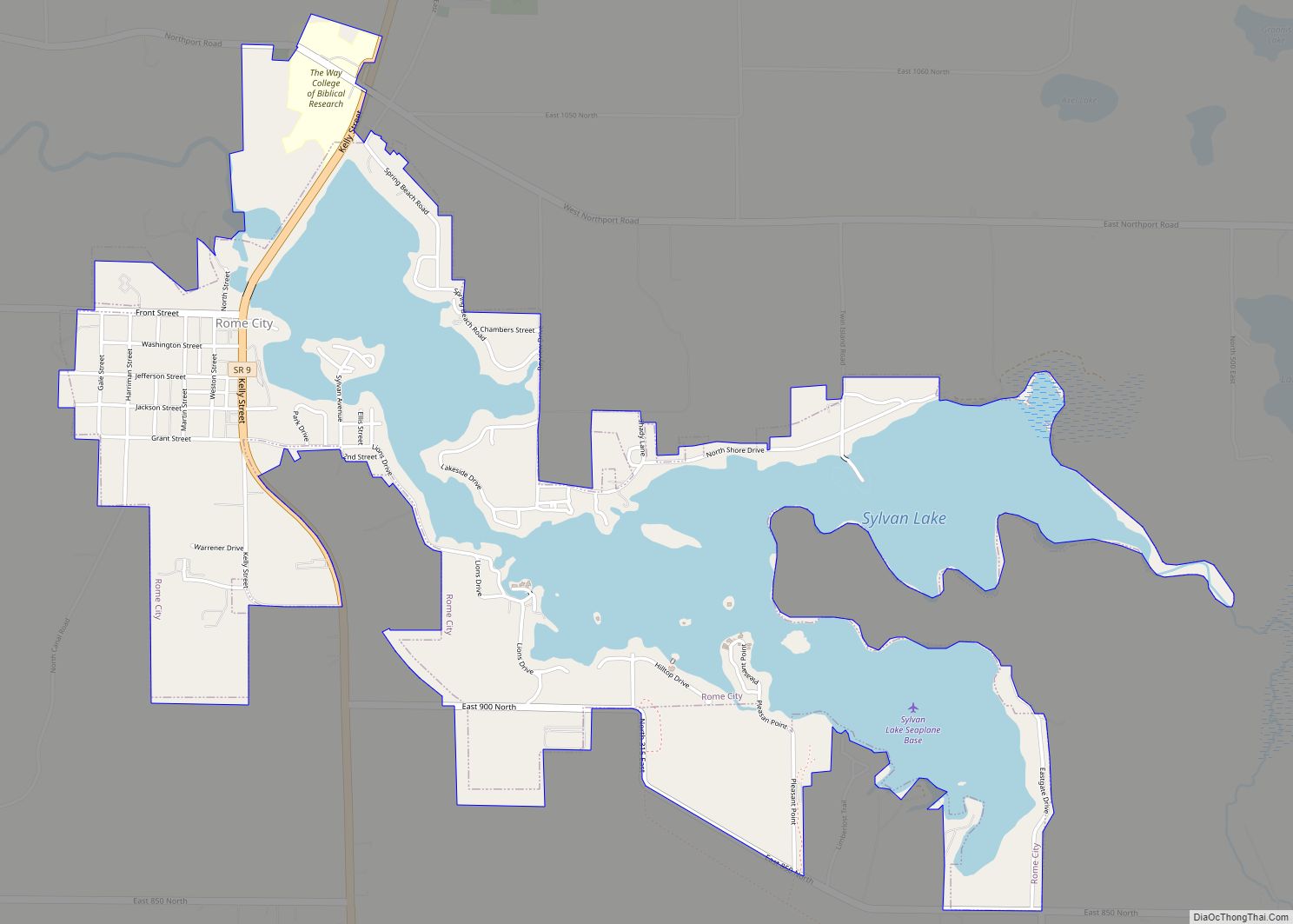
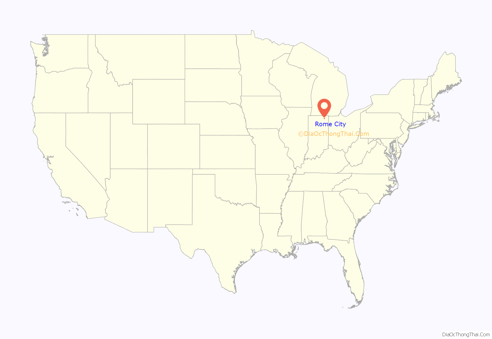
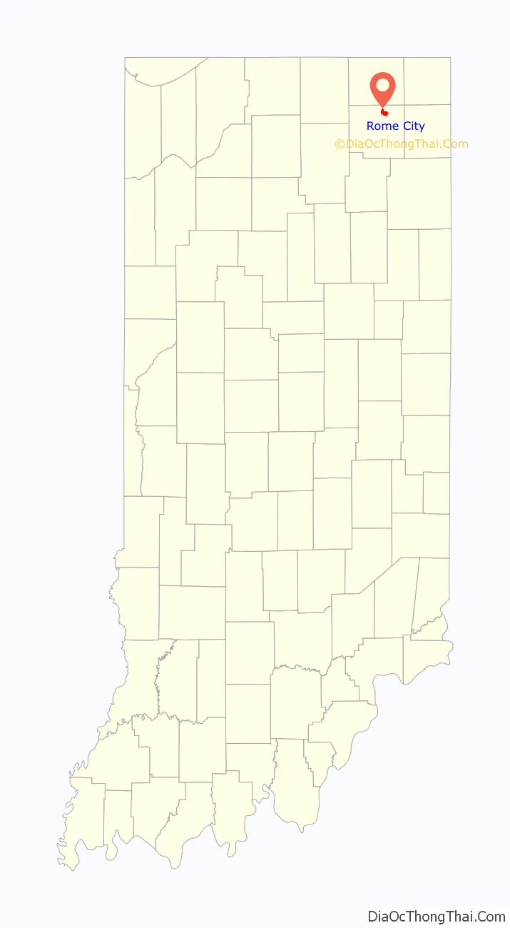
Rome City is a town in Orange Township, Noble County, in the U.S. state of Indiana. The population was 1,361 at the 2010 census.
| Name: | Rome City town |
|---|---|
| LSAD Code: | 43 |
| LSAD Description: | town (suffix) |
| State: | Indiana |
| County: | Noble County |
| Elevation: | 935 ft (285 m) |
| Total Area: | 2.47 sq mi (6.40 km²) |
| Land Area: | 1.47 sq mi (3.81 km²) |
| Water Area: | 1.00 sq mi (2.59 km²) |
| Total Population: | 1,322 |
| Population Density: | 898.71/sq mi (346.90/km²) |
| ZIP code: | 46784 |
| Area code: | 260 |
| FIPS code: | 1865808 |
| GNISfeature ID: | 442268 |
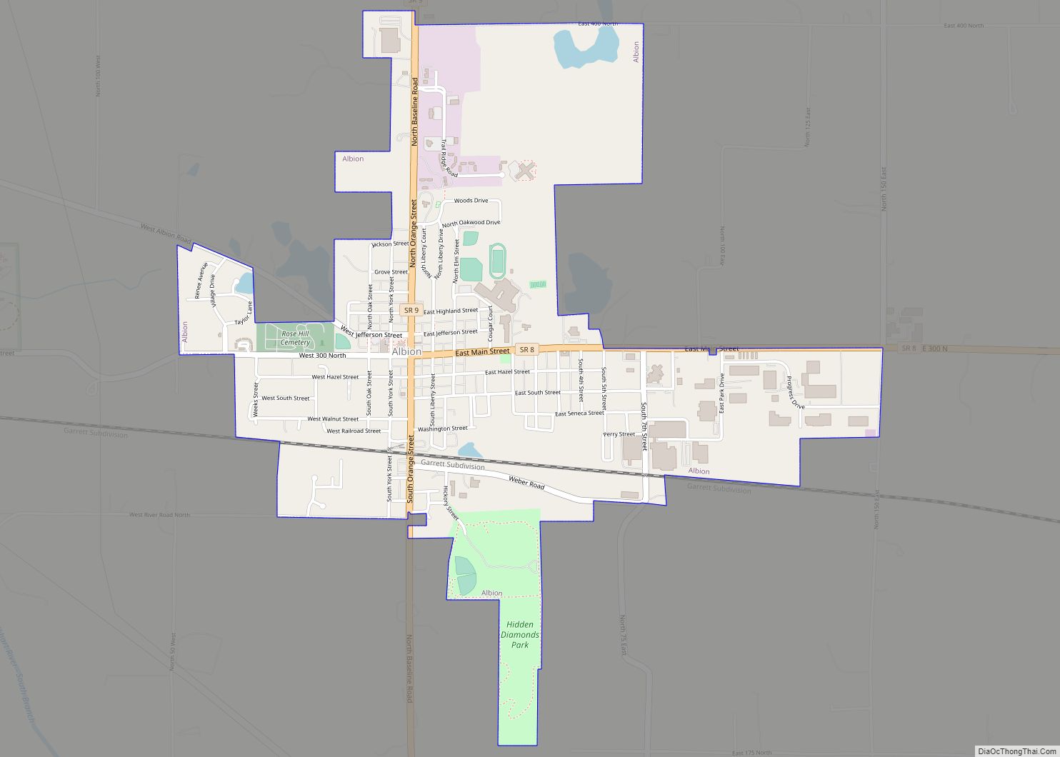
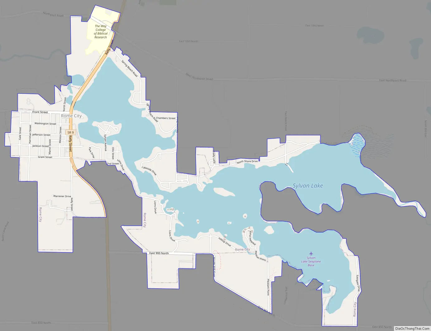
Online Interactive Map
Click on ![]() to view map in "full screen" mode.
to view map in "full screen" mode.
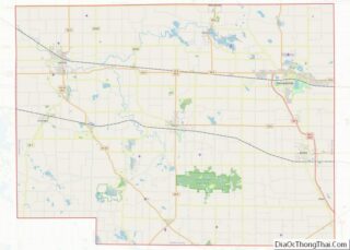
Rome City location map. Where is Rome City town?
History
Rome City was laid out in 1839. A post office has been in operation at the town since 1868.
Rome City Road Map
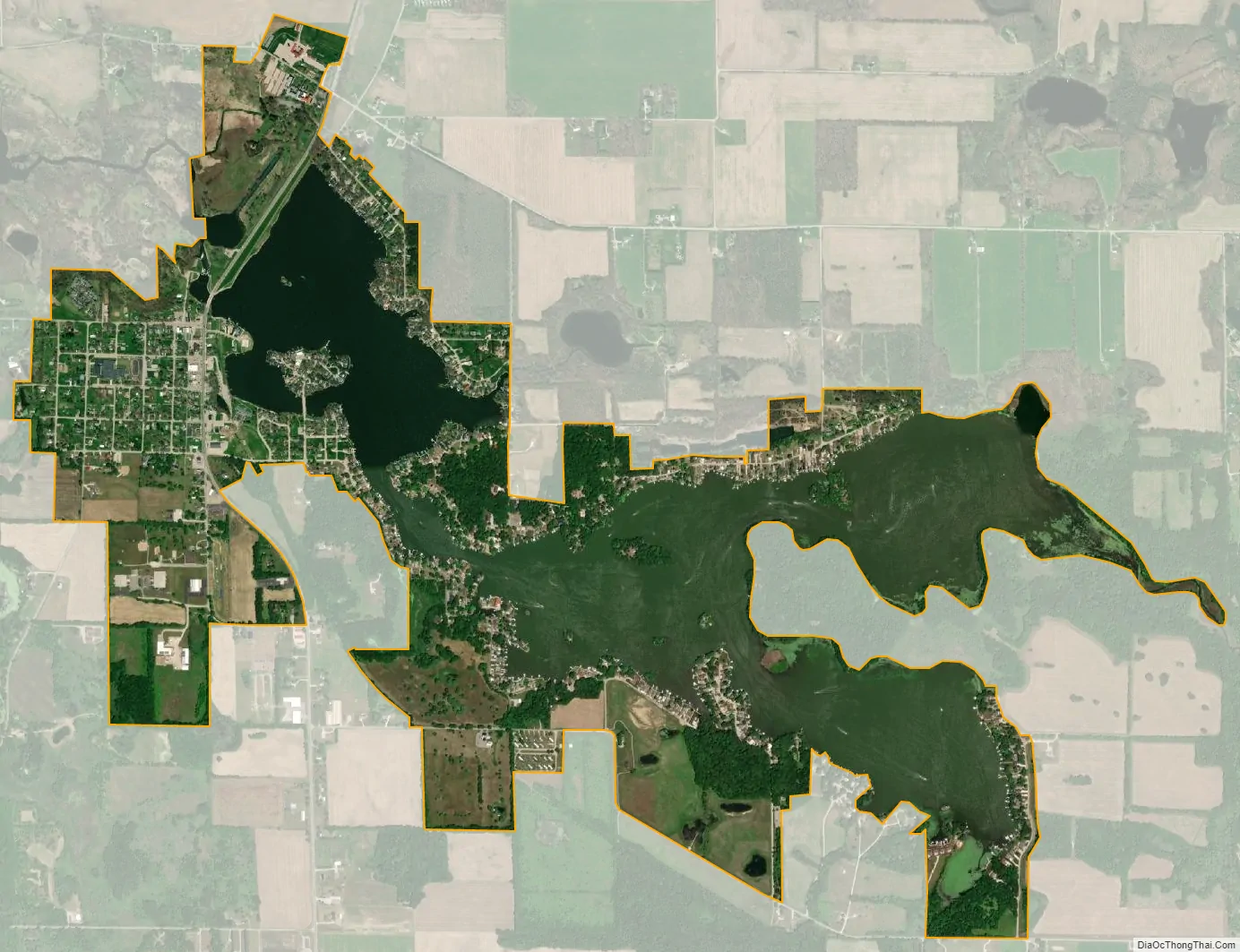
Rome City city Satellite Map
Geography
Rome City is located along Indiana State Road 9 adjacent to Sylvan Lake.
According to the 2010 census, Rome City has a total area of 2.151 square miles (5.57 km), of which 1.16 square miles (3.00 km) (or 53.93%) is land and 0.991 square miles (2.57 km) (or 46.07%) is water.
See also
Map of Indiana State and its subdivision:- Adams
- Allen
- Bartholomew
- Benton
- Blackford
- Boone
- Brown
- Carroll
- Cass
- Clark
- Clay
- Clinton
- Crawford
- Daviess
- De Kalb
- Dearborn
- Decatur
- Delaware
- Dubois
- Elkhart
- Fayette
- Floyd
- Fountain
- Franklin
- Fulton
- Gibson
- Grant
- Greene
- Hamilton
- Hancock
- Harrison
- Hendricks
- Henry
- Howard
- Huntington
- Jackson
- Jasper
- Jay
- Jefferson
- Jennings
- Johnson
- Knox
- Kosciusko
- LaGrange
- Lake
- Lake Michigan
- LaPorte
- Lawrence
- Madison
- Marion
- Marshall
- Martin
- Miami
- Monroe
- Montgomery
- Morgan
- Newton
- Noble
- Ohio
- Orange
- Owen
- Parke
- Perry
- Pike
- Porter
- Posey
- Pulaski
- Putnam
- Randolph
- Ripley
- Rush
- Saint Joseph
- Scott
- Shelby
- Spencer
- Starke
- Steuben
- Sullivan
- Switzerland
- Tippecanoe
- Tipton
- Union
- Vanderburgh
- Vermillion
- Vigo
- Wabash
- Warren
- Warrick
- Washington
- Wayne
- Wells
- White
- Whitley
- Alabama
- Alaska
- Arizona
- Arkansas
- California
- Colorado
- Connecticut
- Delaware
- District of Columbia
- Florida
- Georgia
- Hawaii
- Idaho
- Illinois
- Indiana
- Iowa
- Kansas
- Kentucky
- Louisiana
- Maine
- Maryland
- Massachusetts
- Michigan
- Minnesota
- Mississippi
- Missouri
- Montana
- Nebraska
- Nevada
- New Hampshire
- New Jersey
- New Mexico
- New York
- North Carolina
- North Dakota
- Ohio
- Oklahoma
- Oregon
- Pennsylvania
- Rhode Island
- South Carolina
- South Dakota
- Tennessee
- Texas
- Utah
- Vermont
- Virginia
- Washington
- West Virginia
- Wisconsin
- Wyoming