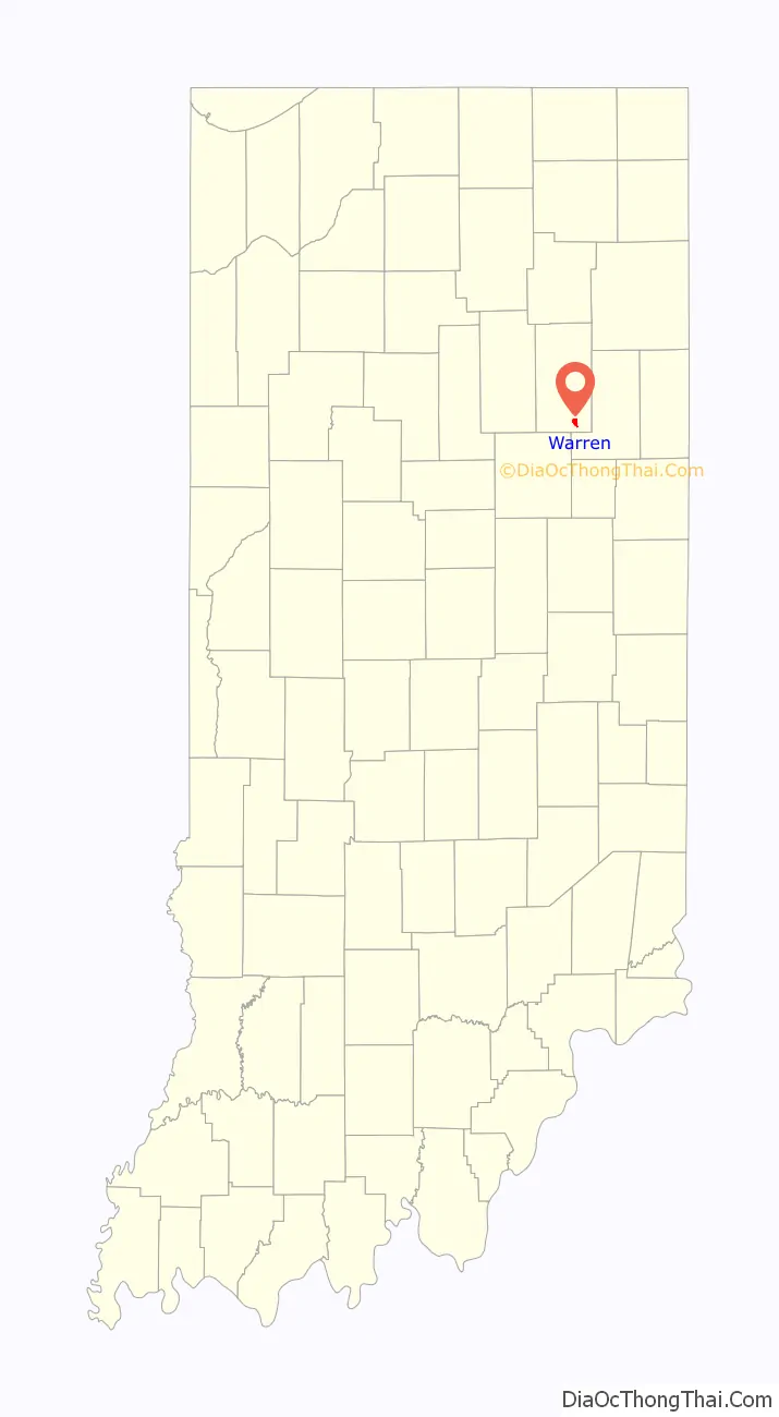
Warren is a town in Salamonie Township, Huntington County, Indiana. The population of Warren was 1,182 at the time of the 2020 census.
| Name: | Warren town |
|---|---|
| LSAD Code: | 43 |
| LSAD Description: | town (suffix) |
| State: | Indiana |
| County: | Huntington County |
| Elevation: | 823 ft (251 m) |
| Total Area: | 1.09 sq mi (2.82 km²) |
| Land Area: | 1.08 sq mi (2.80 km²) |
| Water Area: | 0.01 sq mi (0.01 km²) |
| Total Population: | 1,182 |
| Population Density: | 1,091.41/sq mi (421.54/km²) |
| ZIP code: | 46792 |
| Area code: | 260 |
| FIPS code: | 1880108 |
| GNISfeature ID: | 0445479 |
| Website: | http://www.warrenindiana.com/index.html |
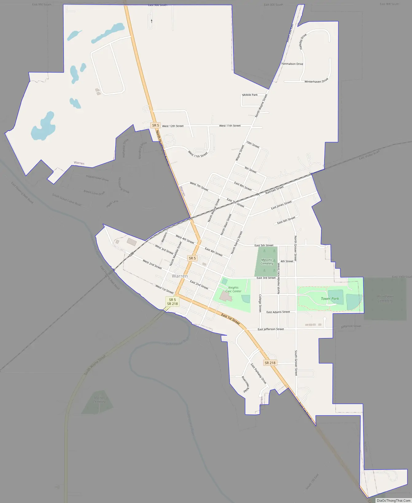
Online Interactive Map
Click on ![]() to view map in "full screen" mode.
to view map in "full screen" mode.
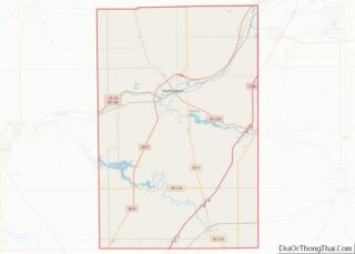
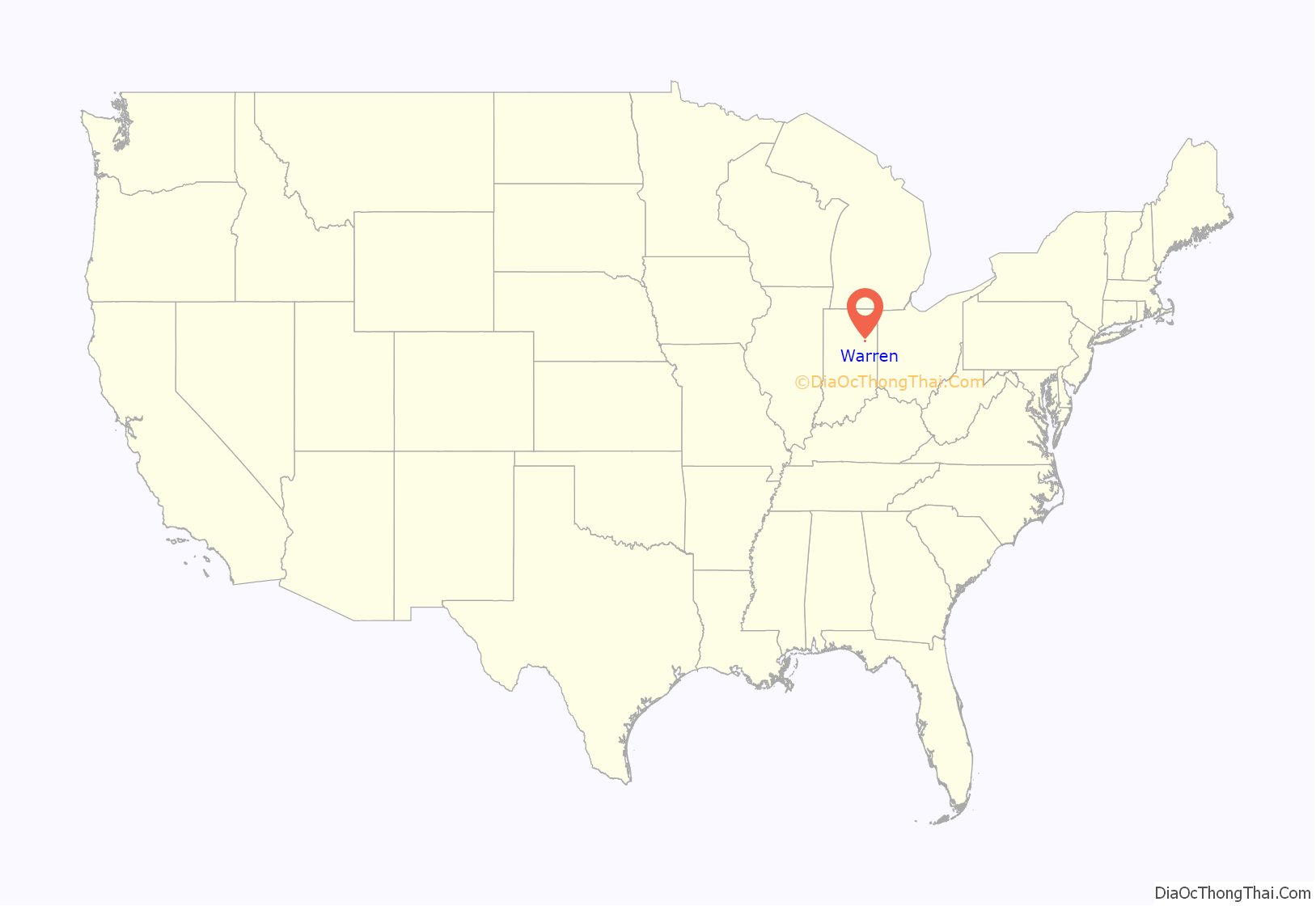
Warren location map. Where is Warren town?
History
Warren, originally known as “Jonesboro,” was platted in 1833 near the Indianapolis & Ft. Wayne Road. In 1837, founder Samuel Jones sold his first lot. The name was later changed due to there being another town of Jonesboro nearby, south of Marion. The town experienced growth in 1878 when a new railroad line was built through the neighborhood.
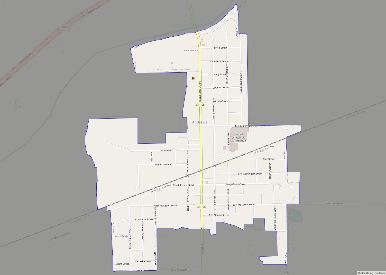
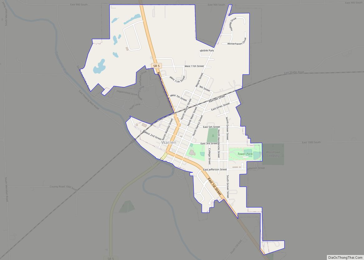
Warren Road Map
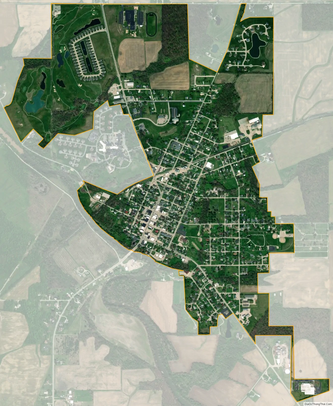
Warren city Satellite Map
Geography
Warren is located at 40°41′6″N 85°25′24″W / 40.68500°N 85.42333°W / 40.68500; -85.42333 (40.685112, -85.423446), along the Salamonie River. The town lies just southeast of Interstate 69 between exits 273 and 278.
According to the 2010 census, Warren has a total area of 1.145 square miles (2.97 km), of which 1.14 square miles (2.95 km) (or 99.56%) is land and 0.005 square miles (0.01 km) (or 0.44%) is water.
See also
Map of Indiana State and its subdivision:- Adams
- Allen
- Bartholomew
- Benton
- Blackford
- Boone
- Brown
- Carroll
- Cass
- Clark
- Clay
- Clinton
- Crawford
- Daviess
- De Kalb
- Dearborn
- Decatur
- Delaware
- Dubois
- Elkhart
- Fayette
- Floyd
- Fountain
- Franklin
- Fulton
- Gibson
- Grant
- Greene
- Hamilton
- Hancock
- Harrison
- Hendricks
- Henry
- Howard
- Huntington
- Jackson
- Jasper
- Jay
- Jefferson
- Jennings
- Johnson
- Knox
- Kosciusko
- LaGrange
- Lake
- Lake Michigan
- LaPorte
- Lawrence
- Madison
- Marion
- Marshall
- Martin
- Miami
- Monroe
- Montgomery
- Morgan
- Newton
- Noble
- Ohio
- Orange
- Owen
- Parke
- Perry
- Pike
- Porter
- Posey
- Pulaski
- Putnam
- Randolph
- Ripley
- Rush
- Saint Joseph
- Scott
- Shelby
- Spencer
- Starke
- Steuben
- Sullivan
- Switzerland
- Tippecanoe
- Tipton
- Union
- Vanderburgh
- Vermillion
- Vigo
- Wabash
- Warren
- Warrick
- Washington
- Wayne
- Wells
- White
- Whitley
- Alabama
- Alaska
- Arizona
- Arkansas
- California
- Colorado
- Connecticut
- Delaware
- District of Columbia
- Florida
- Georgia
- Hawaii
- Idaho
- Illinois
- Indiana
- Iowa
- Kansas
- Kentucky
- Louisiana
- Maine
- Maryland
- Massachusetts
- Michigan
- Minnesota
- Mississippi
- Missouri
- Montana
- Nebraska
- Nevada
- New Hampshire
- New Jersey
- New Mexico
- New York
- North Carolina
- North Dakota
- Ohio
- Oklahoma
- Oregon
- Pennsylvania
- Rhode Island
- South Carolina
- South Dakota
- Tennessee
- Texas
- Utah
- Vermont
- Virginia
- Washington
- West Virginia
- Wisconsin
- Wyoming