Princeton is a home rule-class city in Caldwell County, Kentucky, in the United States. It is the seat of its county. The population was 6,329 during the 2010 U.S. Census. Princeton is home to several notable attractions such as Adsmore Museum, Champion-Shepherdson House (home of the Princeton Art Guild), University of Kentucky Research and Education Center Botanical Garden, Capitol Cinemas, the Annual Black Patch Festival, and Newsom’s Aged Kentucky Ham.
| Name: | Princeton city |
|---|---|
| LSAD Code: | 25 |
| LSAD Description: | city (suffix) |
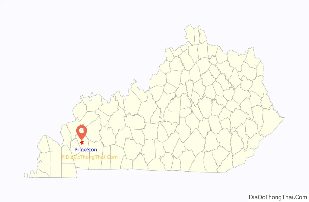
| State: | Kentucky |
| County: | Caldwell County |
| Incorporated: | 1854 |
| Elevation: | 482 ft (147 m) |
| Total Area: | 9.01 sq mi (23.33 km²) |
| Land Area: | 8.99 sq mi (23.27 km²) |
| Water Area: | 0.02 sq mi (0.06 km²) |
| Total Population: | 6,270 |
| Population Density: | 697.75/sq mi (269.41/km²) |
| ZIP code: | 42445 |
| Area code: | Area codes 270 and 364 |
| FIPS code: | 2163138 |
| GNISfeature ID: | 0501350 |
| Website: | www.princeton.ky.gov |
Online Interactive Map
Click on ![]() to view map in "full screen" mode.
to view map in "full screen" mode.
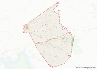
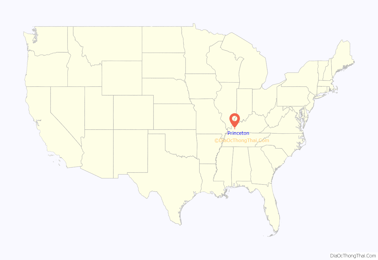
Princeton location map. Where is Princeton city?
History
The community at the head of Eddy Creek was first called Eddy Grove for the creek’s source at a large whirling spring. 1,700 acres (690 ha) of surrounding land was granted to the Virginian William Prince for his service during the American Revolution. He settled there in what was then Livingston County in 1799 and erected Shandy Hall, a brick home and tavern. Prince’s heirs and another local landowner named Thomas Frazier granted 40 acres (16 ha) around Eddy Grove and Prince’s Place towards the establishment of a new town in 1817, provided the courthouse of the newly formed Caldwell County was relocated there from Eddyville. The county court accepted the proposal in July and named the new community Princetown, which shortened to Princeton by the time of the Eddy Grove.
Construction of Princeton College began in 1860 but was delayed by the commencement of the Civil War. Confederate troops camped on its campus in 1861, using one of the buildings as a hospital when the area came under Confederate control. Following the Confederate retreat in early 1862, Union soldiers occupied the town for the remainder of the war. In December 1864, Confederate-allied Kentuckian cavalry under Gen. Hylan B. Lyon raided the town and razed the courthouse, which was serving as a Union garrison.
The expansion of railroads in the late 19th century made Princeton an important junction on several major railway lines, most notably the Illinois Central and the Louisville and Nashville Railroad. Princeton was also at the center of the Black Patch Tobacco Wars that occurred after the turn of the 20th century.
Since 1925, Princeton has housed the University of Kentucky Research and Education Center, a campus of the University of Kentucky’s College of Agriculture.
2021 tornado
A large, violent, and historic tornado tracked through the southern part of Princeton during the late evening hours of December 10th, 2021. The tornado traveled about 165.6 miles, forming in northwestern Obion County, Tennessee, and reaching EF4 strength on many occasions along its path, before dissipating in Grayson County, Kentucky. Almost 70 homes were demolished in or near Princeton. Many of the homes damaged or destroyed surrounded the Princeton Golf and Country Club, which now hosts a landfill of approximately 60 homes.
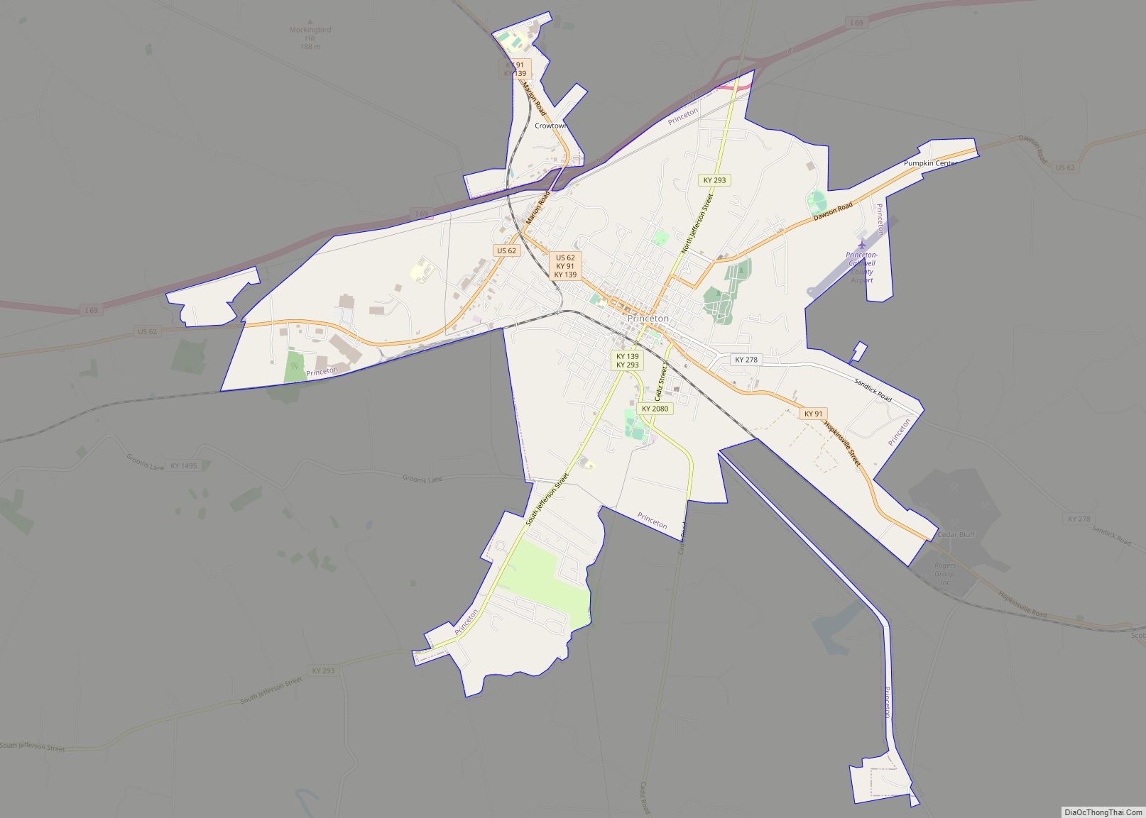
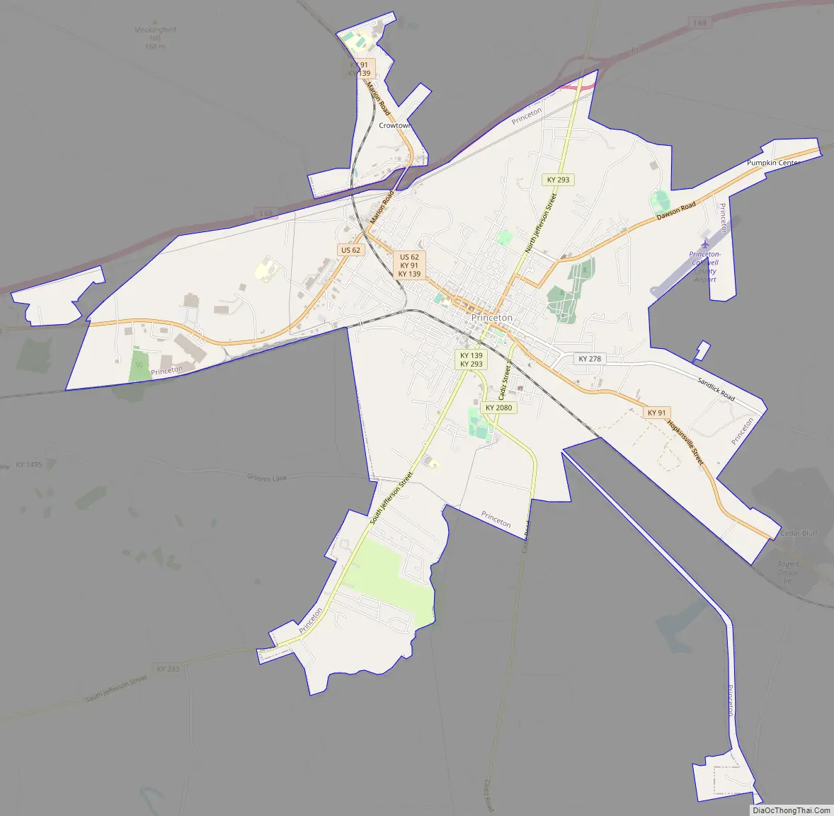
Princeton Road Map
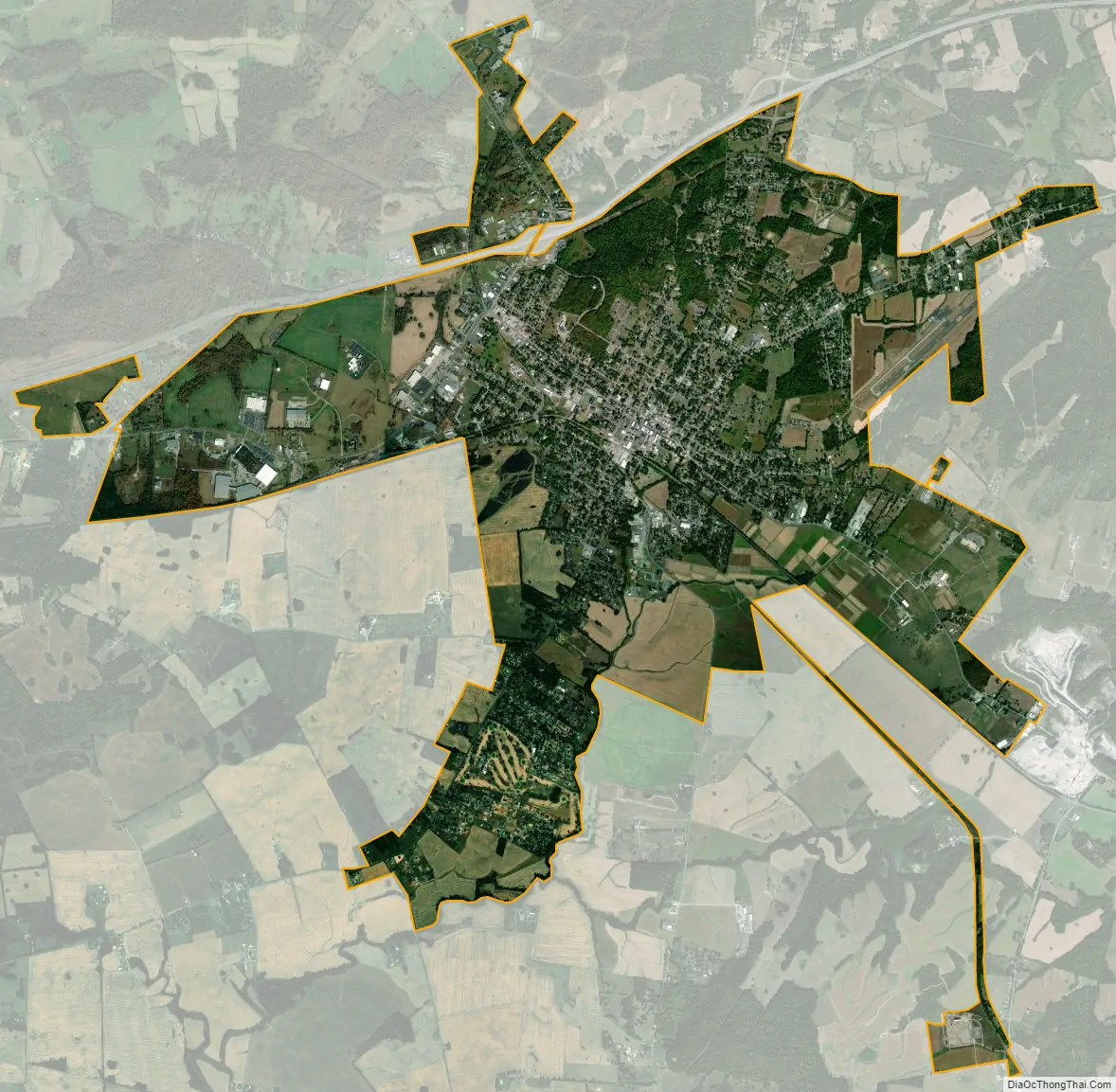
Princeton city Satellite Map
Geography
Princeton is located slightly southwest of the center of Caldwell County at 37°6′28″N 87°52′57″W / 37.10778°N 87.88250°W / 37.10778; -87.88250 (37.107674, -87.882479). According to the United States Census Bureau, the city has a total area of 9.0 square miles (23.3 km), of which 0.023 square miles (0.06 km), or 0.26%, is water.
U.S. Route 62 (Kentucky) passes through the city center, leading east 12 miles (19 km) to Dawson Springs and west 12 miles (19 km) to Eddyville. Interstate 69 runs along the northern edge of Princeton, with access from exits 79 (Kentucky Route 91) and 81 (KY 293). KY 91 runs northwest from Princeton 22 miles (35 km) to Marion and southeast 28 miles (45 km) to Hopkinsville.
Hays Spring, located on Hayes Spring Road west of the city limits, is a natural spring that once supplied the water to the Princeton area.
Princeton was a prime viewing spot for the total solar eclipse of August 21, 2017. This eclipse was viewable across the United States, with its maximum peak in Princeton, where totality lasted 2 minutes and 40 seconds.
Climate
The climate in this area is characterized by hot, humid summers and generally mild to cool winters. According to the Köppen Climate Classification system, Princeton has a humid subtropical climate, abbreviated “Cfa” on climate maps.
See also
Map of Kentucky State and its subdivision:- Adair
- Allen
- Anderson
- Ballard
- Barren
- Bath
- Bell
- Boone
- Bourbon
- Boyd
- Boyle
- Bracken
- Breathitt
- Breckinridge
- Bullitt
- Butler
- Caldwell
- Calloway
- Campbell
- Carlisle
- Carroll
- Carter
- Casey
- Christian
- Clark
- Clay
- Clinton
- Crittenden
- Cumberland
- Daviess
- Edmonson
- Elliott
- Estill
- Fayette
- Fleming
- Floyd
- Franklin
- Fulton
- Gallatin
- Garrard
- Grant
- Graves
- Grayson
- Green
- Greenup
- Hancock
- Hardin
- Harlan
- Harrison
- Hart
- Henderson
- Henry
- Hickman
- Hopkins
- Jackson
- Jefferson
- Jessamine
- Johnson
- Kenton
- Knott
- Knox
- Larue
- Laurel
- Lawrence
- Lee
- Leslie
- Letcher
- Lewis
- Lincoln
- Livingston
- Logan
- Lyon
- Madison
- Magoffin
- Marion
- Marshall
- Martin
- Mason
- McCracken
- McCreary
- McLean
- Meade
- Menifee
- Mercer
- Metcalfe
- Monroe
- Montgomery
- Morgan
- Muhlenberg
- Nelson
- Nicholas
- Ohio
- Oldham
- Owen
- Owsley
- Pendleton
- Perry
- Pike
- Powell
- Pulaski
- Robertson
- Rockcastle
- Rowan
- Russell
- Scott
- Shelby
- Simpson
- Spencer
- Taylor
- Todd
- Trigg
- Trimble
- Union
- Warren
- Washington
- Wayne
- Webster
- Whitley
- Wolfe
- Woodford
- Alabama
- Alaska
- Arizona
- Arkansas
- California
- Colorado
- Connecticut
- Delaware
- District of Columbia
- Florida
- Georgia
- Hawaii
- Idaho
- Illinois
- Indiana
- Iowa
- Kansas
- Kentucky
- Louisiana
- Maine
- Maryland
- Massachusetts
- Michigan
- Minnesota
- Mississippi
- Missouri
- Montana
- Nebraska
- Nevada
- New Hampshire
- New Jersey
- New Mexico
- New York
- North Carolina
- North Dakota
- Ohio
- Oklahoma
- Oregon
- Pennsylvania
- Rhode Island
- South Carolina
- South Dakota
- Tennessee
- Texas
- Utah
- Vermont
- Virginia
- Washington
- West Virginia
- Wisconsin
- Wyoming