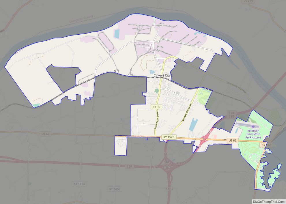
Calvert City is a home rule-class city in Marshall County, Kentucky, United States. The population was 2,514 at the 2020 census.
| Name: | Calvert City city |
|---|---|
| LSAD Code: | 25 |
| LSAD Description: | city (suffix) |
| State: | Kentucky |
| County: | Marshall County |
| Elevation: | 381 ft (116 m) |
| Total Area: | 18.51 sq mi (47.94 km²) |
| Land Area: | 17.88 sq mi (46.30 km²) |
| Water Area: | 0.63 sq mi (1.64 km²) |
| Total Population: | 2,514 |
| Population Density: | 140.63/sq mi (54.30/km²) |
| ZIP code: | 42029 (Calvert City), 42044 (Gilbertsville) |
| Area code: | 270 & 364 |
| FIPS code: | 2112016 |
| GNISfeature ID: | 2403972 |
| Website: | www.calvertcity.com |
Online Interactive Map
Click on ![]() to view map in "full screen" mode.
to view map in "full screen" mode.
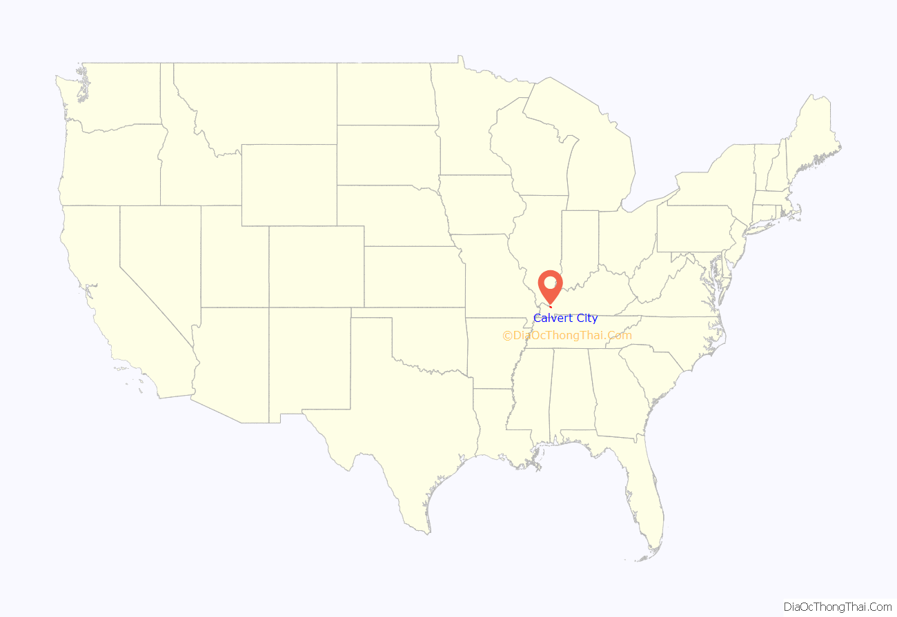
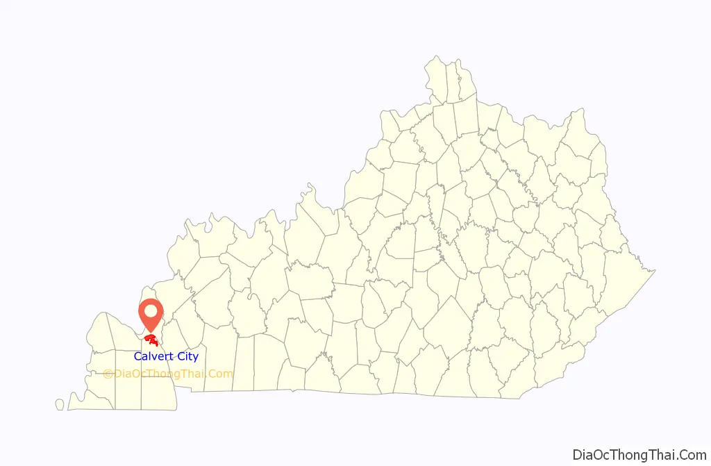
Calvert City location map. Where is Calvert City city?
History
Calvert City was named for Potilla Willis Calvert. He built his home, Oak Hill, in 1860 and around a decade later gave a portion of his land to a new railroad, specifying that a station be built near his home. That station served as the starting point of the town, which was incorporated on March 18, 1871. The railroad station and post office long favored the shorter Calvert, but the Board on Geographic Names reversed its earlier decision in 1957 and switched to the longer form.
By 1896, Calvert City was known as a sundown town, where African Americans were not allowed to reside. By 1908, the rest of Marshall County had also expelled its African American residents.
During the Ohio River flood of 1937, Calvert City’s business district and much of the residential area were severely damaged by floodwaters.
In the 1940s, the construction of nearby Kentucky Dam by the Tennessee Valley Authority brought plentiful electric power that led many industrial plants, mostly chemical manufacturers, to locate between the city and the Tennessee River. Merchant Luther Draffen was instrumental in attracting the dam and industrial plants.
Calvert City Road Map
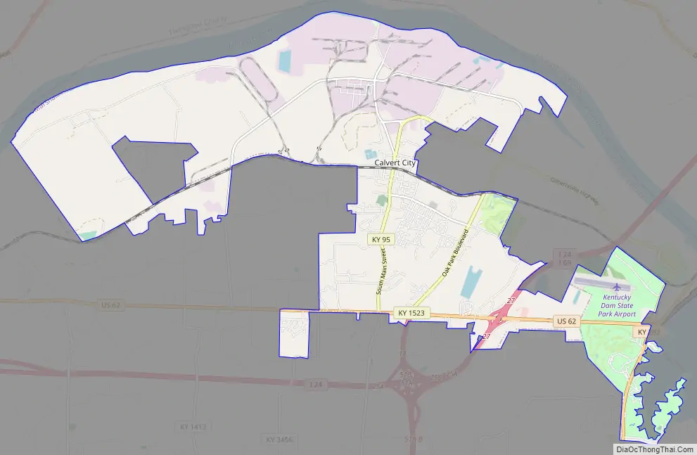
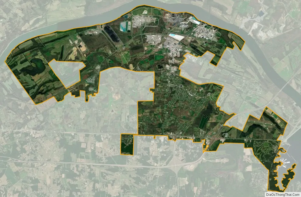
Calvert City city Satellite Map
Geography
Calvert City is in northern Marshall County, along the south bank of the Tennessee River, 13 miles (21 km) upstream from its mouth at the Ohio River. It is 18 miles (29 km) east of Paducah, 13 miles (21 km) north of Benton, the Marshall county seat, and 30 miles (48 km) west of Princeton. The city limits extend southeast as far as the western shore of Kentucky Lake on the Tennessee River.
According to the United States Census Bureau, Calvert City has a total area of 18.5 square miles (48 km), of which 17.9 square miles (46 km) are land and 0.6 square miles (1.6 km), or 3.42%, are water.
See also
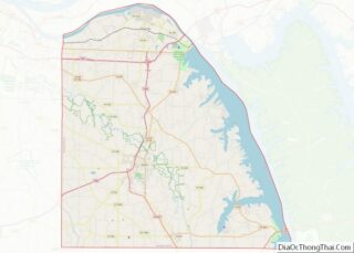
Map of Kentucky State and its subdivision:- Adair
- Allen
- Anderson
- Ballard
- Barren
- Bath
- Bell
- Boone
- Bourbon
- Boyd
- Boyle
- Bracken
- Breathitt
- Breckinridge
- Bullitt
- Butler
- Caldwell
- Calloway
- Campbell
- Carlisle
- Carroll
- Carter
- Casey
- Christian
- Clark
- Clay
- Clinton
- Crittenden
- Cumberland
- Daviess
- Edmonson
- Elliott
- Estill
- Fayette
- Fleming
- Floyd
- Franklin
- Fulton
- Gallatin
- Garrard
- Grant
- Graves
- Grayson
- Green
- Greenup
- Hancock
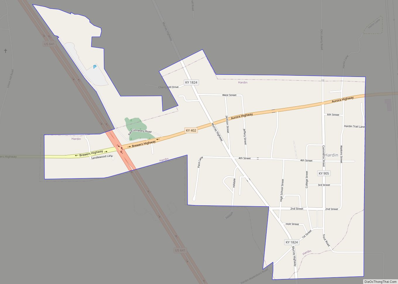
- Hardin
- Harlan
- Harrison
- Hart
- Henderson
- Henry
- Hickman
- Hopkins
- Jackson
- Jefferson
- Jessamine
- Johnson
- Kenton
- Knott
- Knox
- Larue
- Laurel
- Lawrence
- Lee
- Leslie
- Letcher
- Lewis
- Lincoln
- Livingston
- Logan
- Lyon
- Madison
- Magoffin
- Marion
- Marshall
- Martin
- Mason
- McCracken
- McCreary
- McLean
- Meade
- Menifee
- Mercer
- Metcalfe
- Monroe
- Montgomery
- Morgan
- Muhlenberg
- Nelson
- Nicholas
- Ohio
- Oldham
- Owen
- Owsley
- Pendleton
- Perry
- Pike
- Powell
- Pulaski
- Robertson
- Rockcastle
- Rowan
- Russell
- Scott
- Shelby
- Simpson
- Spencer
- Taylor
- Todd
- Trigg
- Trimble
- Union
- Warren
- Washington
- Wayne
- Webster
- Whitley
- Wolfe
- Woodford
- Alabama
- Alaska
- Arizona
- Arkansas
- California
- Colorado
- Connecticut
- Delaware
- District of Columbia
- Florida
- Georgia
- Hawaii
- Idaho
- Illinois
- Indiana
- Iowa
- Kansas
- Kentucky
- Louisiana
- Maine
- Maryland
- Massachusetts
- Michigan
- Minnesota
- Mississippi
- Missouri
- Montana
- Nebraska
- Nevada
- New Hampshire
- New Jersey
- New Mexico
- New York
- North Carolina
- North Dakota
- Ohio
- Oklahoma
- Oregon
- Pennsylvania
- Rhode Island
- South Carolina
- South Dakota
- Tennessee
- Texas
- Utah
- Vermont
- Virginia
- Washington
- West Virginia
- Wisconsin
- Wyoming