Chocowinity is a town in Beaufort County, North Carolina, United States. The population was 820 at the 2010 Census. The town is a part of the Washington Area located in North Carolina’s Coastal Plains region.
| Name: | Chocowinity town |
|---|---|
| LSAD Code: | 43 |
| LSAD Description: | town (suffix) |
| State: | North Carolina |
| County: | Beaufort County |
| Elevation: | 39 ft (12 m) |
| Total Area: | 1.00 sq mi (2.58 km²) |
| Land Area: | 1.00 sq mi (2.58 km²) |
| Water Area: | 0.00 sq mi (0.00 km²) |
| Total Population: | 722 |
| Population Density: | 724.17/sq mi (279.72/km²) |
| ZIP code: | 27817 |
| Area code: | 252 |
| FIPS code: | 3712580 |
| GNISfeature ID: | 1019670 |
| Website: | www.beaufort-county.com/Chocowinity/Chocowinity.htm |
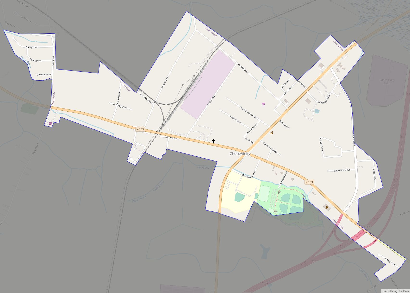
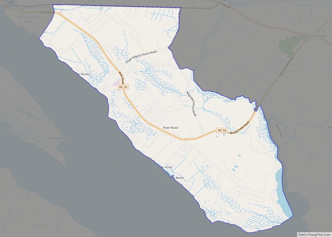
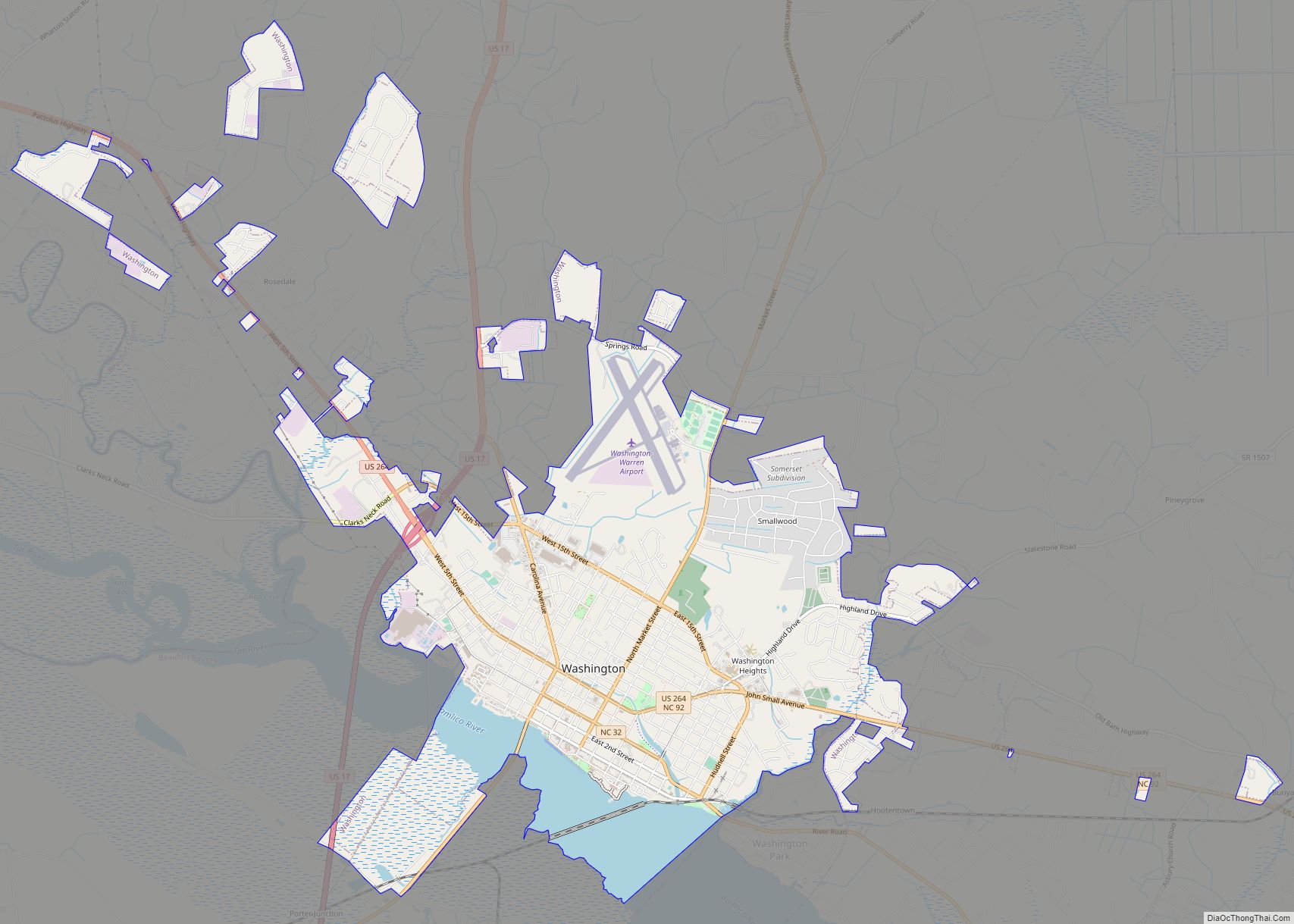
Online Interactive Map
Click on ![]() to view map in "full screen" mode.
to view map in "full screen" mode.
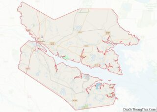
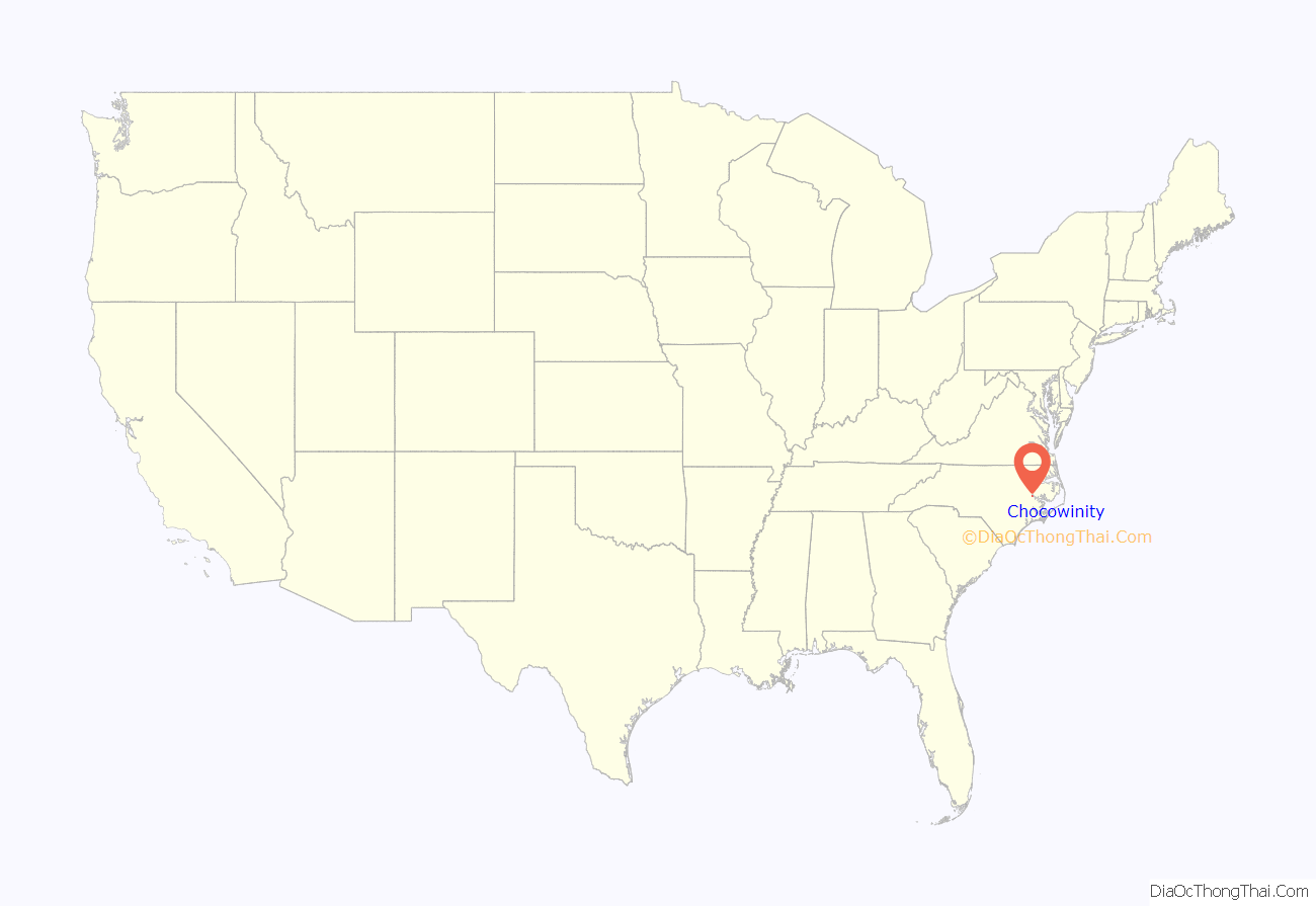
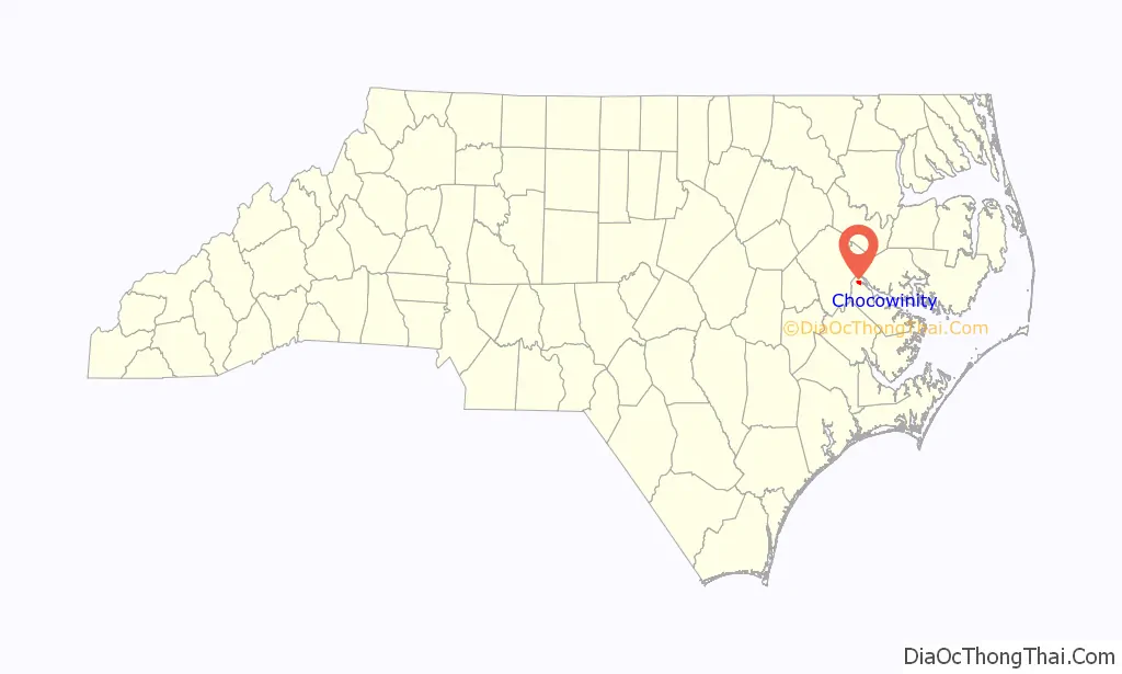
Chocowinity location map. Where is Chocowinity town?
History
The meaning of the name Chocowinity appears to be derived from the Tuscarora word chackauene, meaning “otter” or “little otters.” However, most people from the area insist that the name actually means “fish in many waters.” In 1928, Rev. N.C. Hughes, D.D., met a well-educated Native American encamped on the banks of the Edisto River in South Carolina. While talking with him, Mr. Hughes mentioned he lived in a small village with a Native American name. Mr. Hughes pronounced the name “Chocowinity” and also spelled its former name of “Chocawanateth.” The Indian thought for a moment and finally responded, “Oh yes, I have it now. That word means FISH FROM MANY WATERS.”
In the early 20th century, Chocowinity became the railroad hub of the regional system known as the Norfolk Southern Railway in 1910. The town is sometimes called Marsden as a result of a railroad communications problem. Around 1917, the railway started calling the pivotal location “Marsden”, which was easier to spell on a telegraph than “Chocowinity”. The source of the new name was apparently taken in honor of one of its financial backers, Marsden J. Perry of New York, who eventually served as president of the railroad.
The regional Norfolk Southern (one of the predecessors of the modern system which adopted the same name) had lines between Norfolk, Virginia and Charlotte and served many locations in southeastern Virginia (including branches to Virginia Beach and Suffolk) and most of eastern and central North Carolina, including Raleigh, Elizabeth City, New Bern, Morehead City, Goldsboro, Durham, Fayetteville, Asheville, and Greenville. The regional carrier was acquired by the Southern Railway, and lent its historic name to the merger with the Norfolk and Western in the early 1980s to form the current large Norfolk Southern Railway System. The railroad resumed using “Chocowinity” to designate the location in 1970, after railway telegraphs were replaced with voice communications via 2-way radios. [1]
The Trinity Episcopal Cemetery was listed on the National Register of Historic Places in 2011.
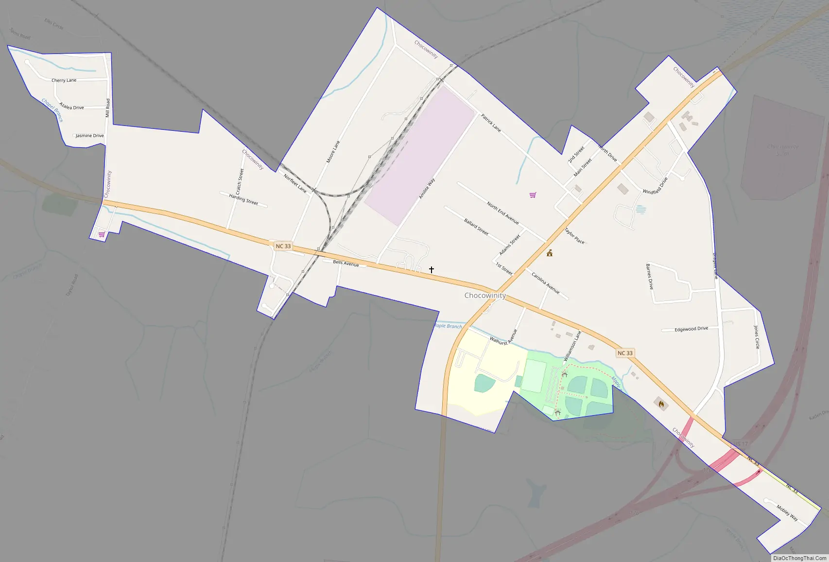
Chocowinity Road Map
Chocowinity city Satellite Map
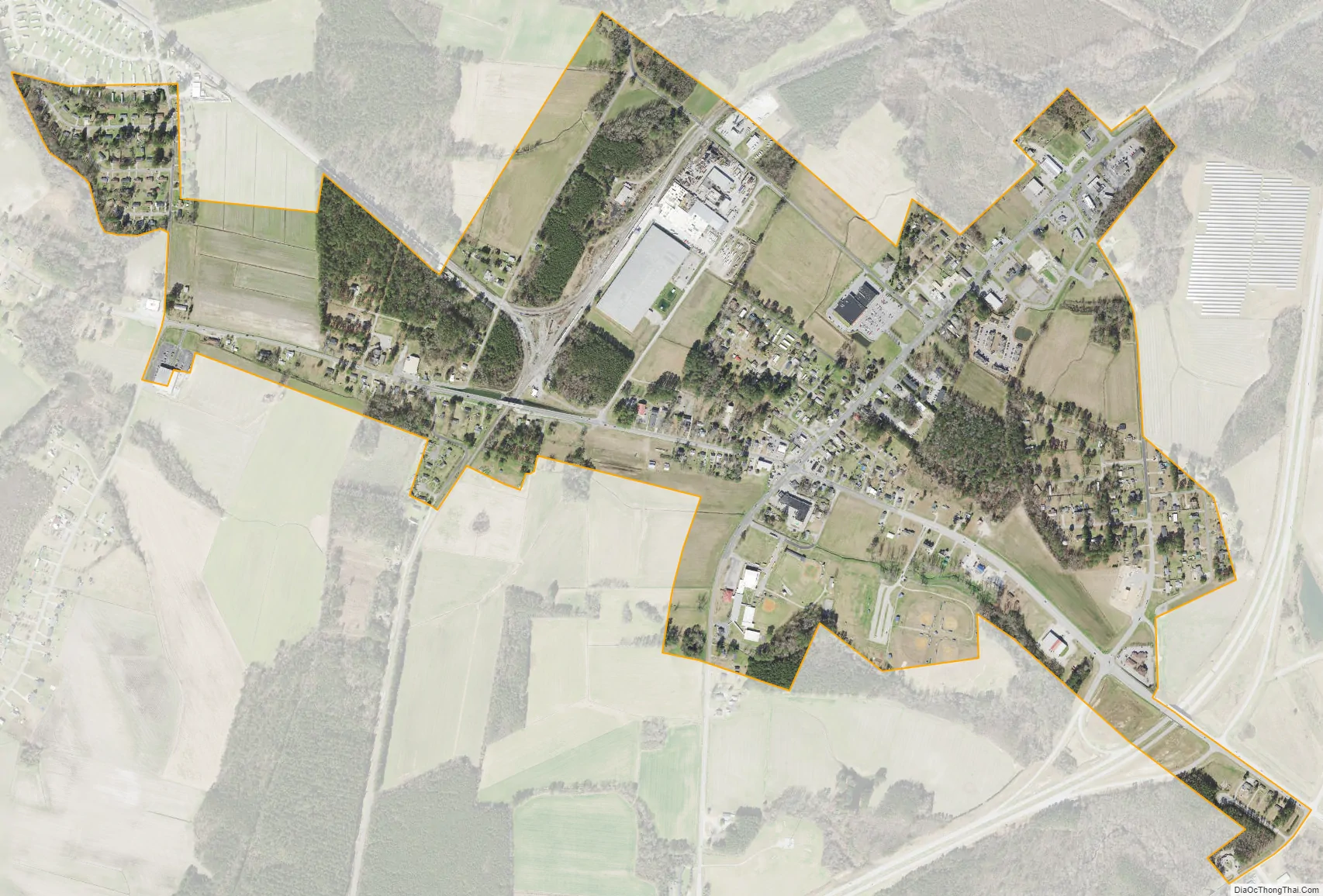
Geography
Chocowinity is located at 35°30′57″N 77°6′2″W / 35.51583°N 77.10056°W / 35.51583; -77.10056 (35.515788, -77.100528).
According to the United States Census Bureau, the town has a total area of 1.0 square mile (2.6 km), all land.
See also
Map of North Carolina State and its subdivision:- Alamance
- Alexander
- Alleghany
- Anson
- Ashe
- Avery
- Beaufort
- Bertie
- Bladen
- Brunswick
- Buncombe
- Burke
- Cabarrus
- Caldwell
- Camden
- Carteret
- Caswell
- Catawba
- Chatham
- Cherokee
- Chowan
- Clay
- Cleveland
- Columbus
- Craven
- Cumberland
- Currituck
- Dare
- Davidson
- Davie
- Duplin
- Durham
- Edgecombe
- Forsyth
- Franklin
- Gaston
- Gates
- Graham
- Granville
- Greene
- Guilford
- Halifax
- Harnett
- Haywood
- Henderson
- Hertford
- Hoke
- Hyde
- Iredell
- Jackson
- Johnston
- Jones
- Lee
- Lenoir
- Lincoln
- Macon
- Madison
- Martin
- McDowell
- Mecklenburg
- Mitchell
- Montgomery
- Moore
- Nash
- New Hanover
- Northampton
- Onslow
- Orange
- Pamlico
- Pasquotank
- Pender
- Perquimans
- Person
- Pitt
- Polk
- Randolph
- Richmond
- Robeson
- Rockingham
- Rowan
- Rutherford
- Sampson
- Scotland
- Stanly
- Stokes
- Surry
- Swain
- Transylvania
- Tyrrell
- Union
- Vance
- Wake
- Warren
- Washington
- Watauga
- Wayne
- Wilkes
- Wilson
- Yadkin
- Yancey
- Alabama
- Alaska
- Arizona
- Arkansas
- California
- Colorado
- Connecticut
- Delaware
- District of Columbia
- Florida
- Georgia
- Hawaii
- Idaho
- Illinois
- Indiana
- Iowa
- Kansas
- Kentucky
- Louisiana
- Maine
- Maryland
- Massachusetts
- Michigan
- Minnesota
- Mississippi
- Missouri
- Montana
- Nebraska
- Nevada
- New Hampshire
- New Jersey
- New Mexico
- New York
- North Carolina
- North Dakota
- Ohio
- Oklahoma
- Oregon
- Pennsylvania
- Rhode Island
- South Carolina
- South Dakota
- Tennessee
- Texas
- Utah
- Vermont
- Virginia
- Washington
- West Virginia
- Wisconsin
- Wyoming