Elkton (formerly Conrad’s Store) is an incorporated town in Rockingham County, Virginia, United States. It is included in the Harrisonburg Metropolitan Statistical Area. The population was 2,762 at the 2010 census. Elkton was named for the Elk Run stream.
It is located along the south fork of the Shenandoah River at the intersections of east-west U.S. Route 33 and north-south U.S. Route 340. The town celebrated its 100th anniversary in 2008.
| Name: | Elkton town |
|---|---|
| LSAD Code: | 43 |
| LSAD Description: | town (suffix) |
| State: | Virginia |
| County: | Rockingham County |
| Elevation: | 971 ft (296 m) |
| Total Area: | 3.21 sq mi (8.31 km²) |
| Land Area: | 3.16 sq mi (8.19 km²) |
| Water Area: | 0.05 sq mi (0.12 km²) |
| Total Population: | 2,726 |
| Population Density: | 918.09/sq mi (354.44/km²) |
| ZIP code: | 22827 |
| Area code: | 540 |
| FIPS code: | 5125408 |
| GNISfeature ID: | 1494217 |
Online Interactive Map
Click on ![]() to view map in "full screen" mode.
to view map in "full screen" mode.
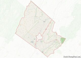
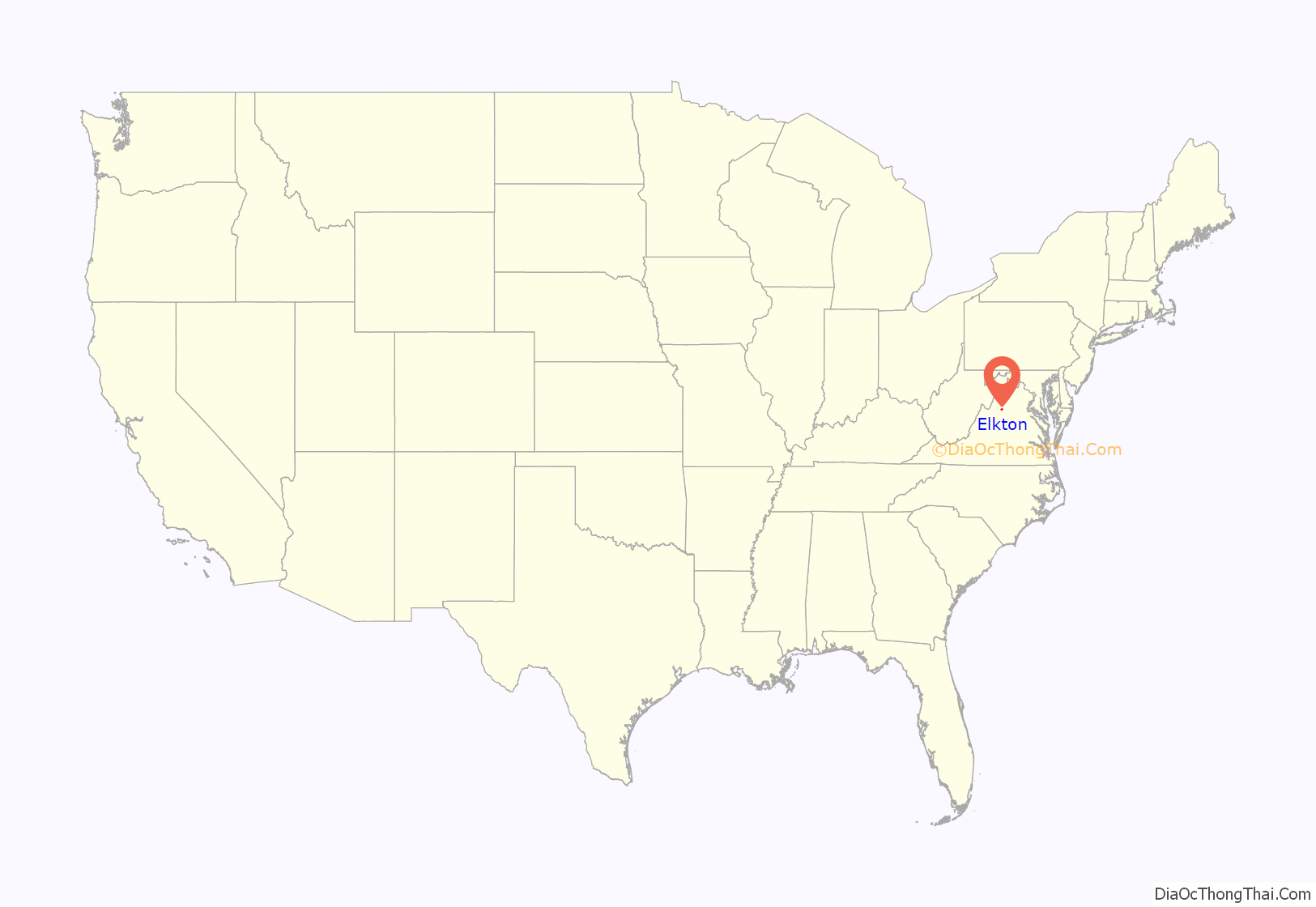
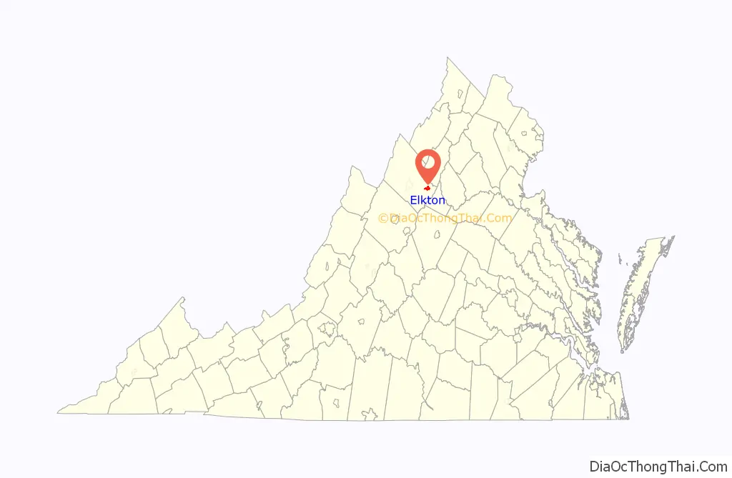
Elkton location map. Where is Elkton town?
History
One of the first European-Americans to settle permanently in the area was Adam Miller (Mueller), a native of Germany. In 1741, Miller purchased 820 acres (3.3 km), including a large lithia spring, near Elkton and lived on this property for the remainder of his life. He sold 280 acres (1.1 km) of this property to his son-in-law, Jacob Baer, and the spring on Miller’s land is still known as Bear Lithia Spring.
Conrads Store was a general store built by George Conrad about 1812. George Conrad was a son of Captain Stephen Conrad who served during the American Revolution. In 1816, Conrads Store became a United States post office with George Conrad as its first postmaster. During the American Civil War (1861–1865), Conrads Store operated as a Confederate post office. In September 1866, postal service was briefly discontinued at Conrads Store, and intermittently resumed and discontinued over the next decade until 1881 when the name, Elkton, was adopted as the name of new passenger station of the Shenandoah Valley Railroad. In January 1881, Elkton, Virginia was established as a post office. The Town of Elkton was officially incorporated on March 14, 1908.
An important building in the town’s history is the Jennings House. Built in 1840 by Dr. Samuel B. Jennings, the house was transformed into a hospital during the Civil War. The historic Jennings House was converted to house the local government. In the Summer of 2016, local government offices & the Elkton Police Department were moved out of the Jennings building in favor of the Elkton Area Community Center. On December 11, 2020, the Jennings House was opened as the Elkton Town Hall after a nearly 8 month restoration process to restore the home and add modern amenities like updated electric, plumbing, HVAC, ADA compliant restrooms, and a wheelchair lift. The town Christmas tree can be found across the street from the house.
Located on Rockingham Street, the Miller-Kite House was the headquarters of General Stonewall Jackson at the start of the Shenandoah Valley Campaign during the Civil War. Now the house is a town landmark and museum, housing many items from the war and some of Jackson’s personal belongings. In one of the second-story windows a cardboard cutout of the General watches the street. Many visitors report stories of ghosts or unusual behavior while in the house.
In addition to the Miller-Kite House, Bon Air and the Kite Mansion are listed on the National Register of Historic Places.
Elkton Road Map
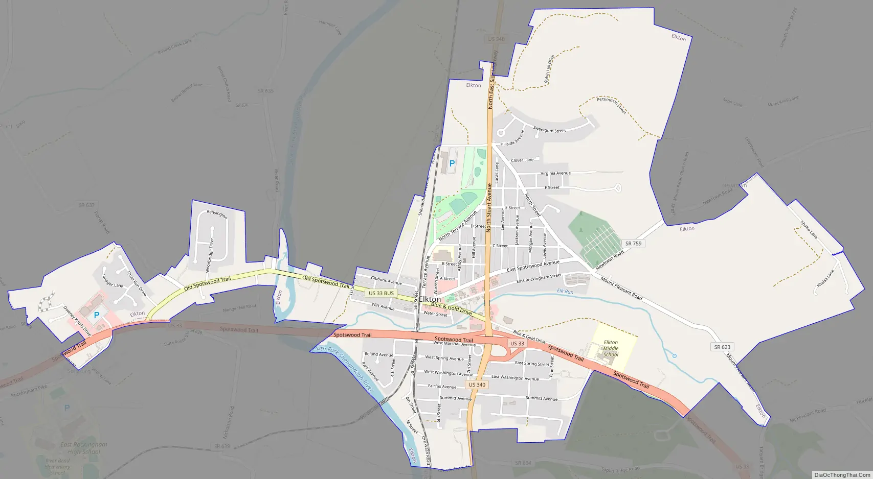
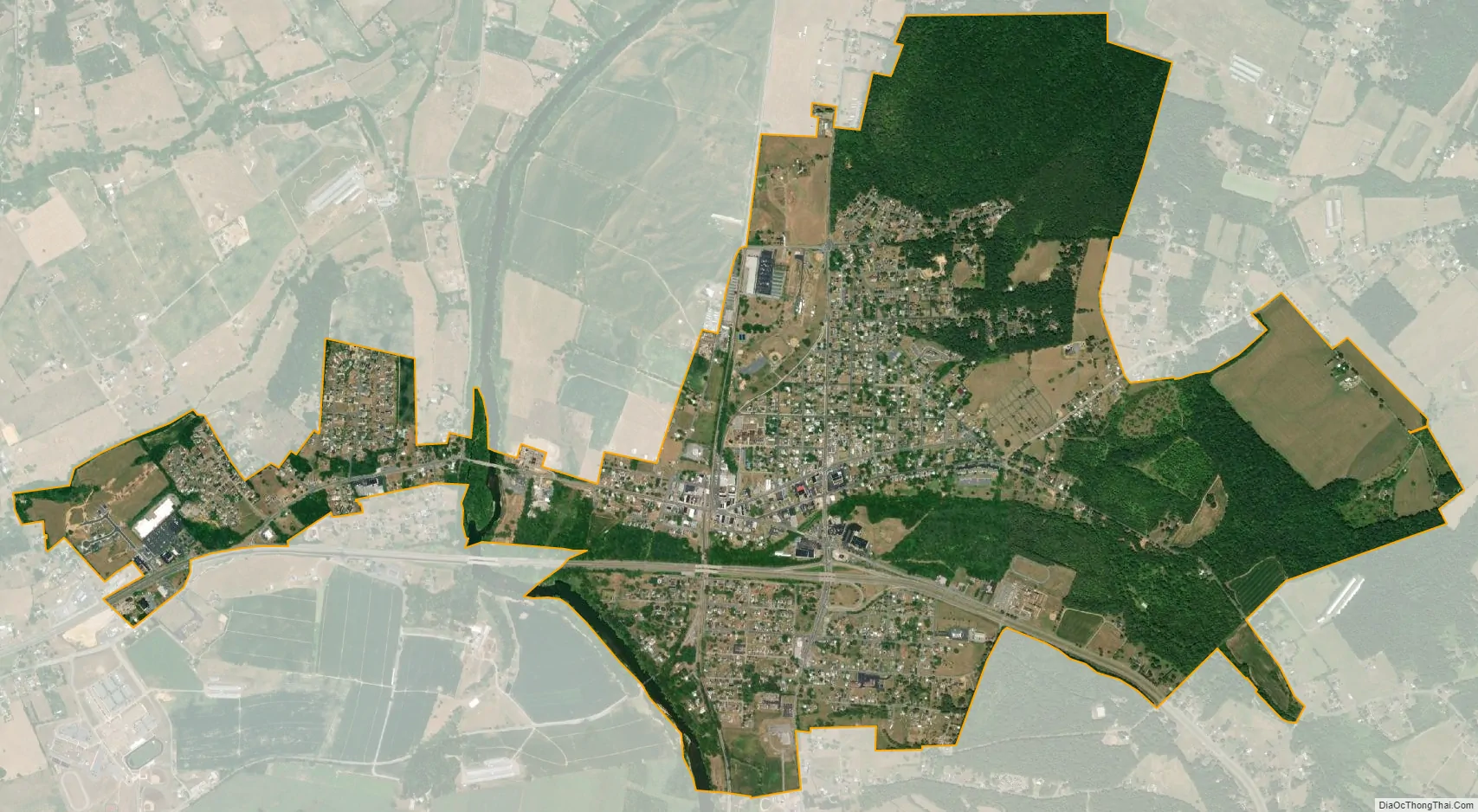
Elkton city Satellite Map
Geography
Elkton is located at 38°24′30″N 78°37′13″W / 38.40833°N 78.62028°W / 38.40833; -78.62028 (38.408298, −78.620321). It is located on the northeast portion of Rockingham County, Virginia. Elkton is bordered by Page County to the north, the Blue Ridge Mountains to the east, the Massanutten Mountain range to the west, and the Merck manufacturing plant and MillerCoors brewery and distribution center to the south. Norfolk Southern’s Virginia Division’s rail line, Route 33, and the South Fork of the Shenandoah River all cut through the town. The general area is agricultural, filled with farm lands and rural scenes.
According to the United States Census Bureau, the town has a total area of 1.4 square miles (3.6 km), of which, 1.4 square miles (3.5 km) of it is land and 0.04 square miles (0.1 km) of it (1.43%) is water.
See also
Map of Virginia State and its subdivision:- Accomack
- Albemarle
- Alexandria
- Alleghany
- Amelia
- Amherst
- Appomattox
- Arlington
- Augusta
- Bath
- Bedford
- Bedford City
- Bland
- Botetourt
- Bristol
- Brunswick
- Buchanan
- Buckingham
- Buena Vista
- Campbell
- Caroline
- Carroll
- Charles City
- Charlotte
- Charlottesville
- Chesapeake
- Chesterfield
- Clarke
- Clifton Forge City
- Colonial Heights
- Covington
- Craig
- Culpeper
- Cumberland
- Danville
- Dickenson
- Dinwiddie
- Emporia
- Essex
- Fairfax
- Fairfax City
- Falls Church
- Fauquier
- Floyd
- Fluvanna
- Franklin
- Frederick
- Fredericksburg
- Galax
- Giles
- Gloucester
- Goochland
- Grayson
- Greene
- Greensville
- Halifax
- Hampton
- Hanover
- Harrisonburg
- Henrico
- Henry
- Highland
- Hopewell
- Isle of Wight
- James City
- King and Queen
- King George
- King William
- Lancaster
- Lee
- Lexington
- Loudoun
- Louisa
- Lunenburg
- Lynchburg
- Madison
- Manassas
- Manassas Park
- Martinsville
- Mathews
- Mecklenburg
- Middlesex
- Montgomery
- Nelson
- New Kent
- Newport News
- Norfolk
- Northampton
- Northumberland
- Norton
- Nottoway
- Orange
- Page
- Patrick
- Petersburg
- Pittsylvania
- Poquoson
- Portsmouth
- Powhatan
- Prince Edward
- Prince George
- Prince William
- Pulaski
- Radford
- Rappahannock
- Richmond
- Roanoke
- Roanoke City
- Rockbridge
- Rockingham
- Russell
- Salem
- Scott
- Shenandoah
- Smyth
- Southampton
- Spotsylvania
- Stafford
- Staunton
- Suffolk
- Surry
- Sussex
- Tazewell
- Virginia Beach
- Warren
- Washington
- Waynesboro
- Westmoreland
- Williamsburg
- Winchester
- Wise
- Wythe
- York
- Alabama
- Alaska
- Arizona
- Arkansas
- California
- Colorado
- Connecticut
- Delaware
- District of Columbia
- Florida
- Georgia
- Hawaii
- Idaho
- Illinois
- Indiana
- Iowa
- Kansas
- Kentucky
- Louisiana
- Maine
- Maryland
- Massachusetts
- Michigan
- Minnesota
- Mississippi
- Missouri
- Montana
- Nebraska
- Nevada
- New Hampshire
- New Jersey
- New Mexico
- New York
- North Carolina
- North Dakota
- Ohio
- Oklahoma
- Oregon
- Pennsylvania
- Rhode Island
- South Carolina
- South Dakota
- Tennessee
- Texas
- Utah
- Vermont
- Virginia
- Washington
- West Virginia
- Wisconsin
- Wyoming