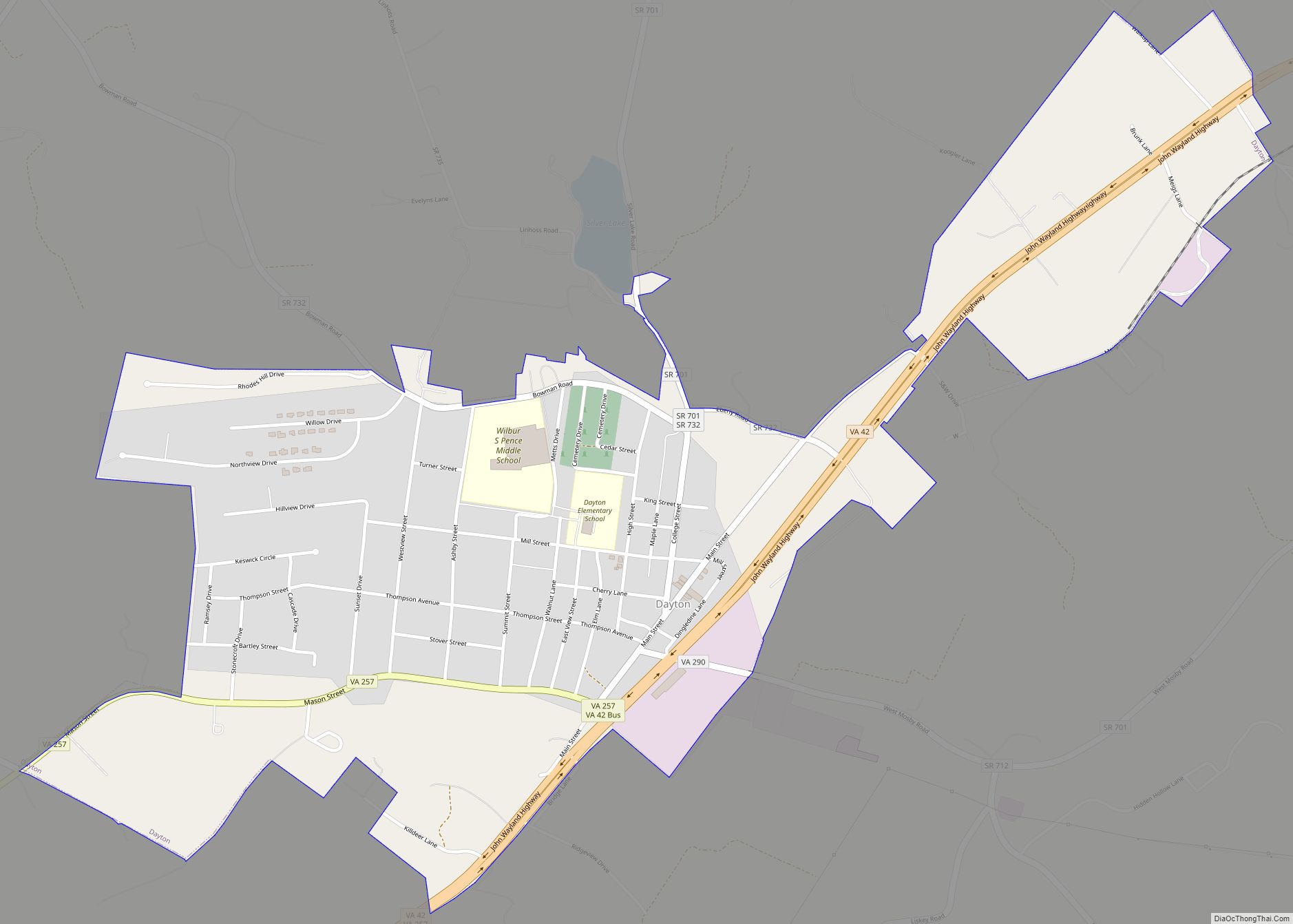
Dayton is a town in Rockingham County, Virginia, United States. The population is 1,530 as of the 2010 census. It is included in the Harrisonburg, Virginia Metropolitan Statistical Area.
| Name: | Dayton town |
|---|---|
| LSAD Code: | 43 |
| LSAD Description: | town (suffix) |
| State: | Virginia |
| County: | Rockingham County |
| Incorporated: | 1879 |
| Elevation: | 1,204 ft (367 m) |
| Total Area: | 1.03 sq mi (2.67 km²) |
| Land Area: | 1.03 sq mi (2.67 km²) |
| Water Area: | 0.00 sq mi (0.00 km²) |
| Total Population: | 1,530 |
| Population Density: | 1,587.78/sq mi (612.82/km²) |
| ZIP code: | 22821 |
| Area code: | 540 |
| FIPS code: | 5121648 |
| GNISfeature ID: | 1492844 |
| Website: | www.daytonva.us/ |
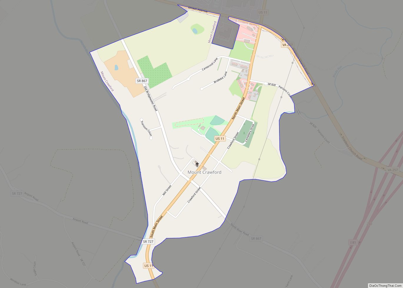
Online Interactive Map
Click on ![]() to view map in "full screen" mode.
to view map in "full screen" mode.
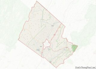
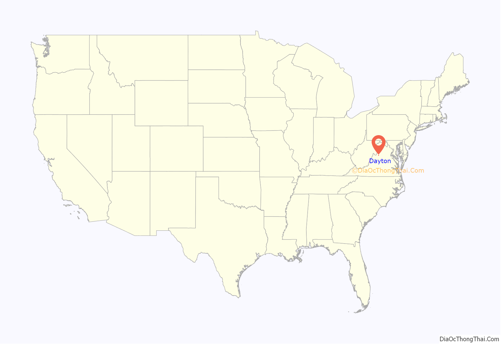
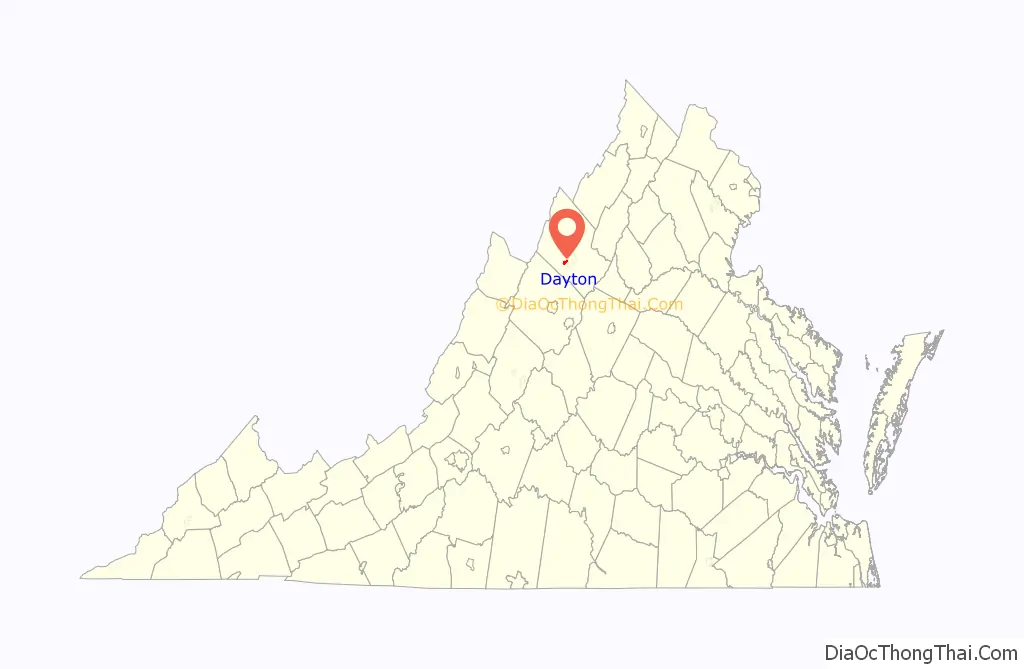
Dayton location map. Where is Dayton town?
History
The town of Dayton is one of the oldest settled communities in Rockingham County, and is the county’s second oldest incorporated town, after Bridgewater. The first settler in Dayton was Daniel Harrison (c. 1702-1770), whose family settled along Cooks Creek, north of downtown. Daniel was the eldest son of Isaiah Harrison and second wife Abigail and was born in Oyster Bay, Long Island, New York. Daniel’s brother Thomas Harrison founded Harrisonburg several miles to the northeast. They and their three brothers had migrated from New York to Delaware and then to Orange County Virginia before settling in the Shenandoah Valley.
The family homestead, a two-story stone house, has been owned and maintained since 1977 by a private, non-profit organization, Fort Harrison, Inc. The town was known as Rifeville or Rifetown until 1833.
Shenandoah University has its roots in Dayton, when it was known as the Shenandoah College and Conservatory of Music. The college was organized in 1875 under the leadership of Rev. A.P. Funkhouser. This was a major institution in Dayton until 1960, when it moved to Winchester. College Street was named after the school and many of the street’s buildings served as part of the campus.
The Dayton Historic District, Daniel Harrison House, and Peter Paul House are listed on the National Register of Historic Places.
In 2018, a series of strikes and protests were held at the town’s Cargill plant.
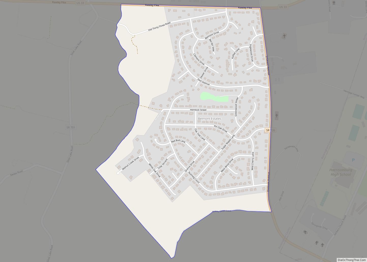
Dayton Road Map
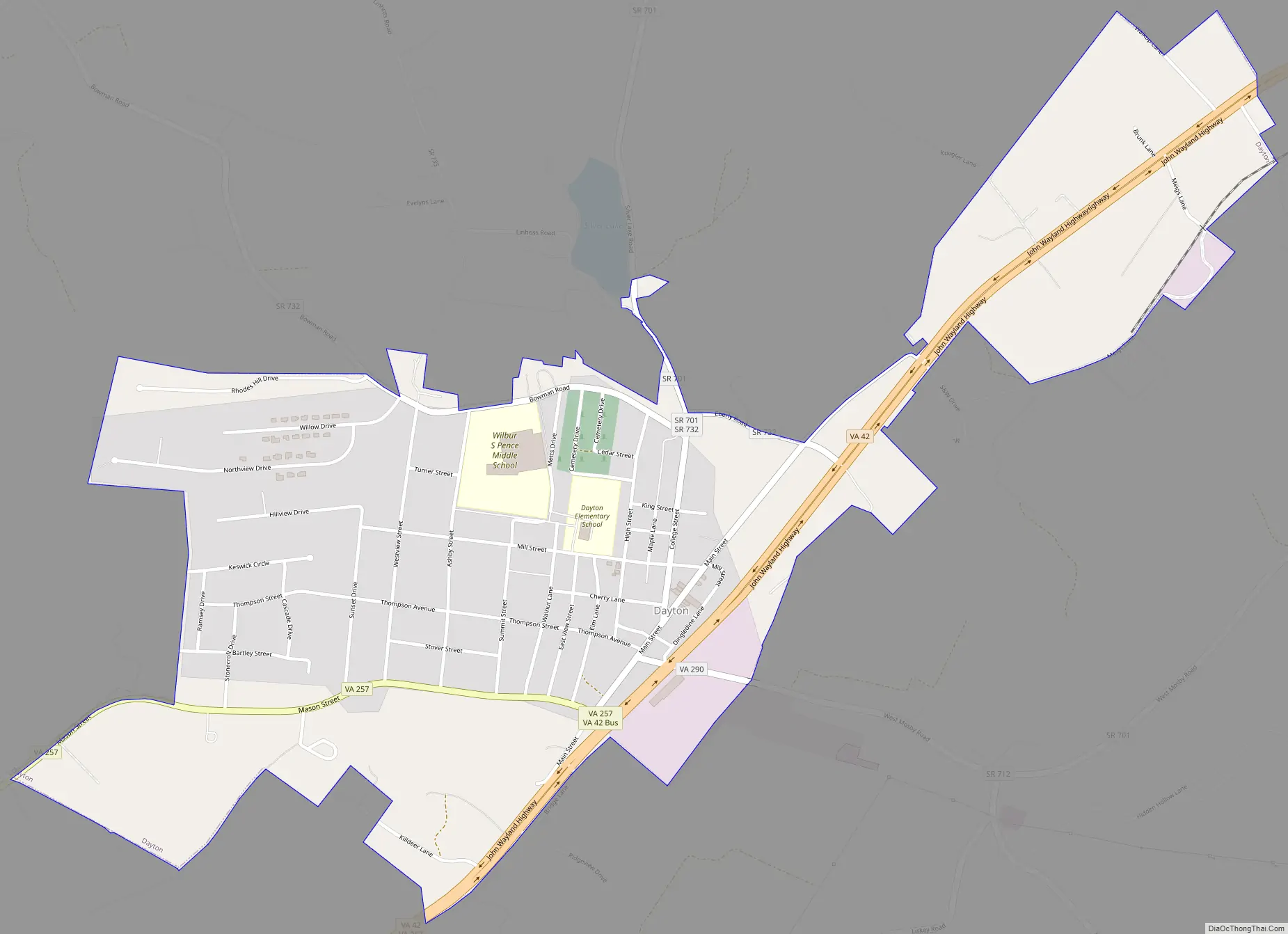
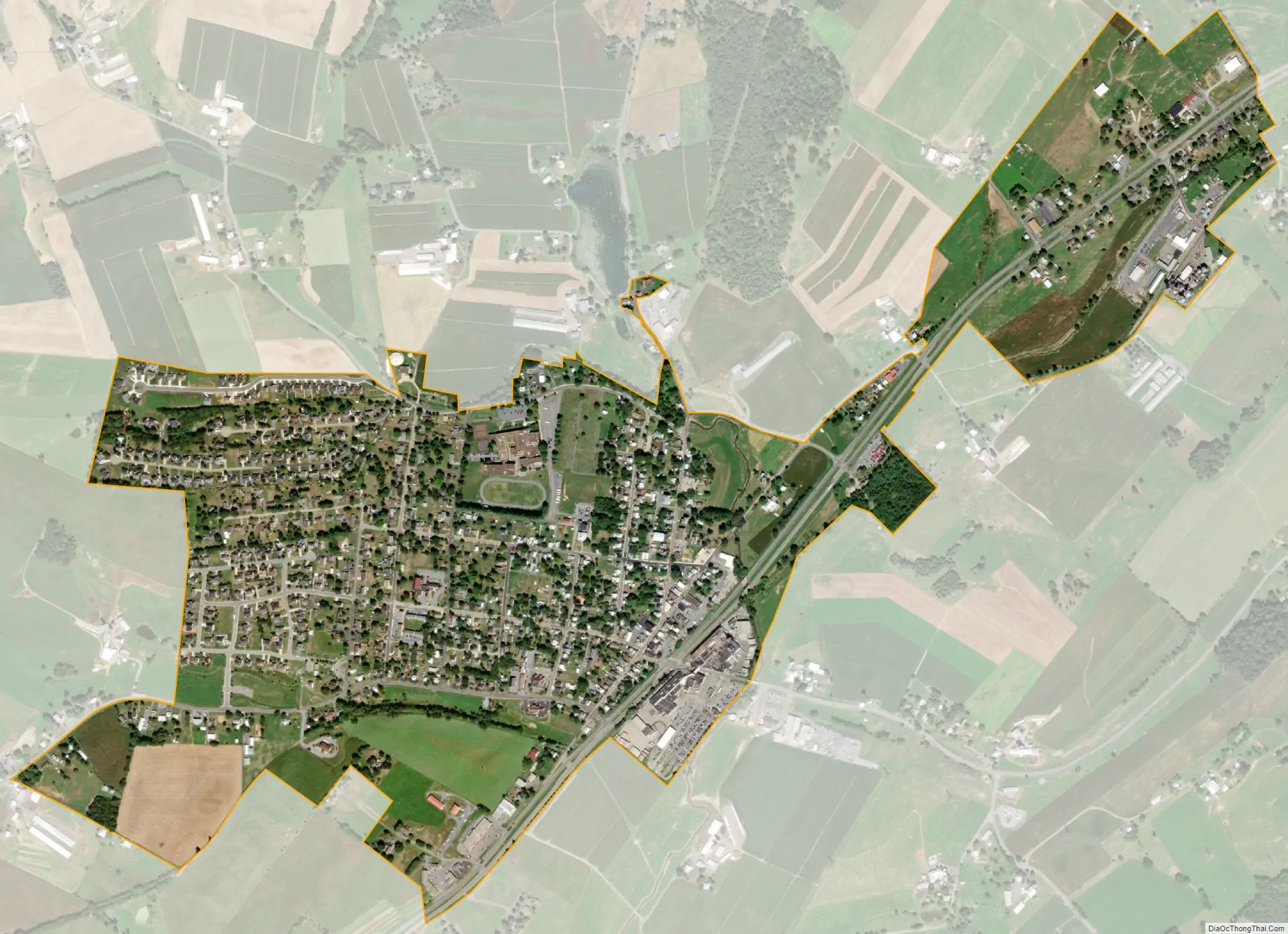
Dayton city Satellite Map
Geography
Dayton is located at 38°24′59″N 78°56′22″W / 38.41639°N 78.93944°W / 38.41639; -78.93944 (38.416323, -78.939440). The town is approximately two miles southwest of Harrisonburg and two miles northeast of Bridgewater.
According to the United States Census Bureau, the town has a total area of 0.8 square miles (2.1 km), all of it land.
See also
Map of Virginia State and its subdivision:- Accomack
- Albemarle
- Alexandria
- Alleghany
- Amelia
- Amherst
- Appomattox
- Arlington
- Augusta
- Bath
- Bedford
- Bedford City
- Bland
- Botetourt
- Bristol
- Brunswick
- Buchanan
- Buckingham
- Buena Vista
- Campbell
- Caroline
- Carroll
- Charles City
- Charlotte
- Charlottesville
- Chesapeake
- Chesterfield
- Clarke
- Clifton Forge City
- Colonial Heights
- Covington
- Craig
- Culpeper
- Cumberland
- Danville
- Dickenson
- Dinwiddie
- Emporia
- Essex
- Fairfax
- Fairfax City
- Falls Church
- Fauquier
- Floyd
- Fluvanna
- Franklin
- Frederick
- Fredericksburg
- Galax
- Giles
- Gloucester
- Goochland
- Grayson
- Greene
- Greensville
- Halifax
- Hampton
- Hanover
- Harrisonburg
- Henrico
- Henry
- Highland
- Hopewell
- Isle of Wight
- James City
- King and Queen
- King George
- King William
- Lancaster
- Lee
- Lexington
- Loudoun
- Louisa
- Lunenburg
- Lynchburg
- Madison
- Manassas
- Manassas Park
- Martinsville
- Mathews
- Mecklenburg
- Middlesex
- Montgomery
- Nelson
- New Kent
- Newport News
- Norfolk
- Northampton
- Northumberland
- Norton
- Nottoway
- Orange
- Page
- Patrick
- Petersburg
- Pittsylvania
- Poquoson
- Portsmouth
- Powhatan
- Prince Edward
- Prince George
- Prince William
- Pulaski
- Radford
- Rappahannock
- Richmond
- Roanoke
- Roanoke City
- Rockbridge
- Rockingham
- Russell
- Salem
- Scott
- Shenandoah
- Smyth
- Southampton
- Spotsylvania
- Stafford
- Staunton
- Suffolk
- Surry
- Sussex
- Tazewell
- Virginia Beach
- Warren
- Washington
- Waynesboro
- Westmoreland
- Williamsburg
- Winchester
- Wise
- Wythe
- York
- Alabama
- Alaska
- Arizona
- Arkansas
- California
- Colorado
- Connecticut
- Delaware
- District of Columbia
- Florida
- Georgia
- Hawaii
- Idaho
- Illinois
- Indiana
- Iowa
- Kansas
- Kentucky
- Louisiana
- Maine
- Maryland
- Massachusetts
- Michigan
- Minnesota
- Mississippi
- Missouri
- Montana
- Nebraska
- Nevada
- New Hampshire
- New Jersey
- New Mexico
- New York
- North Carolina
- North Dakota
- Ohio
- Oklahoma
- Oregon
- Pennsylvania
- Rhode Island
- South Carolina
- South Dakota
- Tennessee
- Texas
- Utah
- Vermont
- Virginia
- Washington
- West Virginia
- Wisconsin
- Wyoming