Lizton is a town in Union Township, Hendricks County, Indiana, United States. The population was 488 at the 2010 Census. It is one of the three towns (Pittsboro and North Salem being the other two) that make up North West Hendricks School Corporation.
| Name: | Lizton town |
|---|---|
| LSAD Code: | 43 |
| LSAD Description: | town (suffix) |
| State: | Indiana |
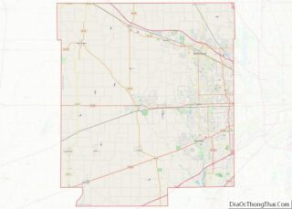
| County: | Hendricks County |
| Elevation: | 955 ft (291 m) |
| Total Area: | 0.66 sq mi (1.72 km²) |
| Land Area: | 0.66 sq mi (1.72 km²) |
| Water Area: | 0.00 sq mi (0.00 km²) |
| Total Population: | 511 |
| Population Density: | 770.74/sq mi (297.58/km²) |
| ZIP code: | 46149 |
| Area code: | 317 |
| FIPS code: | 1844442 |
| GNISfeature ID: | 0438191 |
| Website: | http://townoflizton.com/ |
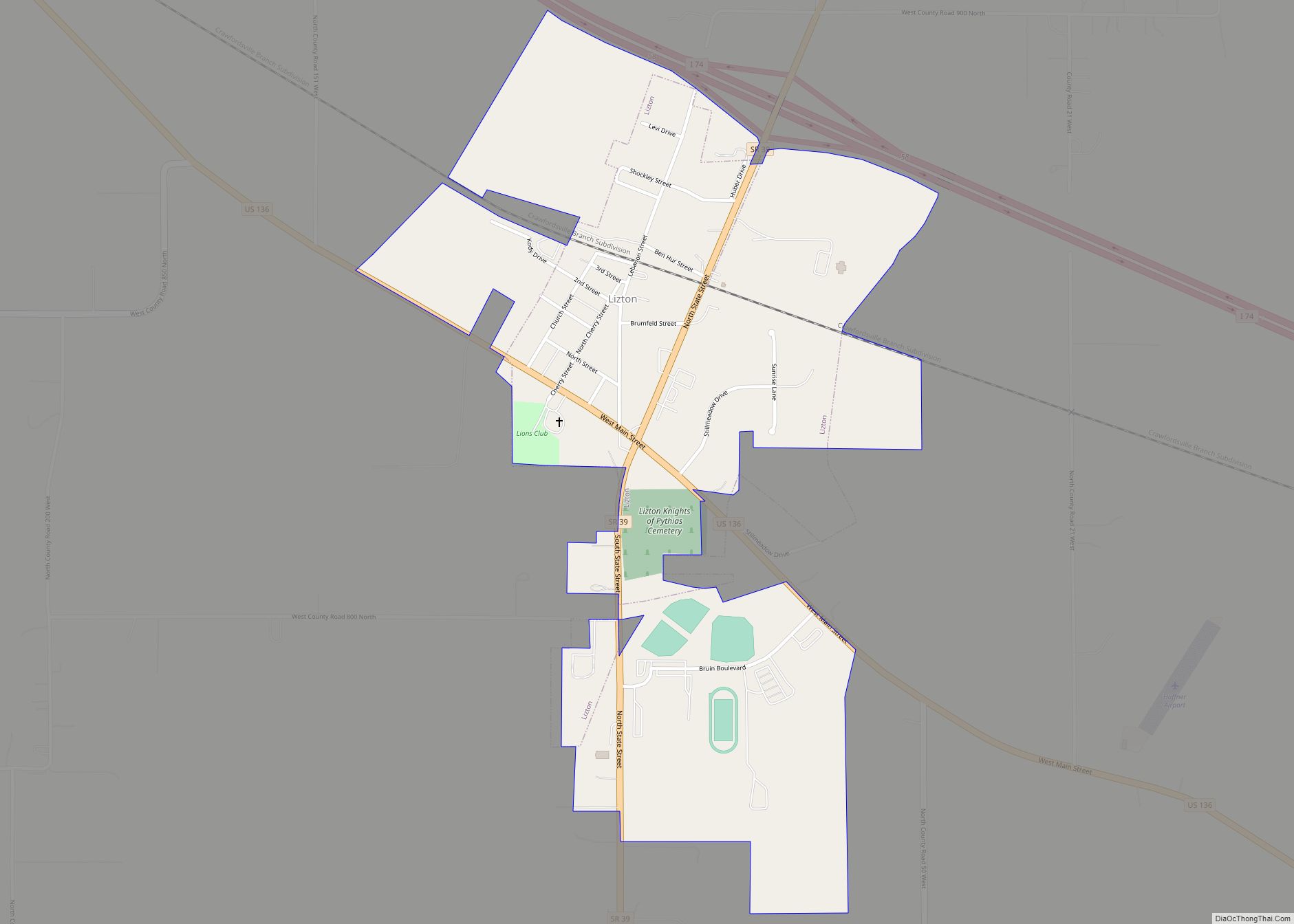
Online Interactive Map
Click on ![]() to view map in "full screen" mode.
to view map in "full screen" mode.
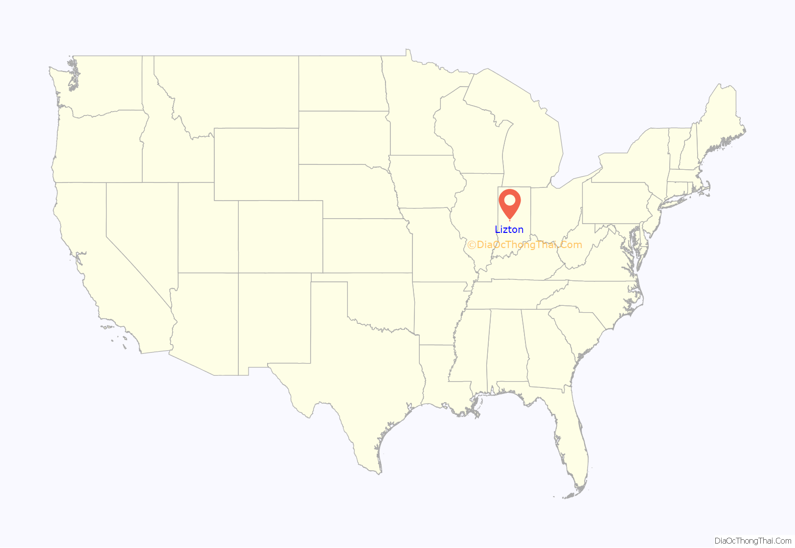
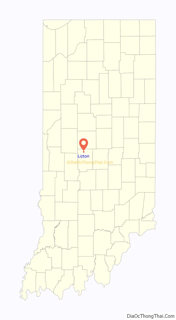
Lizton location map. Where is Lizton town?
History
Lizton was originally called New Elizabeth, and under the latter name was laid out in 1837 by Jesse Veiley, and named for his wife, Elizabeth.
The post office was established as New Elizabeth in 1854, and was renamed Lizton in 1873. According to one source, the name may have been changed by the railroad.
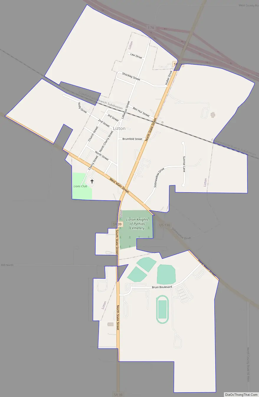
Lizton Road Map
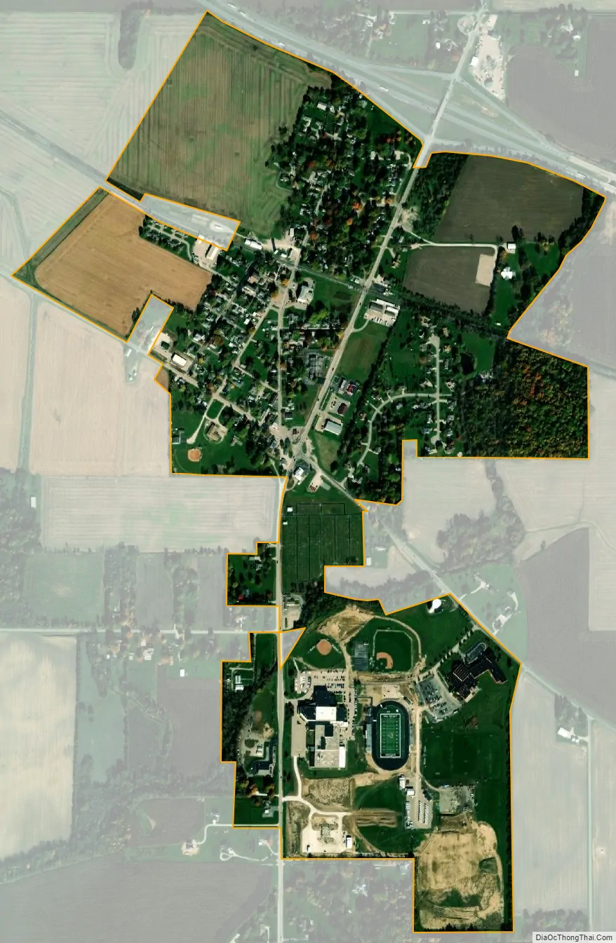
Lizton city Satellite Map
Geography
Lizton is located at 39°53′7″N 86°32′39″W / 39.88528°N 86.54417°W / 39.88528; -86.54417 (39.885274, -86.544207).
According to the 2010 census, Lizton has a total area of 0.57 square miles (1.48 km), all land.
See also
Map of Indiana State and its subdivision:- Adams
- Allen
- Bartholomew
- Benton
- Blackford
- Boone
- Brown
- Carroll
- Cass
- Clark
- Clay
- Clinton
- Crawford
- Daviess
- De Kalb
- Dearborn
- Decatur
- Delaware
- Dubois
- Elkhart
- Fayette
- Floyd
- Fountain
- Franklin
- Fulton
- Gibson
- Grant
- Greene
- Hamilton
- Hancock
- Harrison
- Hendricks
- Henry
- Howard
- Huntington
- Jackson
- Jasper
- Jay
- Jefferson
- Jennings
- Johnson
- Knox
- Kosciusko
- LaGrange
- Lake
- Lake Michigan
- LaPorte
- Lawrence
- Madison
- Marion
- Marshall
- Martin
- Miami
- Monroe
- Montgomery
- Morgan
- Newton
- Noble
- Ohio
- Orange
- Owen
- Parke
- Perry
- Pike
- Porter
- Posey
- Pulaski
- Putnam
- Randolph
- Ripley
- Rush
- Saint Joseph
- Scott
- Shelby
- Spencer
- Starke
- Steuben
- Sullivan
- Switzerland
- Tippecanoe
- Tipton
- Union
- Vanderburgh
- Vermillion
- Vigo
- Wabash
- Warren
- Warrick
- Washington
- Wayne
- Wells
- White
- Whitley
- Alabama
- Alaska
- Arizona
- Arkansas
- California
- Colorado
- Connecticut
- Delaware
- District of Columbia
- Florida
- Georgia
- Hawaii
- Idaho
- Illinois
- Indiana
- Iowa
- Kansas
- Kentucky
- Louisiana
- Maine
- Maryland
- Massachusetts
- Michigan
- Minnesota
- Mississippi
- Missouri
- Montana
- Nebraska
- Nevada
- New Hampshire
- New Jersey
- New Mexico
- New York
- North Carolina
- North Dakota
- Ohio
- Oklahoma
- Oregon
- Pennsylvania
- Rhode Island
- South Carolina
- South Dakota
- Tennessee
- Texas
- Utah
- Vermont
- Virginia
- Washington
- West Virginia
- Wisconsin
- Wyoming