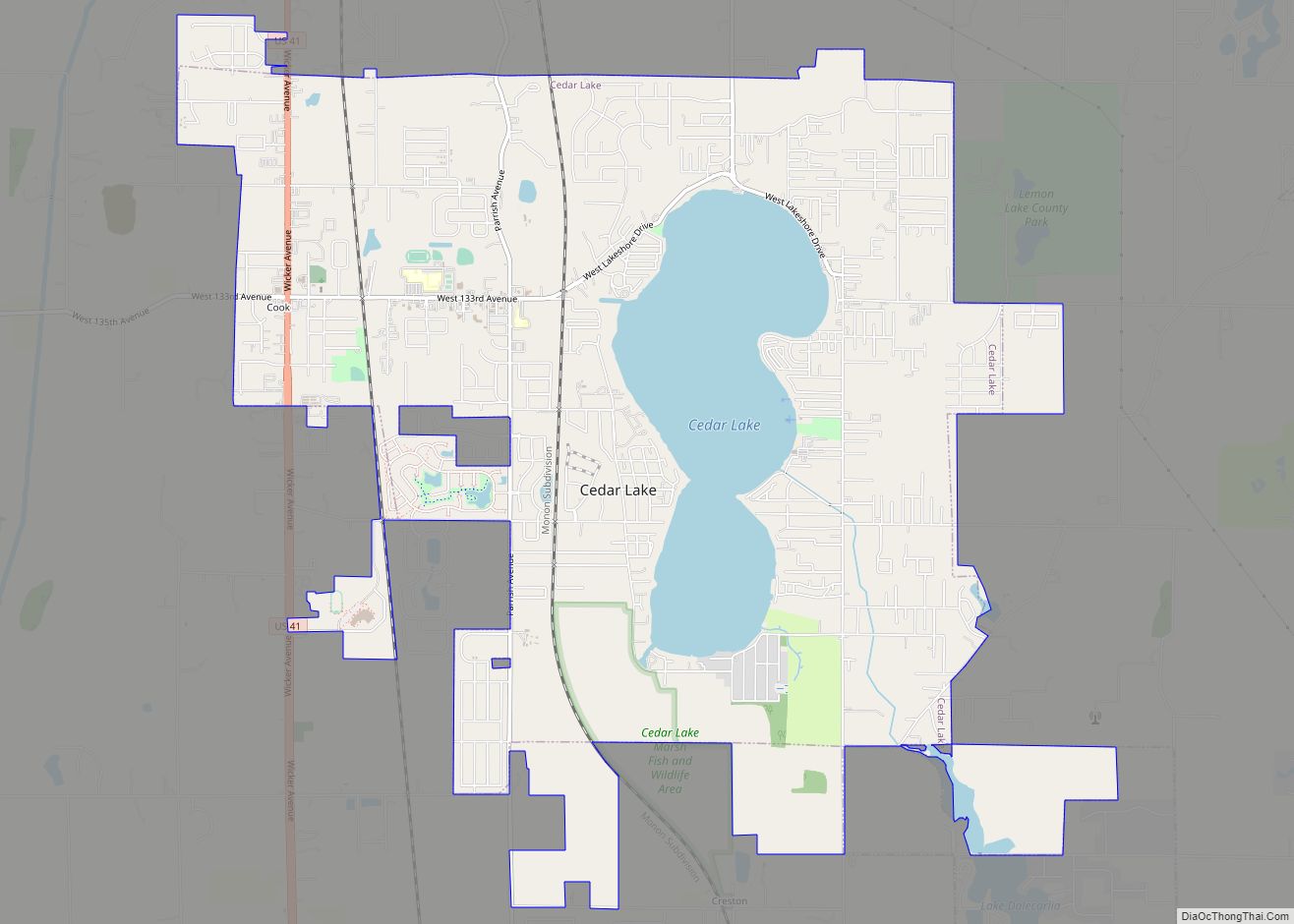
Cedar Lake is a town in Hanover and Center townships, Lake County, Indiana, United States. It is near the Illinois state line. Its population was 11,560 at the 2010 census. The town is notable for its location on Cedar Lake, the Lake of the Red Cedars museum, and veteran charity organization Operation Combat Bikesaver.
| Name: | Cedar Lake town |
|---|---|
| LSAD Code: | 43 |
| LSAD Description: | town (suffix) |
| State: | Indiana |
| County: | Lake County |
| Elevation: | 709 ft (216 m) |
| Total Area: | 10.17 sq mi (26.34 km²) |
| Land Area: | 8.75 sq mi (22.66 km²) |
| Water Area: | 1.42 sq mi (3.68 km²) |
| Total Population: | 14,106 |
| Population Density: | 1,612.48/sq mi (622.56/km²) |
| ZIP code: | 46303 |
| Area code: | 219 |
| FIPS code: | 1811062 |
| GNISfeature ID: | 0432282 |
| Website: | http://www.cedarlakein.org/ |
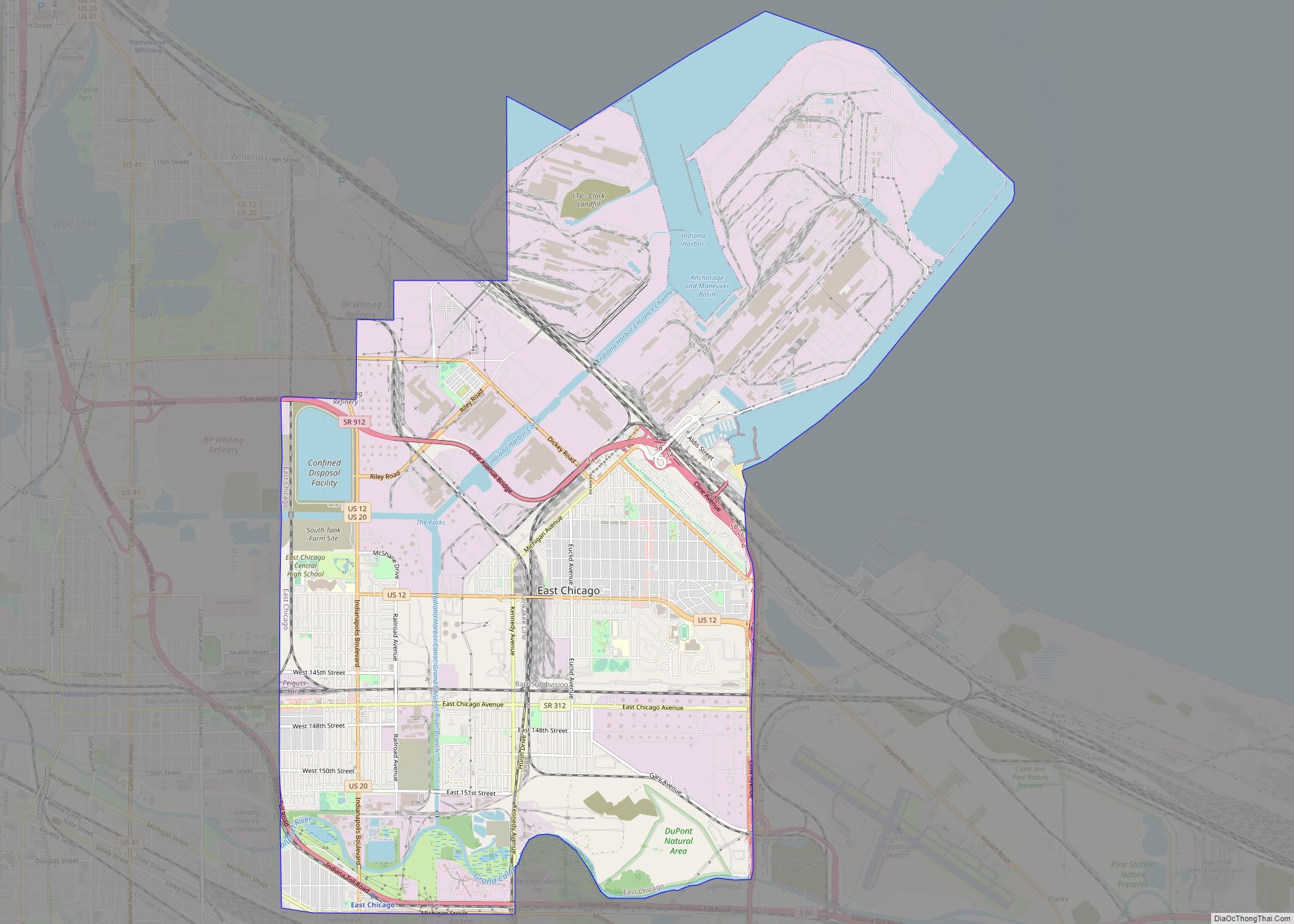
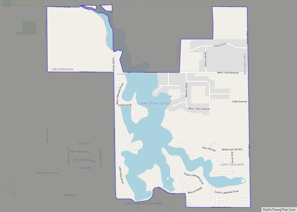
Online Interactive Map
Click on ![]() to view map in "full screen" mode.
to view map in "full screen" mode.
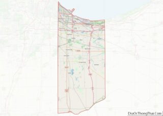
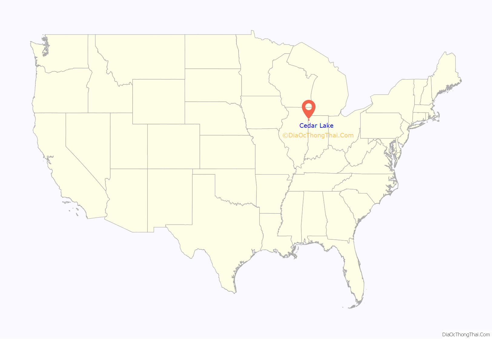
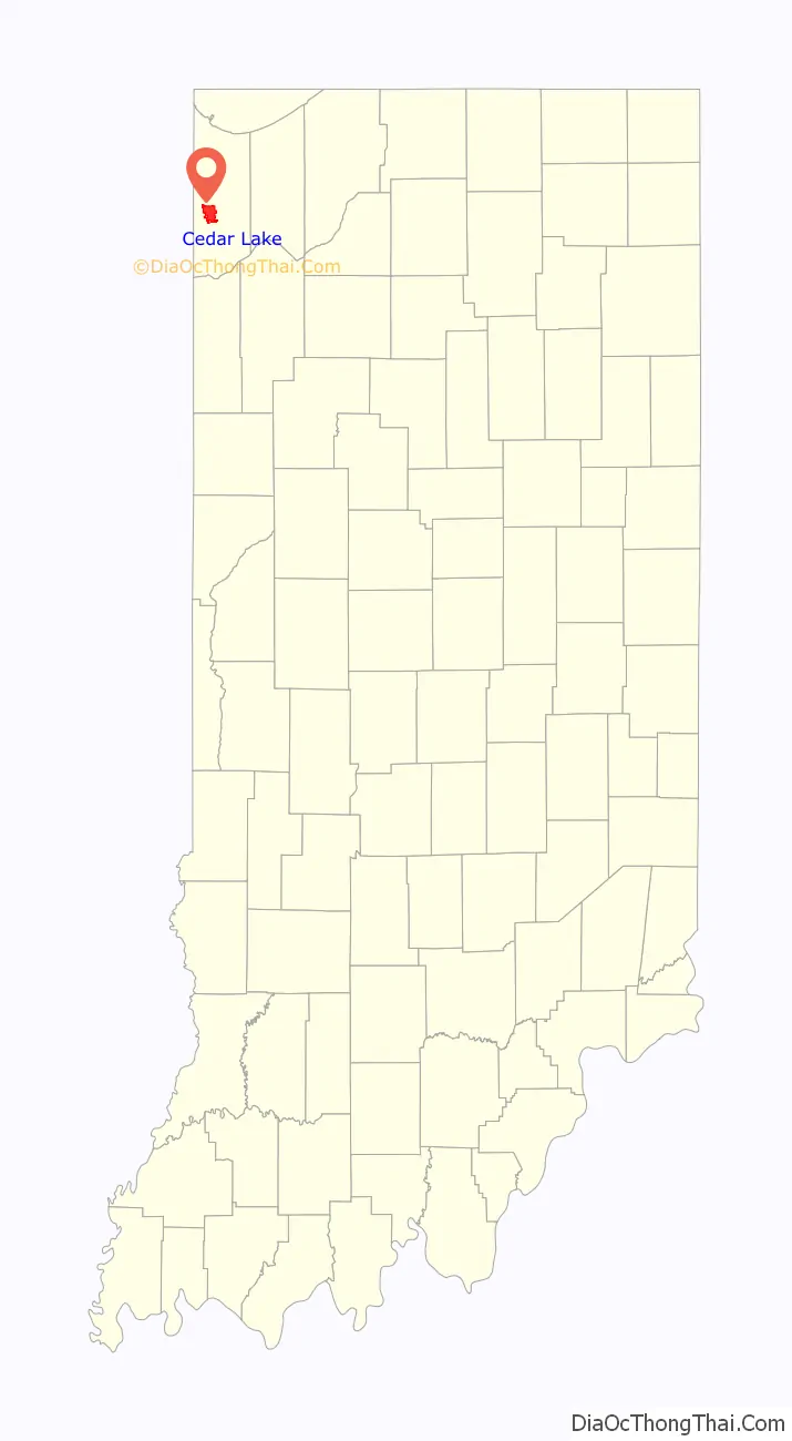
Cedar Lake location map. Where is Cedar Lake town?
History
Cedar Lake was settled by pioneers in the mid-19th century and was originally named West Point; the name “Cedar Lake” belonged to a nearby town that is now called Creston, Indiana. In 1839, the town that was then called West Point competed with the settlements of Liverpool and Lake Court House (later called Crown Point) to be the county seat of Lake County, but lost out to Liverpool. By 1870, the Cedar Lake Post Office was established, giving the area a new name. After the Monon Railroad came to the lake’s western shore in 1882, many new residents flocked to the area along with tourists who saw the lake as a resort destination. From the late 19th century to the early 20th century, Cedar Lake was a popular place for Chicagoans looking for a retreat from the city. The lake had over 50 hotels at the time and several pavilions and ballrooms that brought many well-known bands to entertain the visitors.
The Lassen Hotel and Monon Park Dancing Pavilion are listed in the National Register of Historic Places.
Cedar Lake Road Map
Cedar Lake city Satellite Map
Geography
According to the 2010 census, Cedar Lake has a total area of 9.61 square miles (24.89 km), of which 8.22 square miles (21.29 km) (or 85.54%) is land and 1.39 square miles (3.60 km) (or 14.46%) is water. The lake, which is the largest natural lake in northwest Indiana, appears to have formed from glacial meltwaters. There is an abundance of hills around the lake, which are evidence of the Valparaiso Moraine running through the area.
The 781 acre lake is naturally fed by small streams, storm runoff, and a natural spring. The lake has a median depth of 8.8 feet. Its deepest depth at 16 feet located in the middle basin. The lack of clarity in the water is due to the low refresh rate of the water and the shallow depths combined with the size of the lake. The lake bed is composed mostly of a dirt and sand mixture, clay, and rocks.
See also
Map of Indiana State and its subdivision:- Adams
- Allen
- Bartholomew
- Benton
- Blackford
- Boone
- Brown
- Carroll
- Cass
- Clark
- Clay
- Clinton
- Crawford
- Daviess
- De Kalb
- Dearborn
- Decatur
- Delaware
- Dubois
- Elkhart
- Fayette
- Floyd
- Fountain
- Franklin
- Fulton
- Gibson
- Grant
- Greene
- Hamilton
- Hancock
- Harrison
- Hendricks
- Henry
- Howard
- Huntington
- Jackson
- Jasper
- Jay
- Jefferson
- Jennings
- Johnson
- Knox
- Kosciusko
- LaGrange
- Lake
- Lake Michigan
- LaPorte
- Lawrence
- Madison
- Marion
- Marshall
- Martin
- Miami
- Monroe
- Montgomery
- Morgan
- Newton
- Noble
- Ohio
- Orange
- Owen
- Parke
- Perry
- Pike
- Porter
- Posey
- Pulaski
- Putnam
- Randolph
- Ripley
- Rush
- Saint Joseph
- Scott
- Shelby
- Spencer
- Starke
- Steuben
- Sullivan
- Switzerland
- Tippecanoe
- Tipton
- Union
- Vanderburgh
- Vermillion
- Vigo
- Wabash
- Warren
- Warrick
- Washington
- Wayne
- Wells
- White
- Whitley
- Alabama
- Alaska
- Arizona
- Arkansas
- California
- Colorado
- Connecticut
- Delaware
- District of Columbia
- Florida
- Georgia
- Hawaii
- Idaho
- Illinois
- Indiana
- Iowa
- Kansas
- Kentucky
- Louisiana
- Maine
- Maryland
- Massachusetts
- Michigan
- Minnesota
- Mississippi
- Missouri
- Montana
- Nebraska
- Nevada
- New Hampshire
- New Jersey
- New Mexico
- New York
- North Carolina
- North Dakota
- Ohio
- Oklahoma
- Oregon
- Pennsylvania
- Rhode Island
- South Carolina
- South Dakota
- Tennessee
- Texas
- Utah
- Vermont
- Virginia
- Washington
- West Virginia
- Wisconsin
- Wyoming