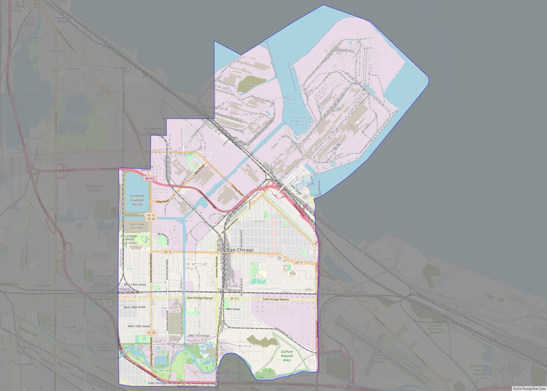
East Chicago is a city in Lake County, Indiana, United States. The population was 29,698 at the 2010 census. The city is home of the Indiana Harbor and Ship Canal, an artificial freshwater harbor characterized by industrial and manufacturing activity. Situated along Lake Michigan, East Chicago is about 18 miles from downtown Chicago, Illinois and is just west of Gary, Indiana.
| Name: | East Chicago city |
|---|---|
| LSAD Code: | 25 |
| LSAD Description: | city (suffix) |
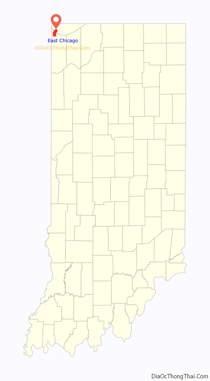
| State: | Indiana |
| County: | Lake County |
| Elevation: | 591 ft (180 m) |
| Total Area: | 14.86 sq mi (38.50 km²) |
| Land Area: | 14.18 sq mi (36.71 km²) |
| Water Area: | 0.69 sq mi (1.78 km²) |
| Total Population: | 26,370 |
| Population Density: | 1,860.32/sq mi (718.29/km²) |
| ZIP code: | 46312 |
| Area code: | 219 |
| FIPS code: | 1819486 |
| GNISfeature ID: | 0433875 |
| Website: | www.eastchicago.com |
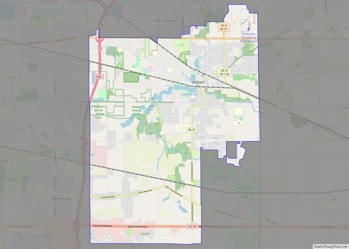
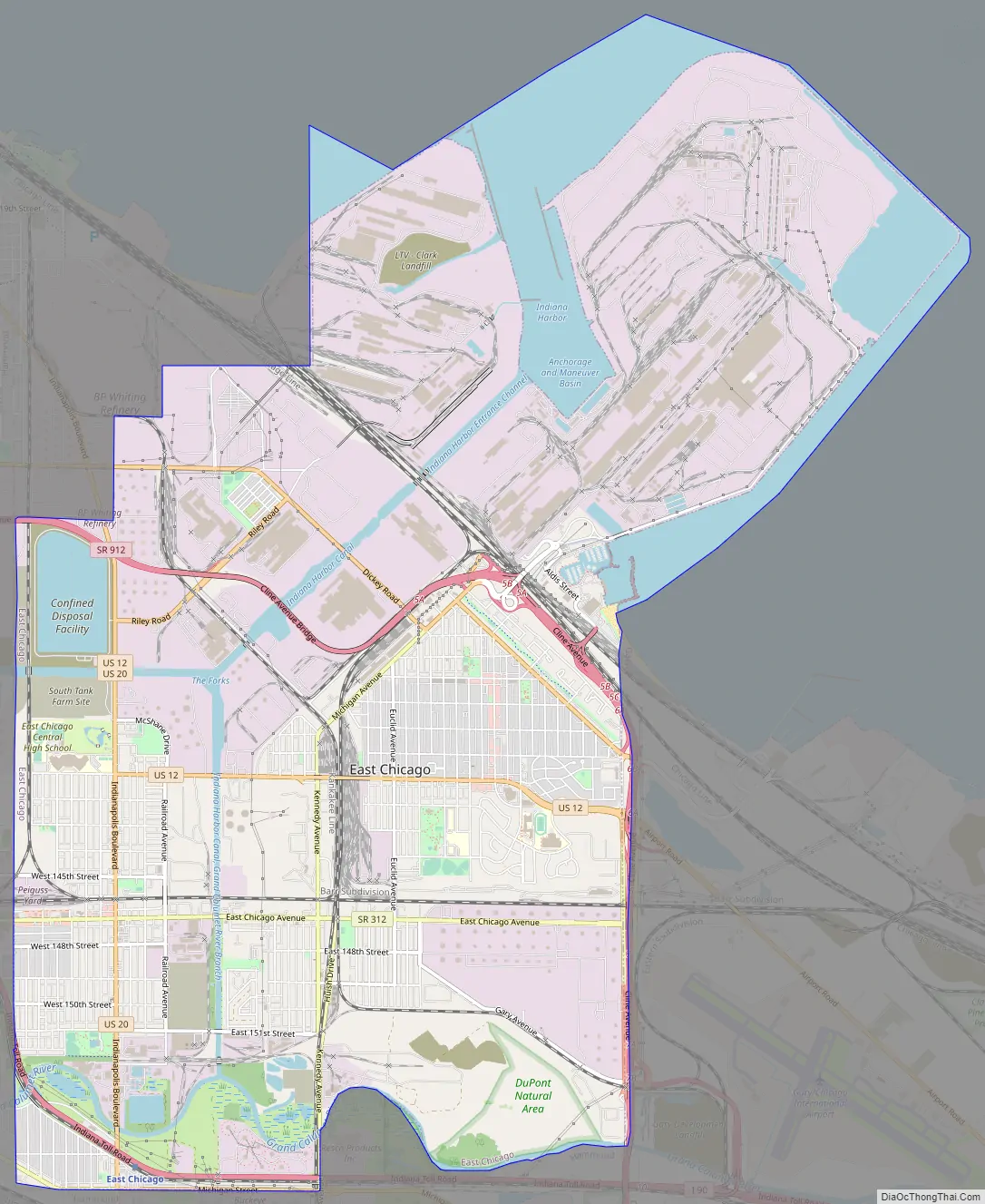
Online Interactive Map
Click on ![]() to view map in "full screen" mode.
to view map in "full screen" mode.
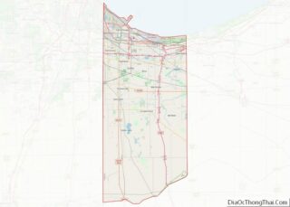
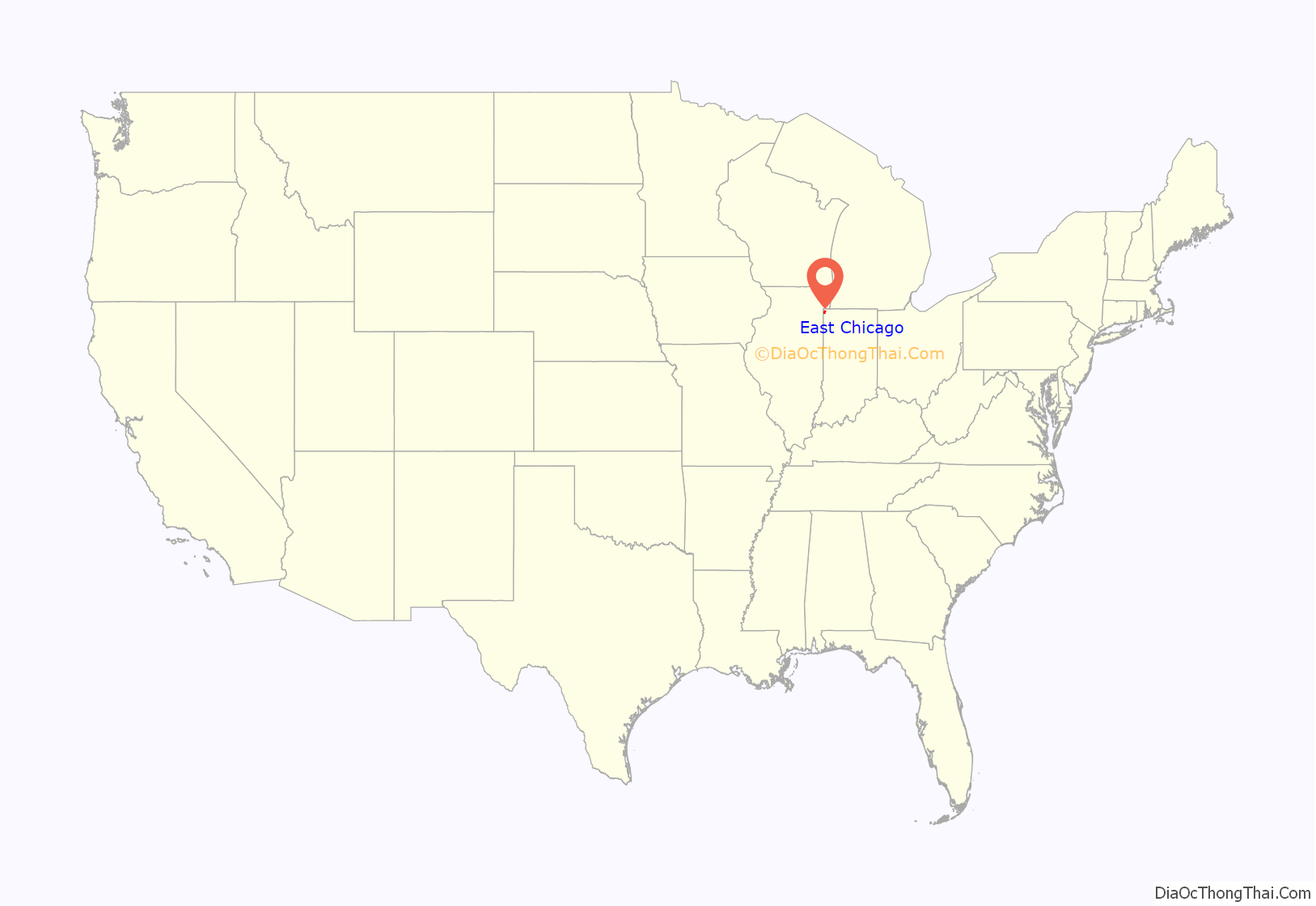
East Chicago location map. Where is East Chicago city?
History
The land that became East Chicago was originally swampland unsuitable for farming. The state of Indiana began selling off plots of land to railroads and speculators after 1851 to fund the local school system. Settlement of the area was very slow at first, and as late as the 1890s, the city had no proper streets or public utilities. East Chicago was incorporated as a city in 1893. The city was named from its location east of Chicago, Illinois.
The 1900 Census gives a total population of just 3,411, but the arrival of Inland Steel in 1903 transformed the city into an industrial powerhouse. The city’s population skyrocketed to over 24,000 by 1910, powered by immigration from all over Europe and the United States, and quickly became the most industrialized city in the United States, with over 80% of the city’s land zoned for heavy industry. Inland Steel dominated the city’s economy through the 1990s, and expanded its massive integrated mill at Indiana Harbor multiple times through the 1980s. From 60,000 tons of steel capacity in 1903, it expanded to 600,000 tons by 1914 and reached 1 million in 1917, and eventually peaked at 8.6 million tons in 1978. By 1907, East Chicago boasted a navigable waterway link to Lake Michigan and to the Grand Calumet River: the Indiana Harbor Ship Canal. Steel mills, petroleum refineries, construction firms, and chemical factories operated at Indiana Harbor and along its inner canal system.
Republic Steel, Youngstown Steel, LaSalle Steel, and U.S. Steel all eventually had steel-making operations in the city. During World War I, East Chicago was nicknamed the “Arsenal of America” (not to be confused with Detroit’s label as the “Arsenal of Democracy” during WWII) and the “Workshop of America”.
A rivalry developed between Indiana Harbor, the “East Side” home of Inland Steel and most working-class families, and East Chicago’s “West Side,” the residential enclave of the native-born business community. Locals spoke of the “Twin City” to describe spatial, residential, and class divisions at the heart of the town’s identity. The “Twin City” moniker remains to this day.
During the 1910s, several thousand Mexicans immigrated to East Chicago to work in the mills during the labor shortage of 1917-1918 due to U.S. participation in World War I, and also acted as strike breakers during labor unrest in 1919. Most were single men who eventually hoped to return to Mexico, but many stayed on and eventually were joined by their families. The small Mexican community was targeted for voluntary and forced repatriation during the 1930s and 1950s (1,800 were deported in 1932 alone), but those who remained eventually paved the way for later Latino immigration after 1965.
Black Americans also began to arrive in the 1910s and 1920s as part of the first wave of the Great Migration, and this continued from the 1940s to 1960s. According to a city demographic survey in 1959, there were 1,000 Mexican families and 10,000 African American families, along with 3,000 Polish families. There were also a large number of families that identified as Puerto Rican, Romanian, Serbian, Italian, Lithuanian, and Croatian. Over 70 nationalities were represented, with over 59 congregations of the Protestants, Orthodox, Catholic Churches, as well as Jewish synagogues.
Like neighboring Gary, Indiana, East Chicago quickly developed a reputation as a rough industrial city, plagued by extreme pollution, ethnic and racial tensions, organized crime, illegal gambling & clubs, political corruption, prostitution, and other vices. The city continued to rapidly grow in the 1910s and 1920s, and the population peaked in 1960 at 57,669. However, East Chicago’s population began to decline in the 1960s as suburbanization, white flight, affordability of automobiles, and the construction of highways meant that workers no longer had to live in the city, but could commute from less-polluted suburbs.
It was the Steel crisis of the 1974-1986 period that completely devastated East Chicago, as it did other industrial cities like Gary, Cleveland, Pittsburgh, and the south side of Chicago. East Chicago’s population plunged to 47,000 in 1970, 34,000 by 1990, and 29,000 by 2010. Employment at Inland Steel peaked at 25,000 in 1969, and successive layoffs over the next 30 years were devastating to the community; by 1998, only 9,000 were employed at Inland Steel. Inland Steel was acquired by Ispat International in 1998. Both the Indiana Harbor mill and Youngstown Steel mill were absorbed and merged by ArcelorMittal in 2004 and subsequently sold to Cleveland-Cliffs in 2020.
The Indiana Harbor Public Library and Marktown Historic District are listed in the National Register of Historic Places.
In 2009, parts of East Chicago were discovered to have toxic lead and arsenic contamination, designated the USS Lead Superfund Site. The site is divided into three zones, with public housing and residential properties. Residents’ decades-long concerns about lead contamination were confirmed in 2016 via EPA testing, especially affecting over 270 families in the West Calumet Housing Complex. As Governor of Indiana, Mike Pence declined to declare the Superfund site a state emergency; his successor Governor Eric Holcomb has issued Executive Order 17-13, declaring a disaster emergency in East Chicago.
East Chicago Road Map
East Chicago city Satellite Map

Geography
According to the 2010 census, East Chicago has a total area of 16.155 square miles (41.84 km), of which 14.09 square miles (36.49 km) (or 87.22%) is land and 2.065 square miles (5.35 km) (or 12.78%) is water.
See also
Map of Indiana State and its subdivision:- Adams
- Allen
- Bartholomew
- Benton
- Blackford
- Boone
- Brown
- Carroll
- Cass
- Clark
- Clay
- Clinton
- Crawford
- Daviess
- De Kalb
- Dearborn
- Decatur
- Delaware
- Dubois
- Elkhart
- Fayette
- Floyd
- Fountain
- Franklin
- Fulton
- Gibson
- Grant
- Greene
- Hamilton
- Hancock
- Harrison
- Hendricks
- Henry
- Howard
- Huntington
- Jackson
- Jasper
- Jay
- Jefferson
- Jennings
- Johnson
- Knox
- Kosciusko
- LaGrange
- Lake
- Lake Michigan
- LaPorte
- Lawrence
- Madison
- Marion
- Marshall
- Martin
- Miami
- Monroe
- Montgomery
- Morgan
- Newton
- Noble
- Ohio
- Orange
- Owen
- Parke
- Perry
- Pike
- Porter
- Posey
- Pulaski
- Putnam
- Randolph
- Ripley
- Rush
- Saint Joseph
- Scott
- Shelby
- Spencer
- Starke
- Steuben
- Sullivan
- Switzerland
- Tippecanoe
- Tipton
- Union
- Vanderburgh
- Vermillion
- Vigo
- Wabash
- Warren
- Warrick
- Washington
- Wayne
- Wells
- White
- Whitley
- Alabama
- Alaska
- Arizona
- Arkansas
- California
- Colorado
- Connecticut
- Delaware
- District of Columbia
- Florida
- Georgia
- Hawaii
- Idaho
- Illinois
- Indiana
- Iowa
- Kansas
- Kentucky
- Louisiana
- Maine
- Maryland
- Massachusetts
- Michigan
- Minnesota
- Mississippi
- Missouri
- Montana
- Nebraska
- Nevada
- New Hampshire
- New Jersey
- New Mexico
- New York
- North Carolina
- North Dakota
- Ohio
- Oklahoma
- Oregon
- Pennsylvania
- Rhode Island
- South Carolina
- South Dakota
- Tennessee
- Texas
- Utah
- Vermont
- Virginia
- Washington
- West Virginia
- Wisconsin
- Wyoming