Lowell is a town in West Creek and Cedar Creek townships, Lake County, Indiana, United States. The population was 10,680 at the 2020 census.
| Name: | Lowell town |
|---|---|
| LSAD Code: | 43 |
| LSAD Description: | town (suffix) |
| State: | Indiana |
| County: | Lake County |
| Incorporated: | 1852 |
| Elevation: | 669 ft (204 m) |
| Total Area: | 6.58 sq mi (17.04 km²) |
| Land Area: | 6.50 sq mi (16.83 km²) |
| Water Area: | 0.08 sq mi (0.21 km²) |
| Total Population: | 10,680 |
| Population Density: | 1,643.84/sq mi (634.65/km²) |
| ZIP code: | 46356 |
| Area code: | 219 |
| FIPS code: | 1845144 |
| GNISfeature ID: | 0438358 |
| Website: | http://www.lowell.net/ |
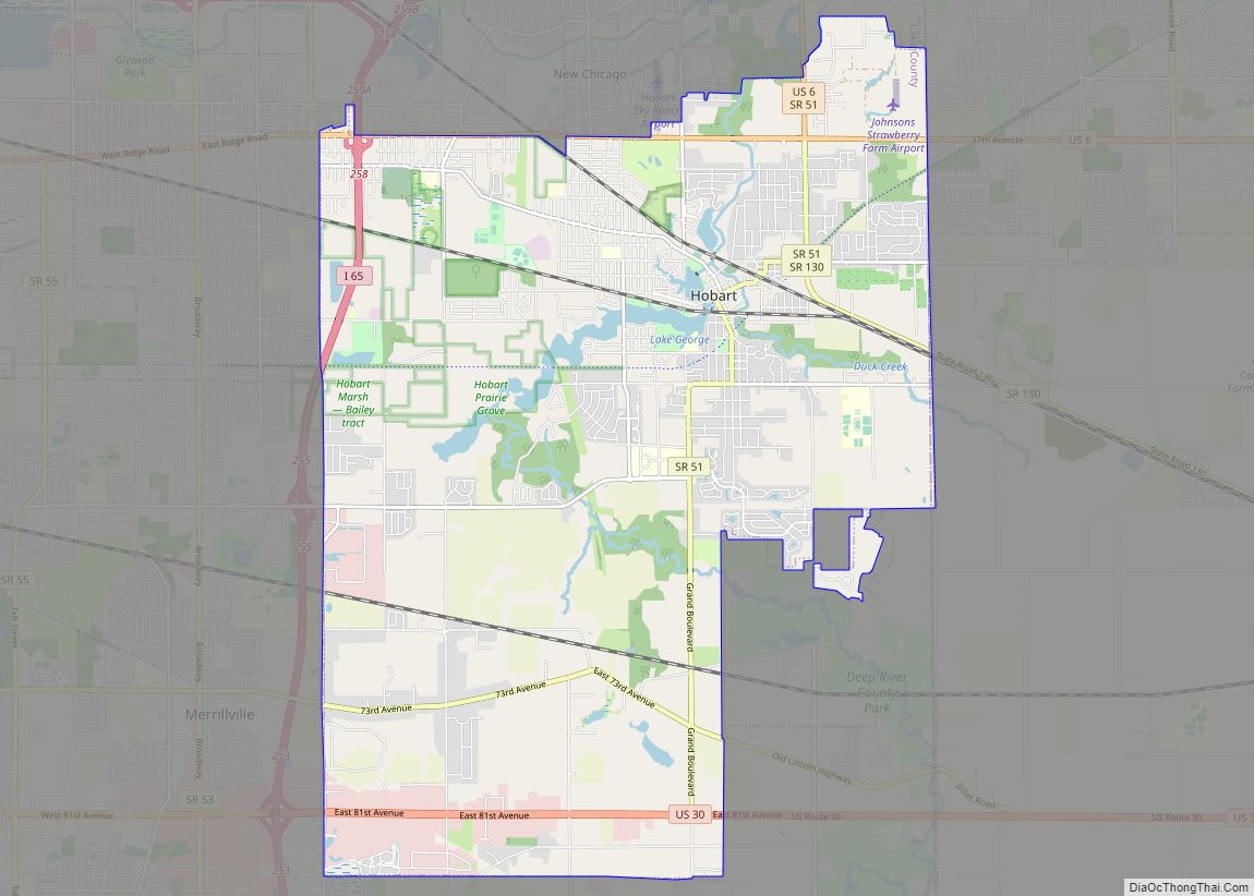
Online Interactive Map
Click on ![]() to view map in "full screen" mode.
to view map in "full screen" mode.
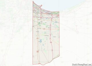
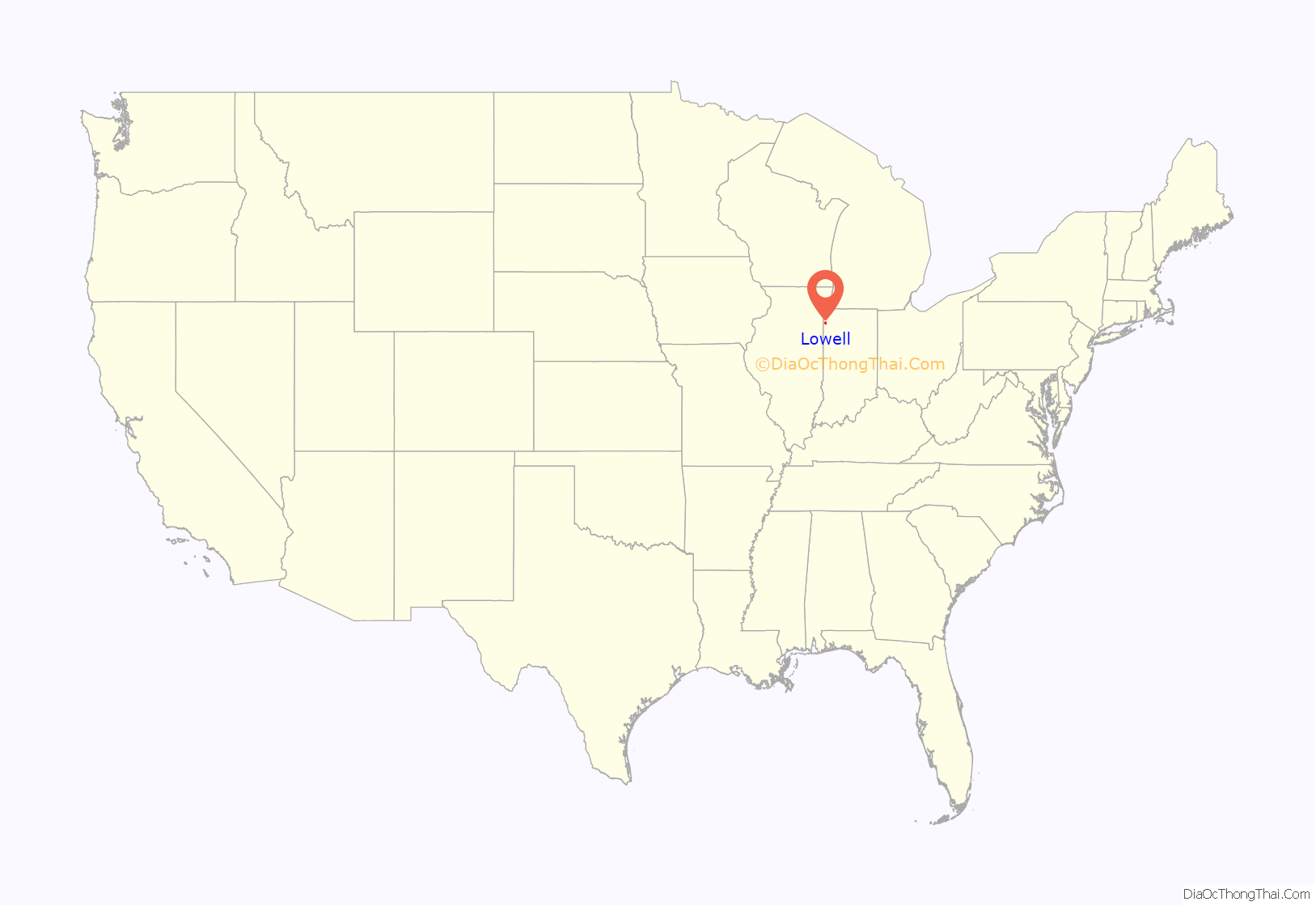
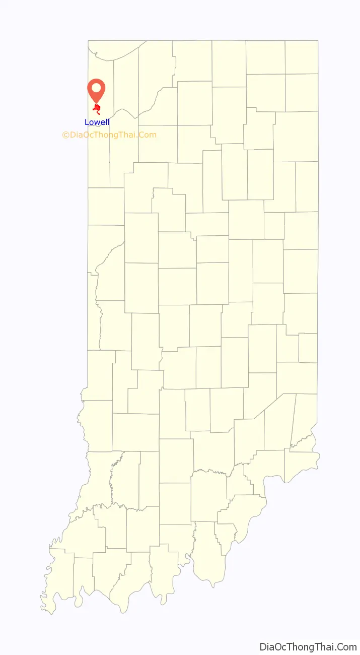
Lowell location map. Where is Lowell town?
History
Lowell was platted in 1853. It was named after Lowell, Massachusetts.
The James Brannon House, Melvin A. Halsted House, Lowell Commercial Historic District, Charles E. Nichols House, and J. Claude Rumsey House are listed in the National Register of Historic Places.
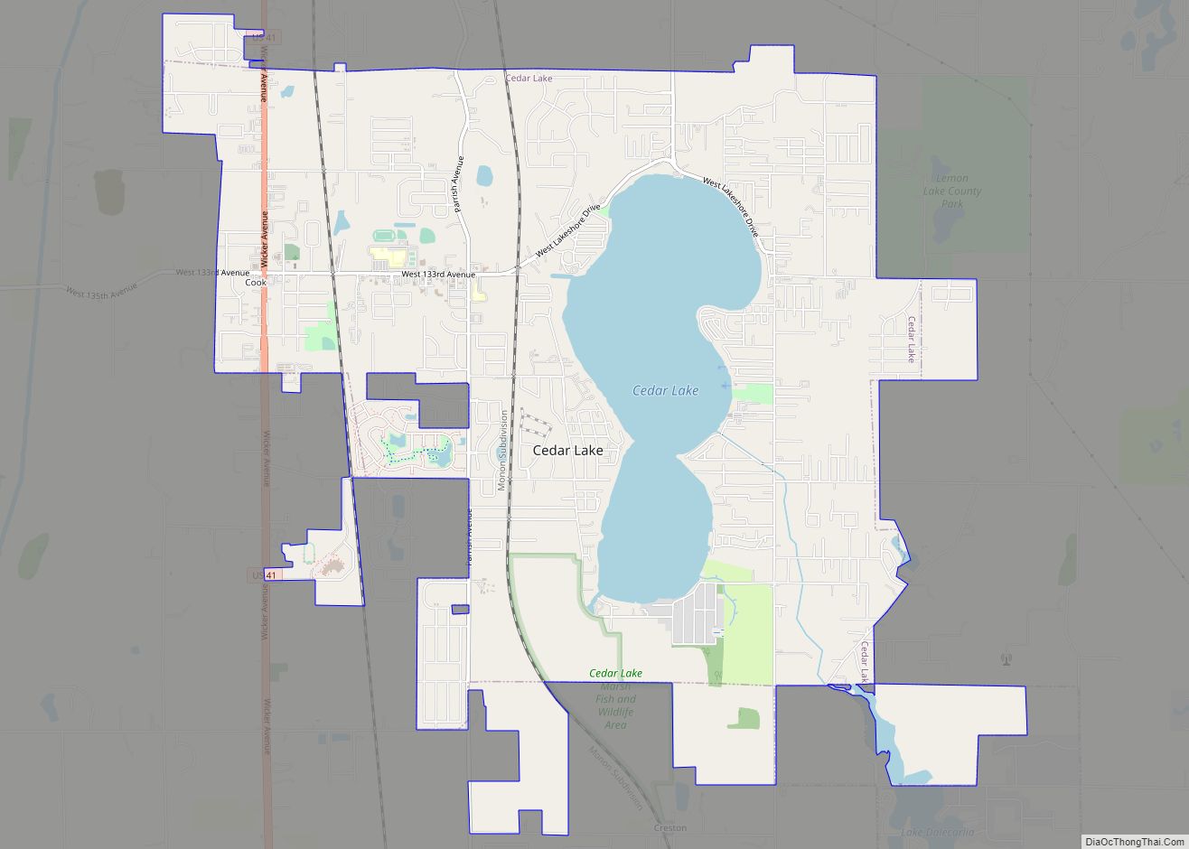
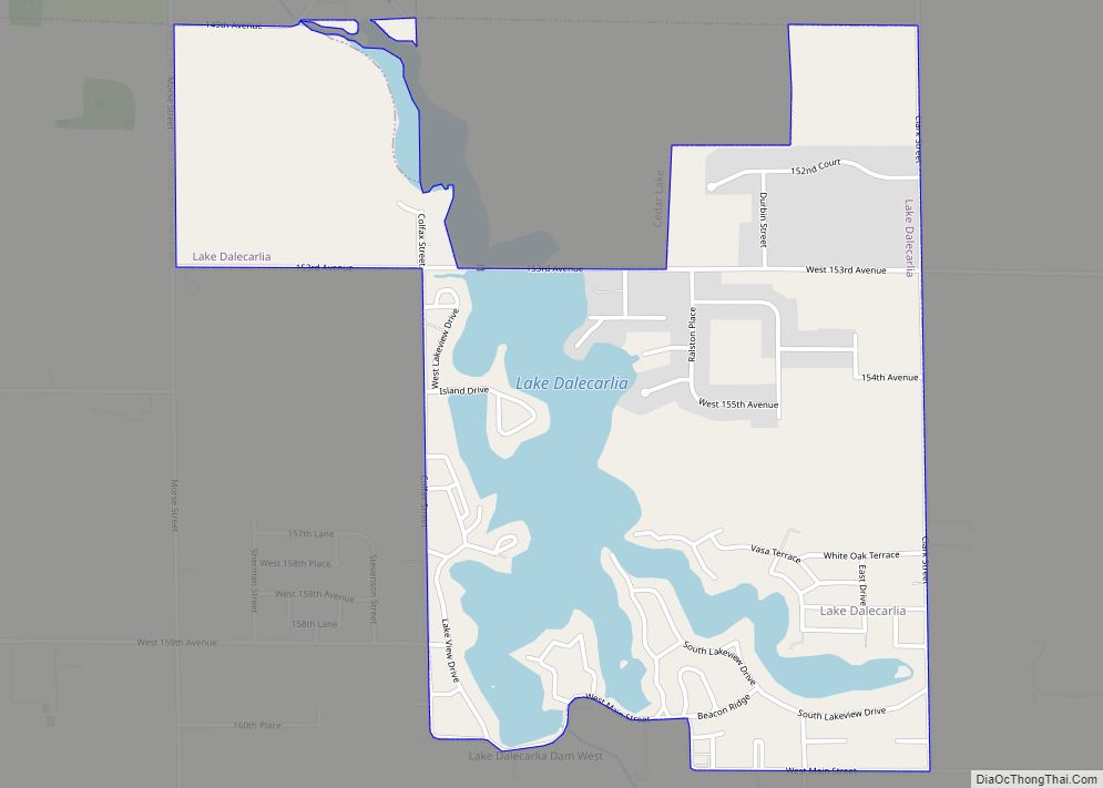
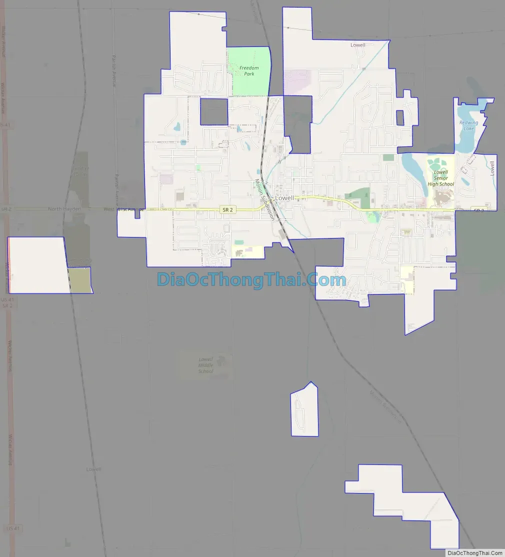
Lowell Road Map
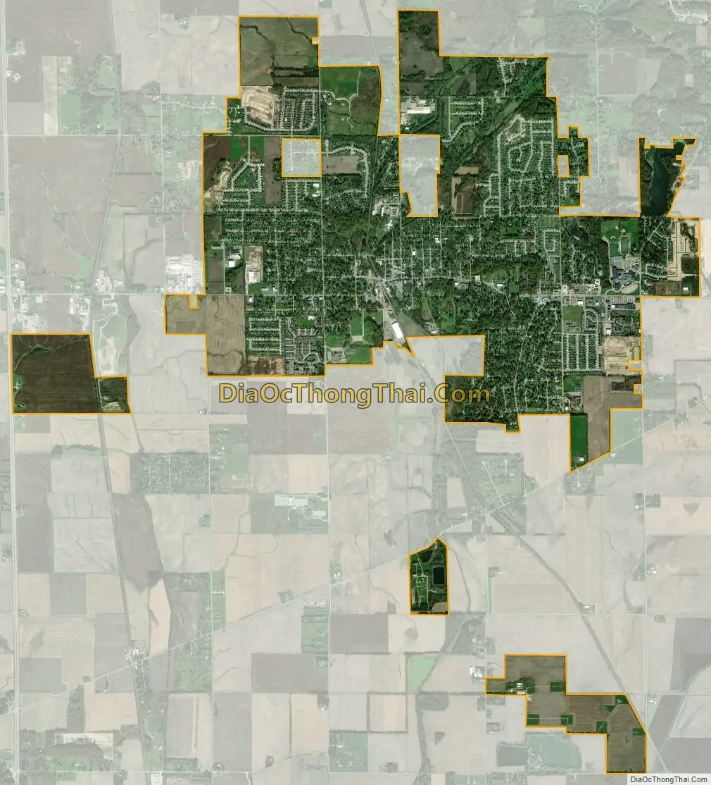
Lowell city Satellite Map
Geography
Lowell is located at 41°18′N 87°25′W / 41.300°N 87.417°W / 41.300; -87.417 (41.2924, −87.4151).
According to the 2010 census, Lowell has a total area of 5.27 square miles (13.65 km), of which 5.18 square miles (13.42 km) (or 98.29%) is land and 0.09 square miles (0.23 km) (or 1.71%) is water.
Located five miles (8 km) outside of the Great Lakes Basin, Lowell sought permission to pipe in lake water to replace city water drawn from its high fluoride deep wells. However, diversion of water out of the Great Lakes requires the approval of the Great Lakes Commission, which includes representatives of all the US states and Canadian provinces that border on the lakes. Lowell’s request was turned down in 1991.
Lowell lies on the Valparaiso Moraine, almost on the Kankakee Outwash Plain. The town also lies near the St. Lawrence Seaway Divide.
Climate
Lowell has a Humid continental climate (Köppen climate classification Dfa) with four distinct seasons.
See also
Map of Indiana State and its subdivision:- Adams
- Allen
- Bartholomew
- Benton
- Blackford
- Boone
- Brown
- Carroll
- Cass
- Clark
- Clay
- Clinton
- Crawford
- Daviess
- De Kalb
- Dearborn
- Decatur
- Delaware
- Dubois
- Elkhart
- Fayette
- Floyd
- Fountain
- Franklin
- Fulton
- Gibson
- Grant
- Greene
- Hamilton
- Hancock
- Harrison
- Hendricks
- Henry
- Howard
- Huntington
- Jackson
- Jasper
- Jay
- Jefferson
- Jennings
- Johnson
- Knox
- Kosciusko
- LaGrange
- Lake
- Lake Michigan
- LaPorte
- Lawrence
- Madison
- Marion
- Marshall
- Martin
- Miami
- Monroe
- Montgomery
- Morgan
- Newton
- Noble
- Ohio
- Orange
- Owen
- Parke
- Perry
- Pike
- Porter
- Posey
- Pulaski
- Putnam
- Randolph
- Ripley
- Rush
- Saint Joseph
- Scott
- Shelby
- Spencer
- Starke
- Steuben
- Sullivan
- Switzerland
- Tippecanoe
- Tipton
- Union
- Vanderburgh
- Vermillion
- Vigo
- Wabash
- Warren
- Warrick
- Washington
- Wayne
- Wells
- White
- Whitley
- Alabama
- Alaska
- Arizona
- Arkansas
- California
- Colorado
- Connecticut
- Delaware
- District of Columbia
- Florida
- Georgia
- Hawaii
- Idaho
- Illinois
- Indiana
- Iowa
- Kansas
- Kentucky
- Louisiana
- Maine
- Maryland
- Massachusetts
- Michigan
- Minnesota
- Mississippi
- Missouri
- Montana
- Nebraska
- Nevada
- New Hampshire
- New Jersey
- New Mexico
- New York
- North Carolina
- North Dakota
- Ohio
- Oklahoma
- Oregon
- Pennsylvania
- Rhode Island
- South Carolina
- South Dakota
- Tennessee
- Texas
- Utah
- Vermont
- Virginia
- Washington
- West Virginia
- Wisconsin
- Wyoming